


 Feel free to hang out and lurk as long as you like. However, we would like to encourage you to
 gotdurt
2
- Joined
- May 13, 2004
- Messages
- 3,983
- Reaction score
- 23
- Location
- Burnet-ish, Tx
- First Name
- Casey
- Last Name
- Fry
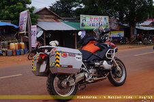
In the fall of 2001 a buddy and I rode halfway down the Baja peninsula and back (about 1200 miles) mostly on jeep trails and dirt roads. What made this fun is that none of the roads or trails in Baja Mexico have names except for the 3 main highways, and neither of us had a GPS. We picked our route from a topo atlas I found that showed trails less travelled and potenial gas stations ("potential" because they don't always have gas). This was a very low budget grid of maps designed with offroad adventurers in mind. I think some of the trails were even hand drawn. I photocopied each page on 11x17 paper, then taped them together and ran them through a house plan scanner to be plotted on a roll of 36" architectural bond. This was our "map". To our surprise, we were able to navigate the planned route quite closely.
Here's the story:
http://www.clfry.com/adv/baja.html
Here's the story:
http://www.clfry.com/adv/baja.html
Last edited: