


 Feel free to hang out and lurk as long as you like. However, we would like to encourage you to
 ARKANSAS TRAIL TO TRAIL TOUR FALL 07
It’s Fall 07 and I have a week of vacation. What to do? I knew it would be on two wheels but which set and where? I have been to Arkansas on street bikes and man do they have some great pavement. I thought about the cornering nirvana, but truth be told, I was ready to get dirty. I had been hearing of places that had some pretty good reputations and wanted to check them out. I got long time riding partner Ham to join up on this recon and we both put in vacation time and got our machines ready.
My ride was undecided until the last minute. I have two plated dirtbikes. The first is a DRZ400s and the second option was my 1984 xt600. Both bikes are dirt capable but both have their strengths and weaknesses. I chose the xt600 as its strengths center on what my butt would sit on for six days. The seat is most awesome and an all day joy to sit on. The motor is a tractor and the bike gobbles up gravel roads and two track with competence that defies its age. The deciding factor was what Ham was riding. His horse for the trip was his trusty Klr 650. It is a big bike and although Ham is a big guy, I was afraid that I would be tempted to point the DRZ up a trail that was unmanageable for the Klr. In the end, the XT was the right choice. This bike carried me through the mountains of Mexico and Arkansas is not Mexico…..or is it?
THE PLAN
I poured over maps of Arkansas using http://maps.live.com. As you zoom in, the terrain features are clearly visible and boy was there terrain all over the place. While the elevations were not huge, they were plentiful. Maps live also indicated there was plenty of dirt to ride. For years, I have been hearing of Wolf Pen Gap ATV area but had never been. Brock Creek kept popping up in the KTM Talk forums too. The loose plan was to truck to Mena and put the bikes on the ground there. I always like having the truck within a couple hundred miles of the bikes. It sure makes it easier if rider or bike breaks down and can’t continue. The basic plan was that there was no plan other than riding these two areas and finding dirt roads between the two. I would be using my Garmin GPS to sniff out routes along the way. To keep costs down, we decided to pitch tents in the National Forest each night.
SATURDAY
One of the things that make Ham a great riding partner is that he is always on time. Right on the button he shows up and we make our way out of town. We go over his son’s football game and we talk it up about how some of our dualsport buddies were going to be jealous. We live in the northern sector of the DFW metroplex and it took roughly 5 hours of pavement to get to Mena, AR. I consult the map and we make our way to one of the trailheads of Wolf Pen Gap ATV riding area.
URL=http://www.flickr.com/photos/14935403@N02/1701232586/][/URL]

We unload here.
At the trailhead we see quite a few trailers. It is after lunch so we are the last ones here for the day. Bikes come out of the truck and we suit up. I see lots of ATVs but no bikes. Wait a sec….yes, there goes an XR400. One of those ugly green pickups pulls up but as with most of the time the driver is great. He introduces himself and starts a conversation with us. The guy Im talking about is driving one of those Forest Service aka FS trucks. He gives us lots of info about Wolf Pen Gap and some other areas that are close by. We are anxious to get going as it is 2:00pm by now. I’ve read that there are 35miles or so of ATV trail in the place and we want to hit it all.
The riding is great for the machines that we are on. There are some technical rocky uphills but being veterans of the INT, we scale them no problem. As I am riding Im judging the terrain and fun factor for my real off-road bike and while it is not single track, it is fun. There are lots of erosion control humps in the trail that would make great jumps on the CR. During the day we find some nice views and some pretty cool water crossings. Im mad at myself for not taking pictures of the water crossings here as they were the best on the trip.
URL=http://www.flickr.com/photos/14935403@N02/1701231916/][/URL]
It’s hard to tell, but we are on top of big hill looking down on a valley.
On top of this hill, we have a train of ATVs pull up behind us. Before long we are making conversation with this friendly bunch. We are having trouble matching trail numbers on the map with what is actually on the trail. Turns out the map I printed off the internet are old and they have renumbered the trails. Im looking at this guy that is giving us the “where to go and what to see”, and something in my head is going off that I should know him. We are about to go and I shake his hand and tell him my name and before he gives me his, the bell goes off. “Your name is Alan” I said and he looked at me funny.
Years ago, I used to work at dirt oval tracks in north Texas. My father in law at the time was either a general manager or race official and I was either working or spectating. Turns out Alan was one of the first great truck racers back in the mid-late 80s. They were racing modified trucks on dirt ovals long before NASCAR. Alan knows my ex in-laws and brother in laws very well. That sealed the deal and he invited us to come back to the campers later that evening. We had a lot more of Wolf Pen Gap to see but that is what we intended to do.
An hour or so later we run into Alan again and he offers to take us to a cave that is outside of Wolf Pen Gap. We couldn’t miss that, so we followed and he took us here.
URL=Http://www.flickr.com/photos/14935403@N02/1701232264/][/URL]

The cave is behind Ham. The bikes are through that hole and 40yrds away.
After a nice rest, we got back on the bikes and put in some more miles on the WPG trail. Around 5:30, the shadows were getting long and we had two options. First we could bail out and use pavement to the trailhead or run another 15 miles of trail back to the truck. The second option would mean riding trail after dark which neither of us wanted to do as we were getting tired and hungry. So pavement was agreed on and off to the truck we went. When we got to the truck, the trailhead was empty which was the opposite from when we arrived.
Loaded up we headed into Mena for some dinner. We found a local version of Taco Bell and chowed down on some grub. As we ate, we decided that we would take Alan up on his offer and put up tents by his group's campers. Alan had given us directions but I was going from memory and it was DARK. What should have taken us 45min ended up taking us 2hours before we located Alan’s camp. It was late, but we whipped out the tents and headed over to the campfire for an extended BS session. Alan and Billy live in east Texas and do most of their ATVing in Arkansas for good reason but we filled them in on our local riding areas. I also told him of my trips to Moab. We exchanged phone/addresses and I promised to send him a CD of Moab riding pictures. It was 1am before we called it quits.
SUNDAY
Its 9am and the earplugs are still in so Im dead to the world. Ham finally drops something on the tailgate of the truck by my tent and that is what wakes me up. Turns out he has been up awhile and even cleaned off in the stream. We break down camp and say goodbye to Alan and Billy before leaving.
URL=http://www.flickr.com/photos/14935403@N02/1701232420/[/URL]

That’s me on the left and Alan on the right.
Itching to ride we head back into Mena to dump off the truck and get back on the bikes. But before we do this we decide on lunch at a combination Wendy’s/Gas Station. We grab some hamburgers and gobble them down. As Im walking to the truck I see a familiar sight. There is an older gentleman with a small box mounted on the back of his Kawasaki cruiser. He and his little black spaniel are taking a break. I can’t believe it. Last year (to the day and hour) I met this guy in the same parking lot. Burt and his little black spaniel are pulling a dejavu. Last year I was on a sport bike trip with some college buddies of mine when we met this biking pair. A year later, he recognizes me and we take up right where we left off. He tells me of his summer on the bike touring out west and his flying trips too as he is an aviator as well.
URL=http://www.flickr.com/photos/14935403@N02/1700380317[/URL]

Me, Burt and Maggie(I think)
Its already 1:00 and we haven’t even saddled up! Being on vacation means not being in a hurry but we are ready to ride. We unload the bikes in the parking lot of Arkansas finest and hit the road with no destination in mind. I hit some nice rolling twisty county dirt roads on our way to the NF. The road gradually worsens….oh yeah….and we start climbing through the trees. Like many days ahead, we ride up and down dirt paths in the NF. At the end of the afternoon we have 100 miles or so under our belt. Alan told us of a nice view point called Buck Knob. Turns out we weren’t far away but we needed to eat and get some fuel. We made our way towards pavement via GPS indicated roads when we ran into a GoatTrail Green type of road. This one was called Shiloh Rd before it became this.
url=http://www.flickr.com/photos/14935403@N02/1700380499[/url]

Taking a break
Then we ran into a fence
url=http://www.flickr.com/photos/14935403@N02/1701233216[/url]

Time to turn around
I would have kept pushing but the road was unknown for another 6 miles. It was just too late in the day to try it so we backtracked. We made our way to pavement and got gas. A café was next door so we had ourselves a big Sunday dinner. After we cleaned our plates, we went back to the store for snacks. We found an information booth in human form behind the counter. He was a young local hunter that knew the woods. He gave us a great map but doubted we could make the top of Buck Knob before the sun set.
url=http://www.flickr.com/photos/14935403@N02/1700380851[/url]

Purt near dark
url=http://www.flickr.com/photos/14935403@N02/1700380945[/url]

Lots of these at the top so we both called home.
We had found a great campsite earlier in the day and I had marked it on the GPS. Turns out we were only a couple of miles from that spot. Bonus feature of this spot would be that we could return to Buck Knob early in the morning for a more enlightened view. I lead us to camp and it was literally lights out. No moon and no humanity…..just darkness and Ham snoring.
MONDAY
Breaking camp and eating whatever snacks we had was first. Then it was back to Buck Knob. Guess what? The road was still fun. We top out amongst the antennae and are greeted with a beautiful view.
url=http://www.flickr.com/photos/14935403@N02/1700381439[/url]

Nice.
url=http://www.flickr.com/photos/14935403@N02/1701234164/[/url]

Ham and his horse.
We head on down the hill and are making a course to the northeast. I am flying down the road when I run into a couple of these guys.
url=http://www.flickr.com/photos/14935403@N02/1700382047/[/url]

Lost
There were four of them and they had not eaten in a long time. The others were dodgy, but this little guy came up to me. Ribs and stomachs chewing on backbone is their condition best described. I opened up my backpack and opened up a bag of Chex mix. I soon had 4 new best friends. Luckily, they had labeled collars and I put the phone number in my phone as I had no reception here. Ham got off his bike and kept them busy and I rode up to the highway to look for reception. Fortunately for the dogs, somebody picked up the phone. Seems they had been “runnin em”. Whatever that means. A lady came and retrieved them pronto as they only lived a few miles away.
We were on our way. The road we found the dogs on looked like this.
url=http://www.flickr.com/photos/14935403@N02/1700381911/[/url]

Klrs rule
We made our way east for 30miles or so before heading north. Wheels were covering some great stuff. Pretty much dualsport nirvana. Pace was fast on some of the roads but slower do to road conditions, switchbacks and sometimes animals. Sometime after 1:00pm, we came to the point that fuel was needed but we hadn’t come across a town big enough to have gas. We came out of the trees, got to pavement and made a beeline to Danville.
Not only did the bikes need fuel (as I hit reserve on the way into town), so did we. There is always a local café and it didn’t take us long to find it. Being after lunch hour the place was empty but the cook was still willing.
url=http://www.flickr.com/photos/14935403@N02/1701234604/[/url]

I was so hungry that I almost ate it all before taking a picture.
A storm blew in so we chilled, had dessert, made some calls, and waited it out.
url=http://www.flickr.com/photos/14935403@N02/1700382301/[/url]

Clouds hide the hill
I eyeballed the maps as we were on our way to Brock Creek Riding Area which is north of the Arkansas River. I knew there would be no dirt roads crossing a river that big so with time getting short, we slabbed across the river into Russellville and found a WalMart. Ham wanted to buy a small compressor to air up his mattress at night. Those tasks done, we headed out into the sprinkles for the rest of the afternoon. It seemed that we were chasing the storm front that blew through Danville. We kept getting spit on but no real rain. We could always see it just ahead but never ran into it. Late in the afternoon we arrive in Jerusalem.
url=http://www.flickr.com/photos/14935403@N02/1700382389/[/url]

VFD and map consultation
A local gave us the heads up on which road we were looking for. We made our way under cloud cover. I was bummed because I was afraid that riding true trail on these bikes might be a bit much with the muddy conditions. We arrived at Brock Creek to find it empty on a Monday afternoon. We took off the saddlebags and hit a couple of miles of the ATV sections. They were great in spite of the few really muddy places which made us gentle on the clutch and easy on the gas. Bikes of this weight DO NOT like mud period. It is possible to stay upright and moving but it is a PITB.
url=http://www.flickr.com/photos/14935403@N02/1700382611/[/url]

XT and Me
It was getting dark and we weren’t sure if we were going to get more of the wet stuff. Tents up became the plan with a washup in the lake if we got it done in time. I finally got to see some soap and water.
TUESDAY
The morning broke out in bright sunshine. All was well until Ham tried to start his bike. Click Click. Crap! The pump Ham had bought was a tire pump. It will inflate an air mattress but it takes time as it puts our pressure in small amounts ….not volume. We ran the pump for 15-20 min to air up the mattresses and ended up running the battery down. A good push and the bike came to life. I told him to ride around on the road a bit to charge up the battery. So he did. After 15 min, he was back. We decided to make sure the connections on the battery were good and that he had enough water in the battery.
url=http://www.flickr.com/photos/14935403@N02/1700383221/[/url]

Ham adding juice
We have to push start him again. Both of us are leery about going into the trees with a bike this big that might not start on its own but we do it anyway. ATV designated trails are what we agree to start off with as there are plenty, and if make those ok, we will try some of the single track designated trails.
It takes us awhile to find a trail but before long we are riding some great stuff. Rocky, rutty, with a touch of dirt. Perfect. Elevation both up and down too. Some of it looks like this.
url=http://www.flickr.com/photos/14935403@N02/1700382731/[/url]

Ham coming out of a corner
url=http://www.flickr.com/photos/14935403@N02/1701235492/[/url]

Me coming up a hill
This goes on all morning.
url=http://www.flickr.com/photos/14935403@N02/1700382857/[/url]

Ham on the trail
I had a knobby (kenda 270s) while Ham used Avons which were a definite 50/50 tire. I was amazed at how well his tire performed. It seems the sidewall is fairly soft and the tire would wrap around rocks and stick. His bike is a lot heavier than mine but it tractored up some gnarly stuff. We did run high air pressure to avoid pinch flats. It didn’t seem to affect the handling much.
url=http://www.flickr.com/photos/14935403@N02/1701229192/[/url

At one of the trailheads.
About midmorning we come to a go-around due to a fallen tree. The new trail goes down a bit and then straight back up. We have a problem as the trail is muddy on this uphill. Ham doesn’t quite make it and stalls the bike. It won’t start. We have to muscle it up to a section of trail that is hardpacked and push it off. Now we are wondering if we have a bad battery on our hands. At this point, he remembers that the Klr has a handy ground to the headlight within reach. He unplugs the laser beam of a headlight and we continue being careful not to stall. His headlight is an aftermarket that is bright to say the least. It must pull a bit on the charging system because the battery came around quickly after the ground wire was pulled.
After 30 miles of roaming the various ATV trails, we make our way back to the campground. I had noticed on the trail maps that there was a nice looking 2 mile section of single track that looked like there wouldn’t be any hill climb problems. I went ahead and ran it alone and it was sweet. To be honest, these bikes can do quite a bit but we were afraid of finding a slippery uphill that we couldn’t get up or backtrack out of. I had read that some of the single track was aggressive and we didn’t want to spend an hour doing LastManStanding on 350lb dualsports. I finished the single track and caught up with Ham.
We waved goodbye to Brock Creek and made our way east until fuel made us head into town. This time it was the town of Hector. School was letting out as we pulled up for our once daily feast at the local café. I had this for dinner.
url="http://www.flickr.com/photos/14935403@N02/1700383329/[/url]

Yes, I had to use gloves to eat it.
Followed by this.
url=http://www.flickr.com/photos/14935403@N02/1701235998/[/url]

Pie and ice cream are like Forrest and Jenny
url=http://www.flickr.com/photos/14935403@N02/1701235884/[/url]

Ham had this.
We got in a conversation with a local and he asked where we had been and where we were going. He asked if we had been to Moccasin Gap as there was riding to be had there. In my research, I had come across this area but it seemed it was a horse specific area. Turns out that it is multiuse even though it’s not billed as such. Hey, it was in range for the afternoon so we located it on the GPS and headed in that direction using dirt.
The afternoons ride became quite epic. We found a great two track that ran along a valley. There was a bit of sand mixed in with the rock. Fast and fun with a bonus towards the end.
A nice big water crossing and enough light to take pictures. I ran across first to take Hams picture which turned out blurry. He then took my picture.
url=http://www.flickr.com/photos/14935403@N02/1700383613/[/url]

Me going back across to get my picture taken
url=http://www.flickr.com/photos/14935403@N02/1701236210/[/url]

Yes, it’s an unacceptable bobble but no fall
So I want another shot at it and ride back across. I make it 95% of the way and hit a rock that results in this.
url=http://www.flickr.com/photos/14935403@N02/1700383921/[/url]

Yup, I go swimming.
The bike is still running and I manage to keep water out of the air box but not my boots or gloves. It isn’t cold so Im laughing my butt off.
Finally, I make good.
url=http://www.flickr.com/photos/14935403@N02/1701236566/[/url]

Practice makes perfect even with saddle bags full of water.
url=http://www.flickr.com/photos/14935403@N02/1701236658/[/url]

Before we surf
The trail ended up getting tight rutty and going most definitely uphill. It was to the point that I left Ham somewhere on the hill because I was afraid to stop. I made it to the top with a holler and it wasn’t soon before the big Klr made its way up. The trail dumped us on pavement which was a short ride to Moccasin Gap Campground. It’s late in the day as we idle in and I am seeing nothing but horses. Im not seeing any OHV anywhere. Wait; there is a trailer with a quad. I get off my bike and talk to the lady who owns the quad. She assures me that these are multiuse trails and the horse folks are friendly. We thank her for the info and push our bikes to a camp spot after depositing 3 dollars in the metal can. This place is advertised as horse friendly but it is multiuse. I’ve heard the only way to get trail funding is to make it multiuse. Tents up, eyes closed.
WEDENSDAY
It’s pretty cold last night and it takes us awhile to get out of our sleeping bags. Once we do, I look at the map and there are 4or5 main trails and it looks to be 30-40miles worth. We leave our camp stuff set up and hit the trail. It’s not long before I figure out why the horse folks like this area. There is a lot more dirt than rock for the most part. The nights dew keeps dust down and we make good progress. We do run into the horse folks several times through the morning but we use good trail etiquette, and they are appreciative. Im using stock exhaust, which isn’t very sexy, but promotes the sport in my eyes. The trails are perfect for what we are riding. If we have to share trails like these, Im ok with it. There are lots of hill climbs, water crossings, and switchbacks. Nice.
url=http://www.flickr.com/photos/14935403@N02/1700384721/[/url]

Ham on a very slippery water crossing.
It’s getting to be lunchtime and I have used up my fuel supply. Its time to get back to camp and pack up. All my clothes got wet in the previous evenings tipover. I hung everything up and it was dry when we got back. Saddlebags loaded, we quietly made our way to the road and made a quick run to Dover. Again it was midafternoon when we opened the door to yet another café. This time I got some sort of Club sandwich as I am sure my cholesterol was getting pegged by the previous meals. I negated any benefit of the Club sandwich by stuffing my gut with cheese fries and slurping a large milkshake.
This afternoon’s ride is the best of trip in my eyes. After leaving Dover, it is not long before we hit the NF. We are traveling in a valley when I see a road on the left that shows itself on the GPS as a trail. Quickly, I sense that this is going to be good. It is overgrown two track that crosses the creek many times. We see homesteads that are quite old along this section. It’s not long before we see mostly ATV tracks on this lightly traveled “road” In the late afternoon, nature shows her beauty. I was running out of room on the camera but I had to stop.
url=http://www.flickr.com/photos/14935403@N02/1717333741/[/url

Creek with tree reflections
Next is the best water crossing picture of the trip. Note the perfect mirror image on the water.
url=http://www.flickr.com/photos/14935403@N02/1700389815/[/url]

Cool picture of Ham and his Klr
URL=http://www.flickr.com/photos/14935403@N02/1700387497/[/URL]

Self portrait
This awesome two track goes on and on. As a matter of fact, it goes to the end of the valley. The trail disappears into the trees and makes a nasty vertical ascent for a long way. I bomb up it like I did the one the day before. This one is nastier and longer and more fun but I am worried if it might be too much for the Klr. Not to worry as Ham is a Klr Jedi Master. Hams large powerful size allows him to put that bike in places that Kawasaki never intended. Hey, big guys need big bikes. Once on top the trail mellows out and wanders around on a ridge. Problem is that we need to find a suitable campsite soon. We make our way on a dirt county road before the GPS suggests this little thing of a road. I could tell it descended, so I make the turn. It was a good decision. Steep and narrow we go all the way to the bottom. Purple hashes indicate private property on either side of this road that might be 5ft wide. At the bottom we can see Arkansas history. There are old rock walls and rock foundations still in place. At one time, this road saw more traffic. It’s getting darker and nowhere to camp so we keep on following the road. We finally hit a much more used NF road and soon find a suitable place to set up tents for the last time. We have been on the road awhile and sleep comes easy once again.
THURSDAY
I kept forgetting to take pictures of camp but I finally remembered. It was cold, just look at Ham.
url=http://www.flickr.com/photos/14935403@N02/1700387633/[/url]

My room for the week
We load up and get to riding. We wind our way north until we need fuel. I shouldn’t say we because Ham has a fuel range of a B1 bomber…well, at least 260miles. My bike has a smaller tank but it was getting anywhere from 65-70miles to the gallon. I just felt better opening the gas cap at the 120mile mark. The only time I hit reserve was at 130. We ended up getting fuel in Deer. The Gps pointed our way west and we rode FS roads until Cass.
url=http://www.flickr.com/photos/14935403@N02/1700387797/[/url]

Morning shot on a lonely bridge
We then left the Ozark National Forest and made our way south to cross the Arkansas River. We found a great little buffet for an early lunch. Then, it was back on the bike for the home stretch. We continued on slab towards Magazine Mountain. While pavement is not what we were looking for, it was hardly disappointing. Lots of twists and little traffic. We made our way back into the Ouachita National Forest and back on the dirt. We found a ridge road that carried us toward Mena and made time. We came out of the trees 30 miles north of Mena and finished up the days ride on pavement. By the time we pulled into Mena, the wheels had turned 210miles.
url=http://www.flickr.com/photos/14935403@N02/1700379329/[/url]

Ham taking a nap
url=http://www.flickr.com/photos/14935403@N02/1701241236/[/url]

Im whipped too.
url=http://www.flickr.com/photos/14935403@N02/1701241026/[/url]

Toasted tires.
EPILOGUE
We had covered 820 miles and 90% of it was on dirt/trail. We suffered ZERO flats. True, we had more than the trail standard 12psi but it was worth not having flats. I did loose my speedo cable three days in and toasted a new rear tire. A few low speed tipovers were the big “crashes” for the both of us. I did get wet the one time. My hands blistered a bit under the calluses but my butt never hurt at the end of the day. The weather was spectacular. We were early for the fall color event but that would have meant riding in cool to cold conditions. The financial aspect of this trip was surprisingly cheap. We both averaged less than 20 dollars a day. Not including fuel for the truck, I spent less than $100 in 6 days riding. We suffered by not getting showered regularly but it was nice on the wallet not having to pay for a motel every night. The ability to pitch camp wherever also made routing very flexible. There aren’t many towns large enough to support a hotel in the areas we rode. I purchased a NorthFace tent prior to the trip and it paid for itself by night three. I used my saddlebags from my street bike and they held up remarkably well. After I washed them, they looked new. I kept my tent and sleeping bag in a small drybag laced across the rear fender. Finally, other than Wolf Pen Gap and Brock Creek as destinations, we roamed and found more than enough to ride. The GPS, loaded with Garmin Topo, did a great job keeping us in the dirt. I did notice that the FS road numbers rarely matched what was on the screen. We did share the woods with bow hunters. They were dispersed and always waved when we went by one of their camps. Ham almost took a deer out on day 3 and I had a large tom turkey try to run under the bike. Ham, as always, was a lot of fun to ride with. We suggest that you bring your whiskey with you as it seemed the whole state is dry. We did without. I have to apologize to Lust for having to endure phone calls from me taunting him for not going.
A five star ride. Thanks for reading.
It’s Fall 07 and I have a week of vacation. What to do? I knew it would be on two wheels but which set and where? I have been to Arkansas on street bikes and man do they have some great pavement. I thought about the cornering nirvana, but truth be told, I was ready to get dirty. I had been hearing of places that had some pretty good reputations and wanted to check them out. I got long time riding partner Ham to join up on this recon and we both put in vacation time and got our machines ready.
My ride was undecided until the last minute. I have two plated dirtbikes. The first is a DRZ400s and the second option was my 1984 xt600. Both bikes are dirt capable but both have their strengths and weaknesses. I chose the xt600 as its strengths center on what my butt would sit on for six days. The seat is most awesome and an all day joy to sit on. The motor is a tractor and the bike gobbles up gravel roads and two track with competence that defies its age. The deciding factor was what Ham was riding. His horse for the trip was his trusty Klr 650. It is a big bike and although Ham is a big guy, I was afraid that I would be tempted to point the DRZ up a trail that was unmanageable for the Klr. In the end, the XT was the right choice. This bike carried me through the mountains of Mexico and Arkansas is not Mexico…..or is it?
THE PLAN
I poured over maps of Arkansas using http://maps.live.com. As you zoom in, the terrain features are clearly visible and boy was there terrain all over the place. While the elevations were not huge, they were plentiful. Maps live also indicated there was plenty of dirt to ride. For years, I have been hearing of Wolf Pen Gap ATV area but had never been. Brock Creek kept popping up in the KTM Talk forums too. The loose plan was to truck to Mena and put the bikes on the ground there. I always like having the truck within a couple hundred miles of the bikes. It sure makes it easier if rider or bike breaks down and can’t continue. The basic plan was that there was no plan other than riding these two areas and finding dirt roads between the two. I would be using my Garmin GPS to sniff out routes along the way. To keep costs down, we decided to pitch tents in the National Forest each night.
SATURDAY
One of the things that make Ham a great riding partner is that he is always on time. Right on the button he shows up and we make our way out of town. We go over his son’s football game and we talk it up about how some of our dualsport buddies were going to be jealous. We live in the northern sector of the DFW metroplex and it took roughly 5 hours of pavement to get to Mena, AR. I consult the map and we make our way to one of the trailheads of Wolf Pen Gap ATV riding area.
URL=http://www.flickr.com/photos/14935403@N02/1701232586/][/URL]
We unload here.
At the trailhead we see quite a few trailers. It is after lunch so we are the last ones here for the day. Bikes come out of the truck and we suit up. I see lots of ATVs but no bikes. Wait a sec….yes, there goes an XR400. One of those ugly green pickups pulls up but as with most of the time the driver is great. He introduces himself and starts a conversation with us. The guy Im talking about is driving one of those Forest Service aka FS trucks. He gives us lots of info about Wolf Pen Gap and some other areas that are close by. We are anxious to get going as it is 2:00pm by now. I’ve read that there are 35miles or so of ATV trail in the place and we want to hit it all.
The riding is great for the machines that we are on. There are some technical rocky uphills but being veterans of the INT, we scale them no problem. As I am riding Im judging the terrain and fun factor for my real off-road bike and while it is not single track, it is fun. There are lots of erosion control humps in the trail that would make great jumps on the CR. During the day we find some nice views and some pretty cool water crossings. Im mad at myself for not taking pictures of the water crossings here as they were the best on the trip.
URL=http://www.flickr.com/photos/14935403@N02/1701231916/][/URL]
It’s hard to tell, but we are on top of big hill looking down on a valley.
On top of this hill, we have a train of ATVs pull up behind us. Before long we are making conversation with this friendly bunch. We are having trouble matching trail numbers on the map with what is actually on the trail. Turns out the map I printed off the internet are old and they have renumbered the trails. Im looking at this guy that is giving us the “where to go and what to see”, and something in my head is going off that I should know him. We are about to go and I shake his hand and tell him my name and before he gives me his, the bell goes off. “Your name is Alan” I said and he looked at me funny.
Years ago, I used to work at dirt oval tracks in north Texas. My father in law at the time was either a general manager or race official and I was either working or spectating. Turns out Alan was one of the first great truck racers back in the mid-late 80s. They were racing modified trucks on dirt ovals long before NASCAR. Alan knows my ex in-laws and brother in laws very well. That sealed the deal and he invited us to come back to the campers later that evening. We had a lot more of Wolf Pen Gap to see but that is what we intended to do.
An hour or so later we run into Alan again and he offers to take us to a cave that is outside of Wolf Pen Gap. We couldn’t miss that, so we followed and he took us here.
URL=Http://www.flickr.com/photos/14935403@N02/1701232264/][/URL]
The cave is behind Ham. The bikes are through that hole and 40yrds away.
After a nice rest, we got back on the bikes and put in some more miles on the WPG trail. Around 5:30, the shadows were getting long and we had two options. First we could bail out and use pavement to the trailhead or run another 15 miles of trail back to the truck. The second option would mean riding trail after dark which neither of us wanted to do as we were getting tired and hungry. So pavement was agreed on and off to the truck we went. When we got to the truck, the trailhead was empty which was the opposite from when we arrived.
Loaded up we headed into Mena for some dinner. We found a local version of Taco Bell and chowed down on some grub. As we ate, we decided that we would take Alan up on his offer and put up tents by his group's campers. Alan had given us directions but I was going from memory and it was DARK. What should have taken us 45min ended up taking us 2hours before we located Alan’s camp. It was late, but we whipped out the tents and headed over to the campfire for an extended BS session. Alan and Billy live in east Texas and do most of their ATVing in Arkansas for good reason but we filled them in on our local riding areas. I also told him of my trips to Moab. We exchanged phone/addresses and I promised to send him a CD of Moab riding pictures. It was 1am before we called it quits.
SUNDAY
Its 9am and the earplugs are still in so Im dead to the world. Ham finally drops something on the tailgate of the truck by my tent and that is what wakes me up. Turns out he has been up awhile and even cleaned off in the stream. We break down camp and say goodbye to Alan and Billy before leaving.
URL=http://www.flickr.com/photos/14935403@N02/1701232420/[/URL]
That’s me on the left and Alan on the right.
Itching to ride we head back into Mena to dump off the truck and get back on the bikes. But before we do this we decide on lunch at a combination Wendy’s/Gas Station. We grab some hamburgers and gobble them down. As Im walking to the truck I see a familiar sight. There is an older gentleman with a small box mounted on the back of his Kawasaki cruiser. He and his little black spaniel are taking a break. I can’t believe it. Last year (to the day and hour) I met this guy in the same parking lot. Burt and his little black spaniel are pulling a dejavu. Last year I was on a sport bike trip with some college buddies of mine when we met this biking pair. A year later, he recognizes me and we take up right where we left off. He tells me of his summer on the bike touring out west and his flying trips too as he is an aviator as well.
URL=http://www.flickr.com/photos/14935403@N02/1700380317[/URL]
Me, Burt and Maggie(I think)
Its already 1:00 and we haven’t even saddled up! Being on vacation means not being in a hurry but we are ready to ride. We unload the bikes in the parking lot of Arkansas finest and hit the road with no destination in mind. I hit some nice rolling twisty county dirt roads on our way to the NF. The road gradually worsens….oh yeah….and we start climbing through the trees. Like many days ahead, we ride up and down dirt paths in the NF. At the end of the afternoon we have 100 miles or so under our belt. Alan told us of a nice view point called Buck Knob. Turns out we weren’t far away but we needed to eat and get some fuel. We made our way towards pavement via GPS indicated roads when we ran into a GoatTrail Green type of road. This one was called Shiloh Rd before it became this.
url=http://www.flickr.com/photos/14935403@N02/1700380499[/url]
Taking a break
Then we ran into a fence
url=http://www.flickr.com/photos/14935403@N02/1701233216[/url]
Time to turn around
I would have kept pushing but the road was unknown for another 6 miles. It was just too late in the day to try it so we backtracked. We made our way to pavement and got gas. A café was next door so we had ourselves a big Sunday dinner. After we cleaned our plates, we went back to the store for snacks. We found an information booth in human form behind the counter. He was a young local hunter that knew the woods. He gave us a great map but doubted we could make the top of Buck Knob before the sun set.
url=http://www.flickr.com/photos/14935403@N02/1700380851[/url]
Purt near dark
url=http://www.flickr.com/photos/14935403@N02/1700380945[/url]
Lots of these at the top so we both called home.
We had found a great campsite earlier in the day and I had marked it on the GPS. Turns out we were only a couple of miles from that spot. Bonus feature of this spot would be that we could return to Buck Knob early in the morning for a more enlightened view. I lead us to camp and it was literally lights out. No moon and no humanity…..just darkness and Ham snoring.
MONDAY
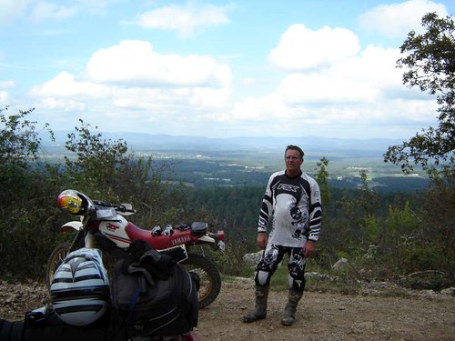
Breaking camp and eating whatever snacks we had was first. Then it was back to Buck Knob. Guess what? The road was still fun. We top out amongst the antennae and are greeted with a beautiful view.
url=http://www.flickr.com/photos/14935403@N02/1700381439[/url]
Nice.
url=http://www.flickr.com/photos/14935403@N02/1701234164/[/url]
Ham and his horse.
We head on down the hill and are making a course to the northeast. I am flying down the road when I run into a couple of these guys.
url=http://www.flickr.com/photos/14935403@N02/1700382047/[/url]
Lost
There were four of them and they had not eaten in a long time. The others were dodgy, but this little guy came up to me. Ribs and stomachs chewing on backbone is their condition best described. I opened up my backpack and opened up a bag of Chex mix. I soon had 4 new best friends. Luckily, they had labeled collars and I put the phone number in my phone as I had no reception here. Ham got off his bike and kept them busy and I rode up to the highway to look for reception. Fortunately for the dogs, somebody picked up the phone. Seems they had been “runnin em”. Whatever that means. A lady came and retrieved them pronto as they only lived a few miles away.
We were on our way. The road we found the dogs on looked like this.
url=http://www.flickr.com/photos/14935403@N02/1700381911/[/url]
Klrs rule
We made our way east for 30miles or so before heading north. Wheels were covering some great stuff. Pretty much dualsport nirvana. Pace was fast on some of the roads but slower do to road conditions, switchbacks and sometimes animals. Sometime after 1:00pm, we came to the point that fuel was needed but we hadn’t come across a town big enough to have gas. We came out of the trees, got to pavement and made a beeline to Danville.
Not only did the bikes need fuel (as I hit reserve on the way into town), so did we. There is always a local café and it didn’t take us long to find it. Being after lunch hour the place was empty but the cook was still willing.
url=http://www.flickr.com/photos/14935403@N02/1701234604/[/url]
I was so hungry that I almost ate it all before taking a picture.
A storm blew in so we chilled, had dessert, made some calls, and waited it out.
url=http://www.flickr.com/photos/14935403@N02/1700382301/[/url]
Clouds hide the hill
I eyeballed the maps as we were on our way to Brock Creek Riding Area which is north of the Arkansas River. I knew there would be no dirt roads crossing a river that big so with time getting short, we slabbed across the river into Russellville and found a WalMart. Ham wanted to buy a small compressor to air up his mattress at night. Those tasks done, we headed out into the sprinkles for the rest of the afternoon. It seemed that we were chasing the storm front that blew through Danville. We kept getting spit on but no real rain. We could always see it just ahead but never ran into it. Late in the afternoon we arrive in Jerusalem.
url=http://www.flickr.com/photos/14935403@N02/1700382389/[/url]
VFD and map consultation
A local gave us the heads up on which road we were looking for. We made our way under cloud cover. I was bummed because I was afraid that riding true trail on these bikes might be a bit much with the muddy conditions. We arrived at Brock Creek to find it empty on a Monday afternoon. We took off the saddlebags and hit a couple of miles of the ATV sections. They were great in spite of the few really muddy places which made us gentle on the clutch and easy on the gas. Bikes of this weight DO NOT like mud period. It is possible to stay upright and moving but it is a PITB.
url=http://www.flickr.com/photos/14935403@N02/1700382611/[/url]
XT and Me
It was getting dark and we weren’t sure if we were going to get more of the wet stuff. Tents up became the plan with a washup in the lake if we got it done in time. I finally got to see some soap and water.
TUESDAY
The morning broke out in bright sunshine. All was well until Ham tried to start his bike. Click Click. Crap! The pump Ham had bought was a tire pump. It will inflate an air mattress but it takes time as it puts our pressure in small amounts ….not volume. We ran the pump for 15-20 min to air up the mattresses and ended up running the battery down. A good push and the bike came to life. I told him to ride around on the road a bit to charge up the battery. So he did. After 15 min, he was back. We decided to make sure the connections on the battery were good and that he had enough water in the battery.
url=http://www.flickr.com/photos/14935403@N02/1700383221/[/url]
Ham adding juice
We have to push start him again. Both of us are leery about going into the trees with a bike this big that might not start on its own but we do it anyway. ATV designated trails are what we agree to start off with as there are plenty, and if make those ok, we will try some of the single track designated trails.
It takes us awhile to find a trail but before long we are riding some great stuff. Rocky, rutty, with a touch of dirt. Perfect. Elevation both up and down too. Some of it looks like this.
url=http://www.flickr.com/photos/14935403@N02/1700382731/[/url]
Ham coming out of a corner
url=http://www.flickr.com/photos/14935403@N02/1701235492/[/url]
Me coming up a hill
This goes on all morning.
url=http://www.flickr.com/photos/14935403@N02/1700382857/[/url]
Ham on the trail
I had a knobby (kenda 270s) while Ham used Avons which were a definite 50/50 tire. I was amazed at how well his tire performed. It seems the sidewall is fairly soft and the tire would wrap around rocks and stick. His bike is a lot heavier than mine but it tractored up some gnarly stuff. We did run high air pressure to avoid pinch flats. It didn’t seem to affect the handling much.
url=http://www.flickr.com/photos/14935403@N02/1701229192/[/url
At one of the trailheads.
About midmorning we come to a go-around due to a fallen tree. The new trail goes down a bit and then straight back up. We have a problem as the trail is muddy on this uphill. Ham doesn’t quite make it and stalls the bike. It won’t start. We have to muscle it up to a section of trail that is hardpacked and push it off. Now we are wondering if we have a bad battery on our hands. At this point, he remembers that the Klr has a handy ground to the headlight within reach. He unplugs the laser beam of a headlight and we continue being careful not to stall. His headlight is an aftermarket that is bright to say the least. It must pull a bit on the charging system because the battery came around quickly after the ground wire was pulled.
After 30 miles of roaming the various ATV trails, we make our way back to the campground. I had noticed on the trail maps that there was a nice looking 2 mile section of single track that looked like there wouldn’t be any hill climb problems. I went ahead and ran it alone and it was sweet. To be honest, these bikes can do quite a bit but we were afraid of finding a slippery uphill that we couldn’t get up or backtrack out of. I had read that some of the single track was aggressive and we didn’t want to spend an hour doing LastManStanding on 350lb dualsports. I finished the single track and caught up with Ham.
We waved goodbye to Brock Creek and made our way east until fuel made us head into town. This time it was the town of Hector. School was letting out as we pulled up for our once daily feast at the local café. I had this for dinner.
url="http://www.flickr.com/photos/14935403@N02/1700383329/[/url]
Yes, I had to use gloves to eat it.
Followed by this.
url=http://www.flickr.com/photos/14935403@N02/1701235998/[/url]
Pie and ice cream are like Forrest and Jenny
url=http://www.flickr.com/photos/14935403@N02/1701235884/[/url]
Ham had this.
We got in a conversation with a local and he asked where we had been and where we were going. He asked if we had been to Moccasin Gap as there was riding to be had there. In my research, I had come across this area but it seemed it was a horse specific area. Turns out that it is multiuse even though it’s not billed as such. Hey, it was in range for the afternoon so we located it on the GPS and headed in that direction using dirt.
The afternoons ride became quite epic. We found a great two track that ran along a valley. There was a bit of sand mixed in with the rock. Fast and fun with a bonus towards the end.
A nice big water crossing and enough light to take pictures. I ran across first to take Hams picture which turned out blurry. He then took my picture.
url=http://www.flickr.com/photos/14935403@N02/1700383613/[/url]
Me going back across to get my picture taken
url=http://www.flickr.com/photos/14935403@N02/1701236210/[/url]
Yes, it’s an unacceptable bobble but no fall
So I want another shot at it and ride back across. I make it 95% of the way and hit a rock that results in this.
url=http://www.flickr.com/photos/14935403@N02/1700383921/[/url]
Yup, I go swimming.
The bike is still running and I manage to keep water out of the air box but not my boots or gloves. It isn’t cold so Im laughing my butt off.
Finally, I make good.
url=http://www.flickr.com/photos/14935403@N02/1701236566/[/url]
Practice makes perfect even with saddle bags full of water.
url=http://www.flickr.com/photos/14935403@N02/1701236658/[/url]
Before we surf
The trail ended up getting tight rutty and going most definitely uphill. It was to the point that I left Ham somewhere on the hill because I was afraid to stop. I made it to the top with a holler and it wasn’t soon before the big Klr made its way up. The trail dumped us on pavement which was a short ride to Moccasin Gap Campground. It’s late in the day as we idle in and I am seeing nothing but horses. Im not seeing any OHV anywhere. Wait; there is a trailer with a quad. I get off my bike and talk to the lady who owns the quad. She assures me that these are multiuse trails and the horse folks are friendly. We thank her for the info and push our bikes to a camp spot after depositing 3 dollars in the metal can. This place is advertised as horse friendly but it is multiuse. I’ve heard the only way to get trail funding is to make it multiuse. Tents up, eyes closed.
WEDENSDAY
It’s pretty cold last night and it takes us awhile to get out of our sleeping bags. Once we do, I look at the map and there are 4or5 main trails and it looks to be 30-40miles worth. We leave our camp stuff set up and hit the trail. It’s not long before I figure out why the horse folks like this area. There is a lot more dirt than rock for the most part. The nights dew keeps dust down and we make good progress. We do run into the horse folks several times through the morning but we use good trail etiquette, and they are appreciative. Im using stock exhaust, which isn’t very sexy, but promotes the sport in my eyes. The trails are perfect for what we are riding. If we have to share trails like these, Im ok with it. There are lots of hill climbs, water crossings, and switchbacks. Nice.
url=http://www.flickr.com/photos/14935403@N02/1700384721/[/url]
Ham on a very slippery water crossing.
It’s getting to be lunchtime and I have used up my fuel supply. Its time to get back to camp and pack up. All my clothes got wet in the previous evenings tipover. I hung everything up and it was dry when we got back. Saddlebags loaded, we quietly made our way to the road and made a quick run to Dover. Again it was midafternoon when we opened the door to yet another café. This time I got some sort of Club sandwich as I am sure my cholesterol was getting pegged by the previous meals. I negated any benefit of the Club sandwich by stuffing my gut with cheese fries and slurping a large milkshake.
This afternoon’s ride is the best of trip in my eyes. After leaving Dover, it is not long before we hit the NF. We are traveling in a valley when I see a road on the left that shows itself on the GPS as a trail. Quickly, I sense that this is going to be good. It is overgrown two track that crosses the creek many times. We see homesteads that are quite old along this section. It’s not long before we see mostly ATV tracks on this lightly traveled “road” In the late afternoon, nature shows her beauty. I was running out of room on the camera but I had to stop.
url=http://www.flickr.com/photos/14935403@N02/1717333741/[/url
Creek with tree reflections
Next is the best water crossing picture of the trip. Note the perfect mirror image on the water.
url=http://www.flickr.com/photos/14935403@N02/1700389815/[/url]
Cool picture of Ham and his Klr
URL=http://www.flickr.com/photos/14935403@N02/1700387497/[/URL]
Self portrait
This awesome two track goes on and on. As a matter of fact, it goes to the end of the valley. The trail disappears into the trees and makes a nasty vertical ascent for a long way. I bomb up it like I did the one the day before. This one is nastier and longer and more fun but I am worried if it might be too much for the Klr. Not to worry as Ham is a Klr Jedi Master. Hams large powerful size allows him to put that bike in places that Kawasaki never intended. Hey, big guys need big bikes. Once on top the trail mellows out and wanders around on a ridge. Problem is that we need to find a suitable campsite soon. We make our way on a dirt county road before the GPS suggests this little thing of a road. I could tell it descended, so I make the turn. It was a good decision. Steep and narrow we go all the way to the bottom. Purple hashes indicate private property on either side of this road that might be 5ft wide. At the bottom we can see Arkansas history. There are old rock walls and rock foundations still in place. At one time, this road saw more traffic. It’s getting darker and nowhere to camp so we keep on following the road. We finally hit a much more used NF road and soon find a suitable place to set up tents for the last time. We have been on the road awhile and sleep comes easy once again.
THURSDAY
I kept forgetting to take pictures of camp but I finally remembered. It was cold, just look at Ham.
url=http://www.flickr.com/photos/14935403@N02/1700387633/[/url]
My room for the week
We load up and get to riding. We wind our way north until we need fuel. I shouldn’t say we because Ham has a fuel range of a B1 bomber…well, at least 260miles. My bike has a smaller tank but it was getting anywhere from 65-70miles to the gallon. I just felt better opening the gas cap at the 120mile mark. The only time I hit reserve was at 130. We ended up getting fuel in Deer. The Gps pointed our way west and we rode FS roads until Cass.
url=http://www.flickr.com/photos/14935403@N02/1700387797/[/url]
Morning shot on a lonely bridge
We then left the Ozark National Forest and made our way south to cross the Arkansas River. We found a great little buffet for an early lunch. Then, it was back on the bike for the home stretch. We continued on slab towards Magazine Mountain. While pavement is not what we were looking for, it was hardly disappointing. Lots of twists and little traffic. We made our way back into the Ouachita National Forest and back on the dirt. We found a ridge road that carried us toward Mena and made time. We came out of the trees 30 miles north of Mena and finished up the days ride on pavement. By the time we pulled into Mena, the wheels had turned 210miles.
url=http://www.flickr.com/photos/14935403@N02/1700379329/[/url]
Ham taking a nap
url=http://www.flickr.com/photos/14935403@N02/1701241236/[/url]
Im whipped too.
url=http://www.flickr.com/photos/14935403@N02/1701241026/[/url]
Toasted tires.
EPILOGUE
We had covered 820 miles and 90% of it was on dirt/trail. We suffered ZERO flats. True, we had more than the trail standard 12psi but it was worth not having flats. I did loose my speedo cable three days in and toasted a new rear tire. A few low speed tipovers were the big “crashes” for the both of us. I did get wet the one time. My hands blistered a bit under the calluses but my butt never hurt at the end of the day. The weather was spectacular. We were early for the fall color event but that would have meant riding in cool to cold conditions. The financial aspect of this trip was surprisingly cheap. We both averaged less than 20 dollars a day. Not including fuel for the truck, I spent less than $100 in 6 days riding. We suffered by not getting showered regularly but it was nice on the wallet not having to pay for a motel every night. The ability to pitch camp wherever also made routing very flexible. There aren’t many towns large enough to support a hotel in the areas we rode. I purchased a NorthFace tent prior to the trip and it paid for itself by night three. I used my saddlebags from my street bike and they held up remarkably well. After I washed them, they looked new. I kept my tent and sleeping bag in a small drybag laced across the rear fender. Finally, other than Wolf Pen Gap and Brock Creek as destinations, we roamed and found more than enough to ride. The GPS, loaded with Garmin Topo, did a great job keeping us in the dirt. I did notice that the FS road numbers rarely matched what was on the screen. We did share the woods with bow hunters. They were dispersed and always waved when we went by one of their camps. Ham almost took a deer out on day 3 and I had a large tom turkey try to run under the bike. Ham, as always, was a lot of fun to ride with. We suggest that you bring your whiskey with you as it seemed the whole state is dry. We did without. I have to apologize to Lust for having to endure phone calls from me taunting him for not going.
A five star ride. Thanks for reading.
Last edited:

