Feel free to hang out and lurk as long as you like. However, we would like to encourage you to
 Gilk51
2
- Joined
- Jan 14, 2005
- Messages
- 17,300
- Reaction score
- 26
- Location
- Arlington, Texas
- First Name
- Charles ("Chuck")
- Last Name
- Gibke
One of my agenda items yesterday was to go looking for this alleged suspension bridge in Parker County. Now, I had heard of a bridge before and had wanted to look for it - I had heard that it was supposedly still around.
Here is what is says in National Register of Historic Places
But another listing at Bridgemeister says this:
USGS entry: Hightower Bridge
USGS also has an entry for Tin Top
TxDOT has this entry: Suspension Bridges
including this note at the bottom:
(the next page in that article mentions the Regency bridge)
Another Hightower Bridge reference...
And a Handbook of Texas entry:
From a 1981 map, you can see Tin Top and FM2580. If you zoom in one level you get a 1979 map and can see the Hightower bridge but no 2580...
A list of Brazos River Bridges
I got some help from Kelly (FWRex) yesterday after leaving Stephenville. Now, Kelly really knows the roads southwest of Ft. Worth. We looked at a standard Texas map (which leaves out a lot of FMs) and figured out how to head that direction. We did 1188 and 1189 thru Lipan, took a bit of 4, and then crossed the Brazos on 1189 again. At a stop, He said "I think I know a shortcut to get there"... Ho boy, here we go, through Dennis and some other places, but dang if we don't end up southbound on FM1884 - exactly where we should be.

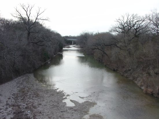
However, I expected to come to a dead end or see a bridge. Instead, we ended up intersecting FM2580 right at Mary's Brazos Cafe, just north of where 2580 crosses the Brazos. We went across the highway and stopped at a gas station. Another rider also was stopping (riding a Suzuki Intruder 1400) and we talked to him a bit. He was from Granbury but considered himself a local & said that the bridge was long gone. Anyway, we talked with him a bit before heading up to I20 and home.
So what is the deal with this bridge? There is conflicting information & it sure seemed longer than 2 miles down FM1884 to any kind of bridge. You would think that Handbook of Texas Online would know whether a bridge was in use or not... (I had a reference that said "In Use" but could not find it again)
Otherwise, it was a good day of riding with Kelly. The wind was really a problem for me with my tall bike, top case, and non-aerodynamic profile. Kelly faired better on his ZRX.
-------
One last note - while looking for the Tin Top bridge, I found a reference to TenMile bridge in Tarrant County. Looks like something to look for (this may be the one I was originally thinking about)...
-------
Oh yeah - a pox on you guys that have posted bridge finding trips and pictures recently! GRRR - you got me into this... You know who you are!
Here is what is says in National Register of Historic Places
Tin Top Suspension Bridge ** (added 1983 - Structure - #77001464)
2 mi. S of Tin Top on SR 1884, Tin Top
Historic Significance: Event, Architecture/Engineering
Architect, builder, or engineer: Parker County
Area of Significance: Commerce, Engineering, Transportation
Period of Significance: 1900-1924
Owner: Local Gov't
Historic Function: Transportation
Historic Sub-function: Road-Related
Current Function: Transportation
Current Sub-function: Road-Related
But another listing at Bridgemeister says this:
1906 Tin Top (Hightower Valley)
Tin Top, Texas, USA (Brazos River)
Mitchell & Pigg
References
HAERTX98 Use: Vehicular
Status: Removed
Main cables: Wire (steel)
Main span: 400f
Notes
Similar to 1906 Brannon's Crossing - Parker County, Texas, USA
USGS entry: Hightower Bridge
Feature Name: Hightower Bridge
Feature Type: bridge
Elevation (feet): 718
State: Texas
County: Parker
USGS 7.5' x 7.5' Map: Tin Top
323435N
0974919W
USGS also has an entry for Tin Top
TxDOT has this entry: Suspension Bridges
including this note at the bottom:
None of the Mitchell and Pigg bridges are still standing today although the Hightower Bridge at Tin Top survived almost 77 years until it collapsed in February 1982.
(the next page in that article mentions the Regency bridge)
Another Hightower Bridge reference...
And a Handbook of Texas entry:
The Tin Top Suspension Bridge, which spans the Brazos River, is listed in the National Register of Historic Places.
From a 1981 map, you can see Tin Top and FM2580. If you zoom in one level you get a 1979 map and can see the Hightower bridge but no 2580...
A list of Brazos River Bridges
I got some help from Kelly (FWRex) yesterday after leaving Stephenville. Now, Kelly really knows the roads southwest of Ft. Worth. We looked at a standard Texas map (which leaves out a lot of FMs) and figured out how to head that direction. We did 1188 and 1189 thru Lipan, took a bit of 4, and then crossed the Brazos on 1189 again. At a stop, He said "I think I know a shortcut to get there"...
However, I expected to come to a dead end or see a bridge. Instead, we ended up intersecting FM2580 right at Mary's Brazos Cafe, just north of where 2580 crosses the Brazos. We went across the highway and stopped at a gas station. Another rider also was stopping (riding a Suzuki Intruder 1400) and we talked to him a bit. He was from Granbury but considered himself a local & said that the bridge was long gone. Anyway, we talked with him a bit before heading up to I20 and home.
So what is the deal with this bridge? There is conflicting information & it sure seemed longer than 2 miles down FM1884 to any kind of bridge. You would think that Handbook of Texas Online would know whether a bridge was in use or not...
Otherwise, it was a good day of riding with Kelly. The wind was really a problem for me with my tall bike, top case, and non-aerodynamic profile. Kelly faired better on his ZRX.
-------
One last note - while looking for the Tin Top bridge, I found a reference to TenMile bridge in Tarrant County. Looks like something to look for (this may be the one I was originally thinking about)...
-------
Oh yeah - a pox on you guys that have posted bridge finding trips and pictures recently! GRRR - you got me into this... You know who you are!
Last edited: