Last edited:


-
 Welcome to the Two Wheeled Texans community!
  Feel free to hang out and lurk as long as you like. However, we would like to encourage you to register so that you can join the community and use the numerous features on the site. After registering, don't forget to post up an introduction!
You are using an out of date browser. It may not display this or other websites correctly.
You should upgrade or use an alternative browser.
You should upgrade or use an alternative browser.
Bad Choices Make Great Stories - The Rundown 2016
- Thread starter Trail Boss
- Start date
- Joined
- Nov 13, 2007
- Messages
- 2,064
- Reaction score
- 550
- Location
- Houston, TX and Phoenix AZ
- First Name
- Peter
- Last Name
- Shaddock
A
Last edited:
- Joined
- Jan 1, 2005
- Messages
- 4,465
- Reaction score
- 1,228
- Location
- Buda, TX
- First Name
- Rich
- Last Name
- Gibbens
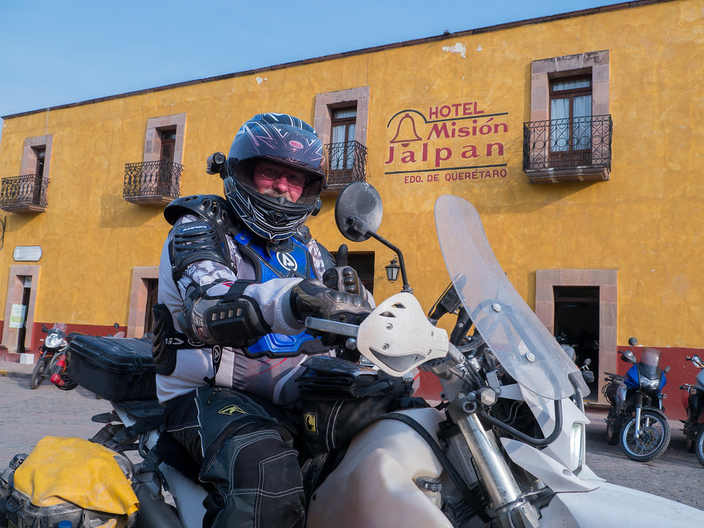
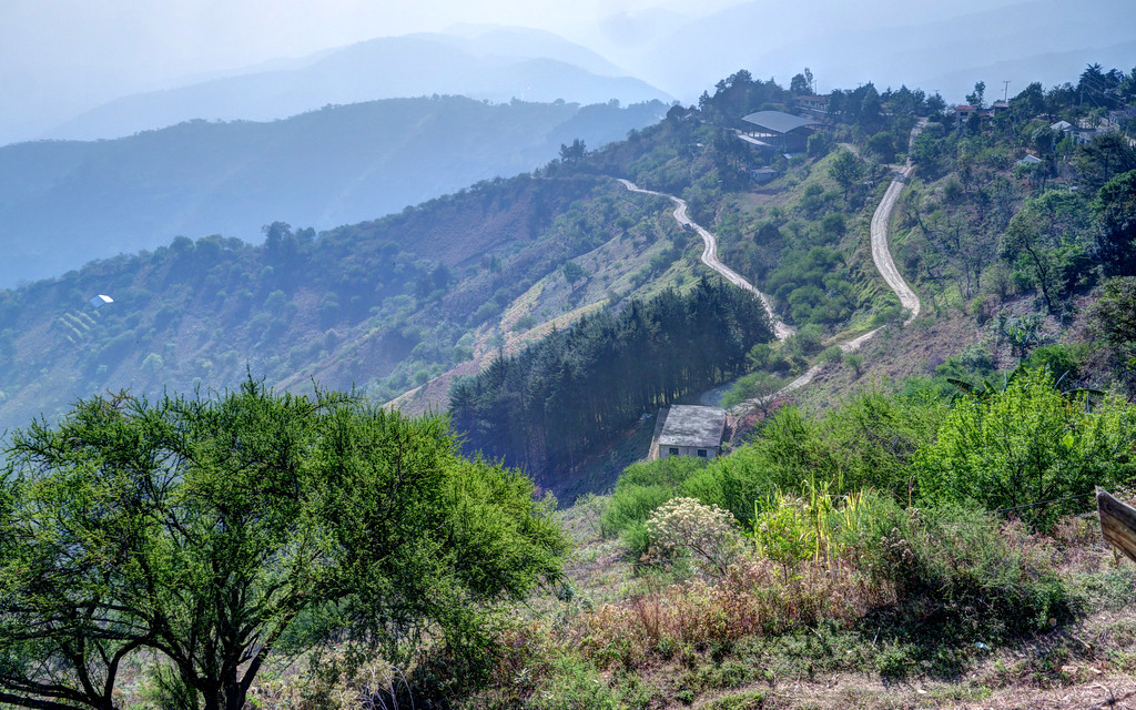
Day 4: Agua Zarco to Tilaco, 102 miles
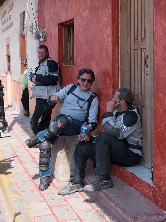
Each day began the same way – up early, drink coffee, eat breakfast, bike prep, story telling and….
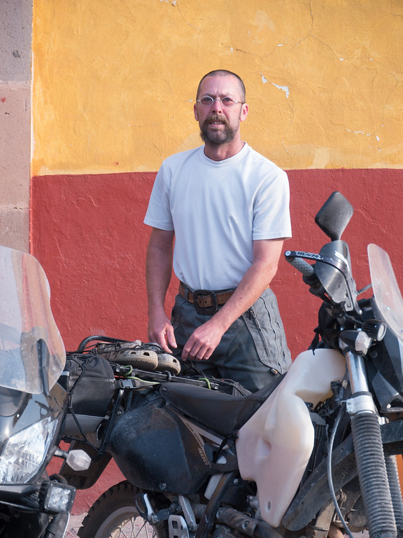
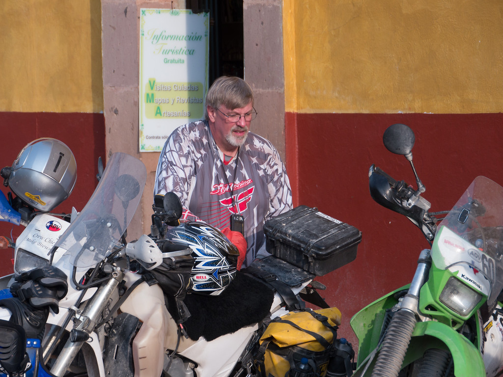

…the occasional high five.
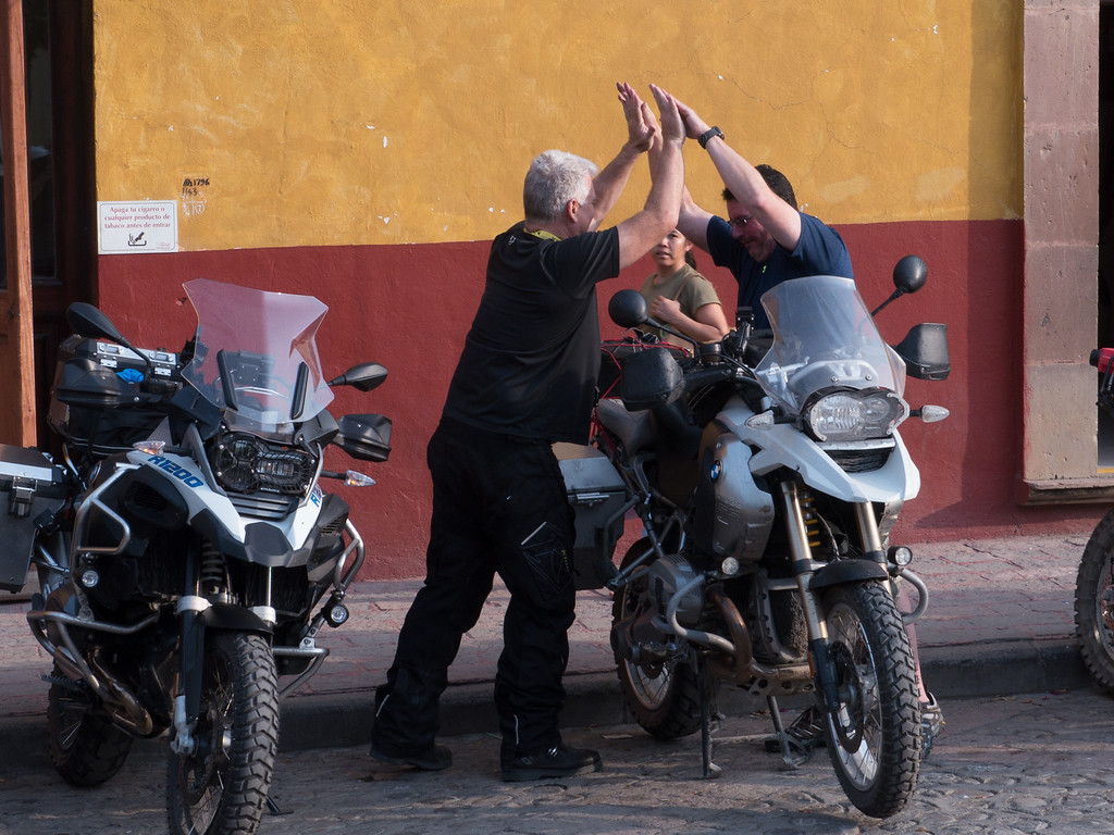
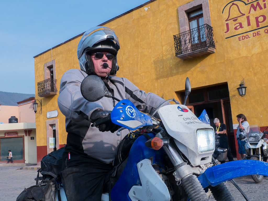
About 9 a.m. riders started heading out for the day’s adventure.
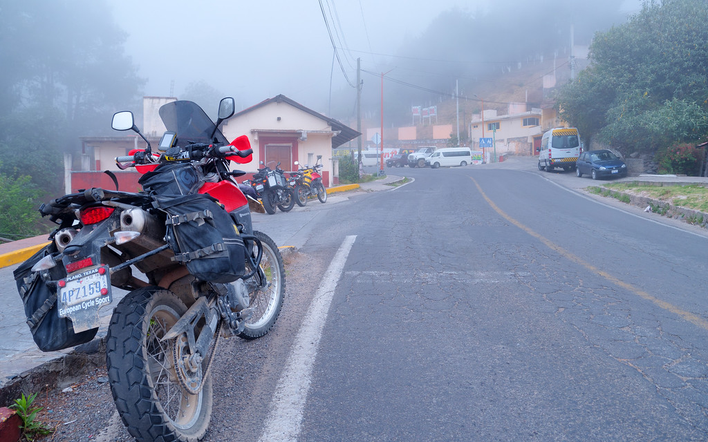
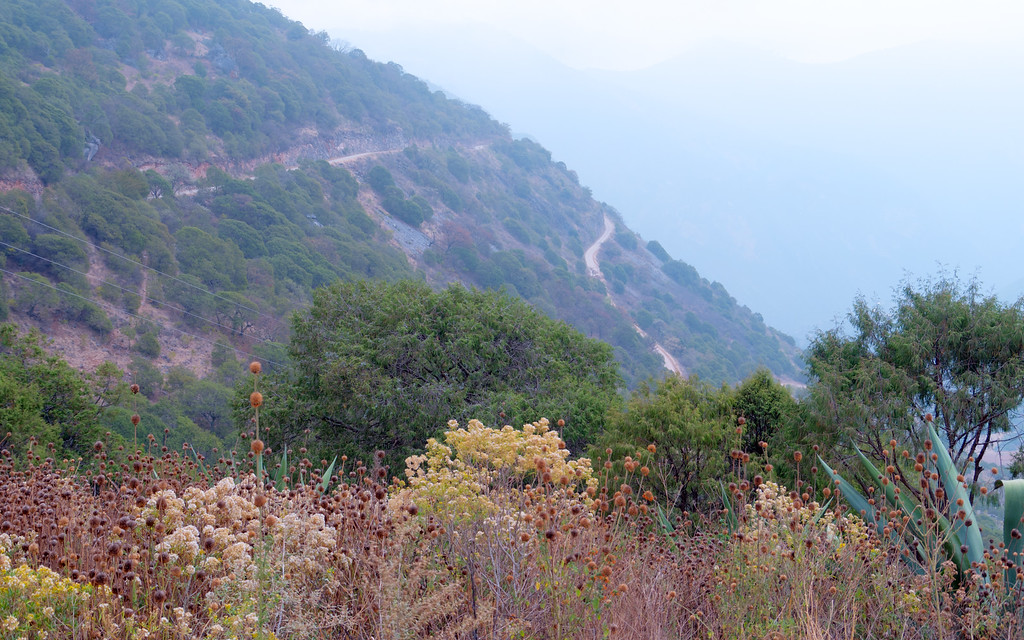
Early morning mist in old Mexico
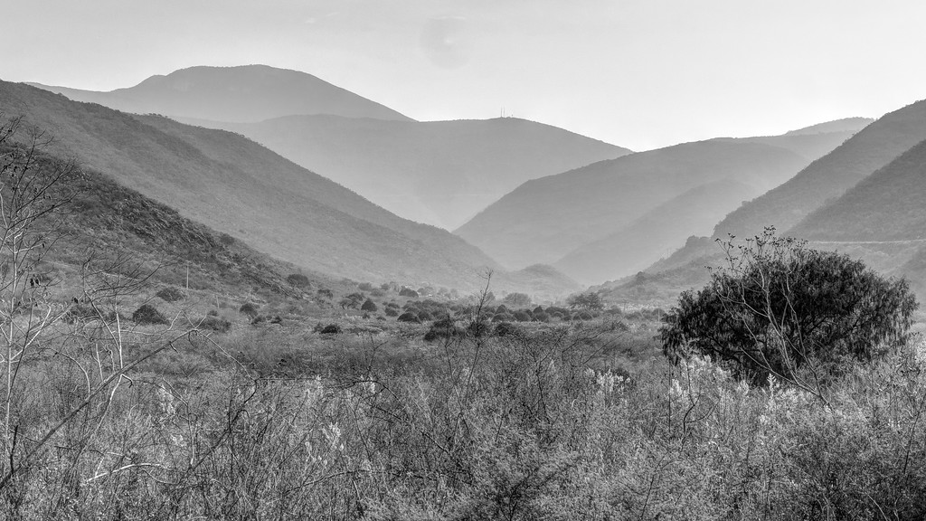
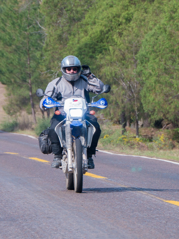
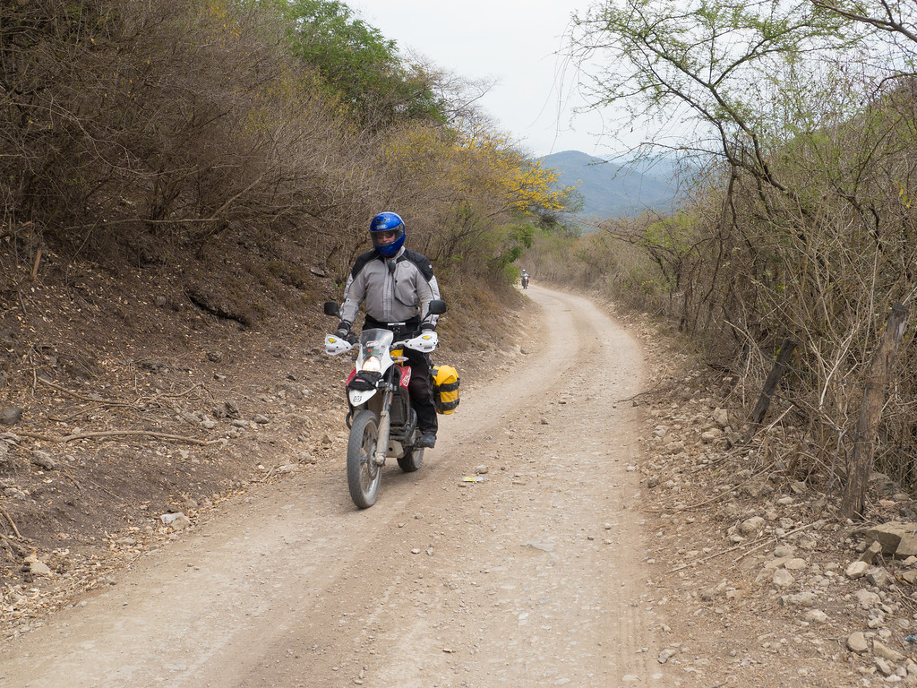
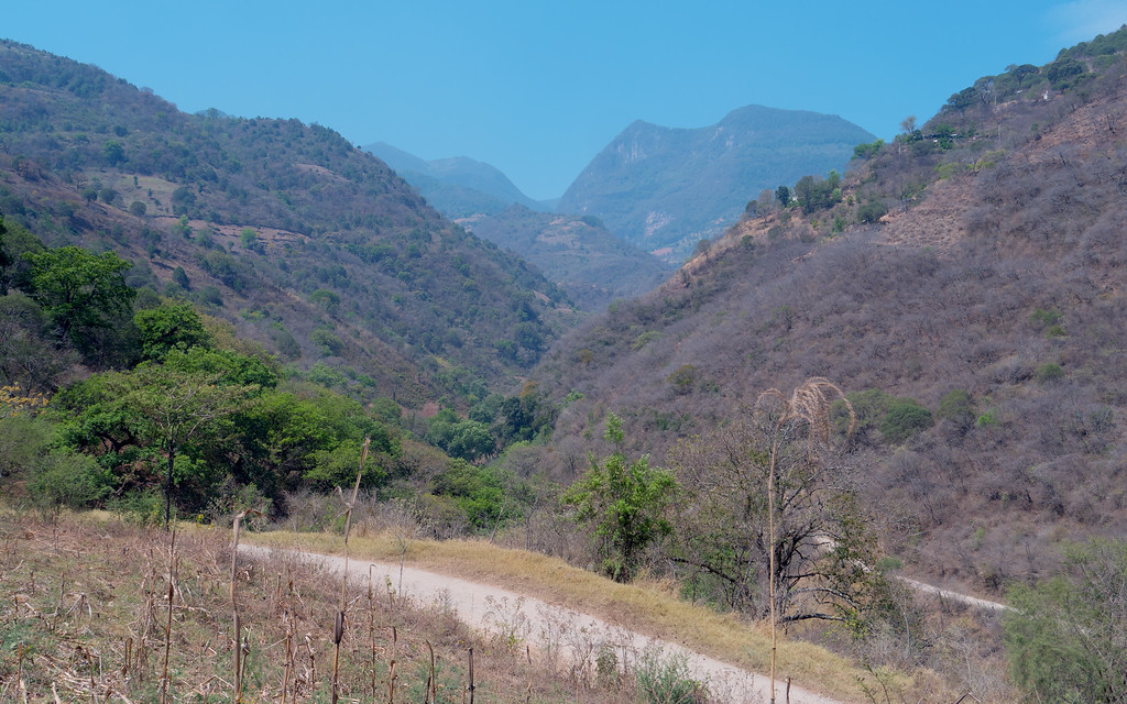
Today my group of four headed east to ride the awesome and amazing Agua Zarca to Tilaco route. We enjoyed 25 miles of spirited pavement riding on Hwy 120 to the cut-off to Agua Zarca. Hwy 120 has been called one of the top 10 roads in Mexico, a title I wouldn’t challenge. Miles and miles of curvy mountain road with mostly good pavement make for excellent riding.

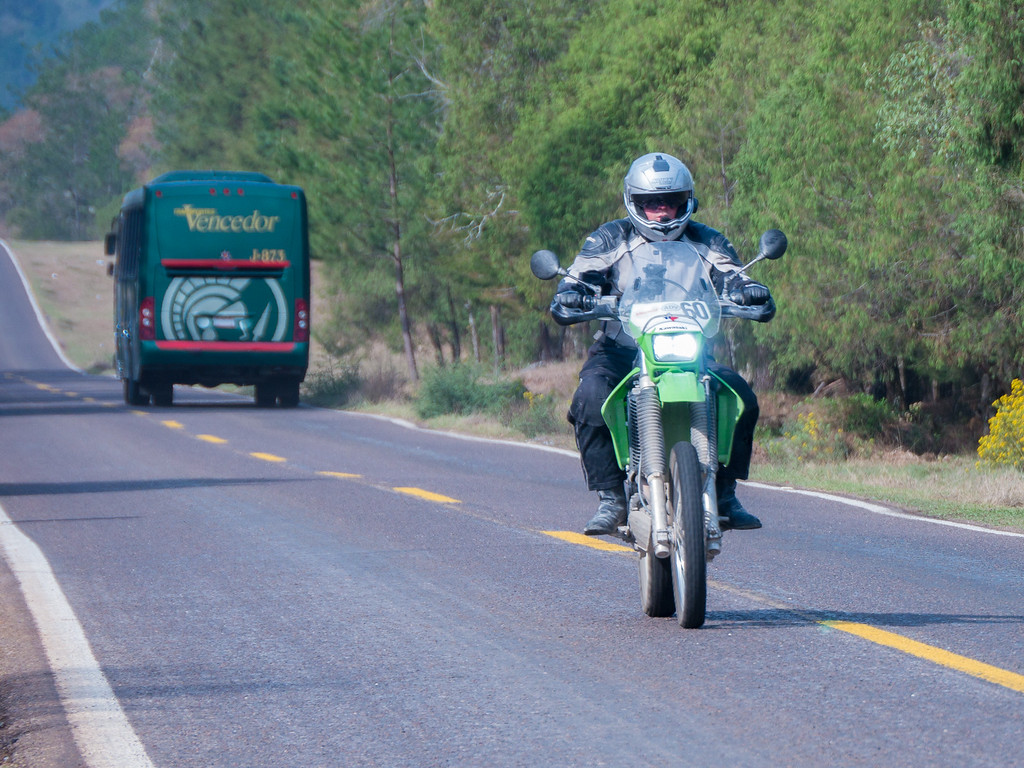
What’s that? I can’t hear you, I’m riding my dual sport motorcycle in Mexico.
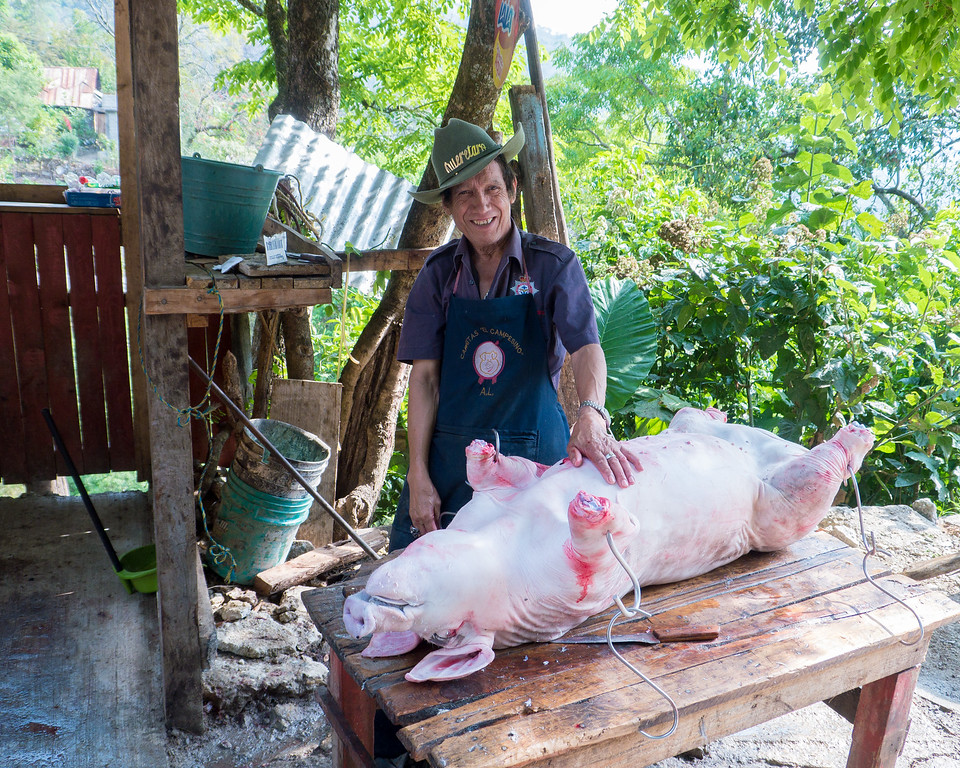
Just outside of Agua Zarca I spotted a fellow butchering a pig so of course I had to stop for a photo.
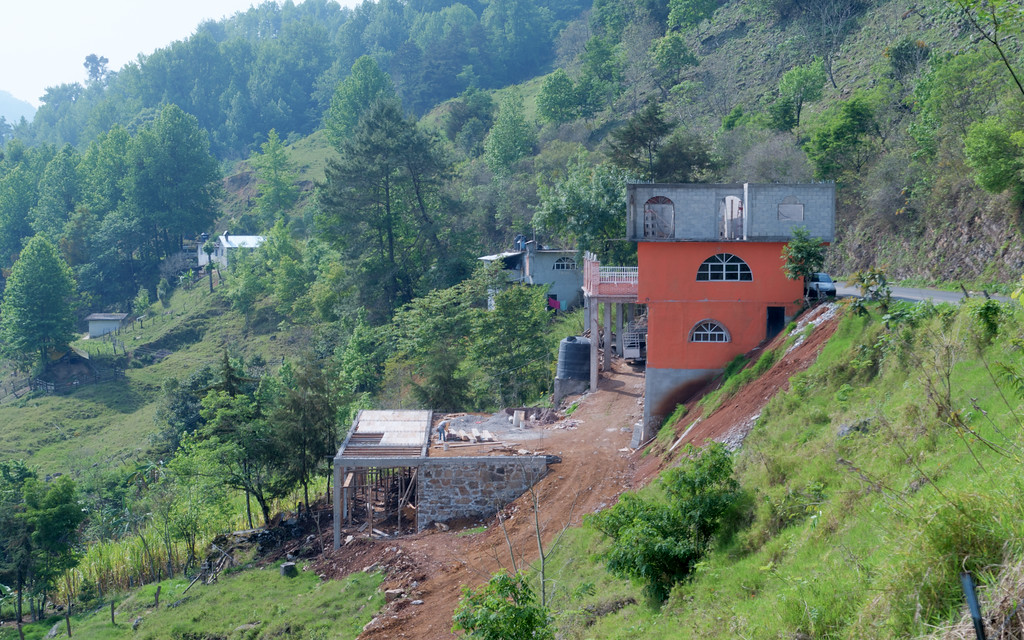
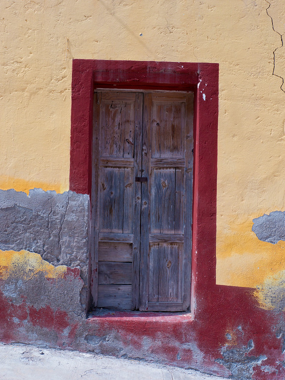
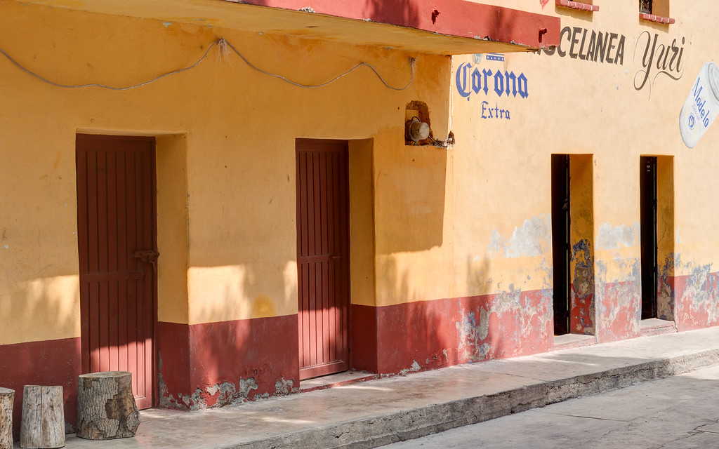
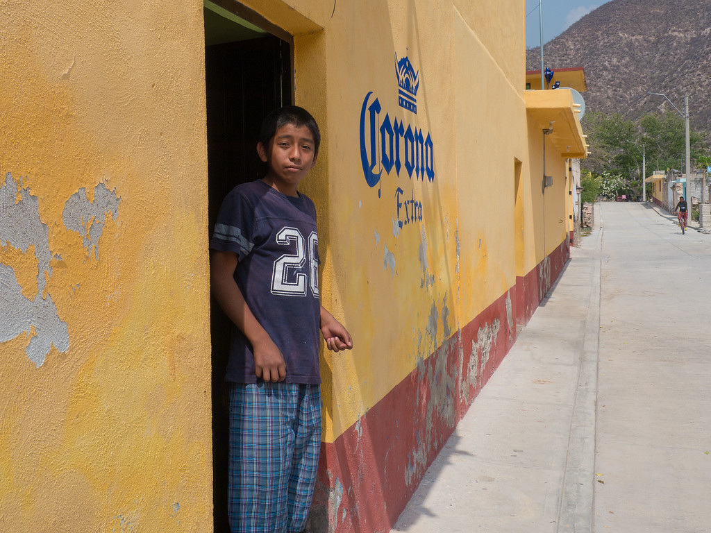
Many of the houses in Mexico are painted in bright, happy colors.
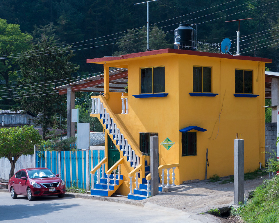
How do you build a house when you don’t own any flat land? Easy – just build it on the side of a hill.
Hugo took advantage of a short break in Agua Zarca to explain to Andre the finer points of throttle control.
Presumably there is no bus service to Agua Zarca so a specially modified Nissan Frontier pickup handles transport duties.

In the small tienda (store) on the main plaza in Agua Zarca I spotted a young lady wearing a bright pink shirt with the words “bad choices make good stories”. I chuckled and realized that I had just found the name of our ride report. Hugo, whose Spanish is much better than mine, explained to the young lady what her shirt said (she didn’t know) but it didn’t seem to have the same effect on her as it did us. She just smiled at the two old gringos while looking at us like we were a few beers short of a six-pack.

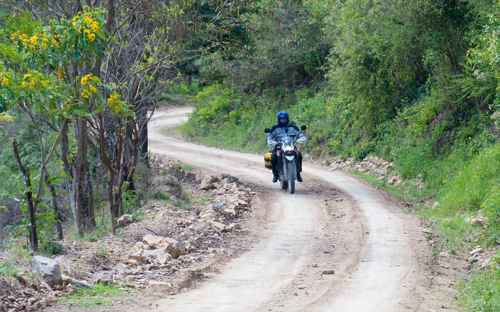
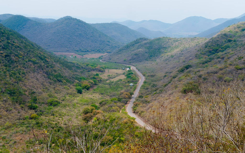
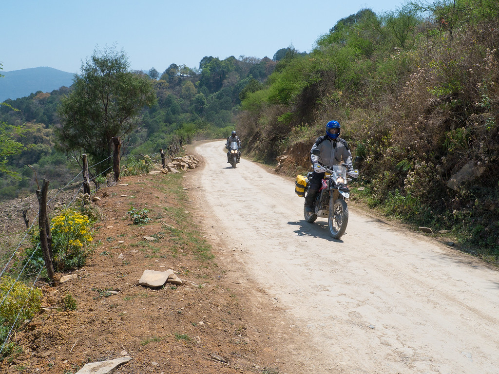
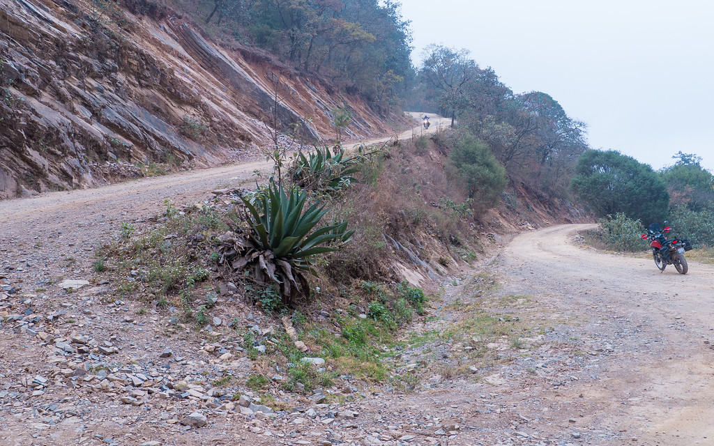
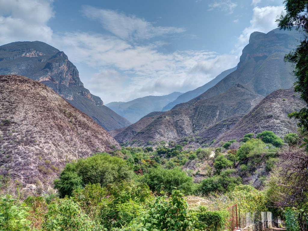
The dirt starts just outside of Agua Zarca. It’s the most beautiful road I can recall riding.
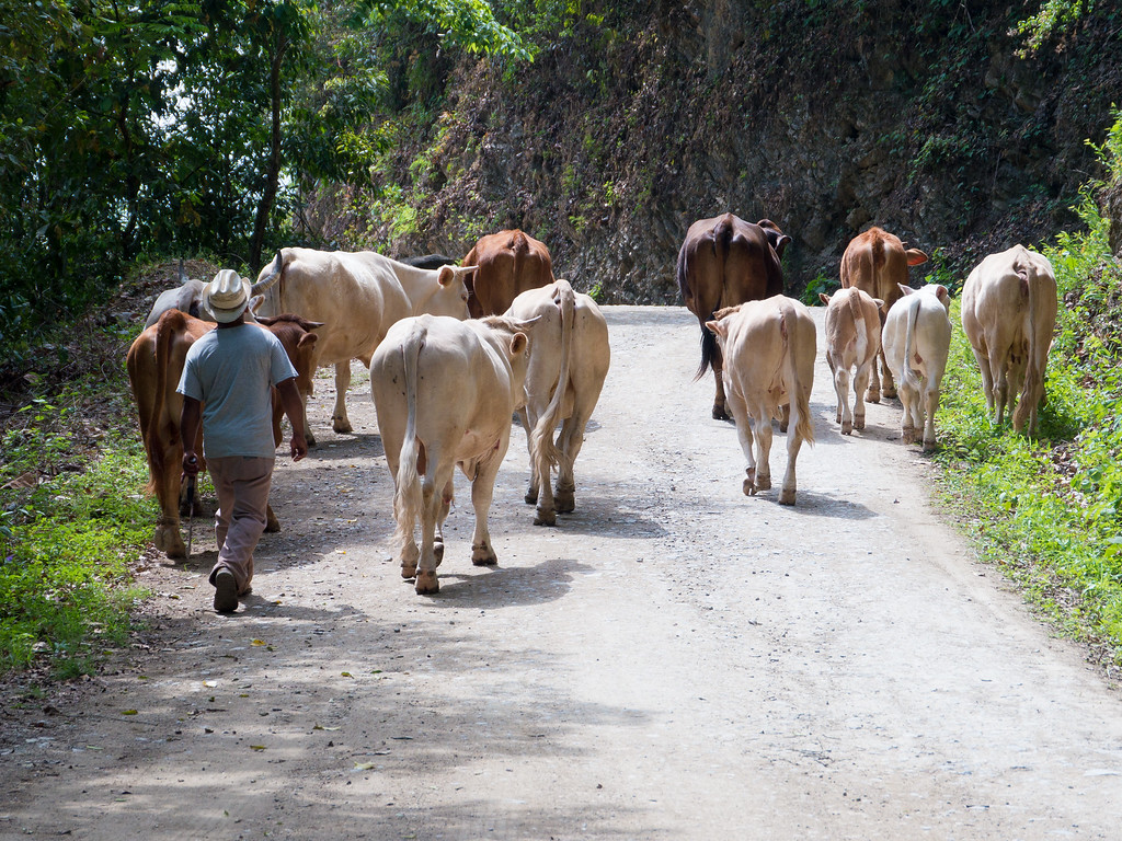
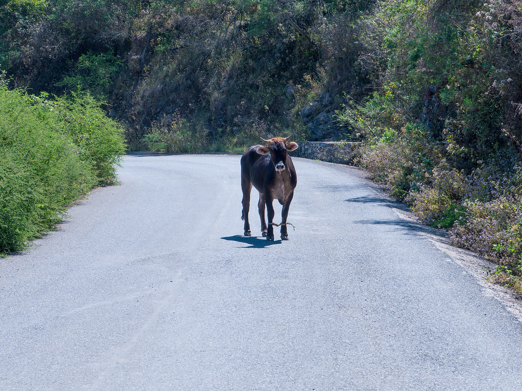
A few miles outside of town we ran into a slow moving road block. We carefully made our way past the herd with no problems.
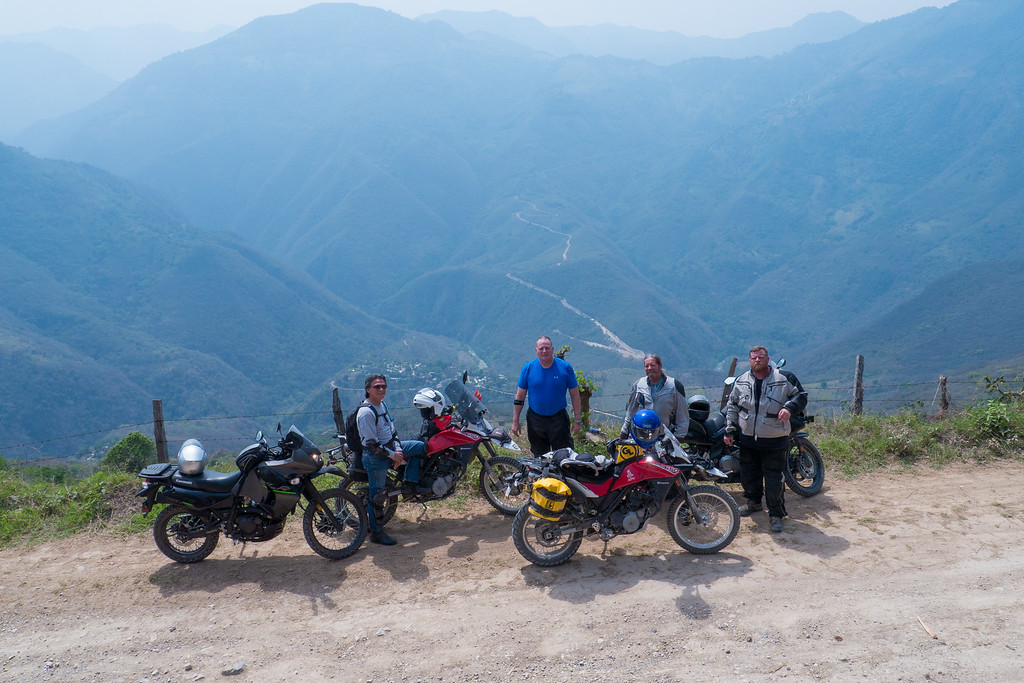
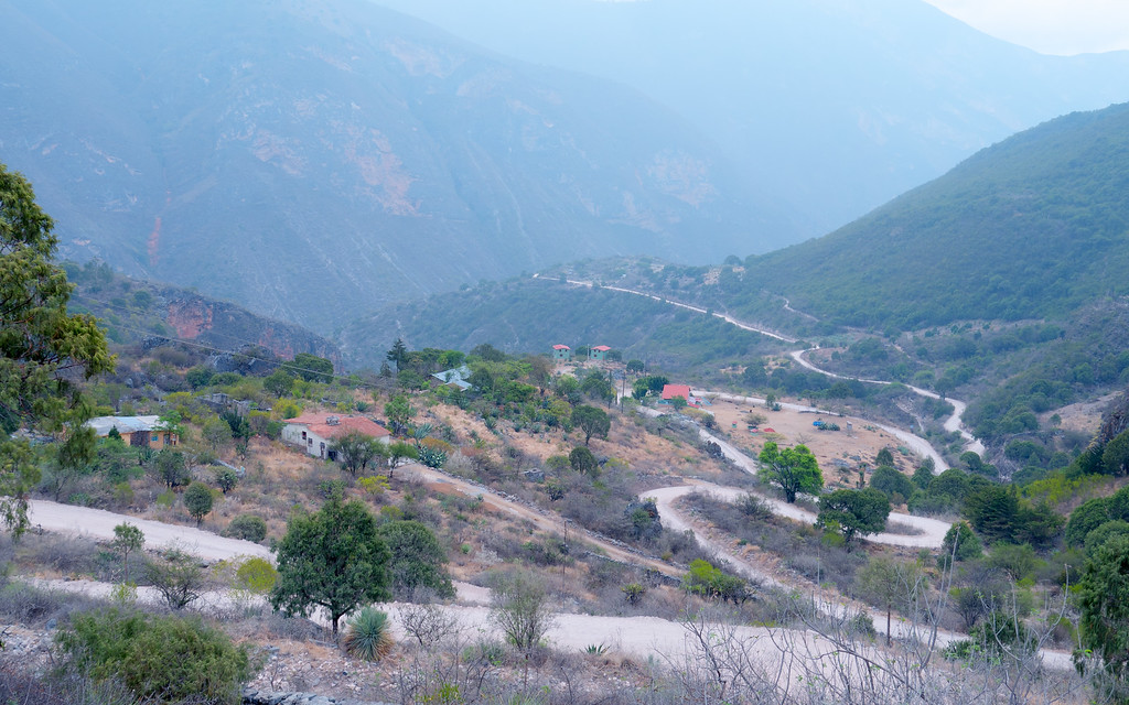
A scenic overlook
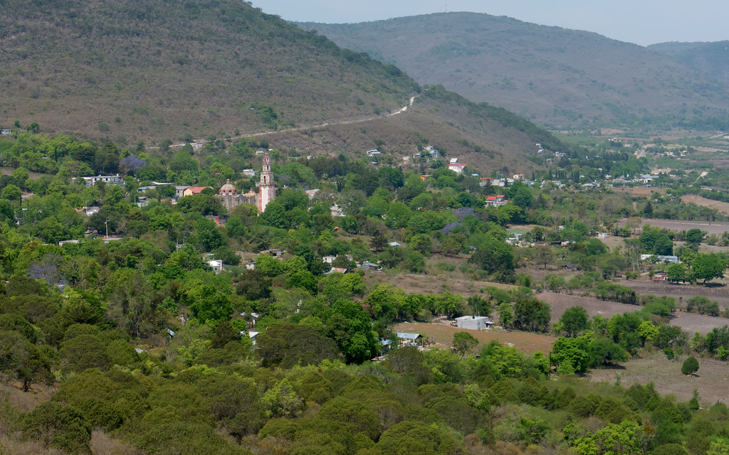
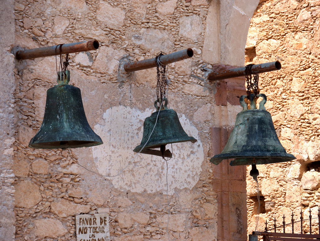
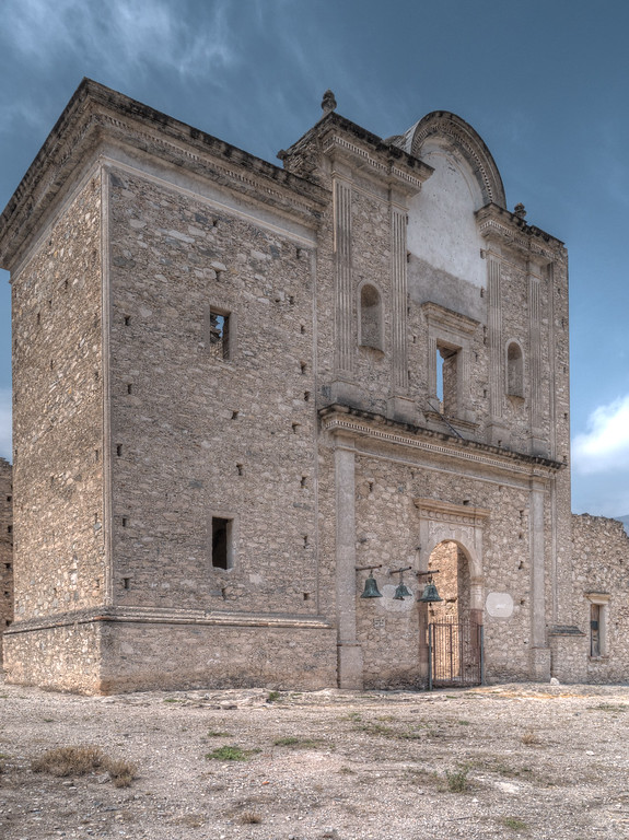
Tilaco is home to one of the 5 missions built by Serra.
After lunch in Tilaco we headed north to Hwy 120 and then on to another dirt section. Here’s the paved road between Tilaco and Hwy 120.
Back in the dirt
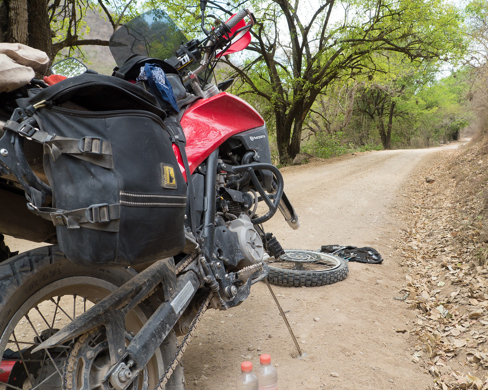
I rolled my front tire off the side of a good sized rock and got a pinch flat. I patched it but the patch didn’t hold. So I put in a new tube and that solved the issue. But I couldn’t get the bead settled correctly on the wheel so the front tire was badly out of balance. We weren’t too far from Jalpan so I rode the bike back to the hotel and fixed the problem in the parking lot with ample assistance and oversight from other riders.
It appears that the road between Agua Zarca and Tilaco will soon be paved. Some of it has been paved since I was here last year and work was clearly still in progress. While the views will still be marvelous, it won’t be the same once it’s paved. I’m glad I got to ride it before the dirt disappears forever.
Each day began the same way – up early, drink coffee, eat breakfast, bike prep, story telling and….
…the occasional high five.
About 9 a.m. riders started heading out for the day’s adventure.
Early morning mist in old Mexico
Today my group of four headed east to ride the awesome and amazing Agua Zarca to Tilaco route. We enjoyed 25 miles of spirited pavement riding on Hwy 120 to the cut-off to Agua Zarca. Hwy 120 has been called one of the top 10 roads in Mexico, a title I wouldn’t challenge. Miles and miles of curvy mountain road with mostly good pavement make for excellent riding.
What’s that? I can’t hear you, I’m riding my dual sport motorcycle in Mexico.
Just outside of Agua Zarca I spotted a fellow butchering a pig so of course I had to stop for a photo.
Many of the houses in Mexico are painted in bright, happy colors.
How do you build a house when you don’t own any flat land? Easy – just build it on the side of a hill.
Hugo took advantage of a short break in Agua Zarca to explain to Andre the finer points of throttle control.
Presumably there is no bus service to Agua Zarca so a specially modified Nissan Frontier pickup handles transport duties.
In the small tienda (store) on the main plaza in Agua Zarca I spotted a young lady wearing a bright pink shirt with the words “bad choices make good stories”. I chuckled and realized that I had just found the name of our ride report. Hugo, whose Spanish is much better than mine, explained to the young lady what her shirt said (she didn’t know) but it didn’t seem to have the same effect on her as it did us. She just smiled at the two old gringos while looking at us like we were a few beers short of a six-pack.
The dirt starts just outside of Agua Zarca. It’s the most beautiful road I can recall riding.
A few miles outside of town we ran into a slow moving road block. We carefully made our way past the herd with no problems.
A scenic overlook
Tilaco is home to one of the 5 missions built by Serra.
After lunch in Tilaco we headed north to Hwy 120 and then on to another dirt section. Here’s the paved road between Tilaco and Hwy 120.
Back in the dirt
I rolled my front tire off the side of a good sized rock and got a pinch flat. I patched it but the patch didn’t hold. So I put in a new tube and that solved the issue. But I couldn’t get the bead settled correctly on the wheel so the front tire was badly out of balance. We weren’t too far from Jalpan so I rode the bike back to the hotel and fixed the problem in the parking lot with ample assistance and oversight from other riders.
It appears that the road between Agua Zarca and Tilaco will soon be paved. Some of it has been paved since I was here last year and work was clearly still in progress. While the views will still be marvelous, it won’t be the same once it’s paved. I’m glad I got to ride it before the dirt disappears forever.
Last edited:
quote:
"The next day I decided to head out on my own based on a recommendation from JT and some Bimbo by the pool, I decided to head out to Rio De Catorce, ..."
If ya look closely, you'll see there were two Bimbos by the pool! ha ha!
"The next day I decided to head out on my own based on a recommendation from JT and some Bimbo by the pool, I decided to head out to Rio De Catorce, ..."
If ya look closely, you'll see there were two Bimbos by the pool! ha ha!
JT
Forum Supporter
This has been a **** of of a week. Thank you all for posting the pics and memories. Chuck wanted to be here. I cant seem to resolve it all, but the pics of Pete and Sid help. Thank you.
Yeah, Bob looks horribly "lost" there. ")

<snip>
Bob was a great tour guide, though he did have some help.
Mission Tour by Charles Nevle, on Flickr
<snip>
- Joined
- Nov 10, 2009
- Messages
- 680
- Reaction score
- 150
- Location
- 10 miles from Mexico
- First Name
- Zeke
- Last Name
- Mtz
The local mex girl is probably askin him for directions
- Joined
- Nov 13, 2007
- Messages
- 2,064
- Reaction score
- 550
- Location
- Houston, TX and Phoenix AZ
- First Name
- Peter
- Last Name
- Shaddock
B
Last edited:
- Joined
- Feb 28, 2003
- Messages
- 51,257
- Reaction score
- 8,294
- Location
- Huntsville
- First Name
- Scott
- Last Name
- Friday
Your Samsung takes great pics! 
- Joined
- Nov 13, 2007
- Messages
- 2,064
- Reaction score
- 550
- Location
- Houston, TX and Phoenix AZ
- First Name
- Peter
- Last Name
- Shaddock
Your Samsung takes great pics!
And amazingly you can shoot underwater with it too. Best phone / camera / PC I have ever owned. Crashproof too!
Unreal that that bike made the rest of the trip. Congratulations .
- Joined
- Nov 10, 2009
- Messages
- 680
- Reaction score
- 150
- Location
- 10 miles from Mexico
- First Name
- Zeke
- Last Name
- Mtz
what happened to peters bike? any pics?Unreal that that bike made the rest of the trip. Congratulations .
nevlec
0
- Joined
- Sep 7, 2004
- Messages
- 659
- Reaction score
- 315
- Location
- Houston, Tx
- First Name
- Charles
- Last Name
- Nevle
Nice pics Pete! I want to go back again already!
- Joined
- Jan 1, 2005
- Messages
- 4,465
- Reaction score
- 1,228
- Location
- Buda, TX
- First Name
- Rich
- Last Name
- Gibbens
what happened to peters bike? any pics?
He had a wreck. Pics of his bike after the crash are in this ride report (his bike is in the back of a pickup truck).
- Joined
- Jan 1, 2005
- Messages
- 4,465
- Reaction score
- 1,228
- Location
- Buda, TX
- First Name
- Rich
- Last Name
- Gibbens
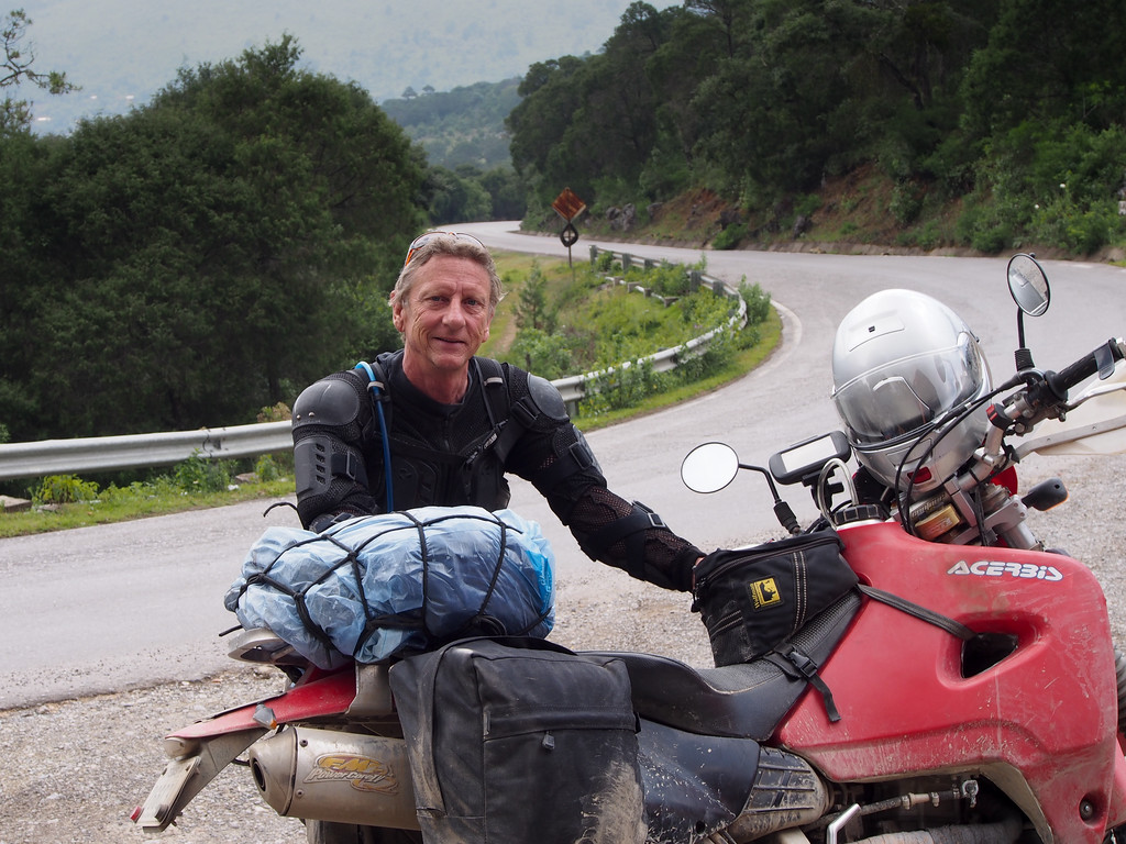
Day 5: New Dirt, 70 miles
As part of my prep for this trip, I spent some time looking at my various Mexico maps and Google Earth in order to come up with some potential new routes for riders to explore. They were unproven routes since no one had ridden them but I felt fairly confident that the roads would be there. What I didn’t have a way of telling was how good, or not, a particular route might be. Would the roads actually be dirt (many dirt roads have been paved but the map hasn’t been updated)? Would the scenery be awe-inspiring? The only way to answer these questions was for someone to go ride the unproved routes.
Luckily, many, or most, of the riders wanted to explore new stuff so every day I had at least one conversation, and usually more than one, about someone’s experience on one of the unproven routes. The more I heard about the new routes the more I wanted to go ride them. So today I set out to ride two new dirt routes that had only been proven in the last day.
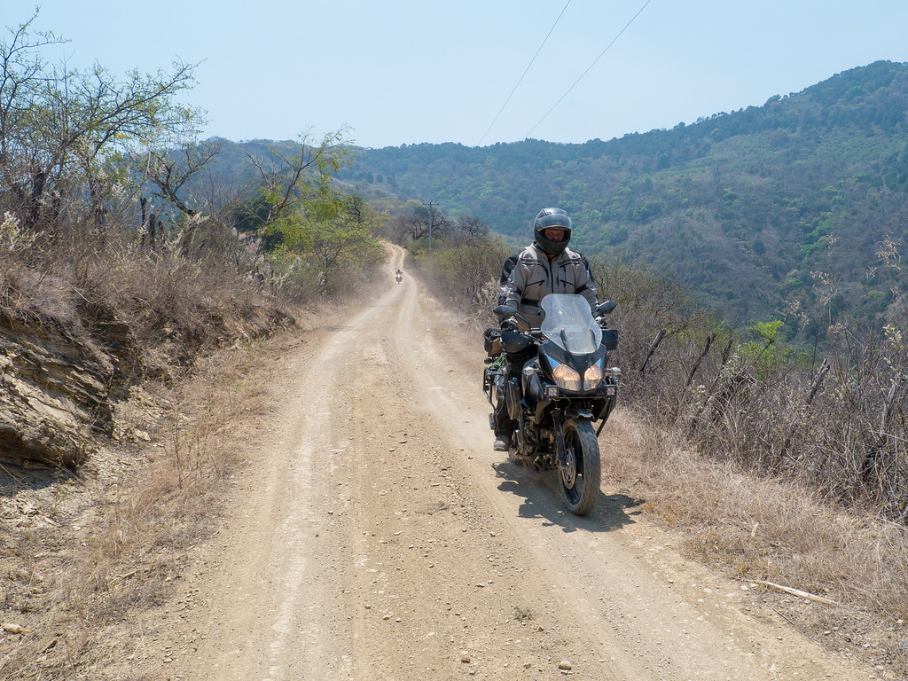
The first road looped south of Jalpan, down into a valley and the back up to the top of the mountains. As expected, the views and scenery were very good. However, this route also had much more civilization that I prefer. While I enjoyed riding it, I wouldn’t seek it out again.
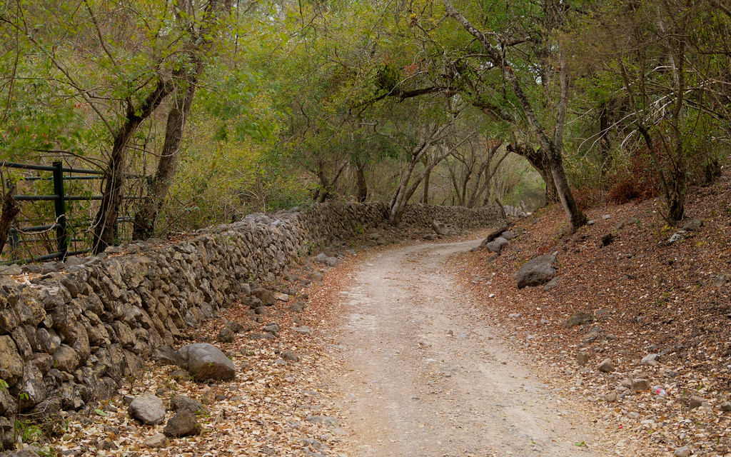
Cobblestone road

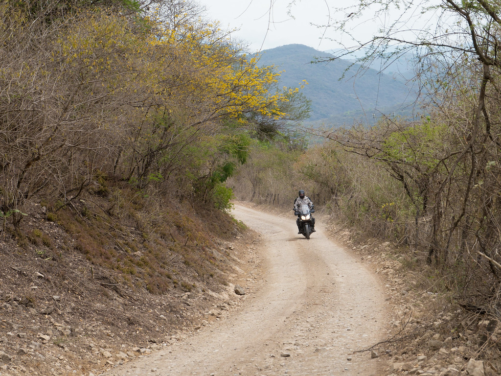
One of the more remote sections of the route (there weren’t a lot of remote sections on this part of the day's ride)
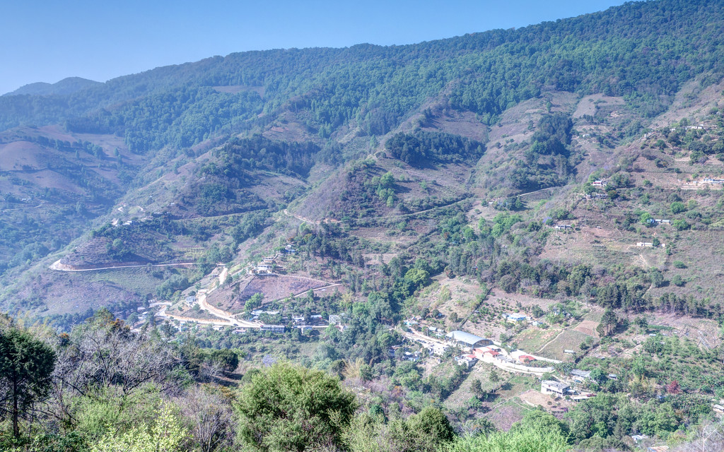

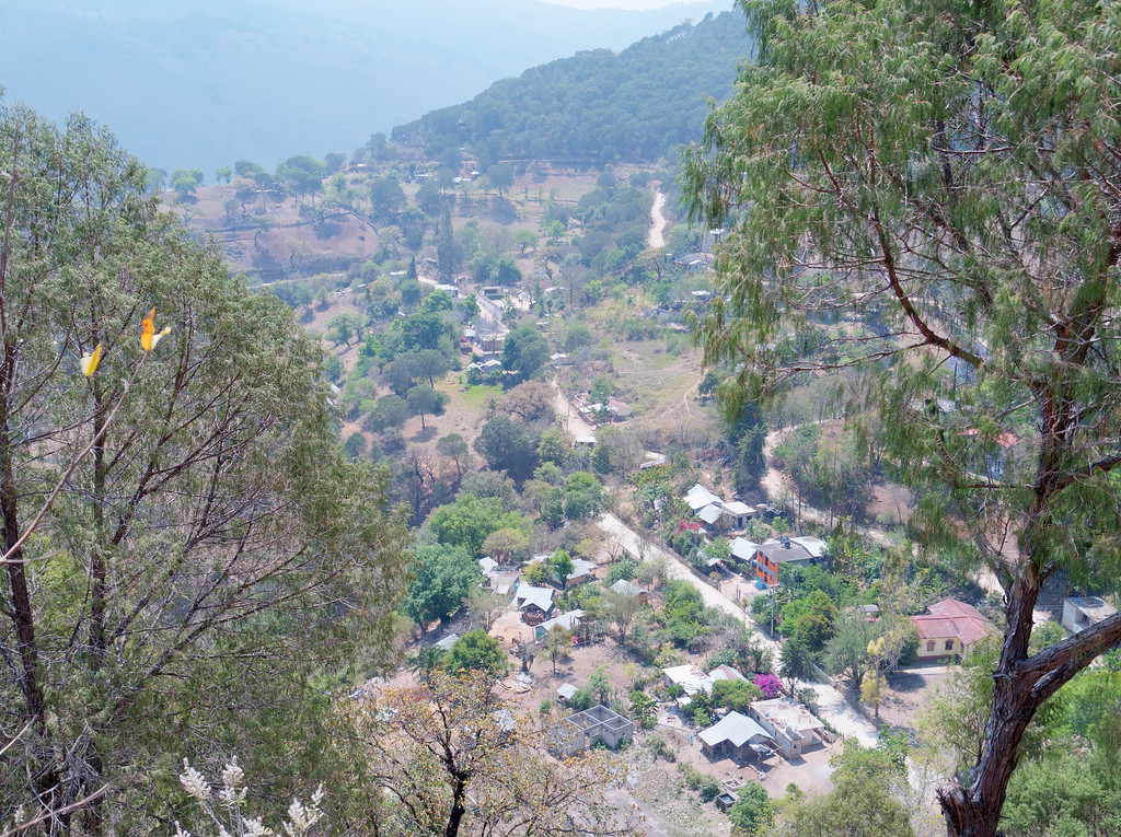
Once we had finished the southern loop it was time to do a short (30 mile) north loop that passed through the village of Maguey Blanco. I had been told by another rider that had ridden this loop the day before that it was more remote than the southern loop, which I was glad to hear.
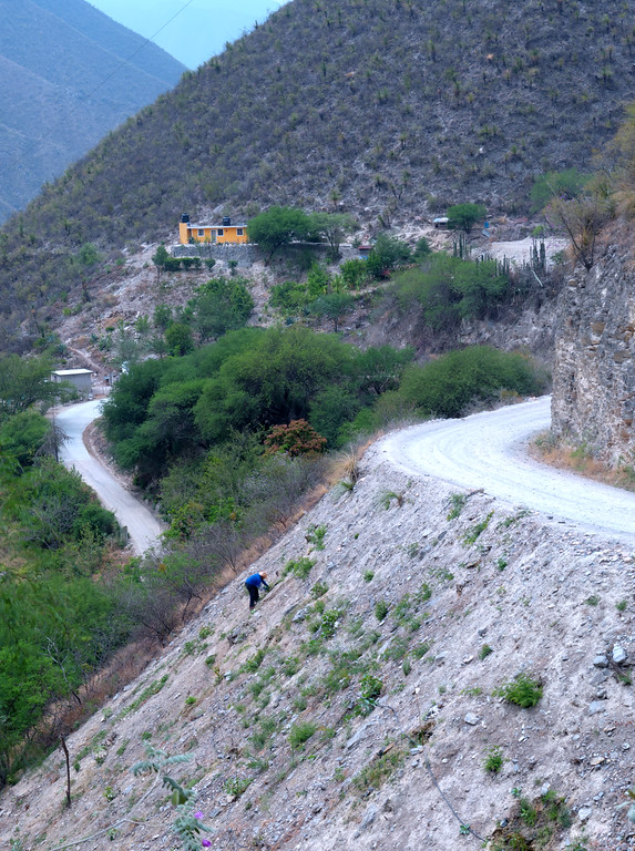
The Maguey Blanco loop started off as an exceptional paved road (one of the roads the map shows as being dirt but that has been paved). It was such a superb road that the next time I’m in the Jalpan area I’m going to explore it further. I recommend that you ride this road when you are in the area.
It was on this road that I ran headfirst into a Mexican stand-off. I was determined to get by and this fellow seemed determined to stand in the middle of the road staring at me. A bit of horn honking and engine revving finally persuaded him to move off the road and let us pass.
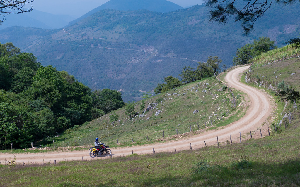
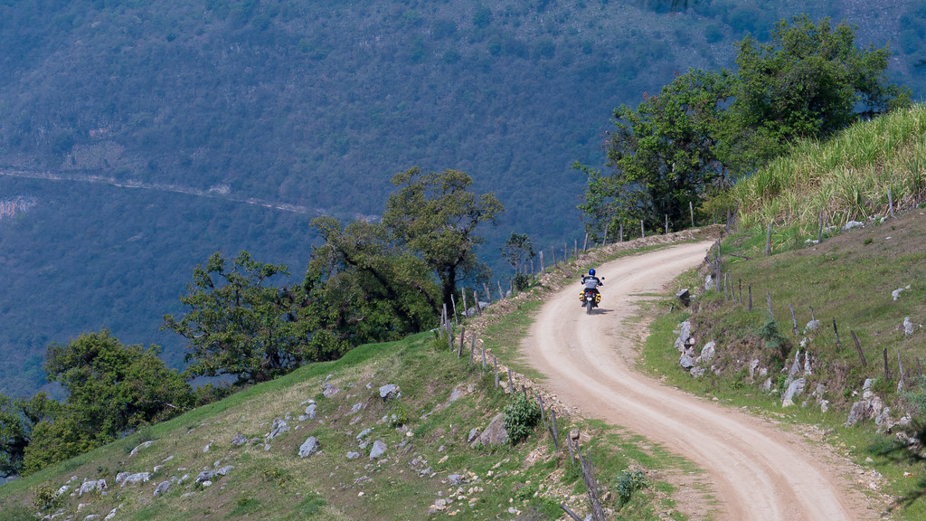
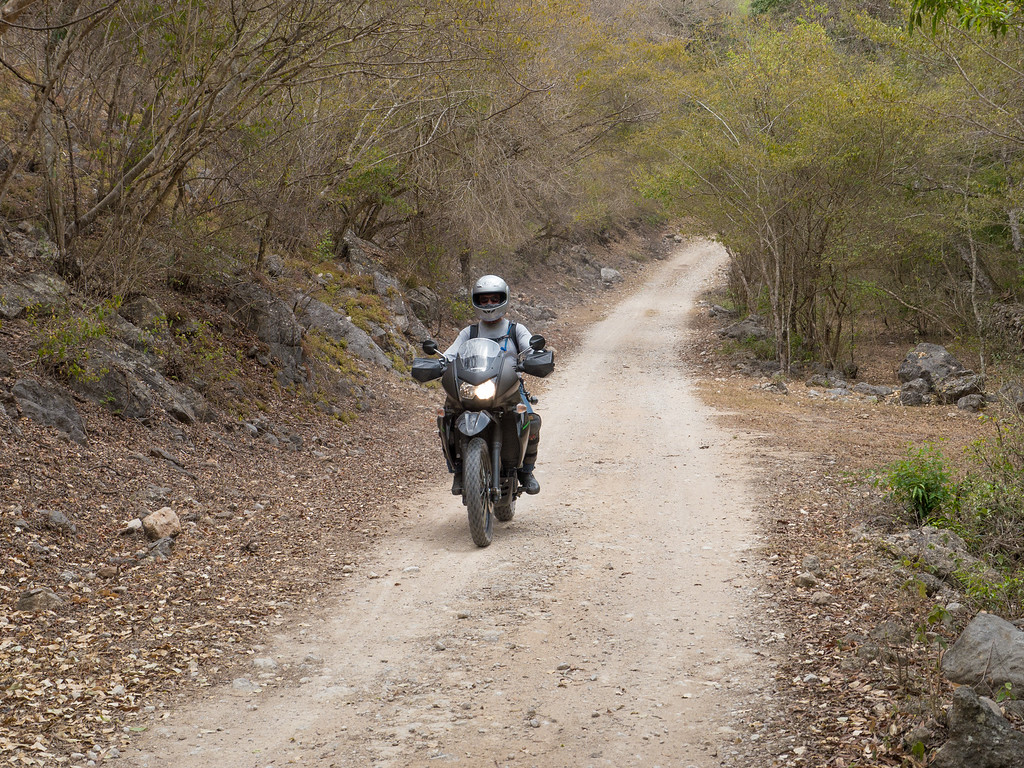
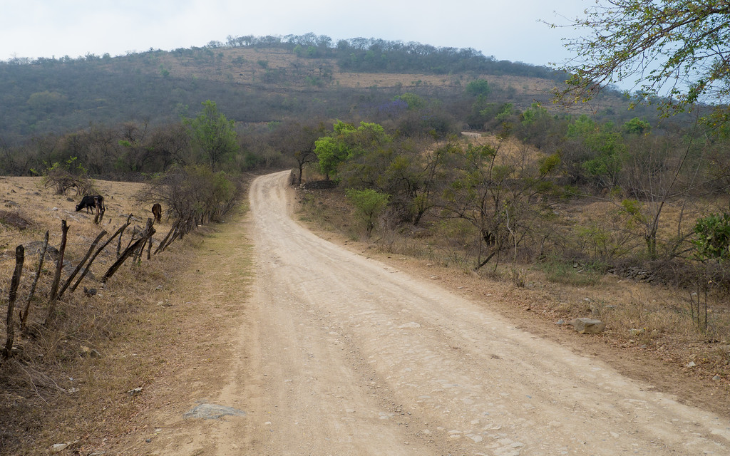
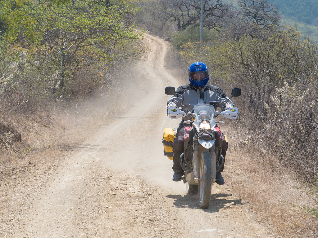
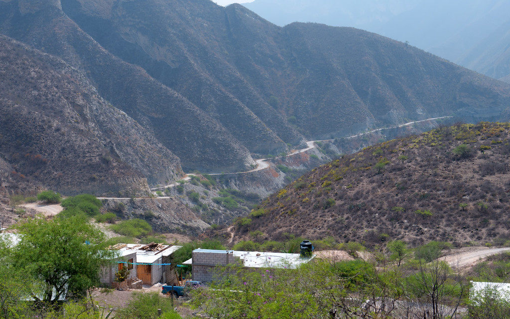
After a few miles of pavement, we reached the dirt at the turn off to Maguey Blanco. This dirt was much more to my liking. The road was an easy class 1 but the views were great. And it was noticeably more remote, with fewer people and civilization.
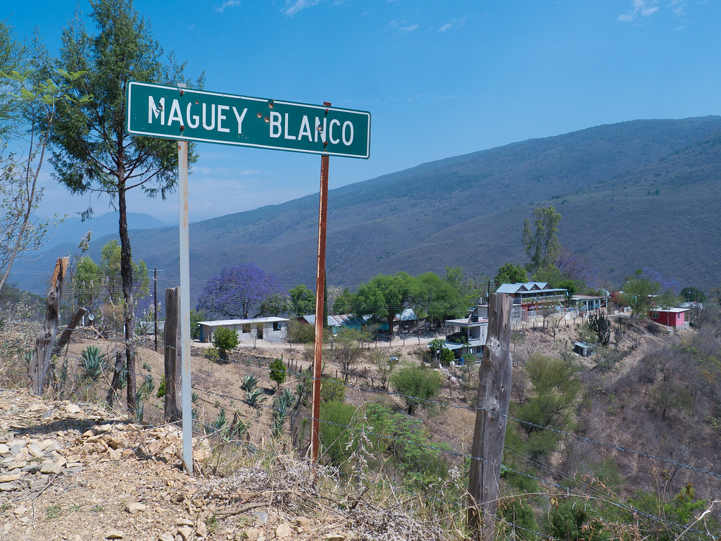
The Maguey Blanco route ends at Hwy 69, about 20 miles easy riding miles north of Jalpan. I recommend the Maguey Blanco route to you as either a fairly short riding day or as an addition to other riding you might be doing in a particular day.
As part of my prep for this trip, I spent some time looking at my various Mexico maps and Google Earth in order to come up with some potential new routes for riders to explore. They were unproven routes since no one had ridden them but I felt fairly confident that the roads would be there. What I didn’t have a way of telling was how good, or not, a particular route might be. Would the roads actually be dirt (many dirt roads have been paved but the map hasn’t been updated)? Would the scenery be awe-inspiring? The only way to answer these questions was for someone to go ride the unproved routes.
Luckily, many, or most, of the riders wanted to explore new stuff so every day I had at least one conversation, and usually more than one, about someone’s experience on one of the unproven routes. The more I heard about the new routes the more I wanted to go ride them. So today I set out to ride two new dirt routes that had only been proven in the last day.
The first road looped south of Jalpan, down into a valley and the back up to the top of the mountains. As expected, the views and scenery were very good. However, this route also had much more civilization that I prefer. While I enjoyed riding it, I wouldn’t seek it out again.
Cobblestone road
One of the more remote sections of the route (there weren’t a lot of remote sections on this part of the day's ride)
Once we had finished the southern loop it was time to do a short (30 mile) north loop that passed through the village of Maguey Blanco. I had been told by another rider that had ridden this loop the day before that it was more remote than the southern loop, which I was glad to hear.
The Maguey Blanco loop started off as an exceptional paved road (one of the roads the map shows as being dirt but that has been paved). It was such a superb road that the next time I’m in the Jalpan area I’m going to explore it further. I recommend that you ride this road when you are in the area.
It was on this road that I ran headfirst into a Mexican stand-off. I was determined to get by and this fellow seemed determined to stand in the middle of the road staring at me. A bit of horn honking and engine revving finally persuaded him to move off the road and let us pass.
After a few miles of pavement, we reached the dirt at the turn off to Maguey Blanco. This dirt was much more to my liking. The road was an easy class 1 but the views were great. And it was noticeably more remote, with fewer people and civilization.
The Maguey Blanco route ends at Hwy 69, about 20 miles easy riding miles north of Jalpan. I recommend the Maguey Blanco route to you as either a fairly short riding day or as an addition to other riding you might be doing in a particular day.
Nobody tells a story like Richard
- Joined
- Feb 20, 2015
- Messages
- 848
- Reaction score
- 291
- Location
- GEORGETOWN,TX
- First Name
- ken
- Last Name
- Musgrove
The best thumper? The one that's in Mexico, of course!
Patrick, you are a fart smeller. that is the most bad __s thing i have heard yet. i dont care what anybody else says. Your pics are great too.
Enjoyed riding with you.
Later Taters. see yall at the next rodeo
- Joined
- Jan 1, 2005
- Messages
- 4,465
- Reaction score
- 1,228
- Location
- Buda, TX
- First Name
- Rich
- Last Name
- Gibbens
- Joined
- Oct 14, 2014
- Messages
- 243
- Reaction score
- 6
- Location
- San Antonio, TX
- First Name
- Chris
- Last Name
- C
Absolutely awesome pictures all the way through this thread. Thanks for sharing. I can't wait till I'm down there next month!
- Joined
- Nov 11, 2007
- Messages
- 4,803
- Reaction score
- 1,776
- Location
- Rendon TX
- First Name
- Mike
- Last Name
- Brewster
I'm a mediocre rider and poor photographer, writer and storyteller, but I will add this; This was my first dual sport ride and it won't be my last. The trip was beyond enjoyable and I appreciate the time and organizing it took to make it possible.
My favorite quote from the week was "....unless it's rained"
Thanks to all for making it a great week.
My favorite quote from the week was "....unless it's rained"
Thanks to all for making it a great week.
Dog needed to look where it was going, the bumper of the truck did not move.
[ame="https://www.youtube.com/watch?v=NF0M0q3kLq4"]Dog's in Mexico - YouTube[/ame]
[ame="https://www.youtube.com/watch?v=NF0M0q3kLq4"]Dog's in Mexico - YouTube[/ame]
- Joined
- Jan 1, 2005
- Messages
- 4,465
- Reaction score
- 1,228
- Location
- Buda, TX
- First Name
- Rich
- Last Name
- Gibbens
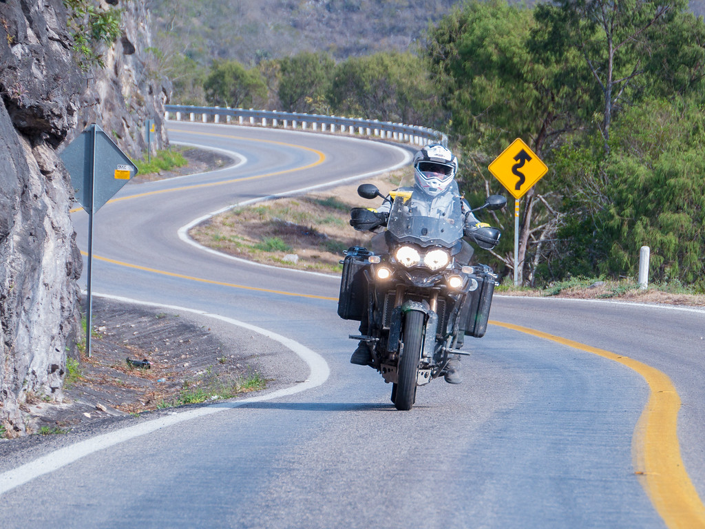
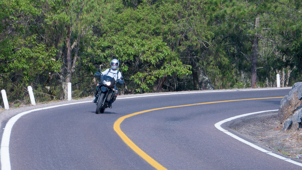
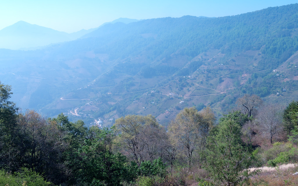
Day 6: The Road to Bucareli, 154 miles
Day 6: The Road to Bucareli, 154 miles
This was our last day before heading back to Texas so I wanted to ensure it was a good day. At the hotel at the end of day 5 I heard several riders raving about the road to Bucareli, so that seemed like a great choice. Subcomm Mark decided to join Stuntman and I so at the crack of 9 a.m. we pointed our bikes west.
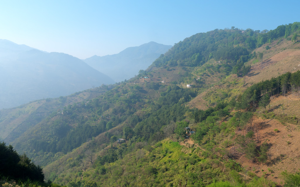
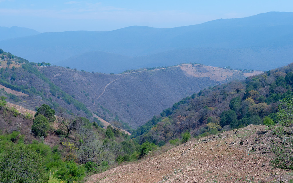
Hwy 120 between Jalpan and Xilitla (the eastern section of Hwy 120) is a fantastic road. You should make a point to go to Mexico just to ride it because it’s that good. Perhaps unbelievably, the Hwy 120 west of Jalpan is even better. From 2500 feet above sea level Hwy 120 climbs to over 8000 feet as it crosses the mountains. As you climb into the clouds the temps drop and the pine forest gets more lush.
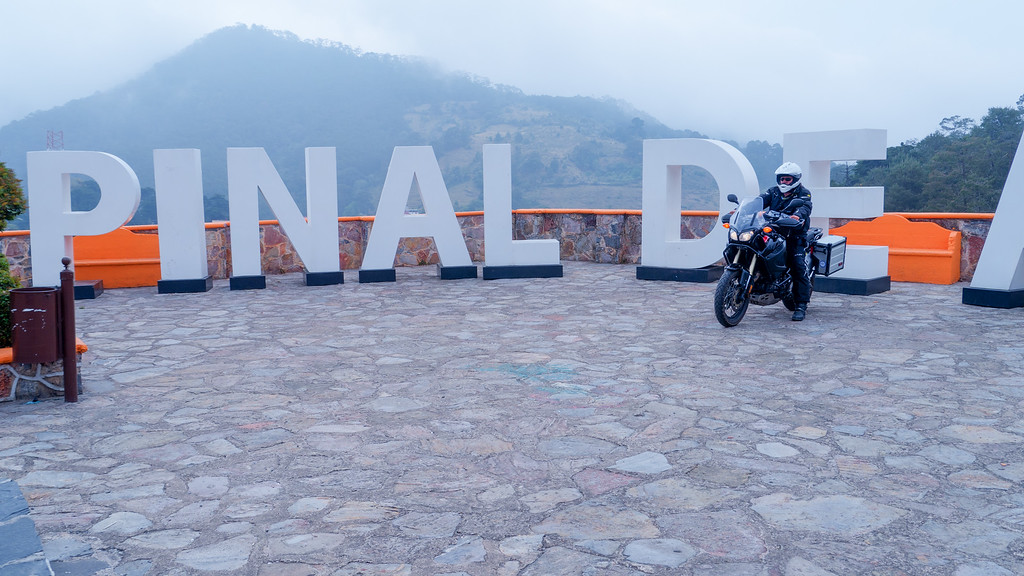
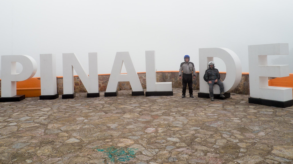
We stopped for a Kodak moment in Pinal de Amoles.
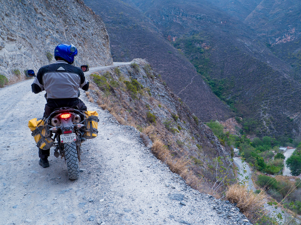
The 19 kilometer road to Bucareli begins at 7700 feet and drops a spectacular 4400 feet by the time you arrive in Bucareli. The reports I had heard back at the hotel in no way exaggerated the awesomeness of this road. Pics simply don’t do it justice. The roads just goes down, down, down, and then down some more. Around every turn were amazing views of the road winding its way down to Bucareli. This is one road you should make a point to ride the next time you are in the area.
![url]](/forums/proxy.php?image=http%3A%2F%2F%5Burl%5Dhttps%3A%2F%2Fphotos.smugmug.com%2FAdventure%2FMotorcycle-Adventure%2FRundown-2016-a-Mexico-Adventure%2Fi-6FvtdGz%2F0%2FXL%2F20160414-_1140612-XL.jpg%5B%2Furl%5D&hash=e2007c8529968148876bc82cf3d4715a)
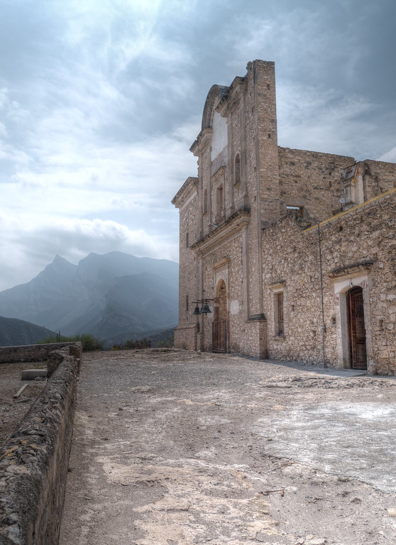
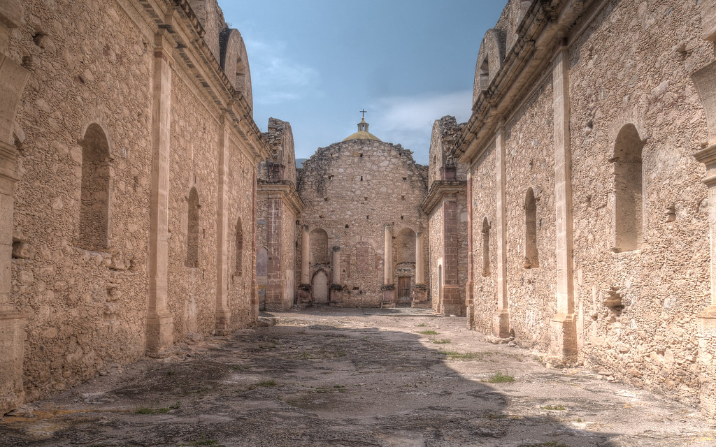
Once in Bucareli we stopped at the local mission and then paid a visit to an old convent that has been preserved as a museum.
Views from Bucareli

The Convent
We did not venture beyond Bucareli but you can if you want to. The road continues down to the river at the bottom of the mountains and then climbs out and to the west.
The thing that really stands out for me about this road is the high exposure. I’ve ridden a lot of shelf roads in Mexico, roads with a drop off on one side and a cliff rising above on the other. With no guard rail or any other restraint, running off a typical shelf road in the mountains of Mexico could be a very, very bad thing, perhaps even fatal. However, the shelf road to Bucareli is special –the extreme height, the steep drop offs, and the miles of road with no vegetation obscuring your view all combine to create a heightened sense of exposure. It truly is marvelous. I still think the road between Agua Zarca and Tilaco is the prettiest road I’ve been on but I do have to say that the road to Bucareli is in a class by itself. Ride this road.
How steep is the drop off? Check out the guy working in this photo. Other areas are even steeper.
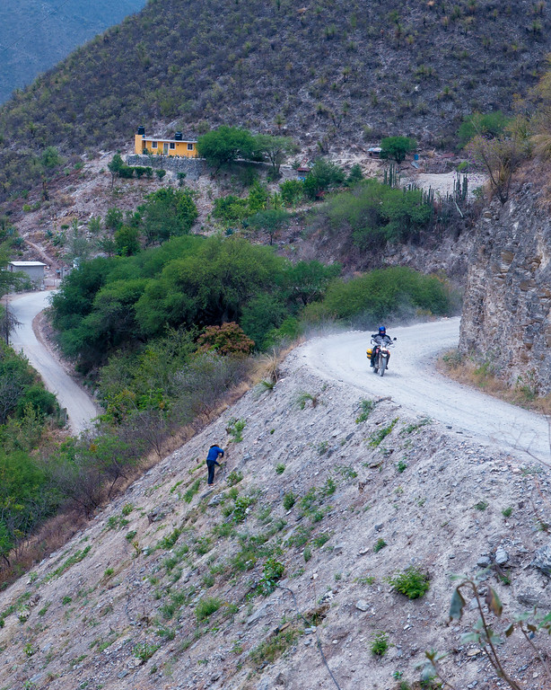
This is my favorite photo of this road

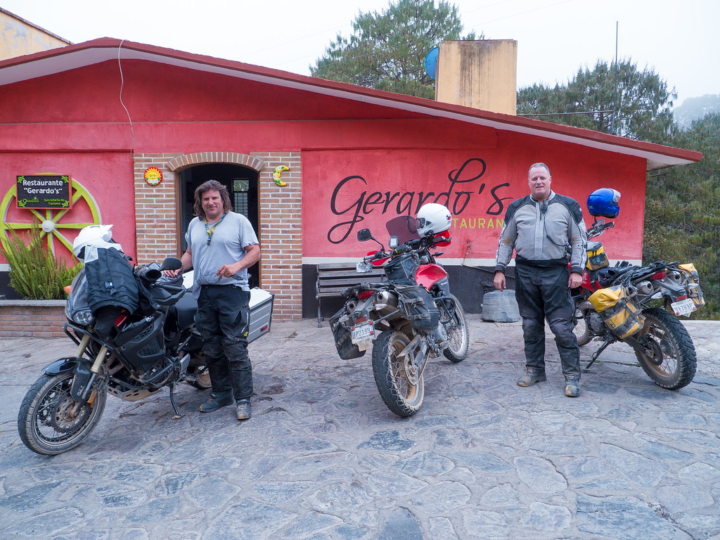
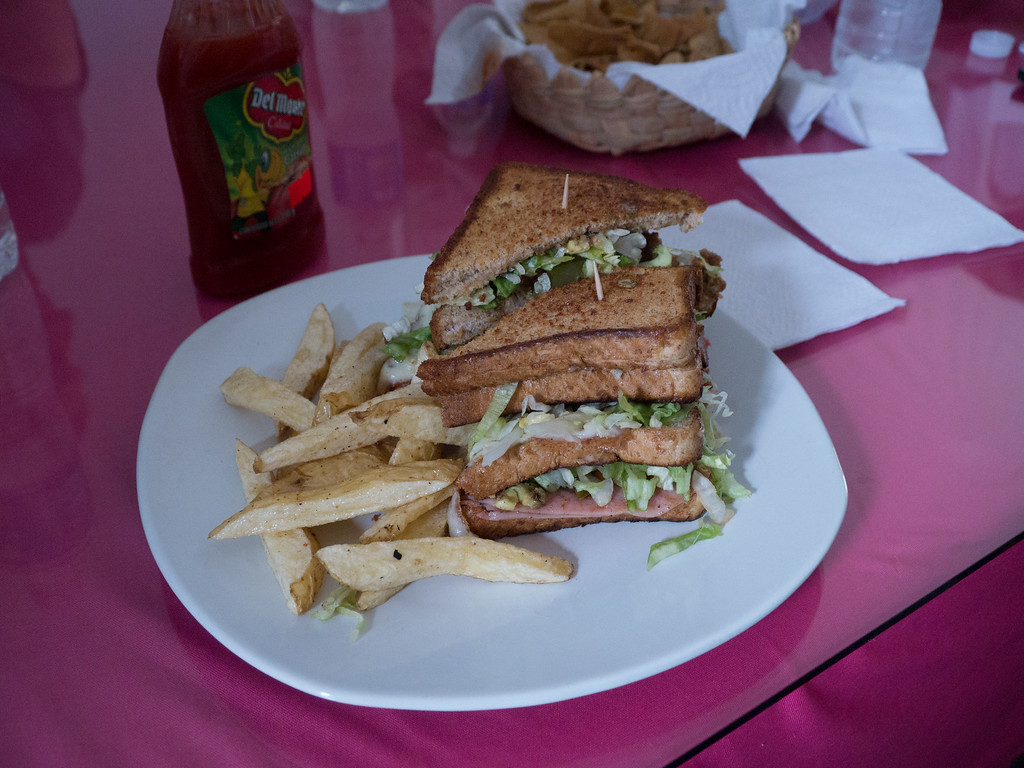
Once back in Pinal, we enjoyed a fine meal at a roadside restaurant called Gerardo’s. The food was good.
With this my story ends. Back in Jalpan all the riders got together for a final dinner and the next day Stuntman Jeff and I rode the 475 miles back to McAllen.
This trip was everything I hoped it would be. A hearty thanks to all who attended – it was a pleasure seeing old friends and making some new ones.
You can see all my trip photos here.
Finally, I dedicate this ride and this report to my friend “CeeBee” Chuck Blair. Chuck is a **** of a guy and has been a friend for many years. He was part of Jalpan recon last year and was planning on attending the rally this year but life interfered and prevented him from doing so. Sadly, Chuck unexpectedly passed away on Sunday, April 17th, gone too soon. I miss him.
Day 6: The Road to Bucareli, 154 miles
This was our last day before heading back to Texas so I wanted to ensure it was a good day. At the hotel at the end of day 5 I heard several riders raving about the road to Bucareli, so that seemed like a great choice. Subcomm Mark decided to join Stuntman and I so at the crack of 9 a.m. we pointed our bikes west.
Hwy 120 between Jalpan and Xilitla (the eastern section of Hwy 120) is a fantastic road. You should make a point to go to Mexico just to ride it because it’s that good. Perhaps unbelievably, the Hwy 120 west of Jalpan is even better. From 2500 feet above sea level Hwy 120 climbs to over 8000 feet as it crosses the mountains. As you climb into the clouds the temps drop and the pine forest gets more lush.
We stopped for a Kodak moment in Pinal de Amoles.
The 19 kilometer road to Bucareli begins at 7700 feet and drops a spectacular 4400 feet by the time you arrive in Bucareli. The reports I had heard back at the hotel in no way exaggerated the awesomeness of this road. Pics simply don’t do it justice. The roads just goes down, down, down, and then down some more. Around every turn were amazing views of the road winding its way down to Bucareli. This is one road you should make a point to ride the next time you are in the area.
Once in Bucareli we stopped at the local mission and then paid a visit to an old convent that has been preserved as a museum.
Views from Bucareli
The Convent
We did not venture beyond Bucareli but you can if you want to. The road continues down to the river at the bottom of the mountains and then climbs out and to the west.
The thing that really stands out for me about this road is the high exposure. I’ve ridden a lot of shelf roads in Mexico, roads with a drop off on one side and a cliff rising above on the other. With no guard rail or any other restraint, running off a typical shelf road in the mountains of Mexico could be a very, very bad thing, perhaps even fatal. However, the shelf road to Bucareli is special –the extreme height, the steep drop offs, and the miles of road with no vegetation obscuring your view all combine to create a heightened sense of exposure. It truly is marvelous. I still think the road between Agua Zarca and Tilaco is the prettiest road I’ve been on but I do have to say that the road to Bucareli is in a class by itself. Ride this road.
How steep is the drop off? Check out the guy working in this photo. Other areas are even steeper.
This is my favorite photo of this road
Once back in Pinal, we enjoyed a fine meal at a roadside restaurant called Gerardo’s. The food was good.
With this my story ends. Back in Jalpan all the riders got together for a final dinner and the next day Stuntman Jeff and I rode the 475 miles back to McAllen.
This trip was everything I hoped it would be. A hearty thanks to all who attended – it was a pleasure seeing old friends and making some new ones.
You can see all my trip photos here.
Finally, I dedicate this ride and this report to my friend “CeeBee” Chuck Blair. Chuck is a **** of a guy and has been a friend for many years. He was part of Jalpan recon last year and was planning on attending the rally this year but life interfered and prevented him from doing so. Sadly, Chuck unexpectedly passed away on Sunday, April 17th, gone too soon. I miss him.
- Joined
- Feb 28, 2003
- Messages
- 51,257
- Reaction score
- 8,294
- Location
- Huntsville
- First Name
- Scott
- Last Name
- Friday
Good stuff Richard!
That is a great shot of Chuck!
That is a great shot of Chuck!
- Joined
- Nov 10, 2009
- Messages
- 680
- Reaction score
- 150
- Location
- 10 miles from Mexico
- First Name
- Zeke
- Last Name
- Mtz
I was lookin at some Private Messages i shared with chuck, and i wanna say how sorry iam to hear of his passin, i never met him but he was a brother, we shared da same mex adv spirit, he was willin to share his advice, thanks chuck.