• Welcome to the Two Wheeled Texans community! Feel free to hang out and lurk as long as you like. However, we would like to encourage you to register so that you can join the community and use the numerous features on the site. After registering, don't forget to post up an introduction!

North Texas April 22 Ride Report

Joined
Oct 28, 2016
Messages
248
Reaction score
1
Location
Irving
This will be a lead off to the ride report so people can start uploading their pictures and comments...

So the day started off cold...thank God I remembered my jacket liner!
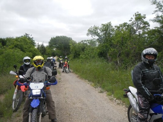
We had 11 people start at Sonic in Waxahatchie, which is a really good turn out. Against my normal routine we waited until 8:15 to get on the road..because someone was running behind..including the cashier at the convenience store...**** she was slow.
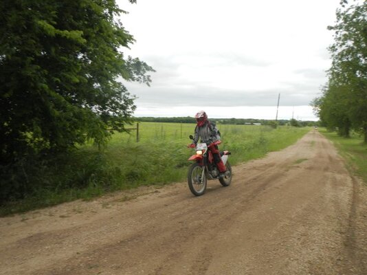
We headed south on 876 and turned off on to Bee creek school road...WOW what a road to travel the trees were awesome...like driving to the batcave.
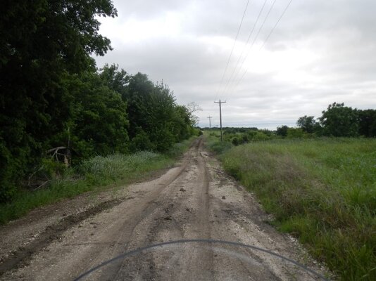
Driving the route we found our first challenge...peagravel mixed with dirt...yeah it's rutted..and it hold its place until you drive over it and then becomes a hole...it claimed its first victim...and then another..the story becomes hazy after that because I thought it claimed 1 more...but no one is talking..
The next challenge was the GPX file I loaded was the wrong one...so CR1145 at lake Whitney was confusing..but we managed to just read the signs(as I was passing them...so we did several U-Turns) and we came out just fine.
We stopped in Clifton for lunch only to find out that 2 more people were trying to catch us...they arrived just after we left....now we are 13.
Bosque County...it has to be the secret stash of good back roads. We came to the first water crossing on CR4250. The NC700X went across and made it look easy...the second person got about 30 feet into the crossing...and the bike came out from under him and he went down hard..then another...and another....that **** moss..
The next water crossing was at CR224..this was the long creek crossing..everyone was extra cautious..and we all made it fine..water was about 12 inches deep.
The last water crossing was small and appeared shallow...well that wasn't the case..it was deep where I crossed...although I didn't lay the bike down it did make me go to the side of the road and stop...all and all the water crossings were mild and good training..speaking of training..
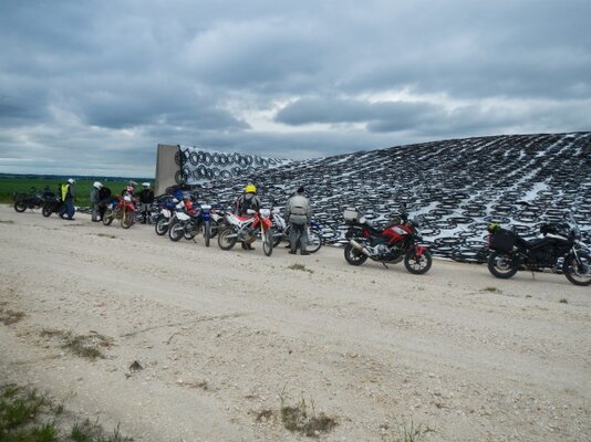
We turned up 3310 and stopped on a long extra wide concrete bridge...took a break. Here we had Gary take out all of tools and explain what makes a good tool bag and some tools you should think about packing. A lot of good info he passed out.
The home stretch was uneventful except for the fact that I had to navigate by paper part of the way because the GPX file was not the right one...dammit!!!
The day ended well..the route had A LOT of travel back roads...which was awesome..better than had planned.
I will fix the GPX file...because this route is a keeper. There are so many back roads in this area, it begs to be explored.
I will upload photos as soon as I can get them resized.
Thanks to all of those who joined me. Until next month!
 
Last edited:
Dang it. Something happened, and I couldn't attend. You wanna post the right gpx file here? I was thinking riding the route next weekend.
 
Good fun. Well put together. I'm impressed. Very tired.
219f40ea1aa02cacbed59dad9c29e154.jpg
d85f0335dfa0d9b8f04e42ff4ac0d1ab.jpg
ccdc29ba5959f5d9b2694ceaa82bfdc4.jpg
fa1c83e2ebdbd0c34d3c8bc849570112.jpg
81505f2efd600cbd082589352338c31c.jpg


Sent from my VIVO XL using Tapatalk
 
Hey Chris, thanks for allowing me to trail on the ride back to Dallas. I was a little worried about missing my left hand mirror and riding in the middle of you and 16KLRHOBO made it much safer than anything else I could have planned. Sorry if I slowed you down any but that wind was terrible.

I'm up and alive this morning and if it wasn't for the soreness of the offroad stuff, the soreness of going down in the afore-mentioned gravel pit wouldn't be so bad. I got home and after doing a little check up in the mirror I'll live but I'm definitely not going to be doing any pull-ups for about a week, lol.
 
No one slowed us down. It was a good pace...and I will cut the rides down another 20 miles to allow for more stops along the way. It was a good day...we had good time...and nobody lost a limb...and no flats!... but I didn't worry...Gary was with us!
 
This ride exceeded my expectations being this close to Dallas. A+. I will definitely do this one again. If I could helicopter my way to Wax and skip Dallas from Lewisville it would be nearly perfect. Great roads and people. Also good to see another KLR. (yes it does stand for Keep Loctite Ready). Thanks to all the people involved and hope to see you again. Great crew. Kuddos to Chris and Gary. This route is a keeper for anyone who wants a fantastic outing. See ya soon

Steve
 
Had a great trip, Chris! Thanks for waiting up for me and Shawn in Clifton. We were going to just follow the gpx and hope to meet in the middle until i heard a bunch of texts come through my sena. Glad i had it or i wouldn't have ever known. You guys rock!
Everything but that wind was a blast and cant wait to find time to do it again.
I am def downloading that new file to check out the other side of the route. Speaking of... Chris, would you mind sharing the name of your iphone gps again?
You told me at the sonic but all i can remember is getting beat up by wind on my ever so not aero dynamic drz. :p
Will repost and make more stills later from my cam.
Thanks again!


Sent from my iPhone using Tapatalk
 
I use OSMAND+ for navigation. Check out the website and see if they have an app for the iPhone.

And by the way this was the first ride using it by itself, and it worked great...i just have to load the right file.
 
Wish I could have made it but bike didn't get finished on time. While ya'll were riding all that my bike looked like this .

18056821_10213081822066333_3441706934019752226_n.jpg
 
I see Frank got you took care of, even if he was a day slower than you would of liked. He does do good work.


He does great work. He's the only mech I recommend to people. This ride was kind of a last min deal and I had originally told him I was in no hurry. So no harm no foul on his part. I'll try to make the next one.


Sent from my iPhone using Tapatalk
 
So where was the pea gravel, on Witten Rd?


The deep gravel we hit was on Dovie Ln just off of 308. Not sure if that is what the others hit, as me and Shawn were following the non updated map.

IF my memory serves me correctly.

Sent from my iPhone using Tapatalk
 
Last edited:
It was pretty early in the ride if I recall. I don't think I had more than 20 miles on the trip meter after eating dirt (or gravel in fact). I think it was marble sized gravel mixed in with mud that was placed on top of a huge mud hole so it had parts that were deeply rutted but it was really dark and grey on the road so if anyone is following you'll see it long before you hit it. Looking back I should have slowed down but no-one else seemed to be so I didn't really think it was as long a pit as it was until it was too late and I was going too fast for my experience level I think. I know on the first section my tire bounced between tow ruts and then I thought it was done but there was a little more that ate my front tire. After that things get a little fuzzy until I heard a large crash and realized that was the sound of me helmet and me hitting the ground.
 
OK ,yes, MacDaddy and I hit that area on Dovie. Used to be about a 2 foot deep hole with a rock ledge to crawl out on the north end. I was surprised when he and I rode it a few weeks ago and the hole was gone. But I did notice the crap gravel fix the county did. I think I have a phone pic of what it used to look like.
 
Well what a great ride, and a nice group of people!! Had a lot of fun, but wished it was a bit warmer! Especially after falling off in the water crossing!! :trust: That will teach me not to play "silly buggers" when on a concrete road, crossing water, it gets very slippery!!

I did have a list of tools that I suggest people bring with them on any DS ride, but they all got wet when I took my unplanned bath, so I have included the list below, you can just copy & paste it if you would like to refer to it at a later date. I also have a GPX file of the actual route that we rode if anyone wants it.

Hope to see you all again in May!!

Gary & Sylvie


What to bring? Anything that is going to break when you drop the bike + puncture repair kit!!

Tools:-
As mentioned I like to bring 3 tyre levers with axle nut spanners on the end (avoids carrying large spanners), I get mine from Cycle gear.
Carry spare front & rear tubes (minimum carry spare front tube as it can be used in rear to get home)
Carry puncture repair kit (in case you get a second puncture)
Carry pump/compressor to inflate tyres
carry lubricant to oil chain and aid tyre fitment or loosen up parts
Carry metric spanners 8mm to 17mm (standard sizes for most dirt bikes)
Carry metric socket set (8mm to 17mm)
Metric Allen keys (2mm to 8mm)
Cross head & flat head screwdrivers
Spark plug spanner
Vice grips (can be used for gear pedal in emergency & generally useful to remove broken bolts)
Pliers
Multimeter (to check resistance & voltage)
wet wipes to clean hands & face
Quick setting 2 part epoxy (fix radiator hole, engine casing hole, etc)
wire cutters
mobile phone
Empty collapsible container to transfer fuel/water, etc

Spare parts:-
spare link for chain
spare clutch and front brake levers
spare clutch cable
Spare throttle cable (just the cable that opens the throttle, if your bike has 2 cables)
Tow rope (very useful for many things!!)
Piece of wire 2' long (Multi core) can be used to replace broken or shorted wires to get you home.
spare spark plug
Spare fuel line 1' (helps transfer fuel from tank to container or replace a damaged line due to a spill or old fuel line.
Cable ties (lots of different sizes)
Spare fuses (5A, 10A & 15A)
assortment of spare metric bolts & nuts (M4, M5, M6 & M8)
Duct tape (any color!)
 
Last edited:
Well what a great ride, and a nice group of people!! Had a lot of fun, but wished it was a bit warmer! Especially after falling off in the water crossing!! :trust: That will teach me not to play "silly buggers" when on a concrete road, crossing water, it gets very slippery!!


I did have a list of tools that I suggest people bring with them on any DS ride, but they all got wet when I took my unplanned bath, so I have included the list below, you can just copy & paste it if you would like to refer to it at a later date. I also have a GPX file of the actual route that we rode if anyone wants it.


Hope to see you all again in May!!


Gary & Sylvie


What to bring? Anything that is going to break when you drop the bike + puncture repair kit!!


Thanks again for that lesson and the taking time to write it all down here for us to save! Very helpful.
And i would LOVE for you to share the route that was actually ridden. I am trying to compile a group of roads to take my father on soon for his first ever dual sport cruise.
Hope to ride with you guys again soon.

Erik


Sent from my iPhone using Tapatalk

Erik - I posted a link to the route that was saved to RideWithGPS and attached the gpx file Sunday morning. I think it is correct but caveat emptor applies. - Bill

http://www.twtex.com/forums/showpost.php?p=1499927&postcount=5
 
Erik - I posted a link to the route that was saved to RideWithGPS and attached the gpx file Sunday morning. I think it is correct but caveat emptor applies. - Bill


http://www.twtex.com/forums/showpost.php?p=1499927&postcount=5


Oh, i must have missed that. Thank you, Bill!

I know what i did now. I needed to delete the old one from my gpx viewer so it will allow the new one to save. Told me i couldnt duplicate due to same name so i disregarded initially.
Thanks again!


Sent from my iPhone using Tapatalk
 
Last edited:
I use OSMAND+ for navigation. Check out the website and see if they have an app for the iPhone.

And by the way this was the first ride using it by itself, and it worked great...i just have to load the right file.

Hey Chris, congratulations on your nuptuals and hopefully you are getting a honeymoon trip this week.

I liked the idea of using OSMAND+ on the phone but was curious what program you were using to build the maps in advance. I recall discussing the issues with base camp and Windows 10, and like you I have issues, but just can't recall what program you said you were using in it's place. When you get time to follow up some it may be of use to the fellows that are putting together a Ghost town map, which I think will benefit all riders in the long run. Thanks sir.
 
OK ,yes, MacDaddy and I hit that area on Dovie. Used to be about a 2 foot deep hole with a rock ledge to crawl out on the north end. I was surprised when he and I rode it a few weeks ago and the hole was gone. But I did notice the crap gravel fix the county did. I think I have a phone pic of what it used to look like.


I have a very up close mental image of what it looks like currently, lol :zen:
 
Time to upload some pictures
 

Attachments

  • DSCN0792.JPG
    DSCN0792.JPG
    117.7 KB · Views: 235
  • DSCN0793.JPG
    DSCN0793.JPG
    114.2 KB · Views: 224
  • DSCN0797.JPG
    DSCN0797.JPG
    89.7 KB · Views: 233
  • DSCN0800.JPG
    DSCN0800.JPG
    97 KB · Views: 240
  • DSCN0790.JPG
    DSCN0790.JPG
    148.7 KB · Views: 240
More Photos
 

Attachments

  • DSCN0801.JPG
    DSCN0801.JPG
    109.1 KB · Views: 243
  • DSCN0806.JPG
    DSCN0806.JPG
    77.8 KB · Views: 239
  • DSCN0807.JPG
    DSCN0807.JPG
    95.8 KB · Views: 233
  • DSCN0808.JPG
    DSCN0808.JPG
    94.3 KB · Views: 249
  • DSCN0814.JPG
    DSCN0814.JPG
    118.2 KB · Views: 232
Back
Top