• Welcome to the Two Wheeled Texans community! Feel free to hang out and lurk as long as you like. However, we would like to encourage you to register so that you can join the community and use the numerous features on the site. After registering, don't forget to post up an introduction!

Trail Suggestions Moab,UT and Red River, NM

Joined
Apr 22, 2004
Messages
523
Reaction score
148
Location
Grand Prairie
First Name
Larry
Howdy all,

We've been to Moab,UT and Red River, NM for years, but never been off road on our bikes. We really, really want to go off road on those roads/trails we see going off in the distance.

I need suggestions for me and my son on our XR650L and Triumph Tiger 800XC, respectively.

We need help deciding which trails to ride around Moab and Red River.

Any further suggestions on what to carry, supplies, tools, maps, what to see, etc would be appreciated.

Thanks
 
Cabristo Lake is usually really pretty. Not sure with the drought what it looks like right now. Goose Lake is also another nice ride in Red River. Roads there seems to be hit and miss as far as condition. Moab, I do not consider myself an expert. I have only been out there a few times and only once with a bike.
 
White Rim Trail in Canyonlands NP outside Moab is legendary. Trust me. One of the Best DS rides in the US. Bring extra water. Again, trust me on this.
 
You can ride out to the parks, Arches, Canyon Lands, Dead Horse Point, etc. (Tourista stuff but still pretty neat).The La Sal loop out to the top of the mountains and then along the river back to Moab would be very good for getting started. There are small side trails that lead to the edge of the world and some incredible scenery. There are no caution signs saying "you're about to fall 3000 feet behind this big rock" so tread with care. The back country trails can be tame to wild so know what you're getting into before turning off into something. Get a map there that has color coded trails and stick to the blue or green ones. Visit with Fred at Arrowhead (in Moab) and he can put you on just what you are looking for. If you're feeling adventurous - and after you've ridden a little - take the potash road along the Colorado river toward Canyon Lands but take a right at the Jug Handle arch and go up Long Canyon. It's doable on your equipment and spits you out on top headed toward Canyon Lands park. You'll see some cool stuff that's off the beaten path. After Canyon Lands go on to Dead Horse. Take the Shafer Trail down the mountain back to Moab. Again, you'll see some cool stuff and have a blast. There's probably all kinds of other stuff but I think that'll fit what you asked for. You could spend several days or weeks out there.
 
One more question - do we need street legal bikes on these trails? My son may consider taking his YZ250F instead of the Tiger.
 
One more question - do we need street legal bikes on these trails? My son may consider taking his YZ250F instead of the Tiger.
Depends on which roads you do and where you start from. You are required to have OHV sticker but not street legal on the remote sections in NewMexico and I believe it is the same in Utah. I got disgusted my last rip to Moab cause there were a jillion bikes, jeeps, and atvs, creating a biblical dust bowl:rolleyes:
 
One of my personal favorites.
7c44a89141fbc90ce3335f8fd0aa17b2.jpg


Cotton Wood Canyon trail, Utah. Trail heads north with several branch out options and eventually hits 12 to the north.
 
White rim trail is fine for those bikes and the most awesome views one can find on a motorcycle. Hoorah pass/Lockhart basin is another spectacular ride that has been simplified for the atv gang over the years. It is a bit more technical but I would ride an XC over it. Not sure about my 800ABS Tiger; maybe if I did not have something with a 21" on front. I have ridden XRL on it before with no problem. You will need a larger fuel tank on the XR, lots of extra water and some food. It must be tied on the bike beyond your best ever tie down job or it will come off. I took me 3 years to perfect how to carry gear out there. I steel plated on large tankbags to rear racks to make it finally stay in place.

April can be very cold there or reasonable. Week one or two of May is best.
 
My favorite rides are still Lockhart/Hoorah Pass, and the White Rim. Not so wide about Kokopelli and have never taken the route from Mexican hat up to Moab. If you ever take Lockhart, you may need a lot of extra fuel even shortshifting the whole way. You need a 6 gallon tank on an XR just FYI. And lots of water. Its a woosie trail now but still managed to take out a buddy two years ago. A couple more technical points tossed in for the intermediate crowd.
 
I just started a trip report for that area. We were out there last April.

I rode Lockhart on my KTM 530 EXC. Personally, I would not take anything over a 650 on that road. Most of it is not bad, but there were some short sections that were quite technical and could be a real handful on a bigger bike if you are not a better than average dirt rider. We did it from South to North. The most difficult section is on the North end and there are tons of pictures and descriptions of it on the net.

Typical road surface for most of the route
Utah_0186.jpg


Just a barbed wire gate across the road!!
Utah_0189.jpg


About 75 yards of steps and ledges heading down into a wash
Utah_0200.jpg


One of the short challenges, but doable if you are careful
Utah_0212.jpg


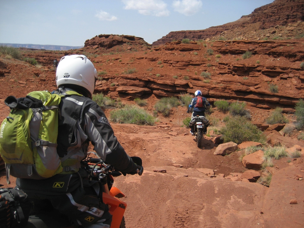
The start of the longest challenge on the North end - basically a BIG wash ravine
Utah_0218.jpg


Middle of it
Utah_0220-2.jpg


End of it
Utah_0225-2.jpg


We also did White Rim. Again, the majority of it is not bad. There are some sections on the NW corner near the Green river with some very deep sand and it goes for a few miles. If you don't like sand, this section could be a deal breaker. It is also a long ride. You will need a bare minimum range of 150 miles with nothing to spare. If you can't do that, I strongly suggest carrying a few extra gallons. Also, run it counter clockwise. This way you hit the sand section early while you are still fresh and not at the end when you are tired.

Part of the sand section on White Rim
Utah_0359.jpg


There are a few sections with fairly steep and somewhat rocky climbs, but they are generally not long. Of course, if it is raining on ANY part of the route, things could get REAL ugly in a hurry.

Shafer Rd up to the Island In The Sky overlook is awesome and easily done on your bikes.

I've attached my track file. There are six routes. We did three on our big bikes (3 1200GSs and a KTM 690 Enduro) and three on the small bikes (KTM 450/530/690 and a DRZ400).

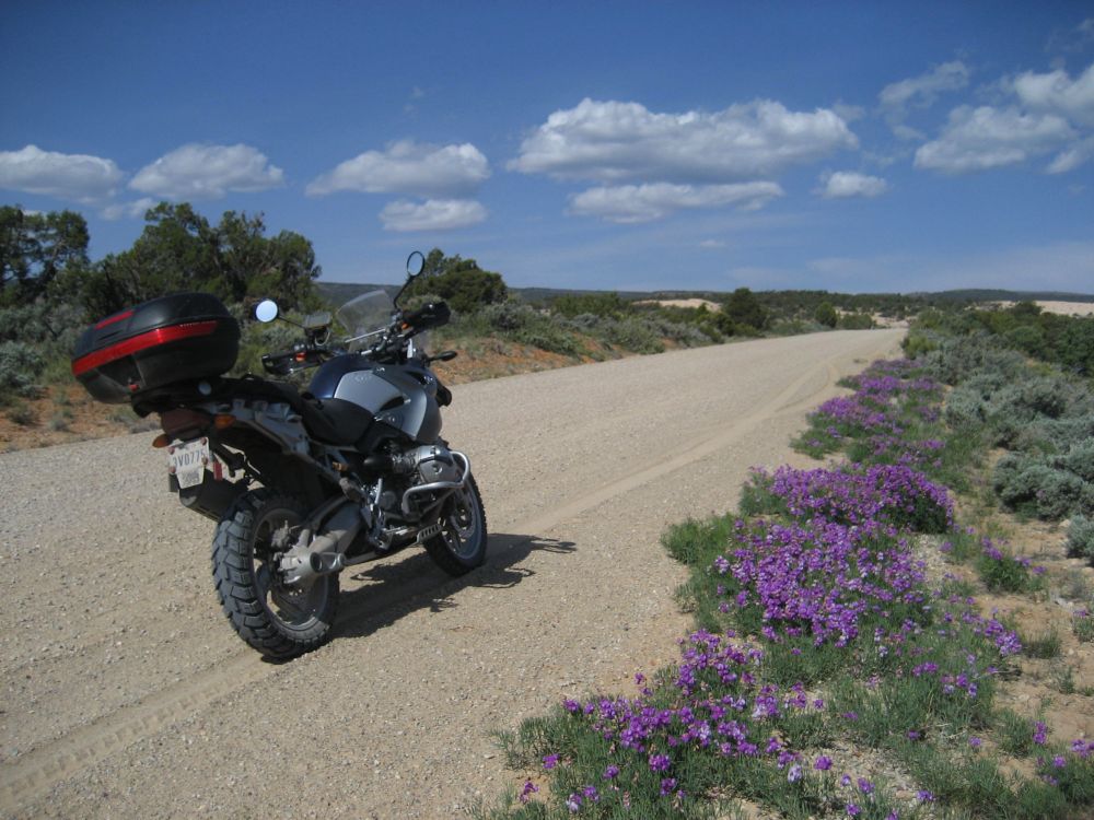
The big bike routes were GrandJunction, LakePowell SW, and Million Dollar Highway. Grand Junction and Million Dollar Highway were all pavement. However, the first 75 miles of the Lake Powell SW route from Blanding to the Hite Marina were absolutely awesome routes for the big bikes!! That is the Northern part of the loop. All of the rest is paved with two exceptions, Mokee Dugway and Comb Wash Rd (DEEP sand!!). Originally, we had planned to run Valley of the Gods after dropping down from Mokee Dugway, but it was raining pretty good at the time and we did not want to risk any nasty mud with the tires we had (Heidenau K60s on my bike). Comb Wash was fantastic, but there was a pretty long stretch of seriously deep sand/silt. I made it through without dropping the GS, but it was a wild ride!

Sand/gravel mix that was fun and ran for some time
Utah_0468.jpg


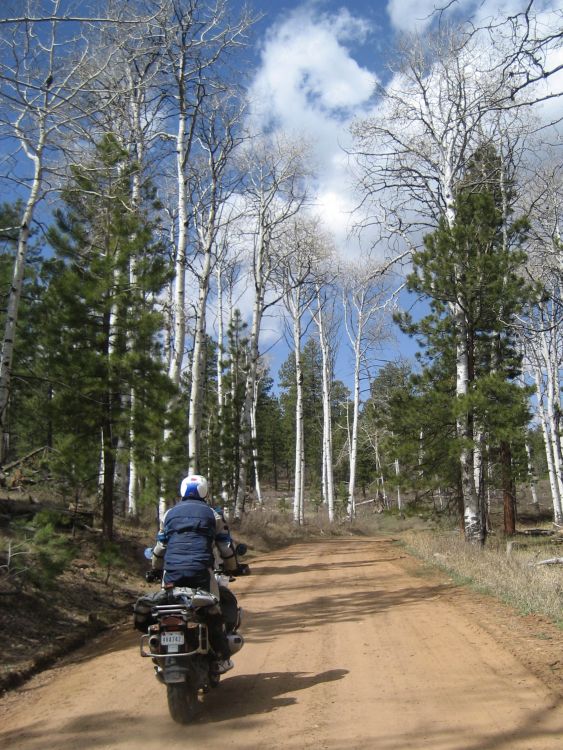
Nice stretch of woods as well
Utah_0471.jpg


Some red dirt/sand along the way
Utah_0479.jpg


Some rocky sections as we dropped down out of the mountains
Utah_0484.jpg


Fairly firm part of sand section where it was safe to stop and restart on Comb Wash Rd.
Utah_0583.jpg


The small bike routes were White Rim, Lockhart, and Sweet Alice. Of those, I would consider Sweet Alice to be big bike friendly with a few small exceptions. I would have been fine on my 1200 GS for most of it. If you look at the far West edge of that route, you will see that we turned left on Left Leg road. This was a non maintained two track trail that was pretty rough. I don't think I'd take a bigger bike down that one. In the center of the route you will see a loop. DO NOT take the big bike down the Northern part of that loop. It is a washed out cow trail. The guys were ragging me pretty hard when we were heading down that one and questioning if I knew where I was going :lol2: Of course, I did :mrgreen: Lastly, there is that leg that runs North just to the East of that loop. Going out it wasn't too bad, just a little sand here and there. However, it brings you to a set of switchbacks that should be named Mutiny Ridge because that is where the guys really questioned my sanity. I got down to the third switchback and stopped. They stopped at the first. There were probably four or five more below me. It was VERY steep and rocky. It was quite challenging even on the 530.

Much of Sweet Alice is like these
Utah_0603.jpg


Utah_0607.jpg


Utah_0628.jpg


This is the switchback where I stopped and the others walked down to me.
Utah_0640.jpg


It is always hard to gauge how a road will be from the responses of other riders because of the WIDE range of rider skill and its impact on impressions of how easy or hard a road may be. There are riders that do roads like Lockhart on 1200GSs and the big KTMs, and some would likely consider it not to be a hard ride. I could probably do it as well, but it would take a LOT more effort and energy than doing it on my KTM 530. As such, the risk of injury to the rider and damage to the bike goes up accordingly. Also, the suspension on the 1200 would make for a rougher ride than that of the 530, which over a 100 miles or more would really start to wear me down.

Just as a reference, all the trail guides and maps I bought before our trip list Lockhart as a difficult/expert route. I think the White Rim was rated as moderate to difficult. You can drive most of Sweet Alice in a car, but it would be a bumpy ride. In fact, we met two trucks pretty far to the West side of the route that were hauling cattle trailers and heading back in toward Blanding as we were heading out. They were going slow though. Other than that, we had the road to ourselves the entire day. Come to think of it, we had Lockhart and the Lake Powell routes all to ourselves as well.
 

Attachments

  • Utah2015Tracks.gpx
    1.3 MB · Views: 266
Great pics and thoughts regarding various interpretations of "difficult" . Lockhart used to be way more difficult than it is now. But its those couple of spots where friends can help get a bike up if needed that make it a good idea to ride in groups of at least 3 out there. the other think I tell folks is to not go fast out there. Running at 80% of your ability is too fast. Think 50-60% for safety. Take your time and save both fuel and your own energy. One little bone snapping get off 50 miles out can ruin everyone's day real quickly and become life threatening.
 
Great pics and thoughts regarding various interpretations of "difficult" . Lockhart used to be way more difficult than it is now. But its those couple of spots where friends can help get a bike up if needed that make it a good idea to ride in groups of at least 3 out there.

Yeah, Ideally I like to have a group of four for this kind of riding. That way if someone has to go for help, two can stay and two can go, leaving no one alone.

the other think I tell folks is to not go fast out there. Running at 80% of your ability is too fast. Think 50-60% for safety. Take your time and save both fuel and your own energy. One little bone snapping get off 50 miles out can ruin everyone's day real quickly and become life threatening.

This is SO true!! In many places, there is NO cell signal. Even if you could get a signal, it would still take a long time for help to get to you and it will be a long bumpy ride back out. I was also told that vehicle recovery starts around $1000 and goes up from there. Even if you aren't blasting down the road, the unexpected can happen.

While heading back on the sweet Sweet Alice route, I got caught out by an ice patch that sent me into a nasty high side, launching me pretty far. I got REAL lucky because I just landed in a bunch of mud and had the wind knocked out of me. I could easily have hit a tree or rock on the way down... I was also wearing good gear. The bike was also mostly fine and rideable. It was another couple of hours of riding after that before we got back to civilization... It could have gone much much worse...

A SPOT, or something similar might not be a bad idea, especially if there will only be two of you. Some roads are fairly we traveled and someone would be along shortly to help if needed. Other roads are not so well traveled and you could be there a LONG time before someone happened upon you if you needed help. You REALLY need the tools and equipment to handle most any problem with the bike. For instance, if your tires are tubeless, what will you do if a rock slashes your tire? I'd suggest carrying spare tubes the same size as your tires. That might at least get you back to a main road. Take a minimum of 3 liters of water. Other than the Colorado and Green river, you won't see much, and they are hard to get to and MUDDY.
 
Years ago when young and tough, on my first trip across Lockhart, we arrived after a biblical rain storm where they got a year's precipitation in 2 days. I had only a big camelback of water and a 40oz Steel Reserve for liquids and thought we were going out for an hour or two warm up ride and then back for lunch. The water crossings just outside of town were nearly 2.5 feet high and county was extricating a Ford Explorer using a grader as we waited to see if it was even possible to cross.

Well... you know its a 190 mile total loop back to Moab after you shoot south a ways to get gas once you hit pavement. Gas is as hard to come by as water. I ended up drinking close to two gallons from multiple puddles on rocks to survive the day. My buddies swore it would be pure as it had been flushed so well and was only a few hours old at this point. They were right, but the chances of finding drinkable water are next to naught out there.
 
Thanks everyone. This is exactly the kind of info we need. I'm gonna follow Scott's Ride Report; great photos and text. We've driven Moab, Monument Valley, Ouray, and Northern New Mexico and loved it. Incredible scenery, breathtaking views. But, we've always wanted to take the "road less taken" on bikes.
 
Back
Top