Feel free to hang out and lurk as long as you like. However, we would like to encourage you to
 jerrybo
0
Well, this a day late. The wi-fi at my motel wasn't working last night.
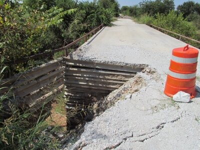
The dirt county road northeast from Pendleton Harbor was a good easy ride with more undulation (sorry). After a few miles I rode north on CR 140, the road that connects to 9 Mile Road. 9 Mile Road became a question mark as I planned the Loop. The word was that the east end of the road near Toledo Bend was closed and no one was sure if it opened up further west. Well, the good news is, it is open from CR 140 west. As I looked east, 9 Mile was open as far as I could see but I didn’t want to take time to see how far it was open.
The rest of the roads through the forest were very good as well and they brought me into the outskirts of Center, my day’s destination. This day was planned as a short day to rest up a bit and do some laundry. I only carry enough changes of clothes for eight days. After a bite of lunch I drove all over town before I found the washateria I was looking for. Center’s street layout is confusing with several highways and FM’s converging from different directions. As I write this I’m doing laundry (yes dear, I separated light and dark).
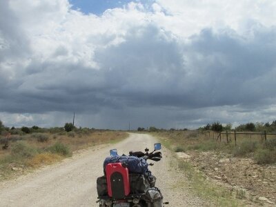
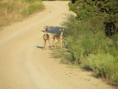
I’ve been blessed with no rain to speak of so far on the trip. I was concerned I might encounter some mud bogs as I did on the eastern half of the Trans-America Trail. One thing I’ve found unusual about east Texas weather is the absence of the wind … a constant in west Texas ... I mean not even a breeze. It’s been a good day with good roads. The mere 100 miles I rode today was a welcome break.
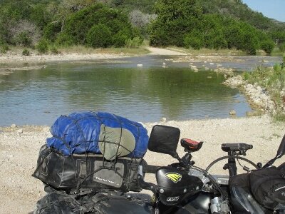
Day Eight
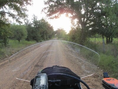
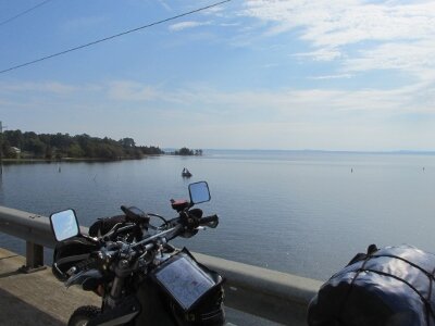
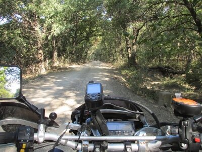
I enjoyed another great breakfast worthy of any dual-sport adventurer. As I prepared to leave, the lady in the next room was sitting outside with her dog. When the dog started to growl at me she said not to worry it was just that the dog wasn’t used to seeing someone dressed up like Spiderman. I was appropriately insulted but I gave her my most humble smile. I left the Bass Buster Inn at 8:30 heading east into the morning sun. A few miles of RR 255 and I turned north on CR 1105 in an effort to ride a little more SAND (ha!). The good news was that very shortly the road surface got better and I noticed even the forest soil was getting darker and less sandy. The roads through the Sabine National Forest north to Yellowpine were really great due to the undulating and circuitous topography (Sorry, I have to use that phrase at least once in every ride log.) From Yellowpine I rode US 87 to Hemphill then FM 3121 to SH 21. I followed SH 21 to the Sabine River Bridge and went off-route momentarily to ride over Toledo Bend Reservoir to Louisiana. After some photo looking back at Texas I tried to video my ride across the bridge, holding my camera in my left hand. I really wish I would have sprung for a GoPro.The dirt county road northeast from Pendleton Harbor was a good easy ride with more undulation (sorry). After a few miles I rode north on CR 140, the road that connects to 9 Mile Road. 9 Mile Road became a question mark as I planned the Loop. The word was that the east end of the road near Toledo Bend was closed and no one was sure if it opened up further west. Well, the good news is, it is open from CR 140 west. As I looked east, 9 Mile was open as far as I could see but I didn’t want to take time to see how far it was open.
The rest of the roads through the forest were very good as well and they brought me into the outskirts of Center, my day’s destination. This day was planned as a short day to rest up a bit and do some laundry. I only carry enough changes of clothes for eight days. After a bite of lunch I drove all over town before I found the washateria I was looking for. Center’s street layout is confusing with several highways and FM’s converging from different directions. As I write this I’m doing laundry (yes dear, I separated light and dark).
I’ve been blessed with no rain to speak of so far on the trip. I was concerned I might encounter some mud bogs as I did on the eastern half of the Trans-America Trail. One thing I’ve found unusual about east Texas weather is the absence of the wind … a constant in west Texas ... I mean not even a breeze. It’s been a good day with good roads. The mere 100 miles I rode today was a welcome break.