• Welcome to the Two Wheeled Texans community! Feel free to hang out and lurk as long as you like. However, we would like to encourage you to register so that you can join the community and use the numerous features on the site. After registering, don't forget to post up an introduction!

ENNIS RUN 3 - AFTER RIDE REPORT -May 13 2017

Joined
Oct 28, 2016
Messages
248
Reaction score
1
Location
Irving
Well I dont know how to start this report.
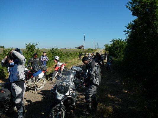
13 Started the ride..... only 2 Finished.

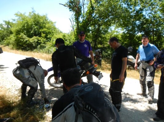
TECHNICALLY .... and I do mean TECHNICALLY.. We had 4 flats.
Kevin hit a piece of barb wire and did a quick plug and go...
Then the Yamaha.....had a valve stem leak...Then 2 pinched tube attempts. So that makes 4... This delay was longer than we expected. However we had shade and drinks.... and no lack of humor.

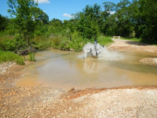
We had 3 spills... All big bikes.. The Tiger, Strom and KTM hit mud, gravel and pea gravel... As for me, I did a dumb *** go thru the middle on a large mud hole and lost it on the other side.. too much power and not enough common sense or experience. it took 4 us to pull it from the ditch and tree i was tangled up in. Pride was the only thing hurt... As for the other two.. Well unfortunate luck for the KTM.... The Strom.. THOMAS... you did very well today. The spill was just a part of learning, and you were a beast coming thru the water crossing...as the picture will show....I WILL SEE YOU ON THE NEXT RIDE.

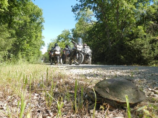
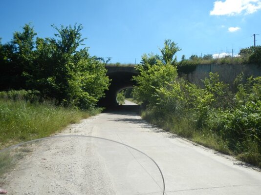
So the route is better than expected. There is more than just gravel along the way. Brown, Black and Tan dirt... roads that were paved on one side and gravel on the other. We had a water crossing that was about 18 inches deep. As the picture of the strom will show.. the front wheel is completely under water. I personally was drenched when I came out on the other side. TOTALLY AWESOME... and Unexpected.

The beach I had planned on riding on....was underwater. Oh well.
We had 1 detour, I will fix the GPX file to reflect the change.

So the ride ended exactly at 1800...with just me and Jeff Hough.
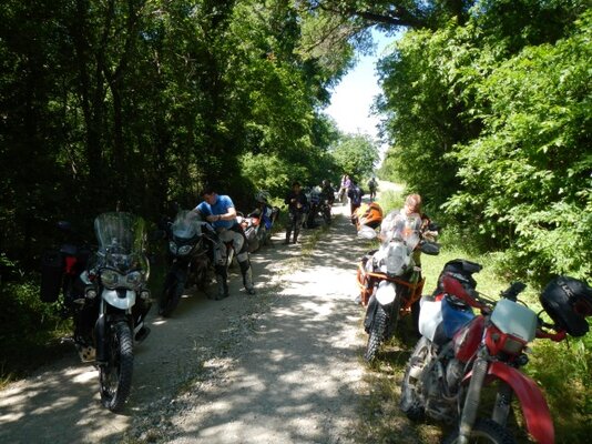
It was a long day, but the route was really good and mostly dirt and gravel.
I had another squirl hit my boots AGAIN.. something about me and squirls.

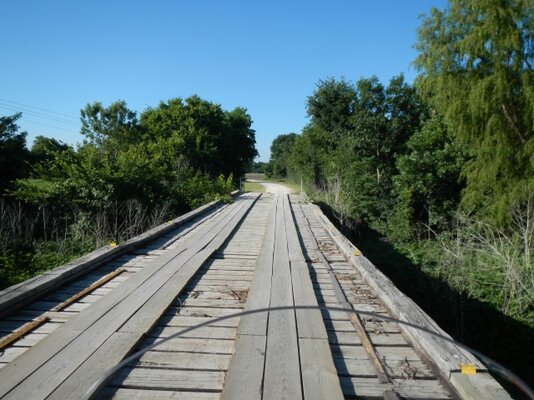
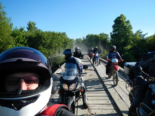
In Summary - This route is a keeper.. Lots to see and so many wooden plank bridges.
 
2 finishers? Everyone leave off the route early?
 
Here is the corrected GPX file and Google Earth File.
I will start uploading the pictures shortly.
 

Attachments

  • EnnisRun3.gpx
    296 KB · Views: 232
  • EnnisRun3.kmz
    17.5 KB · Views: 251

Attachments

  • DSCN0856 - Copy (Custom).JPG
    DSCN0856 - Copy (Custom).JPG
    134.3 KB · Views: 287
Last edited:
Just some of the photos from the link.

This was the first plank bridge we came too...which was the first of about 15 we crossed...It was the only one I knew about. The others were unknown.
 

Attachments

  • DSCN0842 (Custom).JPG
    DSCN0842 (Custom).JPG
    92.7 KB · Views: 245
  • DSCN0840 (Custom).JPG
    DSCN0840 (Custom).JPG
    151.4 KB · Views: 240
  • DSCN0839 (Custom).JPG
    DSCN0839 (Custom).JPG
    119 KB · Views: 245
  • DSCN0837 (Custom).JPG
    DSCN0837 (Custom).JPG
    108.8 KB · Views: 239
  • DSCN0836 (Custom).JPG
    DSCN0836 (Custom).JPG
    114.1 KB · Views: 237
Just some of the scenery we encountered. There was really more covered roads like this than I expected.
 

Attachments

  • DSCN0847 (Custom).JPG
    DSCN0847 (Custom).JPG
    171.9 KB · Views: 228
  • DSCN0846 (Custom).JPG
    DSCN0846 (Custom).JPG
    143.4 KB · Views: 235
  • DSCN0845 (Custom).JPG
    DSCN0845 (Custom).JPG
    146.9 KB · Views: 240
  • DSCN0844 (Custom).JPG
    DSCN0844 (Custom).JPG
    144.3 KB · Views: 241
  • DSCN0843 (Custom).JPG
    DSCN0843 (Custom).JPG
    104.3 KB · Views: 240
So we had our delays....and saw some interesting things people keep on their property..
 

Attachments

  • DSCN0852 (Custom).JPG
    DSCN0852 (Custom).JPG
    122.8 KB · Views: 257
  • DSCN0851 (Custom).JPG
    DSCN0851 (Custom).JPG
    157.9 KB · Views: 250
  • DSCN0853 (Custom).JPG
    DSCN0853 (Custom).JPG
    127.6 KB · Views: 260
  • DSCN0849 (Custom).JPG
    DSCN0849 (Custom).JPG
    97.2 KB · Views: 260
  • DSCN0848 (Custom).JPG
    DSCN0848 (Custom).JPG
    100 KB · Views: 252
And ofcourse the water crossing and the finishing...
 

Attachments

  • DSCN0855 (Custom).JPG
    DSCN0855 (Custom).JPG
    125.9 KB · Views: 227
  • DSCN0857 (Custom).JPG
    DSCN0857 (Custom).JPG
    144.4 KB · Views: 223
  • DSCN0858 (Custom).JPG
    DSCN0858 (Custom).JPG
    105 KB · Views: 232
  • DSCN0859 (Custom).JPG
    DSCN0859 (Custom).JPG
    107.4 KB · Views: 226
Chris, thank you so much for organizing the ride - really nice route! My wr250r had the second flat, which was unfortunate because tube changing or patching on the side of the road isn't fun or easy. I pinched the new tube and we had to improvise a patch... after lots of work (and time :-() we managed to get the bike to a shop in Corsicana. Dlui15 went beyond the call of duty riding with me to Brinson Motorsports in Corsicana... when we got there they told us they don't do motorcycles, didn't have tubes, and couldn't help us. And there wasn't another place nearby either. My flat was back with a vengeance and I couldn't ride the bike home. Dlui15 and I had lunch to recover from the experience and then my wife came to rescue me with a trailer. I learned quite a few things from this experience:
  • Fellow motorcyclists are a wonderful bunch - thank you for all the help!
  • Carrying a spare tube is not enough. I need to be able to install it without pinching it!
  • Carry a second inner tube just in case
  • Carry talcum powder and soap to make the installation more likely to succeed. Carry a patch kit too with fresh cement
  • Check tire pressure at stops to make sure it's not too low
  • Install rim locks to help with a low pressure situation
 
Sounds like a great ride, really sorry Sylvie and I couldn't make it, could have helped with the punctures.. hope to make the next ride. Remember to have fun and enjoy the ride

Gary
 
Texter, check out Baja no pinch tire tool, enjoyed riding with you Saturday.


Sent from my iPad using Tapatalk
 
Weather is looking better for tomorrow and I finally have a chance to get out so i am thinking about this ride or Glen Rose if there is a ride anywhere...
 
Hey Chris, I was coming home from Austin this evening and was fiddling around with OSMand, testing it out while I was on 4 wheels and not having to worry about balancing anything. I was testing it out on my Galaxy S5 using the gpx file you had posted on the thread for the ride we did last month in the Waxahachie area. I had an issue where the starting loop would start at the Sonic, lead south for about a mile, skip the road we turned off on (FM 876), and then it would loop over and back north up the access road to the starting point at the sonic. Is it getting confused due to the lead off road FM 876 being the same road that as part of the last of the loop, missing the fact that instead of turning around we just double back, like maybe it's skipping a way point or something? I figured out to turn on 876 but then when I get down the road about another mile it keeps trying to U turn me so I am just wondering if it is something I am missing with OSMand or maybe I am just not patient enough to run past the part where 876 runs out and the route seperates from the return trip. Any advice you can offer would be most appreciated.
 
I loaded the file in BaseCamp and found a few waypoints that were set off of the route, so if you miss the point, the GPS unit will want you to go back and "hit it".

From this ride, here is an example, where we were on HWY 14 and the waypoint deviates out to CR2390, then turns back half way. So, if you don't hit this u-turn point, the GPS unit will try to route you back to it until you do.

Disclaimer, not all GPS units will do this. Some will skip it and route you to the next point.

picture.php


A suggestion when creating routes is, rather than using tracks, use waypoints and force them in a specific order, and make sure they are exactly on the road. I've experienced that if you set a waypoint even a few feet off to the side of the road, the GPS unit will expect you to go off the road to hit that point.
 
Thanks Charrito... I was discussing a good program to use to evaluate the gpx files with Chris and he mentioned he was having issues with basecamp and windows 10 (as have I). I guess now that I finally have a little down time I will figure out the problem and proceed from there. I was thinking it might have been a waypoint issue. It's just hard to tell on some of the gpx files where routes cross back on top of each other if they are conflicting or not. I was trying to find a function in OSMand where you could tell it to just push to the next waypoint but my inexperience with it is probably the limiting factor.
 
OSM I found will push to the next point if you are on a track that doubles back...but I will email the programmers to add a function or correct this issue. But I really haven't had an issue I guess it's because I am expecting this, a d I k ow it will self correct..
 
Back
Top