• Welcome to the Two Wheeled Texans community! Feel free to hang out and lurk as long as you like. However, we would like to encourage you to register so that you can join the community and use the numerous features on the site. After registering, don't forget to post up an introduction!

Where In The World Is Tracker?

Tracker

post tenebras lux
Forum Supporter
Joined
Dec 25, 2005
Messages
16,564
Reaction score
7,923
Location
Rowdylett, TX
First Name
Gary
NOTE: THIS IS AN OLD THREAD. THE CONTEST IS OVER AND NO LONGER ACTIVE.
+++++++++++++++++++++

Actually, I'm still in Plano, but ...

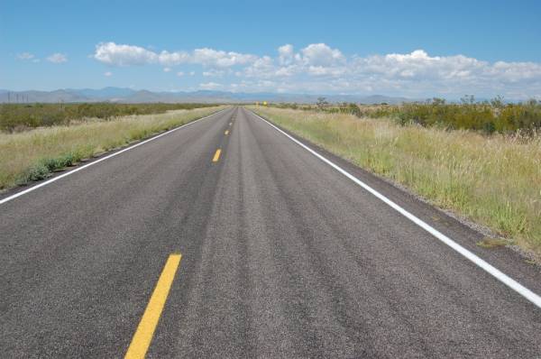
The weather has turned cool, my wunderlust is at a fever pitch, so it's time to take a trip!

To spice it up a little bit, I thought we could have a little google map fun and an informal contest.

Grand Prize: Brand spankin' new TWT T-Shirt purchased by me for the lucky winner, dependent on Tourmeister's T-Shirt availability.

Here's the rules for Where In The World Is Tracker?
  1. As I travel, I'll post up written and photo clues as to my route, but you'll have to use some google ninja skills to figure out my exact route as close as possible. I'll try to post clues every day, but that's all dependent on power availability for my notebook and tethered cell phone on the road. I've created the route on maps.google.com (it's unlisted now).
  2. 24 hours after posting the ""official" end of the trip" post, the person that PM's me (click on my name) with the total mileage guess that is closest to the total miles ridden for the trip wins the T-Shirt.
  3. Don't bust my chops; this is just for fun. If my odometer or some other such calamity befalls me along the way, then I'll use the estimated mileage I've calculated on the google map.
Here's some starting clues.
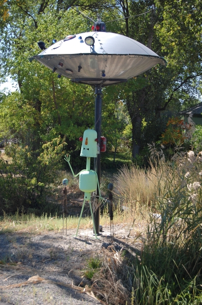
1. 33.012964° N 96.728289° W
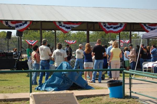
2. I'll leave Saturday and be back Sunday, but I'll be gone longer than one day.

Got to get back to packing... :trust: :rider:
 
Last edited:
This looks like it is going to be a fun thread. I guess I better brush up on my Google ninja skills.
 
:tab
ninja1.gif
:tab
ninja3.gif
 
Official WITWIT Starting Odometer Reading: 17119.7
 
Last edited:
Packing for a multi-day camping MC trip is a challenge, especially on a Speed Triple. I look like the Beverly Hillbillies heading for Cal-Eei-Forn-Eye-Aye. Speaking of "aye", today was International Talk Like a Pirate Day, Arggh, maties, I almost forgot ye.

Anyways, packing. After employing my best scientific methodology testing, I abandoned the magic of the "Magic Heat" stove after it was only thinking about boiling water after 20 minutes. Also pictured is the ever handy LED flashlight/Shiner opener/stove lighter. I went back to my trusty 27 year old Coleman Peak "backpacking" stove. :trust:

200809trip2.jpg


So, packing is 99.9% done as of 23:06. This pic was about 17:00 today.

200809trip1.jpg


After getting a rub mark on the plastic above the tail light from a previous trip, I covered the rub spots with some clear packing tape. Hopefully that will help avoid abrasion marks.

WITWIT Clue 2: After racing down part of George Herbert's finest ribbon of concrete, if I was feeling sad and wanted a touch and go breakfast, you'd know where to find me tomorrow morning. :rider:
 
I know your heading down the "George Bush" Toll Road. I just can't figure out the "touch and go" breakfast. I'm still thinking.
 
I just can't figure out the "touch and go" breakfast.

Blue Hangar - check the DFW events section (airport, pilots, landings, etc.).

George Herbert - could be G. H. W. Bush or it could be the poet :scratch:, or it could be the "land of Herbert" (aaaa - bear) - Louisiana :lol2:

Most likely the GBT...
 
Ah, the open road. A cool morning, little traffic--I am a blessed man.
sat20-21.jpg


I forget how different the country is from the Metromess. Different smells, different pace. solitude. What a glorious day.

Forgotten smells. There's that unique smell of fields that remind me of dove hunting. Not sure what it is; maybe sunflowers? :shrug:

Sometimes, technology is fun. I'm connected to the Internet via my tethered cell phone in the boonies. On the other hand, it's consuming battery at an alarming rate as the notebook is trying to charge the cell phone. UPDATE: Tethered internet on an "extended" network not work so good.

Anyways, The weather was cool this am, low 60's. Had a nice breakfast with my Dad, then hit the road.
sat20-23.jpg


WITWIT clues:
Wound my way through the home town of one of the biggest western boot makers. From there, I visited this guy's home town
MP105_JACK_IN_THE_BOX.jpg

and the birthplace of 4H. Next, the home town of the popular dessert cracker that is a key ingredient of s'mores. Traveled on through the home town of Bob Lily, past a major wind turbine farm to my evening destination--a place where you can be in Colorado and Texas at the same time.

Small town at its finest, a centennial celebration of Newcastle.
sat20-31.jpg


County seat spire of Throckmorton
sat20-33.jpg


The Double Mountain Fork of the Brazos River near Snyder south of Claremont on 208
sat20-36.jpg


A fine dining experience at Chez Leavelle at Lake Colorado City State Park
sat20-40.jpg
 
Last edited:
Gary,

Are you going to be riding all week or is this a to and from calculation??????
 
OK, I'm back. Internet was not as accessible as I'd hoped.

To answer Don's Q, it's a big loop. As far as the # of days, gotta read the clues. :mrgreen:

back in a moment
 
OK, I have Jacksboro, Graham, Olney, and dunno after that... maybe Colorado City...
 
XL tortilla warmer.
sat20-39.jpg


Jacksboro, Graham, Colorado City: ding, ding, ding :clap:
Olney: gong :nana:

The free T-Shirt is gonna take some work and map study. :mrgreen:

Sunday...

...started bright and early. Might as well start it with an early morning campfire.
sat-sun002.jpg


Heading west, I tried to get the 4 images all in one pic that typified west Texas for me: pump jack, fields of sorghum or cotton and a windmill. I could only get 2 of 4.
sat-sun003.jpg


West Texas motto: Our roads are straight and our winds are strong.

For 500,000 trivia points and absolutely no value for the WITWIT contest, who can tell me what this bug catcher is trying to catch? They were along the edges of various fields about every 100 yards from Graham all the way to the New Mexico border.
sat-sun004.jpg


Freebie clue just because I thought this was an interesting shot.
sat-sun005.jpg


I continued on west on my trusty steed, crabbing my way across the rest of Texas at a 5 degree list from the strong south crosswind.

A ways into NM, and shortly after this shot, I got up close and almost personal with a couple of mule deer. It was in the mid fifties for the next hour or so of riding. East side of Cloudcroft on US 82
sat-sun011.jpg


Another gimmie clue on US 70.
sat-sun016.jpg


My stop for the night was Aguirre Springs, a BLM campground near where Colonel Baylor of the Confederate Army routed a numerically superior Yankee force, When the Yanks abandoned their fort; rather than fill their canteens with water, they filled them with "medicinal" whiskey so they wouldn't have to pour it out. After a day's march in the July sun, Baylor's men intercepted the drunk and dehydrated Union forces, which surrendered without a shot being fired.

In like fashion, shortly after I arrived, there were a bunch of picnicking folks, one of which decided to show off his prowess by letting loose a few rounds up into the cliffs. :eek2: I debated on retreating, but they left soon after. The county mountie showed up about an hour later with his trusty AR-15 at the ready, looking for suspects. It was a quite night after that. :lol2:

There was no getting a tent stake in the ground, so I used the trusty rocks instead.
sat-sun020.jpg


/rant on
@#$&$ smokers who leave their butts at a campsite scattered around. I bet I picked up 30 butts.
/rant off

Thus concludes Sunday's ride of 4xx miles.
 
Last edited:
Monday 4xx miles
This is a couple of shots of sunrise from my campsite. The needles were the backdrop to the campground and the valley spread out below.
sat-sun034.jpg


sat-sun036.jpg


sat-sun038.jpg


No photos needed. Primitive Toilets Motto: We'll wake you up quicker than a cup of coffee.

Heading west through the town of "The Crosses", I turned north on a very lightly traveled road. This would be the case for all the roads traveled today.

Arrived at this town named for a popular roasted pepper. The smell of roasted peppers permeated the town of Hatch, NM.
sat-sun047.jpg


Hmmm. Huevos Rancheros. Muy Bien. A good breakfast and a map of the road. :rider:
sat-sun049.jpg


Continuing on, this road rivaled some of Big Bend for "loneliest roads in the US". However, it leads to one of the twistiest roads I've ever rode. I often rode 15-30 miles without meeting a vehicle. NM 152
sat-sun051.jpg


Forgotten dreams from an old building in a silver mining town in Hillsboro.
sat-sun055.jpg


This road had the most twisties I've ever ridden in my life. On camber, off camber, climbing, descending. WooHoo!!! Sign after sign warning 10 mph, 15 mph, 20 mph squiggles, switchbacks between Hillsboro and Santa Clara on NM 152.
sat-sun056.jpg


A ways on, I passed the biggest open pit mine I'd ever seen and the world's biggest open pit copper mine is here, Santa Clara.
sat-sun060.jpg


Ruh, Roh, Looks like rain...
sat-sun061.jpg


The Narrows on NM53 south of Grants, NM
sat-sun062.jpg


La Ventana Natural Arch on NM 53
sat-sun063.jpg


I wimped out tonight after 4xx miles. I was running out of daylight and decided to park it in a town on the highway famous for a place to "get your kicks on ...".

Tomorrow, CO ....
 
Last edited:
Nothing like a soft bed. Tuesday was the day to invade CO. After heading west on the super-slab, I turned north in Henry David's namesake. This road was loooooooooong, straight, and filling-loosening rough.

I had plenty of time to have a long mental debate over whether it was better to go faster and get it over quicker, or slow down and maybe reduce the chance of damage. After 15-20 miles of this, I then got the shock--a sign that read, "Rough road next 21 miles". Huh? What was that last 20 miles. :giveup:

tues23004.jpg


150 something miles later, I arrived at the home of the Connie Mack World Series and the confluence of the San Juan, Animas and La Plata Rivers.

Heading northeast, then north, I crossed into Colorado. Fall was starting to show some of its colors. These three towns to me are my Colorado trifecta. Between the first two runs a narrow gauge railroad. Along the way north, you'll see Engineer Mountain in the distance

tues23001.jpg


The air got chilled as I rolled into the old mining town turned tourist haven and turnaround point for the narrow gauge rail. 2000 men showed up in 1874 to stake their mining claim. Word of warning. Be sure not to be awed by the scenery to the point that you forget to check and make sure your side stand will not sink into the soft shoulder. :doh: 
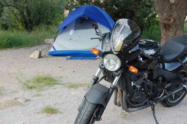
Scratch one turn signal. Fortunately, a little electrician's tape and I was good to go. A nice British chap stopped and helped me get her righted. Otherwise, I would have had to unload all the gear.

This is the site of my mishap.

tues23003.jpg


Heading on north, there were about twelve miles of smiles over three passes (Coal Bank Pass, Molas Pass and Red Mountain Pass) on what's known as The Million Dollar Highway (supposedly a $1m/mile in the 1920's) to the town famous for its hot springs. Heading on north, I made the final stop and stayed with some friends in the town where the Colorado and Gunnison Rivers collide.

Wednesday leads me to my favorite spot in all of CO. The county has the highest average elevation in the lower 48 states. It's also known as the home of Albert Packer who had either good taste In friends or tasty friends. :eek2: :eat:

In the Colorado Rockies
Where the snow is deep and cold
And a man afoot can starve to death
Unless he's brave and bold


Oh Alfred Packer
You'll surely go to ****
While all the others starved to death
You dined a bit too well​
 
Arrived at this town named for a popular roasted pepper. The smell of roasted peppers permeated the town.
sat-sun047.jpg

Hatch, NM

This road had the most twisties I've ever ridden in my life. On camber, off camber, climbing, descending. WooHoo!!! Sign after sign warning 10 mph, 15 mph, 20 mph squiggles, switchbacks.
sat-sun056.jpg

US-191 -- Awesome.

*EDIT* If you're not to Clifton at this point, this must be Hwy 78...

A ways on, I passed the biggest open pit mine I'd ever seen and the world's biggest open pit copper mine is here.
sat-sun060.jpg

Clifton, AZ -- It's quite a sight to see...

That's all I've got for now....

trey
 
Trey, first one was right. 2 & 3 are closer to Hatch, NM on a NM state highway.

At the end of the contest, I'll post all roads and waypoints with a map route.
 
Last edited:
Trey, first one was right. 2 & 3 are closer to Hatch, NM on a NM state highway.

At the end of the contest, I'll post all roads and waypoints with a map route.

Looks like fun... I did a similar route last month, I just keep dragging my feet on posting up the report....

This is good inspiration though.. :rider:

trey
 
Olney: gong :nana:

Well, so much for Google on that one... :giveup:

------- some random attempts at other ones:

I turned north in Henry David's namesake - Thoreau just off I40

Connie Mack World Serious - Farmington, NM. The road must have been 371.

Between the first two runs a narrow gauge railroad - Durango and Silverton

Hot springs in Colorado - I think of Glenwood Springs but it is more likely Ouray (the Switzerland of Colorado)

Colorado and Gunnison Rivers collide - Grand Junction :mrgreen:

"loneliest roads in the US" - US50 (called that in Nevada anyway)

"biggest open pit mine" - Gillette, Wyoming, of course! :mrgreen:
:lol2:
 
They are Boll Weevil traps

I was going to guess that based on the large amount of cotton grown in west Texas. However, I haven't been thru there lately & wasn't sure if they had switched to to a different crop.
 
Wed in CO

I needed an easy day. I'm glad I had a relatively short day planned, mileage-wise, so I could stop and take more pics without feeling rushed. My friend is a county mountie and had lots to share about the area. The mesa that overlooks his town (the one in the background of the pic) has over 200 lakes on it and feeds much of the irrigation in the valley below. They've been called out to break up fights over water rights.

wed24030.jpg


Retracing part of my route before turning east, this oddity stands guard at the north end of Delta, CO.

wed24001.jpg


There were plenty of breaks today as almost every turn, my photographic trigger finger got twitchy. After turning south at Blue Mesa Lake, I found my way to my final destination for the day, Lake City.
I'll let the pictures do the talking for a minute.

wed24010.jpg


wed24015.jpg


Blue Mesa Lake on US 50 towards Gunnison. I messed up and didn't tak CO 92 from Delta to Blue Mesa. It's suppose to be incredible.
wed24014.jpg


My friends, Bob and Linda, are the owners of Rocky Top Lodge (actually a group of nice cabins) at the north end of Lake City. 24 years ago, this was me and his family doing some work on their first cabin. I guess I have gotten a little older. :giveup:
wed24b.jpg


Pics I took within a quarter mile of their cabins. :mrgreen:

wed24019.jpg


wed24024.jpg


The cemetery is about a half a mile hike from their cabins.

wed24028.jpg


wed24025.jpg


wed24026.jpg


Tomorrow, a rest day of sorts with only a short ride to the Lake San Cristobol and some 4x4 in the afternoon. It's suppose to get down to 30-32 tonight. :eek2:
 
Last edited:
Alferd Packer a colorful fellow.

Leave it to the newspapers to make everything political......... :mrgreen:

Wikipedia said:
.......During the trial, a local newspaper reported that presiding judge M.B. Gerry said:

"Stand up yah voracious man-eatin' sonofa***** and receive yir sintince. When yah came to Hinsdale County, there was siven Dimmycrats. But you, yah et five of 'em, ****** yah. I sintince yah t' be hanged by th' neck ontil yer dead, dead, dead, as a warnin' ag'in reducin' th' Dimmycratic populayshun of this county. Packer, you Republican cannibal, I would sintince ya ta **** but the statutes forbid it."[4]

The actual sentencing statement was more in character for an educated state judge:

"Close your ears to the blandishments of hope. Listen not to its fluttering promises of life. But prepare to meet the spirits of thy murdered victims. Prepare for the dread certainty of death." [5]
 
Back
Top