• Welcome to the Two Wheeled Texans community! Feel free to hang out and lurk as long as you like. However, we would like to encourage you to register so that you can join the community and use the numerous features on the site. After registering, don't forget to post up an introduction!

Escape to Witch... er... The Smoky Mountains! May 19-26, 2012

I totally forgot about the "Just Married" couple that could not understand the concept of pulling over :doh:
 
Hey John, I have 75GB of your video files and a folder with a bunch of your still shots sitting on the laptop. Do you need them or did you find some way to keep a copy of all of it?
 
Hey John, I have 75GB of your video files and a folder with a bunch of your still shots sitting on the laptop. Do you need them or did you find some way to keep a copy of all of it?

Yea, I was going to PM you about that, let me send you a hard drive so I can have it, next year I will bring my laptop!
 
Haven't forgotten about this... just not used to coming into work 3-1/2 hours earlier than normal, which I have do to all week... :twitch:
 
Day Four, Wednesday:

:tab So it seems that the tropical storm that had been brewing off the coast has gone AWOL. One day they are getting all breathless about it in the news and the next it is a non event. Well, cool! It is still pretty hazy and damp outside this morning. I'm getting low on Pop Tarts...

:tab 
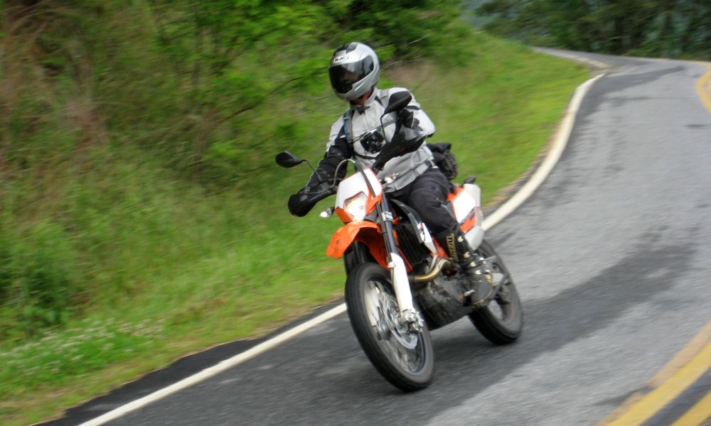
The plan for today is to head North. I want to explore a road that runs up the East side of the Smoky Mountain NP, just to the West of I-40. It means running a good bit of pavement to get there, so hopefully it will be worth it. The whole group is going today, all on the small bikes. A highlight for today should be Hurricane Creek Road. I've seen some pics and read reports from folks on AdvRider, so it looks to be fun! Everyone gears up and we leave just before 10:00am. It seems this has become our pattern for the week, which suits me fine!

:tab 
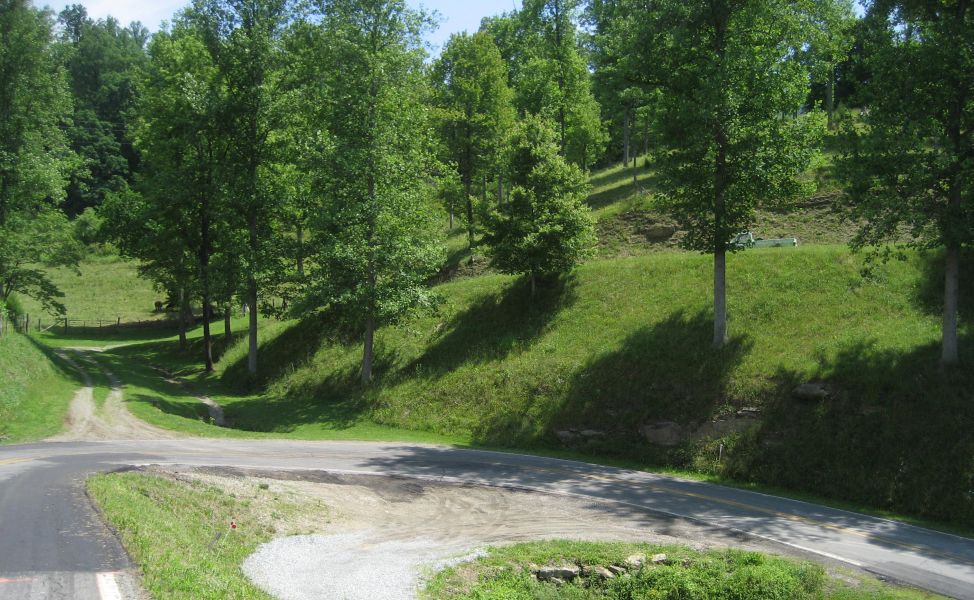
We start the day heading North on NC 215. We'll run this up over the Blue Ridge Parkway and eventually get to I-40. The pavement is damp. The woods have that dark wet look. The leaves of the trees are shiny from the moisture in the air collecting on them. It kind of puts me in a bit of a subdued mood... but still... the road begins to bend and twist... the curves are banked and smooth... and the mental funk is soon left behind as I find my groove.

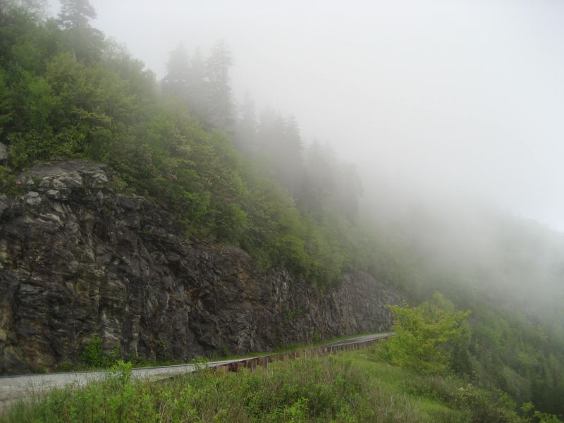
Almost to the top of the ridge at a scenic pull out
IMG_7502.jpg


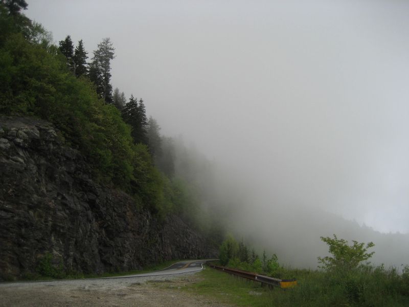
The clouds can get THICK up here in a hurry, visibility going from great to white out in seconds! :huh2:
IMG_7503.jpg


The large firs stand like gloomy sentinels guarding the road below...
IMG_7506.jpg


:tab 
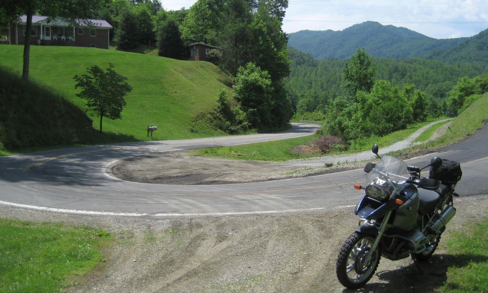
We soon reach the ridge and start down the North side. This side of 215 is known locally as Lake Logan Rd. It roughly follows the Pigeon Forge River down out of the mountains. The top third of the road is quite twisty. In years past, the pavement was almost perfectly smooth. Now it is rough and patched in many places. Still... it is fun nonetheless! There are several cool places along the way down to stop and take in the scenery.

Looking upstream...
IMG_7508.jpg


I love the natural stone and big arches... much nicer than concrete and steel
IMG_7509.jpg


IMG_7510.jpg


:tab We cruise down the road a bit further and come to another bridge. I promise the guys this is the last stop for a while because we've barely gone even a few miles since the last stop.

A good section of the road. A lot of the patches are mid corner.
IMG_7511.jpg


Looking back up the hill
IMG_7513.jpg


John provides a sense of scale
IMG_7514.jpg


IMG_7515.jpg


IMG_7516.jpg


I have seen people swimming down there before... the water is COLD :shock:
IMG_7517.jpg


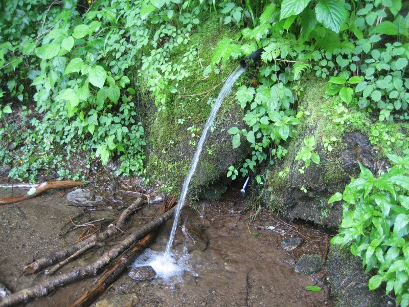
I saw a LOT of these when we lived up in New York when I was a kid.
IMG_7518.jpg


:tab The pipes would just come out of the side of mountain with spring water pouring out of them. We'd stop and fill up coolers for drinking water. I always wondered how they knew where to stick the pipes and how far back they went. I don't taste the water coming from this one, but it looks nice and clear.

Looking up stream
IMG_7519.jpg


They were there a second ago... :shrug:
IMG_7521.jpg


John and Steve
IMG_7522.jpg


:tab The rest of the run down 215 is fun. We don't make any more stops because we really do need to get some miles behind us so we'll have time for the fun stuff later in the day. We cross US 276 and run NC 110 on into Canton. A stop light splits the group and we have a few minutes of minor confusion as we try to get everyone back together. Then we head out of town on I-40 West to Cove Creek. Here we stop to top off the bikes. I'm not real sure how far we'll have to go before the next available gas, so I want to make sure we can go as far as possible.

:tab 
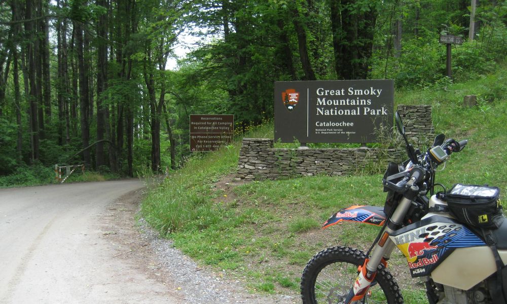
We head Northwest on Cove Creek Rd. (NC 1326 and 1395). It follows the right fork of Cove Creek up into the mountains and brings us to the entrance of the National Park.

IMG_7526.jpg


Roger - He's always busting with enthusiasm... We're working on that ;-)
IMG_7527.jpg


:tab Just to the right of the entrance sign there are two "roads". They are both blocked with steel posts set in the ground, three each, the middle post being hinged so that it can be laid down to allow vehicles to pass. The middle posts are pad locked into the upright position. It looks like where the entrance is now used to be the center of a switch back on an older road. One fork of the road continues up and to the left around the side of the mountain, the other down and to the right. Checking my topo maps shows the lower section going back down to hit the road we just came up. The upper section appears to roughly follow the path of the newer road, but runs higher along the ridge. Neither look like they have seen motorized traffic in a while, but they are not over grown and there are two clearly visible tracks. I don't see any of the typical signs prohibiting motorized access, but we decide to just play it safe and stick to the new road. Still... looking along the upper path... oh... so... tempting... The new road is called Mount Sterling Rd., and on the topo maps is shown as NC 1397.

:tab As we enter into the park, the road becomes like so many out there, following the side of the mountains... in... out... in... out... up... down... up... down... Sometimes it is almost enough to hypnotize me. So I play around with sliding the back end out of the corners to keep myself entertained and focused. We soon pass the turn for Ranger Station Rd. I had thought about running out and back on it, but it looks like it will take a good bit of time and there doesn't appear to be anything real special about it. I'll probably find out later that there is some kind of Ranger tower out there that is totally cool and regret passing up the chance to see it. Oh well...

:tab We eventually drop down into a valley and the road crosses what I think is Catalooche Creek. I've never figured out how a flowing body of water gets the designation of creek, stream, or river. I've seen "rivers" that were barely a trickle or even dried, and I have seen creeks that were flowing well enough to traverse in a boat. This appears to be one of the latter...

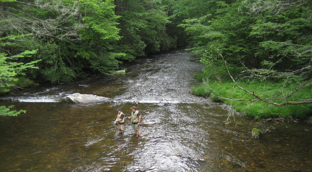
A father passing on the joys of fly fishing to his son... kind of cool to watch them!
IMG_7528.jpg


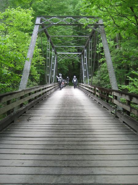
The steel/wood bridge over the creek
IMG_7529.jpg


See those two steel rods coming down behind my bike?
IMG_7530.jpg


:tab One of those rods is severely pitted, almost all the way through the metal. The bridge hangs from the upper frame via these rods. If one were to let go... John is an Inspection Engineer. This is right up his alley so I show him. I know he's got some pics, but he's slow getting them posted :-P

:tab We continue on past the "creek" and climb up out of the valley to Mount Sterling Gap, at just below 4000 feet. Here on the ridge, the old road I mentioned before intersects the new road. This end looks like it is frequently traveled and it is not blocked. I decide to run up the road a ways just to explore. So all of us head up. It starts out some what steep, rutted, and slightly washed out. It's a good two track and I can see this being a LOT of fun, but it is taking us the opposite direction that we want to be heading. So I stop as it starts to level out.

Tell me you wouldn't want to find out where it goes... :cool2:
IMG_7531.jpg


Yeah, Steve is enjoying this road :trust:
IMG_7532.jpg


:tab Well... It would be nice if some local could give me the skinny on this road and let me know if riding it is okay or will get us in a heap of trouble. I make a mental note to keep it in mind for future trips. The frustration of trying to plan routes in this area is that my Topo maps show a TON of trails in the area as dashed lines on the map. Some are roads that can be ridden and some are not. There is no real way to know ahead of time. If I lived out here, I would certainly investigate all of them thoroughly. But since I can only visit and we are trying to maximize riding time, we kind of want to stick with what we know, or have a good idea of, as being roads that get us where we want to go. Which, in this case, is a road that eventually gets us to where we can cross under I-40 and head East.

:tab We return to the intersection on the ridge and continue on the main road. I start to settle back into a nice groove and as I come around a corner I am greeted with a BIG set of surprised eyes!! :shock:

This dude is standing in the middle of the road!
IMG_7533.jpg


:tab For a few seconds, he runs down the center of the road away from me. Then he pauses... turns around... stares at me as I am frantically trying to get my camera out... and calmly walks to the edge of the road and drops down the steep incline into the woods below. I manage to get the shot you see above, but my little point and shoot just can't zoom that well.

He's got a nice rack
IMG_7534.jpg


:tab Once down in the woods, the Elk just kind of hangs out and starts nibbling some nearby leaves. He doesn't appear worried at all and after we all snap a few shots, we take our leave. We soon reach the edge of the park, where FR 288 meets Mount Sterling Road, and we turn East on FR 288. A bit down the road I spot a neat little camping area next to a stream and decide to pull in for a break and some pictures.

A tent pitched right next to this would make for some quality sleep time :sleep:
IMG_7535.jpg


IMG_7536.jpg


Roger, John, Me, and Steve
IMG_7539.jpg


:tab While we are standing around goofing off, I hear the sound of a bike approaching. Sure enough, a bike comes around the corner and I motion for him to pull over for a visit.

Mark, of BigDogAdventures.com, on his tricked out and HEAVILY loaded WR250R... a pleasant surprise.
IMG_7540.jpg


The hatch marks are bear sightings
IMG_7541.jpg


:tab Mark just retired about a week and a half ago. Now he's out just goofing off and roaming about. We pepper him with questions about his bike setup, his video recording setup, and all the other thoughtful little bits and pieces he's put into his bike to make it an adventure ready machine. I really like the marks on the gas tank to let him know how much gas he's got! Gonna have to get that done to my KTM. After a nice visit, we get back under way. We still have quite a few miles to go of unknown riding conditions.

:tab The rest of the run over toward I-40 is great. It is just more of the hard packed forest road with loose gravel over the surface. There is a seemingly endless supply of sharp blind corners. As much as I like to zip along, I still slow wayyy down and hug the inside of these corners. Get hit head on by an ATV, have a CLOSE call with a truck or two, and even have a bike come at you on your side of the road and you get a bit paranoid about blind corners... :wary:

:tab My plan is to stop at a place called Buzzard's Roost. I found out about it kind of at the last minute and didn't really get to research it enough to know exactly where it is. All I know that it is somewhere near I-40, is up real high, and gives a neat view looking down on I-40. However, we reach the end of the road and I never see anything that looks like it might be it. We stop at one point where there is a rough looking road that runs South, which on the map looks like it kind of follows I-40. I run up that a short way and it doesn't look right. It is fun though and is another that I make a note of for future exploration. Then I turn back to the main road. So we head on down the side of the mountain the last bit to the river below.

I think this is the Pigeon River
IMG_7542.jpg


IMG_7543.jpg


:tab We pass a little camp ground area and I spot Mark on his WR, giving him a final wave, we ride on. We cross under I-40 and pick up the start of Cold Springs Creek Rd. It also shows as Harmon Den Rd., on some maps and on the Exit sign for I-40, which causes some confusion later in the day... :doh: Anyway, it starts out like so many other roads in the area and is a pleasant ride.

IMG_7544.jpg


:tab Eventually Cold Springs Creek Rd., or Harmon Den Rd., whichever you want to call it, runs Northeast and hits Max Patch Rd., at Robert Gap. Max Patch shows as NC 1182 on my maps. My original route idea was to head North here and then cut over into Tennessee and eventually run up to US 25, make a big loop around the North side of Hot Springs, come back down NC 209 and eventually wind up right back at this spot, THEN run Hurricane Creek Rd. Well... it is obvious we won't be doing that as we have already burned a good chunk of day light and it is getting on into the afternoon. So we decided to just lop off all of that and head South on Max Patch Rd., now and hit Hurricane Creek Rd.

:tab Max Patch Rd., is more of the same, fun but not real technical. We head South a few miles and then pick up Wesley Creek Rd., which starts to get more fun...

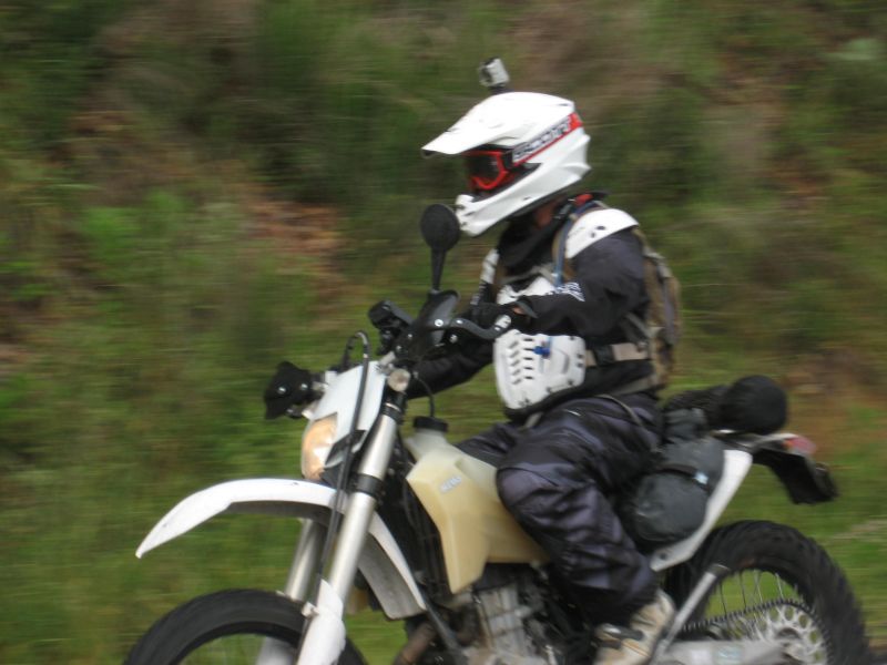
Steve on his KTM 690
IMG_7545.jpg


:tab All day long the air has been heavy with the feeling of rain. We've not actually had to ride in any rain yet, but there have been a few short and light sprinkles here and there. It becomes obvious that this area has seen more than a few light sprinkles!

John on his DRZ
IMG_7546.jpg


Lots of this...
IMG_7547.jpg


And this...
IMG_7548.jpg


Roger on his KTM 450
IMG_7549.jpg


Followed by Steve
IMG_7550.jpg


And John
IMG_7551.jpg


Tell me this doesn't make you want to get out and go riding! :-P
IMG_7552.jpg


:tab 
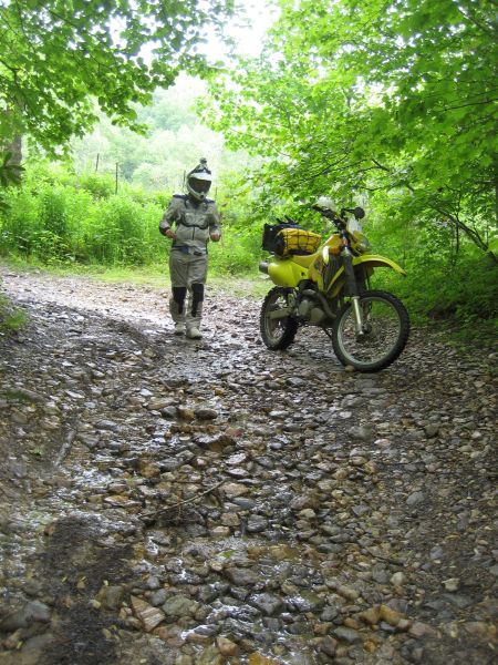
Wesley Creek is not long and we are soon at the beginning of Hurricane Creek Rd. There is a light rain/mist. The leaves of the trees are dripping. The rocks are slick and water is running down the road. The air is still and thick... very thick... Up until now I have been fairly comfortable with the various layers I put on this morning. I should probably take some off now, but I figure once we get rolling it will be fine...

A nice smooth and not to steep section at the beginning of the road
IMG_7553.jpg


IMG_7554.jpg


Note which way the white KTM is facing... You'll understand in a moment... ;-)
IMG_7555.jpg


Looking back the way we came
IMG_7556.jpg


And the direction we are heading...
IMG_7557.jpg


:tab While we are eating some snacks and taking a break, Steve casually taunts Roger with, "I bet you can't get up that..." The "that" he is referring to is a steep climb up the side of the hill that cuts across a switchback, kind of like a lid on the letter U. It is slick, loose, rooted, and steep. Without so much as a triple dog dare, Roger shoots back, "Oh I can get up that with no problem!" The gear goes on without delay and soon cameras are aimed and ready!

:tab Roger drops the bike into gear, hits the gas, and without even a good run up, launches up the hill. Everything is going pretty good until just before the top when the front drops over the little ledge and the rear hangs, spinning and roosting mud. With the front over the ledge and no real danger of sliding backward, Roger is able to feather the clutch, bounce the bike, and get the rear to hook up just enough to push the bike on over the rest of the way. He rolls down around the switch back acting all cool and casual. I know there is video of this. I even have some. But with my country bumpkin internet upload speeds, it would take me weeks to get it uploaded to YouTube! :doh: So we'll have to see if Steve or John can deliver... :cool2:

:tab With Roger's antics and our snacks out of the way, it is time to see what Hurricane Creek is all about, hype or hard core!? Knowing how I tend to run slower than Roger likes to run, I let him take point. Sure enough, he's off like a rabbit through the underbrush, hopping here and there, bouncing along with apparent ease. I am more like a mule... slow and steady... carefully picking my lines... wary of the wet rocks and roots.

Down the rabbit hole to wonderland...?
IMG_7559.jpg


More please! :rider:
IMG_7561.jpg


:tab 
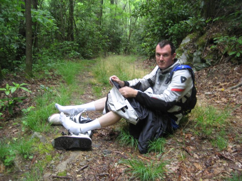
What you see above is actually one of the less technical sections. So the speed has really come down. That combined with the stagnant damp air has me sweating BIG TIME in a few minutes! We don't get very far before I decide it is time to pull over and shed layers!

Had to leave the bike in gear so it would not roll away
IMG_7562.jpg


Seems John has the same idea in mind
IMG_7563.jpg


Roger had gone head and came back... He's telling Steve how awesome it gets :lol2:
IMG_7564.jpg


Nothing to serious... just sticks and stones... wait... how does that rhyme go...?
IMG_7565.jpg


A nice straight section coming up where the speed can come up enough to get air flowing through the mesh gear :clap:
IMG_7566.jpg


I really am holding the camera straight and level... and it IS steeper than it looks :nana:
IMG_7567.jpg


:tab With layers shed and water consumed, we take off again, Roger in the lead. The first mile and a half or so of the road appears to have been the worst, but it's not really all that bad. I guess it is harder simply because it drops in elevation pretty quick, from 4000 feet down to about 3000 feet. After that, the descent is more gradual and less twisty, the road just following and occasionally crossing the creek.

:tab Now, if you have read very many dual sport ride reports, you know they pretty much always involve water crossings. I noticed that from a very young age, basically as soon as he could crawl, my son seemed to have a built in mud/water radar that infallibly led him to messy places. It has only gotten worse as he has gotten older. He's five now. The first day he got to ride his CRF-50 with me on the back he got stuck in deep mud in the back of the yard in the only place with any mud at all and which I specifically told him to avoid... I know... What on earth was I thinking... :doh: :lol2: Anyway, I know a LOT of adult men that don't seem to have outgrown this trait. Maybe it is one of those evolutionary back to the cradle genetic impusles... Salmon swim upstream to their spawning grounds, and if the evolutionary theory is to be believed, grown men gravitate back to the primordial slime and ooze infested puddles from whence they first crawled in some other form... Personally... I think it's just because stomping in mud and making big splashes is FUN!! :flip:

Yeah... Roger is just a big kid like all the rest of us ;-)
IMG_7568.jpg


IMG_7569.jpg


John climbing up the hill out of the creek... this shot sort of gives a good idea of how steep it is
IMG_7570.jpg


:tab There are places along the "road" where the direction to take is not always so obvious. Sometimes there are side paths that are not really the road but they are used enough that they kind of look like they could be the road. Roger usually slows at each of these and waits for me to show up so we can compare GPS notes and make an educated guess. I am cruising along, feeling pretty good, and as I round a curve I am suddenly faced with a decision. There is a fork in the road and I can't slow in time to actually stop before having to commit to one path or the other. I an epic adventurer fail, I pick the path MORE traveled! :doh: I should have known better...

:tab The path to the right is basically a big V carved out of the side of the hill by water rushing down. This should have been my first clue. After all, we are following the road DOWN out of the mountains to lower elevations, not UP. In the bottom of the V is big rocks, so I run up the far side as I try to make the turn. I get up on the top of the V and complete the turn, but there is a big branch right at head height. Not wanting to test my helmet's impact absorbing ability, I let off the throttle, lose all my momentum and...

:tab They say that if there are no pics... it never happened...

:tab So, if someone had happened to be standing there with a camera... He MIGHT have seen me eject from the bike and land in the weeds across the road... He MIGHT have seen the bike fall all the way over so it was pointing down into the bottom of the V... He MIGHT have seen me grab the bars and heft it back up before anyone with a camera DID show up... He MIGHT have seen me make a graceful remount and fast loop around to get back on the right trail as if nothing ever happened...

:tab Fortunately, there was no one standing there with a camera... so... never happened... right? :mrgreen:

:tab I get on down the trail and find Roger waiting. I mumble something about "wrong turn", might have "fallen down", "No worries". We wait for the others to catch up and then take off again.

More puddles :trust:
IMG_7571.jpg


IMG_7572.jpg


Roger waiting to make sure everyone clears the crossing without problems
IMG_7573.jpg


:tab 
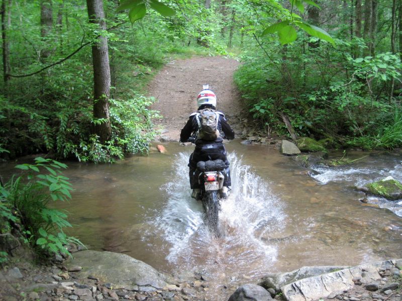
We come to yet another water crossing, but this one looks a little more challenging than those we've already done. There are obviously rocks that have been piled up on the downstream side, perhaps to make the crossing itself smoother. Of course, that also means it is usually going to be deeper. But you just can't take for granted that all the big rocks have been moved. Roger plunges in and hangs close to the rocks, revving the motor and making it across without any problems. On the far side at the climb out point, there are a few good sized chunks of rock embedded in the ground. Since Roger made it look easy, I decide to follow in his tracks... almost... :doh:

:tab About a third of the way across, I hit a good sized rock with the front wheel that Roger did not hit. I am in no danger of going down, but it deflects me upstream into the deeper water. Nothing to do now but look to the far side, shift my weight back and get on the GAS! The motor starts to chug and I see the front tire going deeper... deeper... uh.... deeper... All but the last inch or two of the top of the tire is now under water. I'm twisting the throttle for all its worth now! I can feel the back tire grinding on the rocks below... almost there... almost... there... And the front tire starts to climb back out of the water as I pick up some speed... just in time to hit the big embedded rocks and launch up the far bank to park behind Roger. It might not have been pretty... but I got the job done and didn't go for a swim :lol2: Looking back there is a thick dark mud swirl in the creek where I had been churning up the bottom.

IMG_7575.jpg


:tab In the image above, Roger went to the right, coming at you. I went to the left of the shot and hit the big rocks in the left foreground. This was about a minute or so after I crossed and there is still churned up mud visible in the water. Steve shows up next and pauses on the far side, seeing the swirling mud from my crossing. Roger walks out a bit onto the rocky side and points to the correct line. Steve sees it and gets across without incident. John arrives and it takes a bit more convincing from Roger, but he too takes the right line and gets across without any problems. From here on out, the road levels and straightens a bit. The speed picks up and the air coming through the gear feels great. We soon reach the end of the road and it just drops out onto the shoulder of I-40 on the Northbound side.

:tab From here, we have to run back up the freeway to where we crossed under earlier, then loop under so we can get on the South bound side and start the ride back toward Balsam Grove. Seems simple enough... right?! I take off and hit cruise speed. There is a bit of traffic, so not all of us can get on at once. Just up the freeway, I reach the exit, check my mirror and see Steve coming. So I go ahead and ride on down to the bottom of the exit. Steve joins me a moment later. I look back to see if John is waiting at the top for Roger, but instead seem him blow right by the exit and across the overpass :doh: Fortunately, he happens to look down and sees me and Steve and waves to let us know. I never see Roger. A minute or two later, John comes down the on ramp on the other side of the road to join us. This is when we find out that Roger was in the fast lane and didn't make the exit, thinking instead that we were still ahead of him and that he had to catch up to us.

:tab The next exit is about 10 miles up the road in Tennessee... :huh2:

:tab Hopefully, Roger will realize we are not ahead of him and will take that exit and loop back. But he has no idea what the route plan is, so he could miss us completely. I ride up the edge of the off ramp on the Southbound side so I can watch for his return. While stopped, I get out the cell and call his phone to leave him a message... just in case he thinks to check his phone. Then I kick back and wait a bit. I figure he'll be exiting in 5-10 minutes and maybe he'll call then. John and Steve stayed down under the overpass where it is cooler. So I run back down to tell them I left Roger a message, then run back up to resume my watch on the off ramp, positioned where Roger should be able to see me if he goes by me.

:tab I watch...

:tab I eat some peanut butter crackers... some sunflower seeds... some granola bars... more peanut butter crackers...

:tab No Roger... Dang... It's been almost 30 minutes!

:tab My phone rings!! It's Roger!

"Where are you guys?"

"Where back in North Carolina at the same place where we crossed under I-40 earlier"

"I'm at the North Carolina Welcome Center."

"Oh great, then just head back South to Exit 7 for Cold Spring Creek Rd. and we'll be waiting there for you."

"Okay, I'll be there in a few minutes..."

I park the bike under a tree and wait for him to show up at the exit...
IMG_7576.jpg


:tab I eat another pack of granola bars...

:tab Laying against the base of the tree, a slight breeze blowing, I start to get sleepy. A few 18 wheeler drivers give me a honk or three as they go by. I wave to let them know I am fine.

:tab Ten minutes go by... twenty... thirty...

:tab I am starting to wonder what has happened to Roger. By now, John and Steve have come up and joined me on the side of the freeway. They want an update. I let them know I talked with Roger and he should have been here by now. About that time the phone rings again.

"I'm at the overpass, where are you guys?!"

"WHAT!? How can you be there?! I never saw you go by or take this exit..."

"Well... I'm here!"

:tab Totally confused, we head back down under the over pass and sure enough, there's Roger. After a quick discussion, we realize that when he told me he was as the NORTH CAROLINA visitor center, my brain was so convinced he was calling from Tennessee, I heard, "I'm at the Tennessee visitor center", hence my directions for him to come back SOUTH. Needless to say, that created a good bit of confusion on his end. It seems that in the few moments I went back under the over pass to talk with Steve and John, Roger had ALREADY come South and passed the exit, so I did not see him. Then he called and because I thought he was still North of us, I told him to come South. He did indeed go South for a while, but then came back when he noticed the exit numbers getting bigger. He eventually found the right exit because I told him the number. However, remember the name I mentioned earlier that was on the exit sign...? It is NOT Cold Springs Creek Rd., but is instead Harmon Den Rd. :doh:

:tab Well, with that bit of brain farting out of the way and an hour or more blown (well not really, I enjoyed the eating and rest :-P, while Roger packed on an extra 40 miles or so to today's ride :lol2:), we get back on I-40 and run South. For a freeway, this stretch of road is actually kind of fun, when I am not getting tossed around by the wind blast from 18 wheelers, of which there are many. It runs along a valley formed by the Pigeon River and the shores of Waterville Lake. Fun as it may be though, I want off. So we take the exit for Fines Creek Rd., and head East back into the mountains.

:tab Fines Creek is a nicely paved country road that runs over to Max Patch Rd., the same one as before, but now at the South end where it is paved. We turn right and run a short ways to NC 209 and head South. If you have never ridden NC 209, put it on your bucket list. It's is great. I try to run it almost every time I come out here. Because we truncated the Northern most section of today's route, we missed riding the section just South of Hot Springs. No worries though, it is on the schedule for tomorrow's more street focused ride :trust: Anyway, we run it South for a few miles and find the start of Upper Crabtree Rd., another nice paved country road. A few miles later we cut back South and run Crabtree Mountain Rd., up over the mountains.

:tab Crabtree Mountain road is a LOT of fun. It climbs about 1000 feet pretty quickly up to Crabtree Gap and then drops down the far side just as quickly. The pavement is mostly dry so we can have a little fun! The down side has a short series of tight switch backs.

Looking down hill to the next 15 mph curve
IMG_7577.jpg


Steve
IMG_7578.jpg


Can you see the grin?
IMG_7579.jpg


John
IMG_7580.jpg


John and Roger
IMG_7581.jpg


IMG_7582.jpg


IMG_7583.jpg


:tab 
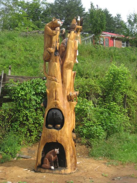
As we near the base of the mountain, the houses are more frequent, which means more driveways, which means slowing down. And then I see this...

IMG_7584.jpg


The other side
IMG_7585.jpg


:tab I really needed a third shot to get it all. It is pretty cool. There are a lot of other wood sculptures in the yard nearby. I don't know if they are for sale or just to take up space in the yard. So off we go... down the gently sloping road toward I40 at Canton. Just a bit further down the road I come to a stop sign, see Steve behind me, but not Roger and John. While stopped at the intersection, a car pulls up next to us with the window down and asks if there are two more with us...

"YES!"

"Well, I think one of them crashed back there a short way."

:shock:

:tab Steve and I get turned around and start to zoom back up the hill but quickly, and much to our relief, find John and Roger coming down to find us. A thumbs up indicates everything is fine. I don't see any obvious signs of problems, so I guess we are good to go :shrug: We reach Canton and Roger indicates that we need gas. I let him know that I am planning to stop here in town. First, we pull over in a Subway parking lot because it is starting to get cool again and we need to layer up before we head back up and over the Blue Ridge Parkway. This is when John tells me that he fell over a while ago on the side of the road because he went to put a foot down and there was nothing there. It was one of those slo-mo oh-no moments where he couldn't stop it and just tipped right on over :lol2: Been there... done that... The people in the car did not see the tip over, just the aftermath, hence their belief that he crashed.

:tab We get back on the road and instead of heading through the center of town again, we take NC 215 down the West side of the Pigeon River back to US 276. It seemed like a good idea at the time. However, as we head out of town the traffic comes to a stop. There are emergency vehicles with lights flashing up ahead of us. It seems we are at the tail end of an accident clean up and they are almost done. So we wait a few minutes and then continue on our way. We make a quick stop for gas and discuss the remaining riding plans.

:tab Earlier, John high sided, or so I was told. No one got it on video or got any pics. So... He and the bike were fine, but between that and his recent tip over, he's getting stiff and about ready to call it a day. I kind of still want to run up 276 to the parkway, a stretch we have not done yet and which is not on any of the remaining routes for the week. Like 215, it is twisty and fun! Roger is up for more. Steve decides he'll ride with John and take the "direct" route home, 215 right up over the parkway to Balsam Grove. Roger and I will take the less direct way home. We gas up the bikes and go our separate ways.

:tab NC 276 follows the East Fork of the Pigeon River, which flows down from the Blue Ridge. There are a lot of homes along 276 as it doesn't really get twisty and fun until right at the base of the ridge. There it climbs fairly steeply up the side of the mountain. Like 215, the pavement is not as good as it has been in years past when I've been here, but it is still good fun. Roger and I zoom to the top of the ridge in short order and start down the South side of 276. My plan now is to pick up FR 475B (the road that starts down near the fish hatchery on Government Rd. The South side of 276 looks like it might have gotten some more rain since yesterday so I take it easy going into the tight corners. We soon reach the start of 475B and head into the woods.

:tab We make quick work of 475B and soon reach Government Rd. We blow through the short stretch of pavement leading from 475B to the parking area at the start of the dirt part of Government Rd. As expected, the road is still pretty wet. There are puddles in the areas with the gravel. However, once we get to the part that had been graded the other day, it is still soft and muddy! Nothing to do but have some fun with it!! :rider: Roger hangs back a bit to avoid getting caked in the mud flinging from my rear tire. While I am roosting through the corners, I stop to think what it might be like right now if I were still on my trusty old KLR 650... I definitely do not think I would be having this much fun! My KLR has been a great bike, but it just never instilled the confidence in handling that the KTM does. I have seen people do amazing things on KLRs, so I know it is more a problem with the operator than the bike. There is just something about the KTM that tells my brain that there is no reason to panic... that things are not are not as bad as they might appear... that this is no problem. And so my brain releases the right wrist to have its way :twisted:

:tab Roger and I have our fun, and before we know it we are at the start of Shoal Creek Rd., and soon pulling into the driveway. Another day of solid riding under the buns! We find John and Steve relaxing and join them. Tonight we cook brauts :eat: My back is flaming, so I grab a pain killer and muscle relaxer early rather than late :huh2:

Lotsa splattering from the mud
IMG_7586.jpg


IMG_7587.jpg


IMG_7588.jpg


IMG_7589.jpg


IMG_7590.jpg


IMG_7591.jpg


:tab A day of playing in the water and mud with friends... I'd call that a quality day :mrgreen:
 
Now... I know I was not the only one on this trip taking pictures... :ponder:
 
Now... I know I was not the only one on this trip taking pictures... :ponder:

Following one of your ride reports kind of reminds me of turning in art work back in grade school. I always colored outside the lines (still do), and the kids before and after me would turn in a master piece. Typically my picture would be used as the example of “what not to do”.

So, here's “how not to do a ride report”

From the moment we arrived at John’s, dad’s home, I could tell this was going to be good!

DSC00595.jpg


The beauty of following Scott is that I don’t have a clue where I’m at, at any given time. Occasionally, I’m accused of being lost, but the truth is that I’m just exploring the nearby states…

DSC00597.jpg

DSC00599.jpg

DSC00601.jpg

DSC00607.jpg


Plenty of water falls to choose from.

DSC00611.jpg


Headed under the Blue Ridge Parkway.

DSC00613.jpg

DSC00614.jpg

DSC00618.jpg

One of several bridges.
DSC00623.jpg

DSC00624.jpg


This was my first visit to Deal’s Gap. It was fun, but I believe the novelty would be short lived for me.

DSC00628.jpg

DSC00630.jpg

DSC00633.jpg

DSC00635.jpg

DSC00636.jpg

DSC00639.jpg

DSC00644.jpg

DSC00645.jpg

DSC00648.jpg

DSC00649.jpg


Heading down TELCO Gap.
DSC00651.jpg

DSC00654.jpg

DSC00656.jpg

DSC00657.jpg

DSC00660.jpg

DSC00667.jpg

DSC00668.jpg


Okay, that’s a couple of days worth from my perspective.
 
Last edited:
I am 100% going back next May unless the Mayans were right.

Great pics Roger.

Scott, thanks for walking us through another great day on that trip.

Steve, get your sword fighting skills up to par for next year, I want the Cabin!!!
 
Great story and pictures Scott. :thumb: I come in here and start reading and the day just fades away. :sun: Only one problem with your ride is you didn't find any dirt. Cause I see no dust! :rider::rofl: It looks and sounds like you had a great ride.
One more observation, not knocking anyones bike choice, but I think Steve took the right one. But then I am biased. :mrgreen: Sam
 
:tab Sam, I would have to agree. If you could only take one bike, that 690 would be just about perfect... except the seat seems to leave a little bit to be desired... :wary:
 
:tab Sam, I would have to agree. If you could only take one bike, that 690 would be just about perfect... except the seat seems to leave a little bit to be desired... :wary:

:haha::moon: Yes, just before we went to the BRP 2 years ago, I sent both KTM seats off to have redone. I knew neither of us would be happy riding 600+ miles on those seats. :rolleyes: The only problem I have is that while I don't ever need to take a second street bike, I need to take a spare rear tire if the mileage on the trip is over 800. :pilot: It's that "heavy right wrist syndrome". It was never a problem when I was a kid on my Honda SL70, but it has begun to cause problems now that I am an adult. :loco:

Keep writing, we want to hear more. :clap:
Sam
 
That's wild running into that Big Dog guy, small world!

:tab I have had similar experiences on many of my trips. I have been stopped for construction or at some place getting gas and have had people walk up to me and say, "Hey Scott!" And I have no clue who they are! Some have been TWT folks, have been to TWT from other sites, or were people from other sites where I post, and they just recognized me. In fact, on the day we were at Deal's Gap on this trip I met some Texas guys and they knew who I was. When we have to make long stops for construction, a common thing in Colorado, I often like to get off the bike and walk up and down the line of stopped vehicles to visit with people, find out where they are from, etc,... I've had lots of encounters this way with people that I've "known" via the net but have never met in person. eoR on AdvRider lives in Arkansas and has a great thread called "Wandering About In The Hundred [Thousand]Acre Wood". I have never met him on purpose, but we have met randomly many times while I have been out riding in Arkansas. Of course, as I get older, the more I suspect that a LOT of what seem like "random" encounters in life may not be so random after all... :wary:
 
The only problem I have is that while I don't ever need to take a second street bike, I need to take a spare rear tire if the mileage on the trip is over 800. :pilot: It's that "heavy right wrist syndrome". It was never a problem when I was a kid on my Honda SL70, but it has begun to cause problems now that I am an adult. :loco:

:tab I put a new set of TKC 80s on the GS for this trip. I rode the bike two days, for maybe a total of 550-600 miles. The back tire is more than half gone... :brainsnap I too have the heavy wrist issue, but those roads just BEG for it :rider:

Keep writing, we want to hear more. :clap:
Sam

:tab Working on it. It just takes a lot of time and I am trying to get it done in between jobs at work. Also, Dad is out of town so I have more work than usual to cover while he's gone and also less time in the evenings since I have to go to bed about 3-1/2 hours earlier than normal. I usually don't come in until 11:30am and when he is gone, I come in at 8:00am. So even if I am not busy, I am usually mentally fried because my sleep schedule is so out of whack :twitch:
 
Last edited:
Day five: Thursday... The long street route... :trust:

:tab So today is going to be the long day for the big bikes. Steve has already decided to sit this one out and maybe do some riding close by. John also decides to stay close, perhaps riding with Steve. I ask Roger if he is up for it and he says, "I'm Game". I have an ambitious route planned for today, over 300 miles... Most of it should be paved. I'm taking my 1200 GS and Roger his relatively new 950 Adventure. I finish the last of my Pop Tarts, gear up and we head out. Our goal... NC 209 up to Hot Springs!

:tab First we have to get there. That means running up NC 215 again. After a long day on the KTM 530, I once again have to spend the first few miles reprogramming my brain to GS mode. The road is mostly dry so we can really enjoy ourselves. It is also fairly clear today weather wise and there's hardly any of the typical morning fog, even as we climb up to the Parkway.

At the same overlook that was shrouded in clouds yesterday - looking North (up hill)
IMG_7592.jpg


Looking South
IMG_7593.jpg


:tab Rather than running NC 215 all the way to Canton again, I decide to go slightly out of the way so we can run a good bit of the Blue Ridge Parkway. So far we have only hit small bits of it and if you bother coming out to this area, it really is a terrible shame not to get in some riding on the BRP. So once we reach the ridge, we head West on the BRP and check out some of the numerous scenic overlooks. I do wish the speed limit was more like 55-60mph instead of the ridiculously low 45mph :doh:

See why they call them the Smoky Mountains!
IMG_7594.jpg


IMG_7594-pano.jpg


IMG_7597.jpg


:tab The BRP really is an incredible road. Go here for some of the history. For the most part, the pavement is usually pretty good. The curves are usually very predictable. Only rarely will there be a decreasing radius curve. If the speeds are kept reasonable, it is quite enjoyable. There are enough scenic overlook/pull outs that if motorists are paying attention to what is behind them, they can easily pull through a turnout and let faster traffic pass, then just pull right back out without ever having to even stop. Then there are those people that just won't pull over no matter what... :doh: Fortunately, we don't have to deal with too many of these people this morning. Interestingly, we really don't even see very many bikes, except at one particular overlook.

Wow... that suit makes me look FAT! :lol2: You'd never guess I only weigh 175 lbs!
IMG_7601.jpg


:tab This is a really common photo op. It is not uncommon to see whole groups of riders with their bikes parked in front of the sign and the riders all draped over and around the sign. Today, there are some riders already taking shots when we pull in so we wait patiently and they get their shots and move out of the way for us.

Yup... even from far away I look fat! I thought black was "slimming"? :giveup:
IMG_7602.jpg


Roger and his beautiful new KTM. Apparently, neon yellow isn't slimming either :cool2: :lol2:
IMG_7603.jpg


:tab After a while, one overlook looks much like any other overlook, trees about as far as you can see and haze. And while I could sit here and look at pretty pictures of our bikes all day, I am sure most of you would rather not, especially since your bikes aren't in the pics :-P So, we settle into a nice cruise mode and eat up some fantastic miles until we reach the exit for US 19. From there we slab it up to the start of NC 209 just past Waynesville. We exit the freeway and turn under the overpass. As I am pulling up to the light I am looking at a gas station on the right corner across the feeder road and trying to figure out how to get into it. I brain fart and ALMOST run a red light because I was expecting it to be green. A brake check by the lady about to turn left across me from the right side grabs my attention and I quickly stop (without the ABS kicking in). Say all the bad stuff you like about "cagers" but this lady was paying attention and I wasn't! So whoever she is, THANKS!

:tab We fill up the bikes and then head North. As one might expect, the road leading out of town has a good deal of traffic and is not real interesting. However, once we reach the spot where 209 makes a hard right away from Max Patch Rd., things change dramatically. It descends around the North side of Hebo Mountain down into a valley and starts following some creeks that eventually coalesce into Spring Creek, which runs a long way. How this road did not get named Spring Creek Rd., is beyond me :shrug: The creeks all head North to the French Broad River. Just North of the NC 63 intersection, the road gets straight for a short bit as it runs through a little valley community... called... Spring Creek. But once we pass this little valley, the REAL FUN begins. The road just gets seriously twisty with fun elevation changes and slightly banked corners. There is almost no traffic, the pavement is dry, and I just settle into third gear and forget about shifting or braking.

:tab If one were in exploration mode instead of cranking out the miles on the known roads mode, this would be a great place to explore. There are TONS of little side roads that wind their way back into the surrounding mountains and valleys. Amazingly, quite a few are very well paved little two lane roads with no shoulder. They are a blast to ride. There is not as much unpaved riding as a knobbied rider might like to find, but there is some. We are not too far from the start of Hurricane Creek Road. My original plan yesterday would have had us coming down 209 to Meadow Fork Rd. (NC 1175) and dropping out right about where we started Hurricane Creek.

:tab A few miles before we reach Hot Springs, I get stuck behind a slow moving car and decide to pull out for a bit to let them get ahead.

Looking South along one of the more open curves in this area
IMG_7604.jpg


IMG_7605.jpg


There are roads everywhere out there that you can't see... but they're there!
IMG_7606.jpg


:tab We reach Hot Springs and head East on US 25. As we ride along, I spot one of the roads I wanted to ride yesterday on the section we lopped off the route. Funny how seeing a road can generate that tugging feeling that makes me want to head down it just to see what I find... You know the feeling... You've felt it... Sometimes that feeling keeps me awake at nights if I have been looking over my numerous maps of areas where I want to go riding. Next trip... That's it... Next trip...

:tab US 25 makes a sharp turn to the South and right there we pick up NC 208 to the North. It is a nice short section that follows Shelton Laurel Creek. It is apparently a popular day trip place as there are quite a few vehicles parked along side the roads and people picnicking and fishing. We get stuck behind a car and I just settle back to enjoy the scenery. The cloud cover has been thinning and the sun is really shining through. Just a mile or two up the road, we turn East on Guntertown Rd. (NC 1318). It is an easy turn to miss because it is right before a stop sign at NC 212, with nothing but a creek and the bridge between the two roads. I miss it... like I have almost every time I've come this way :doh: We turn around at the stop sign and head the right direction.

:tab This road is actually a series of different roads that all connect in a generally West to East direction. So there are a lot of places where turns have to be made to keep us going the right direction instead of wandering off on any of the little tangent roads, which is real easy to do. In fact... just a few miles in I do it :doh: :lol2: I don't always keep the GPS zoomed way in so it is not always readily apparent which road we are on until I have moved away from an intersection a hundred yards or so and see that I am not on the right road. Yeah... I know about the auto zoom feature on the GPS. I hate it :-P It never zooms or unzooms when I want it to. Anyway, we make a short run up Chapel Hill Rd., make a U-turn and come back. Incidentally, Chapel Hill looks like yet another fun road! The road I want is Big Laurel (NC 1318) which follows Big Laurel Creek. Just South of us is Sodom Branch Road... We'll stay away from there for now... :wary:

:tab The road starts out great as expected, but not too far into it we start to encounter construction :doh:

You can see a typical patch here, but sometimes they actually snake around across the lane :doh:
IMG_7609.jpg


IMG_7609-pano.jpg


IMG_7610.jpg


IMG_7611.jpg


IMG_7613.jpg


IMG_7614.jpg


:tab While I am stopped, I hear a voice from behind... While I may have stated that this area is motorcycle heaven, it is not God. It is the guy that owns the house on the hill next to this corner checking to make sure I am okay and don't need any tools to fix anything. That's cool :clap: Then he starts telling me about how he and his wife visited here years ago, fell in love, bought the property as a retirement home location, built the place and then she died before they could move out here. But at least she got to stay here a few times to enjoy it before she died. Well... that's a nice positive way to look at it! I thank him for checking on me and take off to catch up to Roger.

:tab It seems there are a lot of nasty cracks in the road and we continue to encounter more of the patches. The road guys are stripping out long patches about two to three feet wide and then laying new asphalt in them and packing it with a steam roller. Even where they have already finished, the work is so recent that there is a lot of loose asphalt on the road surface. Sooo... that sucks. Fortunately... I have a plan... :deal:
 
They were ALL fun roads! What a great trip. There is so much good dual sport riding in that area. This was my first time to NC and hopefull not my last. Highlights were definitely Hurricane Creek and Pilot Mountain.

A big thanks to the Tourmeister. Since you do all the upfront research all I have to do is show up and ride. Even being lost is fun. BTW, great trip report. I don't know how you remember all that stuff that happens.

Thanks to John and his Dad, too. He opened up his house to complete strangers and even provided us a covered area to store our bikes and gear. Plus staying in his cabin was great. It was so peaceful on the front porch with only the sound of the stream below. The cabin had A/C but I never needed it. I did, however, need the heater a couple of mornings. I think that is the first time I have used a heater in June. I hope I am lucky enough to be invited again next year.

Oh yeah, the Dragon. What a hoot. It was fantastic on the 690. Plenty of power in a light bike. Only downside is it wore my front knobbies down to nubs. A slightly more street oriented tire would have been better for the road work. Or ride it the last day next time.

Steve
 
:tab Okay... work and life got in the way a bit... and that annoying sleep thing, but I will try to bang out the last bit of this over the next few days.

:tab Anyway... we were on a great road made not so fun by recent construction and we were about to execute a back up plan! I like a good plan like anyone else, but I am not so rigid that once I have a plan I can't deviate. I've ridden with people like that and let me tell you that it can easily ruin what would otherwise be a fantastic ride. I view plans as a fall back device to keep things moving in the event I don't see something more interesting than the plan and have time to check that out instead.

:tab Having a GPS makes on the fly planning SOOO much easier than the days before a GPS. I have always enjoyed maps. Remember all those cool maps that used to come folded up inside the National Geographic magazines? I always grabbed those when the new issues would arrive and stashed them away in my room. Some kids might have had a porn stash... well... I was kind of nerdy and had a map stash... what can I say? :shrug: The map thing has kind of stayed with me. Even now that I have several GPSs and there is Google Maps and all other kinds of online maps, I still have a bunch of different paper maps. When planning trips I like to look at all of them. I have discovered that NONE of them are 100% accurate with respect to the reality on the ground. However, between all of them I can usually figure out the reality. A side benefit is that all those hours spent looking at the squiggly lines and numbers tends to burn the map imagery into my head. So even without the GPS I generally have an image in my head of the area where I am and that helps me keep from getting lost... most of the time... It also helps me think of alternate routes in a pinch and the GPS makes finding that route very easy!

:tab My goal is to get to NC 197 so we can run it up over the mountains. On past trips out here, I have randomly picked little side roads that run back South from Laurel Creek Rd., this time it will be Grapevine Rd. (NC 1370). It starts climbing out of the creek valley and winding its way up the side of the mountain through a series of tight switchbacks. It is paved, but it doesn't look like it has been maintained in YEARS. In some places, the "potholes" are almost the entire width of the road. We're quickly up and over the ridge and soon running down out of the mountains following the West Fork Bull Creek. The road and creek descend gently through a mostly straight valley until reaching NC 213.

:tab We cross over NC 213 and continue South on Silvermill Rd. (NC 1611) a short way. I miss a turn, loop back around and we pick up Bend of Ivy Rd. (NC 1576). Now the road starts to get a bit more fun again. It drops down into the Ivy Creek valley, cross the creek and then climbs back out to the Southeast. All the creeks in the area drain back to the West and eventually hit the French Broad River. Bend of Ivy eventually becomes Eller Ford Rd. (Still NC 1576) and intersects NC 197, where we turn East. And just on the other side of US 19... :huh2:

The whole freaking road is getting repaved :doh:
IMG_7615.jpg


:tab Well, there really is no convenient short cut to get where I want to be and I really do want to make the run up over 197... sooo... we wait. The guy in front of us gets out of the car, pops the rear hatch, and starts fixing lunch... I'm wondering if maybe he knows something we don't :shock: Fortunately, the wait is not too long and the pilot truck eventually arrives to lead us through to the other side. No doubt, in a few more days, this road will be really well paved. We soon get past the construction and take off for the base of the mountains looming in the distance.

:tab Remember me pondering how a body of water gets the designation of stream, creek, or river? Well... I have the same question about big bumps of dirt on the ground. Is there a difference between a hill, knob, or mountain? The ridge before us has tons of peaks that have "knob" in the name. It is not like they are short as many of them are higher than 5000 feet. Can someone clue me in on this? Is there a system or is it just random? Anyway, as I ponder such cosmic realities, the road turns to a narrow gravel path and begins to climb and twist its way up into the woods. We pass another rider on what looks like an 1150 GSA going the other way. A quick wave and he vanishes around the next bend. There is a slight cloud cover and the sun is blocked, making it kind of dark and cozy feeling under the canopy of the trees. There is no hint of rain in the air, but it sure helps with keeping the temperature nice. We climb from a starting altitude of about 2100 feet to 4100 feet in the space of a few miles, most of it in the last mile or so. We pass through Cane River Gap and start down the East side of the mountain.

:tab Coming down the East side of the ridge, the road returns to pavement quite soon. It also gets REAL fun!

Hard to see here, but there is a series of about seven switchbacks maybe 100 yds apart and tight at each end!
IMG_7616-pano.jpg


:tab There is a great YouTube video of a whole mess of bikes running through here and you see them going back and forth through all the switchbacks until the last bike finally hits the last corner and vanishes. If I can find it, I'll include it.

And here it is courtesy of "Cuttle" from AdvRider! :clap:
[ame="http://www.youtube.com/watch?v=OXZOLBhZAeg"]Just puttin' around in WNC - NC 197[/ame]

:tab I hit the switch backs and find my groove almost immediately. I accelerate HARD coming out of each corner, brake FIRMLY going into the apex, crank my neck around to look for the exit, gently ease off the brakes and accelerate HARD again for the next one. I could do this all day! :dude: Alas, it is over almost as soon as it began... :tears: The rest of the run down the mountain to the tiny town of Murchinson is still good fun though. We stop at what looks like a small grocery but is in reality a nick/nack furniture upholstery store run by a very nice retired widow and her cool dog.

IMG_7619.jpg


Beautiful, relaxed and friendly
IMG_7620.jpg


If only... :lol2:
IMG_7621.jpg


IMG_7622.jpg


:tab Roger and I wander inside and visit with the woman that runs the place. She keeps a fridge full of drinks and a box of various candy bars which she sells. I lose my mind and grab a Coke and a Snickers. In the past year or so I have really cut WAY back on stuff like Coke and Snickers, and pretty much sugar in general because it has been wreaking havoc on my insides. When I stay off it, things are pretty good. When I don't... well... my body lets me know pretty quick that it is not happy with the junk food. It tastes great while I am drinking and eating it, but in the space of maybe fifteen minutes I start feeling pretty bad on the inside... :uhoh:

:tab While I was enjoying the Coke and Snickers, I was pondering a road that ran off to the South. It follows the Cane River back up into the mountains toward NC 128 and the Blue Ridge Parkway. It shows as East Wart Wilson Rd. (NC 1100). Interesting things along the way look like Blue Sea Falls, Bear Ridge and Bear Gap. The stretch from the falls to Bear Gap looks REAL interesting!! It tees into a road that runs East to Stepps Gap at NC 128, just South of Mt. Mitchell. It runs West and comes out on the BRP at Balsam Gap. I sure would like to know if that goes through... :ponder: We still have a LOT of miles to go for today though... so another time maybe...

:tab We head North on 197, following the Cane River down out of the mountains. It has some nice curves as it runs around the West side of BeeBranch Mountain before hitting US 19E. Now the plan is to work our way East just beyond Hwy 80 and then Cut South to the area known at Little Switzerland, in theory to have lunch... but it is already well after lunch time. Thinking about lunch I fail to notice I am approaching my turn and realize it too late to slow safely. I point for Roger so he can make the turn then I loop back... and miss the very next turn only a 1.4 mile or so down the road... point for Roger again and I loop back :doh: :lol2:

:tab We head South on Blue Rock Rd. (NC 1152). While turning around after missing this road, a car slips in ahead of us, driven by a nice little old couple that look like they are dressed up to go visit someone special. Not wanting to annoy them, I just hang back, hoping they will be turning off soon. We follow them up the side of the mountain and I start to get the feeling they will be going a long way... so I pull off thinking to let them get way ahead of us. While waiting I get to looking at the GPS and I keep seeing Hwy 80 where it runs North of US 19E. I've run many different parts of Hwy 80 on past trips and none of them has ever disappointed. This part looks particularly enticing. Roger notices me playing with the GPS and I mention that I had kind of been wanting to go check out this section but I'm worried about how much extra time it will add to the riding for today. I show it too him and he replies, "I'm game!" Roger is NOT one of those people that whines when we deviate from the plan :thumb: So we backtrack down the mountain, hit 19E and run back West to Hwy 80.

:tab As we approaching the turn for Hwy 80, I spot three other bikes coming toward us and then turn onto 80 right before us. There is a Vstrom 650 in the lead, a BMW 650 (800) GS, and then what I think is a 1200RT at the rear running two up. We slip right in behind them and fall into formation. It does not take long to realize that these people KNOW this road! :bow: It is another of the many roads out here with darn near PERFECT pavement and fantastic curves!

Here's a relatively open portion that gives an idea of the typical pavement quality, but much of the road is FAR tighter than this!
IMG_7623.jpg


:tab Roger kind of hangs back a little, but I never lose sight of him. The riders in front of me are smooth and have a great rhythm. I fall right into the rhythm with them. The RT spots me in his mirrors so he knows I've joined the group. We keep a nice spacing and it is very cool just watching the bikes snaking through the corners. The road crosses the North Toe River and then runs up along the side of a ridge line that roughly parallels the river. It is the section after crossing the river and runs up to NC 226 that is so spectacular.
 
Last edited:
:tab Now, there are days where I can't stop taking pictures and days where it seems like I never stop to take any pictures. I really can't explain why one day is not like the other :shrug: Obviously, the more intense the riding, the fewer pictures get taken just because stopping to take pictures breaks the rhythm of the ride. Either that or I'm so busy hanging on for dear life on a nasty trail that I don't have time to be taking pictures. The run up 80 is the breaking the rhythm issue. When we reach NC 226, the riders in front of us pull into a little parking lot and we pull in behind them just to say, "Howdy!" As expected, they are locals. The lead rider is riding his wife's soon to be ex Vstrom 650, replaced with the new BMW 650(800) GS. We get to chatting and I tell them we are just out hitting all the great roads we can find. Well, that kicks off a good session of him pointing out lots of great roads on the GPS, more than we can even remotely have a hope of riding today.

:tab Grab a map, find Hwy 80 and NC 226 North of US 19E and you will quickly see that the roads in this area look like a splattered plate of spaghetti. Almost every creek and river is shadowed by a road. A rider could spend a lifetime out here and probably never ride every road. This guy says he came here back in the 80's on his way through for a business trip, living in New York at the time, and he never left. I have never met anyone that has said they would not like to live here. I have also rarely met anyone that has figured out how to live here and make a living at the same time. I'm right there with them :doh: I forget to ask this guy what he does for a living. To make living somewhere else more tolerable, I try to tell myself that if I lived here all the time and got to ride roads like this all the time, it would eventually get old and I would no longer appreciate such incredible roads... "Nope! It doesn't", he replies... Oh great... :roll: He does recommend a really good road that will get us kind of back on our original route to Little Switzerland, Double Island Rd. (NC 1308). I thank him, forget to take their picture... and Roger and I take off in search of more motorcycle curvanna.

:tab We head West on 226 along the base of Locust Knob and along the North Toe River, until we reach Red Hill and intersect NC 197 again. We turn South on 197 a short way and soon find Double Island Rd., and head Southeast into the mountains following Little Brush Creek. It starts out gently meandering along the valley, crosses the creek and leaves it behind, at which point it gets FUN! Like 80, the pavement is amazing. The road turns roughly to the South and runs along the side of a ridge on the opposite side of the North Toe River from Hwy 80. About a third of the way back down to US 19E, it shifts over into a different valley and follows the South Toe River, eventually dropping us out near Micaville. What a great ride!! If we had time, I'd turn around and run the whole loop again back to where we first got onto Hwy 80 behind the other riders! As it is, it is pushing past 3:00pm and we need to start pounding out some miles in the direction of home... sort of... :mrgreen:

:tab We get back on US 19E and run back down to Blue Rock Rd., again to head South. No old folks in cars this time and we really get to enjoy the road! It picks up along side the South Toe River and runs down to Halls Chapel Rd. (NC 1169), which continues along the river until it reaches Seven Mile Ridge Rd. (NC 1167). With a name like that, you know it has to be fun :trust: It is! It becomes Chestnut Mountain Rd., then Crab Tree Creek Rd. (NC 1002), which finally runs East to Bearwallow Rd. (NC 1446) and dumps us out at Little Switzerland.

A nice little cafe where I have stopped to eat on prior trips
IMG_7624.jpg


There are some other touristy shops as well... and ghosts :-P
IMG_7624-pano.jpg


:tab Its just after 4:00pm... and the cafe closed at 4:00pm :doh:

:tab Fortunately, the staff has pity on me and they let me in to use the restroom. When I come out Roger is visiting with two Canadian fellows that brought their cruisers down to enjoy the local roads. We stand around eating peanut butter crackers and granola bars as we visit. Then we take off down 226-ALT, the old highway used by everyone before the straighter 226 was put in just to the East. If you are ever in the area, ride 226-ALT and avoid the newer 226 because it has a LOT of traffic, much of which is semis and RVs cooking their brakes :huh2: Now up to this point, Roger has been having fun, but I think the cumulative wear of many days in a row of riding is catching up with him. He says he's having fun but just not hitting that magic groove. Maybe it's because he just hasn't gotten used to the new KTM 990 and how it handles. I've been having a spectacular day, almost ALL of it spent in that zen like state where the bike and I are one with the road. As we head down the mountain on 226-ALT, it continues for me.

:tab I know I have been telling you how great the roads are here. I know I have been telling you how great the pavement is. Seriously, you just have to come ride here to really understand. I can post all the pictures my camera will take. I can go crack open the Thesaurus and find every imaginable adjective to describe it to you. You still won't have but the faintest clue of the reality. Riding such roads is kind of a mixed bag of emotions. It's like hitting the high of some drug, knowing that it won't last and you'll have to come down eventually, everything else seemingly paling in comparison and leaving you craving for evermore. It's always hard to get excited about riding the streets when I get back home to East Texas after spending a week in a place like this... :twitch:

:tab We reach the bottom of the mountain where the new and old 226s come together. We turn around and start the run right back up the mountain. Barely a few minutes later the two Canadian guys come rumbling down past us. They must have been hustling those bike down the mountain to already be this far, because I was booking! :twisted: We give them a wave as we head into the next corner. In what seems like only a handful of minutes, we are back at the top and stop to decide what we will do next. Roger lets me know that he LIKED that section! Apparently he is starting to mind meld with the 990 ;-) But now we need gas... I remember there being some gas stations nearby, but when I last needed them I was not leading the ride and wasn't really paying attention to where we were going. I was just sniffing the tail pipe of the dog in front of me. I vaguely remember it being North of the BRP, so we cross under and head North...

:tab It's a nice little road, but nothing looks familiar and I'm pretty sure we're getting further from any gas instead of closer. I pull under a tree for some shade and check the GPS. It shows there are several stations off to the East a few miles on 226... Oh yeah... Now it comes to me :doh: We drop back under the BRP, head East on 226, pass a little hotel where I spent the night in a honeymoon suite with another guy...

:tab It was the only room they had left and it had another bed :-P

:tab And then we run up to a little town called Spruce Pine, which is situated on the North Toe River. We top off. Seeing that it is getting late in the day, we decide that we really ought to start making our way back West toward home. Time to get on the BRP and cruise!

[And time for me to head home... more tomorrow, including more pics ;-)]
 
Found the YouTube of 197 and put in the post above.
 
Back
Top