• Welcome to the Two Wheeled Texans community! Feel free to hang out and lurk as long as you like. However, we would like to encourage you to register so that you can join the community and use the numerous features on the site. After registering, don't forget to post up an introduction!

GixxerJasen goes to California, and other places...

gixxerjasen

Wow
Forum Supporter
Joined
Oct 9, 2007
Messages
14,589
Reaction score
4,050
Location
Forney-ish
Note: This is cross posted so forgive me for specifying things that might be obvious depending on where you are reading this.

I also usually compose my ride reports and then post them all at once. This is a big one so I'll try posting in installments this time around.

Prologue:
Famous last words: "I will NOT be working on the bike until the last minute this time!"

Earlier this year my wife approached me. We've had a rough year or so dealing with all the COVID related stuff along with my wife and son's medical issues this past year. She told me in no uncertain terms, that I've been busting my butt to take care of them and that I needed to take my motorcycle trip I've been planning for a few years. Bless her.

I planned on attending YFO, the Yosemite FJR Owners meet, in California two years ago. My boss would flip out if I took even a day more than a week at a time. This made it difficult to get to California, attend a meet, and return home. I had determined to use a holiday weekend to ride to Las Vegas and store my bike there, then fly home. Then fly back, grab the bike and hop up to YFO and take my time riding home. Shortly before the trip was to start, I changed jobs, thankfully so I didn't have that boss anymore, but changing jobs meant no vacation, so the trip was put on hold.

I had a few weeks to use this time around when my wife told me to go, and I noticed that the NAFO (North American FJR Owners) meet was in Colorado the previous weekend to YFO. If I play my cards right, I can do both, and have some fun seeing stuff in between.

It always seems that before a trip I'm doing work on the bike right up to trip departure. I decided that I will NOT be working on the bike until the last minute this time. I started two months in advance. My forks needed fluid change, they were leaking and the AK20 cartridges probably needed servicing. I pulled them off and shipped them off to Traxxion to get this done.

PXL_20210730_192404345-XL.jpg


That took a few weeks, but I got them back, even with new stickers!

PXL_20210730_192929186-XL.jpg


On reinstalling the forks, it turns out I had a too short bolt for my upper triple clamp and when I torqued it, the bolt stripped the threads out of the clamp.

PXL_20210814_223706045-XL.jpg


Quickest fix was to get a triple off ebay, which thankfully there were a few. The one I bought had the ignition bolts cut off. This meant I had to drill out the bolts on my busted triple, then drill the bolts out of the new one too. All went without too much drama though.

PXL_20210814_135600681-XL.jpg


I got that done, and put new tires on the bike along with adding a Fobo Bike 2 TPMS set to the wheels. With the wheels off I proactively replaced the front wheel bearings. I changed the pumpkin fluid as well knowing the oil was fresh in the bike. Only problem I ran into, when installing the front wheel back on the bike was that the front brakes were dragging really badly. Like, really bad, enough to explain my poor gas mileage on my Florida trip.

I had two pistons in the front left caliper sticking so I hopped on amazon and ordered a rebuild kit. It was now the Friday before the trip and I'm scheduled to leave the following Wednesday, and the kit will arrive on Monday. Sheesh, cutting it close.

On Monday morning I awoke to an email from Amazon informing me that there was a shipping delay on my kit and it'd arrive mid September. Not acceptable. I jumped onto All Balls Racing site and ordered a kit with overnight shipping praying I'd put the order in early enough that it'd ship today (Monday) for a Tuesday arrival so I can be out on Wednesday.

The kit arrived Tuesday afternoon so I pulled the caliper and split it and started the rebuild process. I found this metal flake from the machining process in the orifice between the two halves. So much for good QC there.

PXL_20210825_000939123-XL.jpg


The brakes primed and bled better than any in my past. I did several bleedings before going to bed, and would do a few more during my work breaks the following day.

I really wanted to spend my last evening at home with my family instead of in the garage, but it is what it is.
 
Day 1
Wednesday, August 25, 2021
Distance: 434.7 miles
Duration: 6 hours, 37 minutes, and 40 seconds
Average Speed: 65.6 mph
Minimum Elevation: 403 feet
Maximum Elevation: 3718 feet

2021-08-25-M.jpg


Not a lot to report this day. I got up early and worked through lunch so I could scoot out a little early. I try to start my trips in this way so I don't have to burn a vacation day doing the boring "Get out of Texas" part of the trip. Going west I usually try to make it to the Amarillo area.

I attended some meetings, did some work, got some brake bleeding done and last minute packing taken care of. The bike was already loaded and ready to go so when the time came I suited up, kissed the wife goodbye and hit the road.

The temps were up, and continued to rise as I rode west. I saw a high of 104F and was sucking down the water from my camelbak.

GH010366_Moment-XL.jpg


I had a dinner destination of JT's Drive In, in Childress Texas.


I found this place on accident last year. The burger and fries were fantastic. Just the right char and flavor on the burger, and the seasoning on the fries was delicious. I had plugged it into my GPS as my dinner destination for this year. I was happy when I arrived because there was a table right under their wall unit air conditioner. I made my order and asked for a large ice water. The lady standing behind the order taker had been eyeballing me in my suit with my red face and sweat running off me, and as soon as I said "Ice water" she ran off to fetch that for me. I was especially thankful for that.

Dinner didn't disappoint, still as good as last year. I'd definitely recommend swinging by if you are passing through.

PXL_20210825_222039614-XL.jpg


I'm definitely a planner. Some folks can just ride and stop wherever, but I stress out if there aren't reservations. Last thing I want to do is wander around from town to town after dark, sore and tired, looking for a place to stay. I went cheap and had put in reservations at the Super 8 in Dumas Texas. On arrival, I was really thankful I'd made reservations in advance, was lucky to be able to find a parking space next to my room.

PXL_20210826_012042062-XL.jpg


That concluded most of the "Get out of Texas" portion of my ride. I'm within an hour of the border and about 3 hours from being able to see the Rocky Mountains. I go to bed early so I can have a head start in the morning to get the fun started.
 

Attachments

  • GH010368_Moment-XL.jpg
    GH010368_Moment-XL.jpg
    172.4 KB · Views: 154
Last edited:
Day 2
Thursday, August 26, 2021
Distance: 506.2 miles
Duration: 9 hours, 27 minutes, and 18 seconds
Average Speed: 53.5 mph
Minimum Elevation: 3665 feet
Maximum Elevation: 11322 feet

2021-08-26-M.jpg


Today is get to NAFO day. It's in Glenwood Springs Colorado, and I'm starting off in Dumas Texas. I get up before the sun is up and hit the road. I tried to stop at McD's down the street for a quick breakfast, but the lobby is closed. This would be a theme throughout the trip, trying to find food I didn't have to eat in the parking lot.

It was a bit brisk at 62F with my Rev'it Tornado 3 mesh suit without my liners but I knew the sun would be up soon to warm me up.

It wasn't long before I was passing familiar landmarks like the Capulin Volcano.

GH010371_Moment-XL.jpg


Passing long trains. Not sure I'd ever seen one with engines in the middle. This was a long one with two engines at the front, four in the middle, and two at the back.

GH010368_Moment-XL.jpg


Before you know it, you are getting close to Raton New Mexico and you come over a rise and get your first glimpse of the Rocky Mountains. I'm not ever able to ride this stretch of the road without a huge smile on my face.

GH010373_Moment-XL.jpg


Colorado 69 is one of my favorite roads. It's not the best road, but it has some nice sweepers along with amazing scenery as you travel up the valley toward US50. It's always a nice way to start a ride here, I call it the "Colorado appetizer."

PXL_20210826_150821779-X2.jpg


GH010377_Moment-XL.jpg


Riding on US50 usually means at least some of this.

GH010378_Moment-XL.jpg


But getting stopped near the front of the group means you can usually dispatch that slower truck and trailer and have the road to yourself.

GH010380_Moment-XL.jpg


As I progressed north through the state, weather started to become a bit of a concern.

GH010381_Moment-XL.jpg


So, Julie (FJRFarrier on FJRiders) has long praised the Cuban Sandwiches at Buchi Cafe Cubano in Leadville Colorado as being particularly amazing. I, having grown up in Tampa Florida, know a thing or two about Cuban sandwiches. I know, that outside of Florida, most restaurants just use a regular Deli pork and call it a Cuban. There is so much wrong about that. Now, of course, I'm skeptical when Julie, from Ohio, says a restaurant in Colorado, has the best Cuban sandwiches. I put it in my GPS to check out.

PXL_20210826_183016535-X2.jpg


PXL_20210826_184501241-XL.jpg


GH010385_Moment-XL.jpg


Ok, so Julie got lucky on her first Cuban sandwich because that was a proper Cuban and it was definitely good. Their Café con Leche was pretty good too. It definitely hit the spot and I enjoyed every bit of that lunch.


While eating lunch I started contemplating the weather. I could go back a little bit and take Independence Pass through Aspen and into Glenwood Springs. However, looking that direction was low level clouds and a lot of rain. Looking at the weather radar confirmed that. I didn't really want to deal with that and I've been over Independence Pass before.

Looking at going north to Interstate 70 and across to Glenwood Springs also showed rain. In addition, there were recently mud slides in Glenwood Canyon on I-70 that had caused various road closures. It's currently back open but only one late each direction causing some traffic and potential closures during the rain like I was seeing on the radar. I decided to tempt fate and head north to I-70.

Before taking off though, I noticed a bicycle store a half block down from the Cuban restaurant. I'd discovered my aging camelbak bladder was leaking and kind of nasty. I popped down and picked up a new one, then put on my rain gear and headed north.

GH010386_Moment-XL.jpg


Running I-70 is about as close as you can get to driving in a Nascar road course race. For the most part, the speed limit isn't even considered a suggestion, and the fast moving traffic is pretty insane. I had a car following along behind me at one point and I was approaching a steep downhill section of I70 and moved left to pass a semi truck. Right as I came alongside his trailer wheels there was a slow moving car ahead in the right lane. The semi truck jerked left to pass the slow moving truck not leaving me in a good situation. I was braking hard downhill on soaking wet pavement headed for a narrow shoulder next to a guardrail. That car following me was about to get an up close front row view of a motorcyclist getting squished. Thankfully the truck saw me at the last second, hit the brakes and moved back into his lane. I zipped by and thanked my lucky stars.

The cleanup crew around the mudslide area has been working hard, and I zipped right through without any traffic or issues. There was one section where you could see that the left lane sure did get torn up from the slide though, and will require some work to get that all fixed.

GH010389_Moment-XL.jpg


Shortly afterwards I was exiting into Glenwood Springs and headed for the Caravan Inn where NAFO was being held. I arrived and was promptly greeted by some folks I've talked to forever online but was never able to put a face with the name until this day. Good times were had, lies were told, and general BSing took place in that parking lot.

PXL_20210826_214944327-XL.jpg


Dinner was next door at the 19th street diner one block over from the hotel.


This was one of the few meals I didn't take a picture of, but it was good and the service was fantastic. My son loves to see what I eat on my trips so if I have the photos. I'll post them.
 
Last edited:
Day 3
Friday, August 27, 2021
Distance: 429.1 miles
Duration: 10 hours, 5 minutes, and 23 seconds
Average Speed: 42.5 mph
Minimum Elevation: 4538 feet
Maximum Elevation: 10840 feet

2021-08-27-M.jpg


It's Friday and I have had a plan for my riding today for a while. Each time I've come to Colorado I've wanted to ride CO-141, but for many reasons, I've always had to scratch it off the itinerary. This time I made it the mission instead of an add on. Today I'm finally going to ride it.

I'm up and preparing to go fairly early. A few others beat me out onto the road this morning but most are still sleeping away while their rides wait patiently to be taken out to hit the roads.

DSC01195-XL.jpg


DSC01197-XL.jpg


Heading out of Glenwood Springs, the sun is hitting the surrounding mountains just right. They really light up under that early morning sun hitting at such a low angle.

GH010390_Moment-XL.jpg


GH010391_Moment-XL.jpg


As you approach Grand Junction, I-70 gets fun and scenic with the curves, canyons and the dam.

GH010392_Moment-XL.jpg


I stopped for gas in Grand Junction to top off, remove some layers and get ready to head up 141. The terrain changes so much along this road, it starts off with these light colored small canyon areas.

DSC01199-XL.jpg


Then it moves into thesee open farming fields with cliffs in the background.

DSC01203-XL.jpg


While taking that photo, another FJR rider came past me. A little down the way he was stopped and I passed him. We did this back and forth for a while and eventually I stopped where he was stopped and we chatted a bit. Eventually we'd ride together for a little while and would catch up with each other back at the hotel.

GH010394_Moment-XL.jpg


GH010396_Moment-XL.jpg


Look at that amazing pavement!

DSC01206-XL.jpg


Eventually the canyon walls start to rise around you and the rocks take on a distinct reddish color.

GH010400_Moment-XL.jpg


GH010398_Moment-XL.jpg


DSC01209-XL.jpg


DSC01211-XL.jpg


DSC01217-XL.jpg


Then you climb up a bit out of the canyon and have some dangerous dropoffs to navigate with the river far below you, but still with cliffs towering above you.

GH010403_Moment-XL.jpg


Lots of folks rode right past the following viewpoint. To be fair, you can't see much from up on the road to know what you are missing.

DSC01221-XL.jpg


Getting that photo, of the full horseshoe, is not for those scared of heights. There's a lot in the way unless you walk all the way up to this edge.

DSC01222-XL.jpg


Looking down, you can see the toe of my boot as to how close I was willing to get to the edge. Also, note that motorcycle boots are NOT ideal rock scrambling boots.

DSC01224-XL.jpg


I'd like to take a moment and comment on the pavement for much of this road. Maybe it's good that I didn't ride it before because, as you might have noticed from the previous photos, a lot of this road is freshly paved. It's so smooth and beautiful, what a joy to ride on.

DSC01225-XL.jpg


Here I've caught up to the other FJR rider, I think he said his name is Dan. I am terrible with names and had to learn so many on this trip, I hope I got it right.

GH010401_Moment-XL.jpg


Finally out of the canyon, you head into the beautiful area around Telluride.

DSC01229-XL.jpg


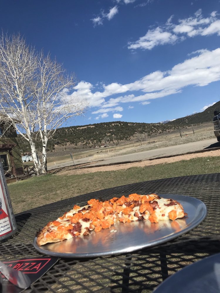
At this point I'm starting to get really hungry. I'm headed into Ridgway and start scrolling through restaurants on my GPS. I'm really wanting some pizza, and suddenly I see it, laugh and know exactly where I'm headed. My boss from my previous job was named Panny. When traveling through Ridgway with the family a few years ago we noticed "Panny's Pizza" and had a good laugh about him owning a pizza restaurant in Colorado (not really).


Today, I'm free of working for Panny, but I'm stopping to have some of "His" pizza.

PXL_20210827_184441206-XL.jpg


I ordered up a personal meat pizza, it was good and I ate every bit of it.

PXL_20210827_185957185-XL.jpg


After that it's a boring slog up to Montrose and dealing with the traffic in that town. While stopped and filling up with gas, a guy comes over to me and points at my bike saying "Gen 2 right?" He's a former FJR rider, used to be on the forums way back and even organized some rides apparently. We had a good chat for a bit before he went his way and I went mine.

I'd read that the ride over Grand Mesa was supposed to be really nice so, I chose that of the three alternate routes I had to get back to Glenwood Springs. I do love running up 133, but I've done that and am trying to see new things on this trip.

Montrose to Delta is a hot slog of a ride. Then you turn and go through Orchard City and Cedaredge and it's all pretty boring, flat, straight with a little bit of traffic. I'm pretty disappointed in this ride so far and thinking I should have hit the black canyon or something else.

Just a few miles north of Cederedge all of that changes when the road shoots up into the sky. In just a bit you are on top of the Mesa with a view that stretches out before you.

DSC01231-XL.jpg


On top of the mesa was this beautiful lake. I had to get a photo of this and hopped off the bike and walked about 10 feet to get a better view. Just getting to this point I was out of breath. Cedaredge is at 6,230' elevation but up here you've climbed up to 11,332'. I watched folks boating around in the lake and thought how much fun it'd be to bring my son and our canoe up to this lake. Then I realized that at this elevation we wouldn't be able to paddle and would have to just float around until someone local could rescue us. :D

DSC01233-XL.jpg


Coming around the other side of the mesa you get similar views looking out toward I-70. Down below me in this photo is a road that made me wish I had an ADV bike or had brought my land cruiser with me.

DSC01236-XL.jpg


After that you drop off the mesa almost as quickly as you go up it. Then approaching I-70 you hit some of the most fun curvy roads in the area. Then it's a ride back down I-70 to Glenwood Springs.

A group of us walked over to the Mexican restaurant there on the same property as the Inn and enjoyed a fantastic dinner. I thought the prices were a little high, but the food was excellent and so flavorful.


Looking back at the menu, I believe this is their Chile Verde Plate. (Tender chicken or pork in a special Mexican green sauce. Served with rice, beans, and choice of tortillas.)

PXL_20210828_012805750-XL.jpg


After that it was back to the parking lot to tell more tall tales of the day's adventures before heading off to bed.
 
I watched folks boating around in the lake and thought how much fun it'd be to bring my son and our canoe up to this lake. Then I realized that at this elevation we wouldn't be able to paddle and would have to just float around until someone local could rescue us.

My wife and I rode various passes on our first trip to Colorado years ago. While stopped at the top of one of them - around 13,000' I think - I was amazed to see people riding their bicycles to the top of the pass. They must have lungs the size of my thighs!
:eek2:
 
My wife and I rode various passes on our first trip to Colorado years ago. While stopped at the top of one of them - around 13,000' I think - I was amazed to see people riding their bicycles to the top of the pass. They must have lungs the size of my thighs!
:eek2:
Yes, the ones headed to the top of Pikes Peak surprised me. I was out of breath riding a motorcycle up there.
 
The ride you show on the map through Gateway/Naturita is one of our all time favorites. I sure miss my old home and riding areas just seeing the pics.
 
Day 4
Off the bike day in Glenwood Springs.

On previous motorcycle trips I never really had a lot of time, so they are always whirlwind trips. This left me disappointed becaues there were always things I wanted to see that didn't involve riding the motorcycle, but with the limited time, I had to rush rush rush to keep to the schedule. I also exhausted myself quite a bit with being on the bike non stop. This trip I decided to build in a few days off the bike to see some things, to give my candy butt a break, and get a little exercise in. I also wanted to ensure that I was back in time for the banquet tonight.

Today would be a day that would test my ability to deal with the frustration of changes and challenge me to be more flexible.

First up, I really wanted to do a little hiking on this trip. I'd done some research and Hanging Lake is supposed to be a really good hike. Due to the popularity of the trail, they limit the number of people per day on the trail by issuing reservations. I had reservations for today made months ago. I chose an early time so I could get up there to see the lake in the early morning light. I did have to ride over to the trailhead, and was possilby one of the first ones out of the gate this morning.


Alas, I arrived at the rest area that serves as the trailhead parking lot to find this.

PXL_20210828_122414616.MP-XL.jpg


I should have checked my email. I'd been staying on top of this one since it had been closed when Glenwood Canyon was closed for the mud slides, but it was reopened before my trip. Apparently though, the rain two days previous had caused a minor slide that damaged the trail and I was issued a cancellation of my reservation and the trail was closed.

I tracked around to another rest area where I confirmed this and looked up some other trails in the area. The first two nearest to the rest area I found to also be closed with gates closed across the trailhead. I rode over to Boy Scout Trail in Glenwood Springs but there wasn't really a place to park except on the very steep sloped street. Thus, I headed back to the Inn to regroup.

I'd planned on seeing Doc Holliday's gravesite today so decided to go ahead and do that. It's walking distance from the Inn so I grabbed my camera and camelbak and started walking. The Inn sits right on CO-82 which is a major thoroughfare and the route to Aspen. It was so busy and noisy I was determined not to walk here and immediately turned right to take some back streets up to the trailhead.

The trail is a very nice, well maintained, walking path. It is a bit steep of a climb, and with Glenwood Springs being at 5,700 altitude, it's a little strenuous but thankfully it's still early and cool enough that I make my way up without too much huffing and puffing and sweating.

PXL_20210828_161143867-XL.jpg


First up, Doc might be the most famous person buried here, but not the only one. Harvey Logan, aka Kid Curry, who ran with BButch Cassidy and the Sundance Kid as a member of "The Wild Bunch" is also buried here. Apparently, after performing a train robbery nearby he was on the run from a posse when his group came upon a rancher. After making demands of the rancher they departed where they were defeated by the latest in technology at the time. The Telephone. Turns out the rancher had a phone and placed a call into the town where the posse was and tipped them off to where Havey and his group were headed. There was a gunfight and Harvey lost his life and ended up being buried here.

PXL_20210828_162252777-XL.jpg


Next was over to Doc Holliday's grave marker.

DSC01239-XL.jpg


Folks like to come and leave little mementos on his grave.

DSC01240-XL.jpg


Reading the various placards around the cemetery fill in a lot of information. This isn't Doc's actual grave site. There was a nice explanation of what a Potters Field was. Basically they believed at that time that everybody deserved a proper burial, even if you were a criminal or very poor. Thus a section was set aside for these folks. As Doc died alone and destitute, he wouldn't have been able to afford a decent burial and was likely afforded a wooden box, a space in the Potters Field, and a wooden grave marker. That grave marker wouldn't be maintained and would have deteriorated long ago. In the 1930's all the grave records were lost, so we know he's buried in this cemetery, but don't know exactly where.

DSC01241-XL.jpg


I took a few photos from some of the overlooks that show how high up you have to hike, the first photo looking off toward the inn.

DSC01245-XL.jpg


The second one looking in the direction I intended to walk to find lunch. What an amazing little neighborhood of eclectic houses many with well maintained yards and beautiful flower gardens.

DSC01249-XL.jpg


Looking back down the sidewalk through the neighborhood.

PXL_20210828_172021456-XL.jpg


I knew down on 82 toward the main part of Glenwood Springs that there were a lot of restaurants. I was checking my phone looking at what was available and one stood out to my mouth and stomach. I decided to hit up Masala & Curry.


I ordered up the chicken Masala with some garlic naan bread. That was some of the lightest softest naan bread I've ever had. The first picture shows the order as it came, which doesn't look like a whole lot of food.

PXL_20210828_173940558-XL.jpg


But I managed to fill my plate twice and was definitely full when I left. Delicious food and excellent service here as well.

PXL_20210828_174723273-XL.jpg


After finishing lunch I headed back to the Inn to do some laundry and confirm my plans and routes for the upcoming days. I would have my flexibity tested once again.

I'd be making my way to and through California over the next week. I was very excited to see the Sequoia National Forest and had planned a couple of camping spots there. Thankfully all the fires are up north so I'm hoping smoke won't be an issue. My first camping in California will be just north of the beautiful Lake Isabella area. As I'm looking at my routes, Google informs me that my route is affected by the French Fire. Google is only too happy to show me a map.

Screenshot_20210828-131026%20%282%29-XL.png


That marker just north of Kernville is my camp site. I go back to my email again and there's an ominous email very recently from recreation.gov. Opening it confirms my dread that my camping reservation is canceled. I start trying to figure out alternate plans that will still be able to include the camping I have planned after this. I'm nervous about taking that 178 because who knows what will happen with the French Fire in the coming days and I could find the road closed and have to backtrack. I need a plan that gets me around the fire on roads likely to be open. The options are slim and I decide I'll have to hotel it in Bakersfield.

I purposely left my laptop behind at home this trip as it's big and bulky and heavy and I didn't want to bring it. However, I don't know how folks deal with only a phone screen because trying to plan and look things up is 10x harder on a tiny touch screen compared to a laptop with a mouse and keyboard. One advantage I have on my side is that my wife absolutely LOVES looking up hotels and comparing and stuff. I decided to "Phone a friend" and call my wife and put her on the case. Within an hour I have a text message from La Quinta in Bakersfield with my reservation information on it.

Laundry completed, I had a lazy afternoon hanging out with folks who had also opted to hang around. Finally we made our way over to the park next door to eat our fantastic banquet put on by the local Kiwanis club. I spent time consuming cheap beer, good food, and conversing that I forgot to take any photos. We moved back to the Inn and spent more time in the parking lot telling even greater lies than previous nights all spending that last evening togther before everyone split up for their various upcoming destinations.

Getting back to my room late, knowing I had to be up early and had a longish day ahead of me, I decided to forgo a shower. I'm going to spend most of tomorrow hot and sweaty alone, so I can get by with one night considering the easy day I had today. By the way, this is what is known as "Foreshadowing."
 
Day 5
Sunday, August 29, 2021
Distance: 582.4 miles
Duration: 11 hours, 13 minutes, and 43 seconds
Average Speed: 51.9 mph
Minimum Elevation: 3521 feet
Maximum Elevation: 8825 feet

2021-08-29-L.jpg


One pin that's been on my map no matter what my plan has been, has been the North Rim of the Grand Canyon. I've never seen the canyon and knew that if I'm passing this direction then I really need to make sure I have a stop here. I've planned ahead and have reservations to camp at the very nice campgrounds there.

So, just like that, NAFO is over, it's early Sunday morning and I'm loaded and ready to go. First thing is tracking along I-70 to Grand Junction again. After that, it's all new stuff for me. First, it' new state day for me. Never been to Utah before but I hear it's beautiful. Where the welcome sign is, well, that's kind of meh.

PXL_20210829_134728442-XL.jpg


I already had it on my route but I'd talked to someone on my trip who found out where I was going and said "When you see the exit for Cisco, take it. That'll take you to where all the car advertisements of the 1980' were filmed, definitely worth it." I was able to easily find the exit and took it.

Side note here. Ugh, steering bearing issue again it seems. As the trip has gone on, when braking I started feeling a light click, that has moved to a bigger clunk. It's getting bad enough that I am getting a slight shimmy today under heavy braking. Not good. Thankfully I brought a decent tool kit and will address this at my camp site.

That said, UT-128 through Cisco is some of the worst maintained pavement I've seen on this trip. My steering is NOT liking this at all. I notice that I have a choice after Cisco to turn south or to stay on the road which will put me back onto the smoother I-70 which I'm currently running parallel to at this point.

Thankfully, the left turn put me onto some seriously beautiful smooth new pavement. They need to continue this back to the Interstate.

Forgot to change my gopro batteries and got absolutely zero footage for the first part of 128, but it's an eerie hazy transition from flat desert to the start of the canyons. Before you know it, you are here.

PXL_20210829_142959719-XL.jpg


I'm so happy the road smoothed out because this ended up being one of my absolutely favorite roads of the trip. Not so much tight twisties, but the scenery as you turn your head every direction makes it great to be on a motorcycle. Still no gopro in here, missed a lot of great stuff.

DSC01251-XL.jpg


DSC01250-XL.jpg


Once I hit Moab I turned south, and even though not as good as 128, the sights along UT-191 were still enjoyable.

At 11:30 I entered Mexican Hat and looking ahead at the map I opted to stop for lunch. I saw a sign that said "Pizza, Beer, Sandwiches" and that seemed like a good idea, well, at least the sandwiches did. I topped off the gas tank and rode across the street. After parking and getting all my gear off I walked toward the front door when a man sitting at the picnic table out front asked if he could help me. I told him I was looking for lunch and he laughed and said there's no lunch. I asked him when he opens and he said he's open for beer and the RV site, but the kitchen doesn't open till 1pm. Seemed strange to me to wait till just after lunch to open your kitchen but whatever, I thanked him and went on my way.

This past spring my parents unknowingly planned out today's route for me. My dad sent me a photo saying they went to where Forrest Gump was filmed for his home and sent me a photo of the street where he started running. I'd seen other folks previously post pictures where he stopped running, so this meant I had to go there. Just south of Mexican Hat as you approach Monument Valley is "Forrest Gump Point." Here he is just before deciding to stop.

Forrest-Gump-Stops-Running-2-movieworldmap.com_-XL.jpg


There were quite a few folks getting photos here. I had my camera set up on my little tripod and had to wait on some girl posing for 62K photos her boyfriend was taking for her instagram account so that I could grab my photo.

DSC01253-XL.jpg


Of course I had to take a bike photo too.

DSC01256-XL.jpg


Right after that, it's another new state day. Arizona.

PXL_20210829_180447780-XL.jpg


Which started off with lots and lots and lots of this.

GH010414_Moment-XL.jpg


Every once in a while a little bit of this.

GH010413_Moment-XL.jpg


I stopped just outside of Page Arizona to get a photograph of the real horseshoe bend. It was super hot and I saw the lines to get to the pay booth just to get in and park so you can walk a short distance for a photograph. Not doing all that today, so I skipped it and continued riding the boring stuff.


And then all of a sudden I entered this little cut through a mountain.

GH010417_Moment-XL.jpg


At the end of the cut is a left turn and you are now hugging the wall of a cliff and are very high up dropping down in altitude quickly to the floor below.

GH010417_Moment2-XL.jpg


Then the scenery started getting interesting. Additionally, the more interesting the scenery got, the higher the air temperature went. I was seeing 104F again running across the valley floor. Thank goodness I bought that new camelbak bladder back in Leadville.

GH010420_Moment-XL.jpg


The Vermillion Cliffs were one of many things I'd see on this trip that you might have seen photos or video of, but you don't really grasp the scale of things until it's right there in front of you. The small cliffs in the foreground are seriously big cliffs, but the ones in the background absolutely tower over them. This was definitely a hot and jawdropping ride.

GH010421_Moment-XL.jpg


DSC01257-XL.jpg


Climbing up out of the valley toward the Grand Canyon you get a last look back toward the cliffs.

DSC01259-XL.jpg


On arrival at the Grand Canyon gate I noticed it was $30 for a car and $25 for a motorcycle. I've already paid $60 for my camping, so I presented my VA card. I was rewarded with a military park pass that would do me well later on in the trip.

As I approached the canyon, I recalled the advice given to me by Marty (OFace on the FJRider). He said since it's my first time, that you'll get glimpses of the canyon, but don't peek. Don't look. Just keep going. When you get to the parking lot, walk out to one of the overlooks and then just look up and take it in. It was hard, the canyon was flashing through the trees in the corner of my left eye and I wanted to look over so bad, especially at the boring slow speeds of a National Park. I kept focused on the road ahead of me and made it to the parking lot. I put my hat on and pulled it down low so I could only see the walkway right in front of me. Then I made the long walk to the hotel veranda, where I set my gear down on a picnic table, approached the wall and looked up.

PXL_20210829_230921259-XL.jpg


I hate admitting when Marty is right, but that was definitely the way to do it. Once again, photos do not convey the scale of things and when I pulled my head up it definitely took my breath away.

Having done that, I took some notes on signs they had for suggestions and headed back up the road to the campgrounds to get checked in. I got my site all set up pretty quickly.

PXL_20210830_012641783-XL.jpg


Then I grabbed some clean clothes and my shower stuff and made the trek across the campgrounds to the laundry/shower building. On arrival there's a big sign out front and on each door saying "Closed for the season." Seriously? They still have labor day weekend coming up and the campgrounds are pretty full but no showers. Not good. I sweated my butt off in that 104F heat today and remember that it's Sunday and I haven't showered since Friday.

I wasn't sure what I'd be able to buy in the camp store so I'd brought some Mountain House Adventure dehydrated meals as well as one of the Omeals "MRE" in the Southwest Style Chicken flavor. It was delicious but certainly not enough food. I grabbed a mini chef boyardee and some dessert at the camp store to supplement it. Then I settled down to a nice fire in the firepit, enjoying this as I wouldn't be able to light a match once entering California. The camp store sold some good dry wood, so easy to light and burned really well.

PXL_20210830_025135374.MP-XL.jpg


As I waited for the coals to burn down, I pulled out my camera to take advantage of the lack of light pollution way out here. I'd heard that my wide angle lens worked really well for some astrophotography so I was determined to give it a try and see what I could figure out. I struggled for a while, upping the ISO and shutter speed and still getting nothing. After four or five of these shots I remembered to take the lens cap off. Hey, it was super dark out there and I couldn't see it was on there. I got a few shots and ended up liking this one.

DSC01267-XL.jpg


After that, it was time to climb into by bedroll. I planned to be up early to watch the sun rise over the canyon.
 
At 11:30 I entered Mexican Hat and looking ahead at the map I opted to stop for lunch. I saw a sign that said "Pizza, Beer, Sandwiches" and that seemed like a good idea, well, at least the sandwiches did. I topped off the gas tank and rode across the street. After parking and getting all my gear off I walked toward the front door when a man sitting at the picnic table out front asked if he could help me. I told him I was looking for lunch and he laughed and said there's no lunch. I asked him when he opens and he said he's open for beer and the RV site, but the kitchen doesn't open till 1pm. Seemed strange to me to wait till just after lunch to open your kitchen but whatever, I thanked him and went on my way.
Just some info for next time. Goulding's Lodge was just a few miles further into the Monument Valley. You could have had some good food and some GREAT scenery to go with it. Goulding's is where John Ford, John Wayne and the cast / crew would stay when they filmed all those Westerns in Monument Valley back in the day. I stayed there in 1979 in a little dinky cabin that must have been built in the late 1800s, but I think they have torn down all the historic cabins to make space for more rooms. It's worth a stop just for the historical aspect.


By the way, it really makes me smile when I read reports like this that tend to rave about the beauty of my state. It's not all just deserts and cactus.
 
By the way, it really makes me smile when I read reports like this that tend to rave about the beauty of my state. It's not all just deserts and cactus.
It's amazing how much of it isn't deserts and cactus. Ya'll keeping secrets to keep the tourists away I think.
 
It's amazing how much of it isn't deserts and cactus. Ya'll keeping secrets to keep the tourists away I think.
Well, there is that too. :trust:

I tend to get upset with magazines like Car & Driver when they do road tests using 191 (The Devil's HIghway); I just want to say "shush up!" because I know a bunch of squirrels are going to want to drive / ride it, have accidents, and invite more LEO presence.

By the way, I found a new to me road the other day that is wonderful. Take 260 east from Show Low / Lakeside / Pinetop to 273 south as if you were going to ski at Sunrise. Continue past the ski slopes to Big Lake and continue past that until you hit 191 just two miles north of Alpine. I always rode 191 south to north but when I got to Alpine I just continued north to Springerville and then to points west. The road to Big Lake from just north of Alpine was always dirt, but apparently they paved it a few years back and I just never got around to taking it.

35 - 45 mph limits almost the entire route, ideal pavement, minimal traffic, no LEO presence on the day I drove it, and curves and elevation changes galore. The downsides are: open range, so you'll have cattle and / or cow pies on the road to avoid; just like on most of 191 there are no guardrails in most places and some of the drop-offs are going to be widow makers if you blow a corner; and the biggest issue is that we grow some of the biggest elk in the nation in this particular part of Arizona so you really need to be on your toes.

Here's the route I would take in the future on the bike. When I hit 191 I can go south for 2 miles to Alpine and have lunch at the Bear Wallow Cafe, or go north to Eagar and then west to Greer for lunch at the Rendezvous Diner. If you do go to the Rendezvous, be prepared to wait for a table.

Screenshot 2021-09-12 9.49.16 PM.png
 
Day 6
Off the bike day.

I'd planned an entire day just hanging out at the Grand Canyon, doing things, relaxing, a little hiking and I got it all done. I started up by waking up early so I could ride over to the lodge parking lot and hike out to Bright Angel Point to watch the sun rise.


What a nice little half mile hike, but wow, there were already lots of folks out there to watch the sun rise too, many with some serious camera gear. I found me a nice vantage point on some rocks and got set up to watch the show. Didn't take too long and the sun was peeking over the edge of the canyon.

DSC01276-XL.jpg


And then a few minutes later, the show was over. Boo!

DSC01277-XL.jpg


So I set about to wait and see what I could make of my morning. I wanted a good shot with the early morning sun at the right angle to light up the canyon but it looked like I'd have to wait. So I pulled my stuff out of my camelbak and made some coffee. No finer place to sit and sip a cup o' joe.

DSC01279-XL.jpg


Occasionally the sun would peek through a hole in the clouds and light up certain areas. Here it is lighting up some folks sitting on the rocks there. The ledge to the left of them was my coffee spot. I moved around a bit trying to find better places to take photos from.

DSC01285-XL.jpg


This is what it looks like viewing out to Bright Angel Point.

DSC01283-XL.jpg


I spent the morning looking at the skies a lot and getting this in return.

DSC01316-XL.jpg


Eventually the guy in this photo moved and that became my spot for the rest of the morning.

DSC01290-XL.jpg


This is the rock I sat on from the other side, right by the end of Bright Angel Point Trail.

DSC01319-XL.jpg


And this is looking down from my rock on Bright Angel Point.

DSC01313-XL.jpg


I sat for about three hours there. Everybody left right after sunrise so I had the place to myself. It was super quiet and the temperature was perfect, so I got to sit and be introspective staring at one of the most beautiful locations on our planet. In the process I snapped around a hundred photos hoping each time that the clouds might open up a little more, but it takes a big hole in the clouds to illuminate an area as vast as the Grand Canyon. In the end I had to settle for the best I could get, which isn't bad. And even better than the photo was the experience I had sitting there that morning.

DSC01304-XL.jpg


Eventually I returned to my camp site and started thinking about lunch. I'd brought a bunch of the Mountain House dehydrated meals to eat while I'm camping as they pack small, but cook easily. I had let my wife and son pick them out and my son was very excited to hear my thoughts on the "Creamy Macaroni & Cheese." I sent him this photo which pretty much sums up my thoughts.

PXL_20210830_191302895.MP-XL.jpg


I think they called for too much water because it was very runny. Then the cheese powder didn't dissolve very well, so it made for kind of a nasty sauce. But, beggers can't be choosers and I was starving so I ate the whole thing.

PXL_20210830_191518300-XL.jpg


Then I walked about a hundred yards over to the edge of the campground and marveled at what I can see so close.

PXL_20210830_212820559-XL.jpg


After that I grabbed my camelbak and set out for an afternoon hike. I picked up the Transept Trail where it comes around the campground and followed that to Bridle Trail, which leads to the North Kaibab Trail. You can take this one all the way down into the canyon. The important thing to remember is that every bit you go down, you have to come back up. I was not about to hike down to the bottom of the canyon. First of all, it's too late in the day, second, I'm having to keep an eye on my Achilles tendon that keeps flaring back up from tendinitis, and the altitude is 8.300'. I've decided to hike down to the Coconino Overlook, and no further. Well, it was further than I thought it'd be. Also, the North Kaibab Trail is the one they'll take you down on mules. This meant I had to dodge fly covered piles of pee and poo all the way down the trail. Not ideal. But the view is still worth it.

PXL_20210830_175350184.MP-XL.jpg


PXL_20210830_175430274-XL.jpg


After that I hiked back up and back to my camping spot. One thing about being at this altitude, if you are in the shade, the weather is absolutely amazing. But if you are out in the high altitude sun it feels like your skin is sizzling.

My picnic table and the rest of the site were in full sun, but the empty site next to me was in full shade. Thus, I spent my afternoon sitting at the neighbors picnic table finishing off the last 2/3 of a book that I've been nursing for quite some time. Such a nice very relaxing afternoon.

Then it was time for dinner. My wife and son voted and chose the Lasagna with Meat Sauce. This is supposed to be my "Not bad" face but my wife says I look terrified.

PXL_20210831_010820299-XL.jpg


Still too much water but the sauce powder dissolved and it turned into a slightly better than chef boyardee quality lasagna. Not bad actually.

PXL_20210831_010831514-XL.jpg


As the night drew to a close, I finished off all of my fire stuff in one fell swoop and had a nice last campfire of the trip.

PXL_20210831_023414638.MP-XL.jpg


Also, showers are still closed. At this point I can barely stand being in the tent with myself. Seriously, who thought this was a good idea?
 
We visited GCNP for the first time back in April. We only got to see it from the South Rim so thank you for the North Rim perspectives!
 
We visited GCNP for the first time back in April. We only got to see it from the South Rim so thank you for the North Rim perspectives!
Any time someone wants to visit and go to the Grand Canyon, I tell them to go ahead and go to the South Rim and enjoy all the touristy stuff, but that the next time they come they need to go to the North Rim so they can really appreciate just how much better it is. We were sitting in the lodge having dinner and looking down into the canyon through their huge picture windows. There was a storm rolling in and we got to see cloud to ground lighting hitting "somewhere" below us down in the canyon.

Very cool. It also made up for the pelting of hail we received on our ride in from the north gate. :eek2:
 
Day 7
Tuesday, August 31, 2021
Distance: 555.0 miles
Duration: 9 hours, 32 minutes, and 23 seconds
Average Speed: 58.2 mph
Minimum Elevation: 328 feet
Maximum Elevation: 8843 feet

2021-08-31-L.jpg


This day was all about making miles and getting to my destination. I didn't even drag the good camera out one time. My primary mission today is to get a shower, because it's getting bad. Of course, as things go, it'll get worse before it gets better.

Second mission is to fix my bike. The head issue is pretty bad, especially under hard braking or rough roads. Thankfully, which we usually don't say on this kind of trip, today will be a lot of flat smooth slab.

I'd given thought the previous night about going to shoot the canyon at sunset, but after a party sunny afternoon, we had dark clouds move in threatening with thunder. They were so dark that I didn't even see the sun set at all. I'd also given thought to getting up early in the morning and giving sunrise another shot but the sky was still socked in with solid dark clouds worse than the previous morning. Thus I set myself to packing up camp and getting moving.

Headed out of Grand Canyon I met with some heavy early morning traffic.

GH010424_Moment-XL.jpg


These guys were determined to eat grass and annoy me. They'd stand right in the road, and when I'd move forward the ones in the road would get startled and run to the left side of the road. That's good, except the ones on the right side of the road would also get startled and run onto the road. Eventually I worked my way into the group on a moment with the road clear and once I had my opportunity I punched it away from them.

Coming norht out of the Grand Canyon I still got some good views and nice motorcycling roads, all while the clouds started to clear to the north. I could still see solid clouds behind me though.

GH010425_Moment-XL.jpg


Somewhere I missed coming back into Utah. Not sure if this was Arizona or Utah but I got my first glimpse of fires with this small one up on the mountain.

GH010426_Moment-XL.jpg


This whole area was not quite done impressing me with it's desert beauty.

GH010428_Moment-XL.jpg


GH010430_Moment-XL.jpg


Out this way there's different laws around semi trucks. Lots of crazy rolling road block trains along the highways.

GH010430_Moment1-XL.jpg


They still have longer trains actually on rails too out here.

GH010433_Moment-XL.jpg


And now it's kind of a new state day. I've flown into Las Vegas many times but does that really count? I haven't even driven in this state, just rode around in taxis and stuff. Either way, I've never ridden to here, or ridden a motorcycle here so I consider it a new state day and can now color this one in on my map.

PXL_20210831_160135821-XL.jpg


And then it's "Viva Las Vegas" time. I'm just rolling through here, but this is the first big city I've gone through since leaving Dallas, so that requires a bit of a recalibration of my brain to survive this stretch of the road. I haven't been here in a while but this city always amazes me at it's ability to just throw up new huge buildings. The landscape of casinos and buildings is constantly under change and makes it almost unrecognizable after a short time.

GH010436_Moment-XL.jpg


GH010438_Moment-XL.jpg


A short time later it's time for another sort of a new state day. I've also flown into California before, but unlike Nevada, I've actually drive here, but it still really doesn't count. I spent several summers here with the Marine Corps Reserves driving huge trucks around the Marine Corps Air Ground Combat Center Twentynine Palms. This usually meant flying into Ontario California and boarding a bus and then seeing nothing but the base for two weeks before boarding a bus to go fly right out again.

PXL_20210831_173822491-XL.jpg


On entering California there's a "California Inspection Facility. I wasn't prepared for this and there was quite a backup of traffic here. I lined up behind cars in the shorter line on the right only to eventually notice the red X above it indicating this lane is closed, but they were processing us anyway. I'm trying to think about where my ID is in case I need to dig it out and present it not knowing what's going on. Eventually I'm just waved through. Looking this up later shows "California Border Protection Stations are 16 checkpoints placed at California's land borders with neighboring states and maintained by the CDFA for the purpose of monitoring vehicle traffic entering the state for the presence of cargo infested with pests." That makes sense as they only seemed to be stopping trucks and RV's for full inspection, most cars and certainly motorcycles were waived through. I didn't video here but grabbed this off of Google, and it seems that Google had a lot less traffic than I did.

CaliforniaInspectionFacility-XL.jpg


I got my first bit of sticker shock at my first gas stop in California. Little did I know, this would be a good price over the next few days. Also, I notice that California uses the emissions pumps where you have to push a spring loaded disc around the nozzle back up the nozzle before fuel will flow. This is easy with a car as you just shove the nozzle into the filler tube and the disc pushes back up naturally. This doesn't work for a motorcycle and you have to hold the nozzle with one hand and push it back up with the other hand. We used to have these in Dallas and I was happy to see them eventually go away. I'll be happy when I don't have to do this here either.

PXL_20210831_181851920-XL.jpg


I'm going to go ahead and get my complaining out of the way before digging back into the good stuff. One of the dumbest laws I've seen is that in California they have separate speed limits for vehicles towing a trailer. The regular speed limit on I-15 is 70mph, unless you have a trailer and then the speed limit is 55mph. I suppose there's a safety related reason for this but it sets up a situation where the right lane is jammed up with trucks doing 55mph, and a long line of angry cars in the left lane stuck behind some idiot doing 65mph, and a few jerks using any gap in the trucks to haul up the right lane and force their way into the line causing panic braking behind them. I don't have any experience lane splitting and there weren't any motorcycles going my way to follow through, nor did this situation seem like a good place to hone my splitting skills so I hung back and dealt with it until I could get off the interstate.

Free and clear of the crazy traffic on the interstate, there's lots of this kind of terrain.

GH010441_Moment-XL.jpg


I have to say, when I got out of the Marine Corps Reserves I was quite content to know that I'd never need to experience the Mojave desert ever again in my life. Unfortunately my rerouting today to avoid the fires is running me smack through the middle of it. It's 106F today in the desert. I needed to stop for gas and to refill my my camelbak, and spotting a gas station with sub $4 gas I pulled off.

Often when doing these kinds of trips, you pass memorable vehicles and then stop for gas and then later repass the same vehicles. Back on day 1 in Texas I kept passing this dirty beat up yellow Porsche. It was pretty distinct due to a bunch of dents in the door just below the side view mirror. After filling up my camelbak with ice and fresh water I walked out of the gas station to see this parked next to me.

PXL_20210831_203157198-XL.jpg


Pretty crazy that six days later I'd find that vehicle parked next to me in the lot this far away. I wondered what he's been doing between Texas and now. Again, it was 106F so I didn't hang out waiting on him to come out to chat with him, but I snapped the above photo and got on my way.

Out this way, there's a few natural resources which are extremely plentiful, and California is diligent in capturing them to turn them into energy. First, there's abundant sunshine pretty much year round, so there's a lot of these solar farms out this way.

GH010440_Moment-XL.jpg


Second is the ever present wind. Lots of wind farms out here. The farms don't appear to be as big as the ones going across western Texas, but they are sizable here. One big difference between the Texas wind farms and out here is that Texas has pretty consistently sized turbines, but California has multiple sized turbines all over the place. This made it pretty interesting to see the different approach to the same solution.

GH010444_Moment-XL.jpg


Eventually the hot desert rocky environment gave way to this hot hilly grassy environment. There's definitely some beauty showing thorugh here.

GH010445_Moment-XL.jpg


On arriving in Bakersfield California, I first topped off with gas so I'd be ready to go in the morning. Then I sought out auto parts stores. I found a place not too far off the highway with a Pep Boys, O'Reilly and AutoZone all right next to each other. I should be able to find what I need here so I pointed the GPS to the Pep Boys.

First, the PepBoys was undergoing a remodel, so the main store was closed and they only had their service area open. Then I went to O'Reilly and was able to find sockets for both the 17mm and the 36mm I needed to do the job on the FJR. The 36mm is of course a 1/2" socket and they did not have any adapters to use it with my 3/8" ratchet. I bought these two and went next door to AutoZone. By the way, it's now 108F here so moving around slowly is miserable and I'm continuing to sweat profusely, as if my body needed that. AutoZone doesn't have the adapter either so I just buy another ratchet handle.

Finally I find my hotel. The guy at the desk is filling me in on the hurricane that hit Louisiana as I've been disconnected from the news the last few days. On getting to my room I fire off text messages to check in on the Cajun FJR folks to see if they are doing ok, which I later find out that they are fine, just dealing with electricity issues.

After firing off those texts, it's time for that much needed shower. It's Tuesday and it's been a lot of sweaty days since my last shower on Friday. I deposit my underwear and socks directly into the trash can never to be used again. After using up almost all of a hotel bar of soap, I'm feeling better and ready to go back out into the heat and tackle that head bearing issue.

On removing the MV Motorrad riser I'm able to quickly spot my issue. It seems that maybe when replacing my triple tree that maybe I didn't properly torque that big 36mm nut on top as it's spinning freely. Thank goodness for the MV riser because it looks like it kept it from spinning all the way off which would probably have been something on backorder and I'd have to find something to use to get home. For grins, since I'm this deep in I pull the upper triple off and give a little torque to the steering head bearing nut, testing to make sure it's not binding at all. All seems good so I reassemble it and take it for a few runs up and down the parking lot with hard braking and there's not any click or anything. I got lucky there and am happy that all is good for the days to come.

PXL_20210831_231812326-XL.jpg


PXL_20210831_231822140-XL.jpg


After that was done, I went in and took another shower. Then I laid down and called the family. First thing my wife told me on the phone was "I hope you took two showers!" I informed her that I did in fact take two showers. After catching up with the family it was time for a cooked meal for a change. One thing my wife is good at when looking at hotels is looking at what's around it. I have a Denny's across the street and an IHOP right next door to the hotel. After a long hot day on the bike, not having to suit up and ride to dinner is certainly welcome. I choose IHOP and opt for the "Quick Two Egg Breakfast."

PXL_20210901_012645339-XL.jpg


After dinner I tune into the news to watch the reports on the hurricane in Louisian and eventually drift off to sleep ready for a beautiful day tomorrow as I salvage what I can from my Sequoia Forest route.
 
Back
Top