• Welcome to the Two Wheeled Texans community! Feel free to hang out and lurk as long as you like. However, we would like to encourage you to register so that you can join the community and use the numerous features on the site. After registering, don't forget to post up an introduction!

Rocketbunny Rocks the Rockies

Becca,

Sounds like a great trip so far. :thumb: Keep up the writings & pics as we'll be staying tuned.
 
Becca, great title! Really catchy! :lol2:

Good read as always. The pictures make one feel like we are there with you. Ride safe and looking forward to the next days.

I didn't know you were gonna be gone THAT long?!
 
...it totally didn’t feel like I was in Kansas anymore. (hehe)

Well, when it's time for you to head back home (cuz you miss us! :trust: ) just click those SIDIs together three times and repeat after me...

"There's no place like Texas"

:rider:
Ride safe girlie!
 
Day 02
Sunday, June 10, 2007
Sallisaw, OK to Rock Port, MO
445 miles

HPIM0933s.jpg


Soon after entering Nebraska, I crossed the (signless!) Missouri River and bedded down for the night near Interstate 29 in Rock Port, MO. I’m perfectly positioned to cross Nebraska tomorrow.

Betcha those "pavement evening grooves" were fun to ride on...not.:eek2:
You must be having a good time.:rider:
 
We pulled in behind you at Idabel OK on Saturday, Then we saw you coming back down the parkway on our way up. Stay safe and have a great journey.

161437161-M.jpg
 
We pulled in behind you at Idabel OK on Saturday, Then we saw you coming back down the parkway on our way up. Stay safe and have a great journey.

161437161-M.jpg

Oh Awesome! There's that black Multistrada. Sorry I didn't get the other bikes right, I was flip-flopping in my mind while writing the trip report as to whether it was accompanied by a GL or ST13.
 
Day 03
Monday, June 11, 2007
Rock Port, MO to Thedford, NE
379 miles

map03.jpg


I am not an early riser. I usually don’t even get to work until 9AM or later.

When touring, I find it difficult to jump out of bed at the crack of dawn and get going. There is always one more chapter of a book to be read… or one more website to check. In the past, I’ve felt guilty for not getting that “early start,” especially on long days.

On this tour, a friend has constantly been reminding me that I am, after all, on VACATION. This break from work is not a time to feel bad about not keeping to schedule, but to enjoy the freedom from it.

So today I finally got checked out of my hotel room at the decadent hour of 10am. After having a quick breakfast, I found myself rolling back into Nebraska under gray cloudy skies.

I was taking the scenic route. In Nebraska, scenic apparently means cornfields, cattle, arrow straight roads, and 60 mph speed limits.

(No, I didn’t take this road.)
HPIM0937s.jpg


Jamming along through the fields to disco on my XM radio, I was shocked to see a brown Park Service sign advertising National Park information on an AM channel. I was puzzled. A National Park? Here? I *had* to investigate.

Just a few miles off my intended route, north of Beatrice, NE, I found Homestead National Monument.

The park commemorates the 1862 Homestead Act and the over 270 million acres of land given away for free by the federal government, opening the American Dream to anyone who could carve a farm out of 160 acres of wild prairie.

Located at the site of one of the first homesteads claimed under the act, curators have been struggling for decades to restore a native prairie ecosystem on land ravaged by 75 years of farming.

HPIM0944s.jpg


Walking around the exhibits inside, I was fascinated both by the stories of hardships endured by the pioneers and the anguish of Native Americans again displaced from land that had been formerly given to them by the government. The last homestead claimed before the act ran out was in Alaska in the mid-70s.

HPIM0942s.jpg


The park was a welcome break, but after leaving, I went back to grinding across Nebraska.

Clouds often play a starring role in my photographs, so I was disappointed with the overcast skies of the morning. After noon, I found that the clouds were thinning out, with patches of blue showing through. The skies continued their metamorphosis throughout the day, with a brilliant blue emerging in the late afternoon. As I got closer to my evening destination, the clouds socked in again and I feared that I would hit rain.

HPIM0946s.jpg


HPIM0949s.jpg


The cornfields all but disappeared heading west on Nebraska 2, the Sandhills Byway. The rolling hills with frequent exposed drifts of sand are not friendly to agriculture, so much of the north-central Nebraska region has never been plowed.

HPIM0954s.jpg


The railroad tracks next to the road were busy. I passed coal train after coal train, with many being only 10 or 15 minutes apart.

HPIM0960s.jpg


Back in 2004 when I was planning my first two week tour, I noticed that there was a National Forest way out in the middle of Nebraska. At the time, bad weather prevented me from visiting. Subsequent trips suffered similarly bad weather or lack of adequate time.

I felt a sense of triumph upon finally reaching the national forest.

HPIM0964s.jpg


Over a century ago, a university professor thought that he could encourage settlement of the sand hills by providing an easy supply of timber. The original forest of Ponderosa pines planted at the time is now aging and slowly being replaced by hand planted oak trees. Because the forest is artificial and located in inhospitable grasslands, it is not self-sustaining.

HPIM0965s.jpg


HPIM0969s.jpg


HPIM0973s.jpg


Getting tired, I decided that I wouldn’t try to make the additional 135 miles to my intended destination of Alliance, NE. A “vacancy” sign in Thedford, NE called and I turned in for the night.

HPIM0971s.jpg


Tomorrow I reach Custer, SD and the Sport-Touring.Net meet. This trip report may be on hiatus for a day or two while I focus on being social and not holing up in my room to write for a few hours each night.
 
Last edited:
Walking around the exhibits inside, I was fascinated both by the stories of hardships endured by the pioneers and the anguish of Native Americans again displaced from land that had been formerly given to them by the government. The last homestead claimed before the act ran out was in Alaska in the mid-70s.

That is interesting. Did you get any pics of the displays that you can share later? Stuff like that interests me a lot.

I guess I figured it out what makes your reports so neat, after you mentioned it. You always make one feel like we are right there with you and I think it is the picture of the sky. :lol2:

Seriously, I can literally see myself standing there in the middle of nowhere and looking up into the clouds. Thank goodness for 21 in screens.
Makes you forget sitting here in the office for a moment. Enjoy your ride! And yes, YOU ARE ON VACATION. Relax, and enjoy! :-P
 
Day 04
Tuesday, June 12, 2007
Thedford, NE to Custer, SD
283 miles

map04.jpg


The huge vacancy sign at my motel had advertised “Wireless Internet! Reasonable Prices! A Relaxing Night in the Sandhills!”

Good thing I’m a sound sleeper. I’m not sure if it could be considered false advertising, but nights tend to be more relaxing when you don’t have coal trains passing within half a football field of your window all through the night. They didn’t bother me, but I can imagine that they might bother some.

My day began with a continuation of the ride through the sand hills.

HPIM0980s.jpg


HPIM0983s.jpg


I caught a coal train just as it crossed under an overpass.

HPIM0977s.jpg


HPIM0988s.jpg


HPIM0989s.jpg


A sign notified me of my passage into “Mountain Time”. I mentally recalculated in my head, deciding not to bother changing the clock on the bike.

I was keeping a wary eye on the sky, worried by dark clouds ahead. I began getting drops three miles before Ellsworth and my turn off NE-2. Rain pelted my helmet as I slowly road past the general store, wondering if I should pause to wait out the storm. Looking down the road, I thought I spied lighter skies.

NE-27 was supposed to be my one fun road in Nebraska. It was advertised as “sweepers” on a motorcycle roads website. It might have been fun, but it was 40 miles of pouring rain with the skies ahead teasing me ever forward.

I love my R1200ST. When the temperature dropped to 60, a flick of my thumb turned on the grip warmers. The wind off the shield kept my visor clear without ever needing to wipe it with my gloves. The bike wasn’t phased by the gusts of wind I could see rocking the trees around me.

I called Mom for a radar check while stopped for lunch in Gordon, NE. She advised me to wait for a little while before continuing, but that I probably wouldn’t see any more heavy rain that day.

Nevertheless, I switched from my soaked summer-weight gloves to the Racer Multi-tops. It was still cool and I continued to see light misting rain past the South Dakota border.

HPIM0995s.jpg

I began to get excited as the Black Hills appeared in the distance.

HPIM0996s.jpg


I found it remarkable that virtually the instant US385 split off from SD-79 I was in the hills. One moment I was flattening the center of my tires, the next I was leaning hard through turns, passing RVs.

After passing through Hot Springs, SD, a tourist-trap horror of an old-West town, I found myself passing over a cattle-grate at the entrance to Wind Cave National Park.

HPIM1000s.jpg


I didn’t fell like investigating the caves, but I did stop to enjoy the scenery and wildlife.

HPIM1007s.jpg


HPIM1013s.jpg


A group of bison near the road seemed spooked by all the stopped cars and were running along the road. I slowed to watch but lack of shoulder prevented me from getting out my camera.

A little colony of these critters near one of the scenic overlooks provided my wildlife shots for the day. Isn’t he cute?

HPIM1005s.jpg


I was very much enjoying my ride through the Black Hills. Rocky outcroppings and ranches nestled in the hills provided a teasing taste of what I will see in the next week.

HPIM1017s.jpg


HPIM1020s.jpg


A sense of dread filled me as I approached the resort where the meet was to be held. A group of riders who had arrived the day before had posted that the driveway to the resort was gravel, uphill, and turning.

Oh, and yeah, it was raining again.

I stopped on the concrete shoulder at the base of the driveway and looked at it. Very uphill, very turning (at the top), very gravel, and very wet. A sign said “200 yards” to the office. I couldn’t see it.

I sat there with my engine running for five minutes, trying to decide what to do. Several cars came and went from the resort. A glance in my mirror showed an FJR1300 (Yamaha sport-touring bike) approaching. The rider waved at me before turning off the highway and riding up the driveway without hesitation.

At that moment I decided to be brave. I got myself to the other side of the highway to give myself some running room so that my clutch would be completely out before getting onto the gravel.

It wasn’t awful. I stayed loose on the bars and gave myself a little bit of speed to make sure that I had enough grunt to get up the hill. The tires didn’t wander at all.

Cresting the hill, I saw the FJR parked on a concrete pad by the office. I slid in next to him and turned off the bike. My hands were trembling, but I had done it.

After initial greetings, I registered at the office and found out where my cabin was. Slingshot was kind enough to take the R1200ST up the gravel road to the cabins for me (and exclaimed at the smoothness of the R12 engine next to his old R1150(?). I started a badly needed load of laundry and explored the resort.

The Canadians had already gotten to the welcome sign.

HPIM1026s.jpg


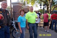
The rest of the evening was a blur of names and faces. I saw old friends from California, people I had met at last years meet, and lots of new people.

HPIM1023s.jpg


HPIM1024s.jpg


HPIM1025s.jpg


DantesDame had surprise for all of us

HPIM1029s.jpg


Stargzrgrl’s new bike gathered some admirers.

HPIM1031s.jpg


This guy (Spectre?) had hit a deer during his ride the meet. The bike went down, lost it’s windshield faring, and entirely ground off the highway peg. Before running off into the bushes, the deer left some hair on his gloves and clutch lever. He was advised to glue that stuff on….such a neat souvenir.

HPIM1032s.jpg


Dinner was yummy, followed by birthday cake, coffee, and various beverages. People were hanging out and swapping stories around the campfire late into the night.
 
At that moment I decided to be brave. I got myself to the other side of the highway to give myself some running room so that my clutch would be completely out before getting onto the gravel.

It wasn’t awful. I stayed loose on the bars and gave myself a little bit of speed to make sure that I had enough grunt to get up the hill. The tires didn’t wander at all.

Cresting the hill, I saw the FJR parked on a concrete pad by the office. I slid in next to him and turned off the bike. My hands were trembling, but I had done it.

I know how much you hate the gravel. :thumb: for conquering the hill. It doesn't seem like the weather is cooperating for you to be camping out. Maybe on the way back.:sun:
 
YEAAAAAY!! She made it! Rocketbunny is now officially rocking the Rockies. :clap:

Wasn't that gravel road worth it though? :mrgreen:

What was the surprise for everyone? I didn't see it in the pic. Was it the b-day cake?
 
YEAAAAAY!! She made it! Rocketbunny is now officially rocking the Rockies. :clap:

Wasn't that gravel road worth it though? :mrgreen:

What was the surprise for everyone? I didn't see it in the pic. Was it the b-day cake?

I dunno if the Black Hills are actually officially in the Rockies. But YEAH! anyway.

The surprise was more for people who know Colleen. She cut her hair short and dyed in a pink stripe.
 
Day 05
Wednesday, June 13, 2007
Custer, SD
0 miles

I decided to take a day off today. I didn’t go anywhere, didn’t see anything.

I slept in, finished a book, and took a long shower. Twas good.

We had a big potluck bbq tonight. There was way too much food and way too much fun.

Some pictures from the evening:

HPIM1035s.jpg


HPIM1038s.jpg


HPIM1041s.jpg


HPIM1042s.jpg


HPIM1043s.jpg


HPIM1046s.jpg


HPIM1047s.jpg


HPIM1048s.jpg


HPIM1051s.jpg


HPIM1052s.jpg


HPIM1053s.jpg


HPIM1054s.jpg


HPIM1056s.jpg


HPIM1057s.jpg
 
And I see you're up late posting! Must have been fun to take it easy for a day and just "be".

Ride on!
 
WOW great report so far!! I would love to do a trip like that this year.. just awesome.. have a great time and be safe.
 
After passing through Hot Springs, SD, a tourist-trap horror of an old-West town, I found myself passing over a cattle-grate at the entrance to Wind Cave National Park.

Sounds like your ride is going great so for!

I actually stayed in Hot Springs, SD a couple years ago on my way home from a trip to Montana and Yellowstone.

Your reports are getting me real pumped up for my upcoming trip to Washington State that starts two weeks from tomorrow.

I sure wished I had your tenacity for doing trip reports. When I am done riding for the day, I am looking for a good meal and a cold beer. Working on a trip report isn't on the radar at all.
 
Enough lolly gagging, there are those amoungst us that have no windows to look out and need pictures of roads and places to make bareable this duty done to afford trips like this.
Get crackin' RB! :lol2:

:popcorn:

Thanks for taking the time to post, :clap:
 
Great report, as usual...!

When did DantesDame get the redness in her hair? I haven't been to ST.N's website since it went down / had that big host change / whatever...

And it looks like Chili Man is crazy as ever....
 
Rocketbunney,

I notice that the fields are all green throughout your trip. There have been stories of drought causing wildfires in Georgia and Lake levels at 1/2 capacity. Is the drought over where you rode?

Great report.
 
Looks like you're having a great time.When will you be coming through Colorado? I live in Colorado Springs and would like to try to meet up with you somewhere to say hello.
 
Day 06
Thursday, June 14, 2007
Custer, SD to Cody, WY
434 miles

map06.jpg


After lots of “Goodbye’s”, “Ride Safe’s”, and “Have Fun’s”, I rolled out of the resort and what felt like another beginning to my trip..

HPIM1058s.jpg


Just outside Custer, US16 narrowed as it went through Jewel Cave National Monument. Due to traffic and lack of shoulder, I didn’t feel safe stopping for pictures.

It was safe enough, but I didn’t feel inspired to stop for pictures on US16 after crossing into Wyoming. (I missed the border crossing while passing some RV’s)

Feeling like my planned route was less than interesting, I decided on the spur of the moment to swing north to Devil’s Tower. I had been there two years ago, but the R1200ST had never seen it.

HPIM1070s.jpg


US14-Alt to Devil’s Tower was fun and scenic.

HPIM1060s.jpg


HPIM1064s.jpg


HPIM1067s.jpg


HPIM1078s.jpg


Next I hopped on I-90 to express back to US16 out of Buffalo.

There are essentially three popular routes between I90 and Cody: US14A, US14, and US16. I did US14A two years ago. Dad has always raved about US16 through Ten Sleep canyon, so I decided to give it a try.

I was wondering about my decision about fifty miles out from Buffalo when I started getting pelted with advertisements for US16. “Most Scenic! Shortest Route to Yellowstone! Least Grade!” All those things might be nice in a car, but to a motorcyclist they evoke thoughts of slow-moving traffic and boring roads.

I decided to stick to my route, figuring that I will probably be back to try US14 in the next few years anyway.

The Cloud Peak Skyway climbs out of Buffalo to scenic Powder River Pass at 9666 feet. The air was crisp and smelled of pine trees and wildflowers.

HPIM1081s.jpg


HPIM1087s.jpg


HPIM1091s.jpg


HPIM1092s.jpg


HPIM1093s.jpg


HPIM1096s.jpg


I was stopping often for pictures. I played leapfrog with a couple of fellow travelers who were doing the same. At one point, one of the drivers asked me “Is that stuff against the fences SNOW?!?!” With car license plates from Florida, I decided to excuse him.

HPIM1099s.jpg


HPIM1103s.jpg


HPIM1106s.jpg


HPIM1110s.jpg


HPIM1114s.jpg


The byway then descends into Ten Sleep Canyon where I was delighted to find colorful high rock walls and long sweeping turns.

HPIM1115s.jpg


HPIM1116s.jpg


HPIM1123s.jpg


Out of the mountains, I stopped at a rest stop about fifty miles from Cody. A aviation museum, next door provided a photo op.

HPIM1125s.jpg


Approaching Cody, I waffled between finding a hotel room and finally managing to use my camping gear. The KOA appeared and the driveway looked paved. I turned in and parked in front of the office next to a very recognizable Honda Blackbird. Birdrunner and his fiance were just checking in. I checked with the office to make sure it was ok, and followed them out to split a $32 campsite.

HPIM1128s.jpg


HPIM1126s.jpg


Ninjagirl and her other half rolled in several hours later. Between the STNers and two cruiser riders who were also in the campground, we had quite a group roasting marshmallows over the fire and telling tales. After so much solo travel, it was admittedly very nice to have a group to chat with.
 
Last edited:
Back
Top