• Welcome to the Two Wheeled Texans community! Feel free to hang out and lurk as long as you like. However, we would like to encourage you to register so that you can join the community and use the numerous features on the site. After registering, don't forget to post up an introduction!

8th Annual NMOHVA Rubber Chicken Ride - Truth or Consequences, New Mexico - October 25-27, 2019

Joined
Sep 22, 2006
Messages
2,623
Reaction score
1,822
Location
Castroville, Texas
First Name
Sander
I just signed up, I hope to see and ride with other TWTers there. This a fund-raising event. All proceeds above NMOHVA's costs will go directly to NMOHVA's Access Defense Fund.


I rode 4 & 5.

Registration for the 2019 event is only $65 and includes Saturday evening dinner, event stickers, and a chance to win great swag and merchandise donated by the awesome manufacturer’s, dealers, and vendors who support NMOHVA.

The 2019 edition of this annual tradition is, once again, a fund-raising event. All proceeds above NMOHVA's costs will go directly tor NMOHVA's Access Defense Fund.

Registration is available online HERE. Check out last years thread with even more details and numerous photos.

All three days (Friday, Saturday, and Sunday) will feature a fantastic variety of great dual sport riding opportunities through the mountains and deserts of south central New Mexico. Check out the thread link above for more information about the great riding terrain available.

All of the motorcycle riding is strictly "no fee" and at the event participant's discretion. Maps and/or GPS tracks of suggested routes will be provided. As always, we anticipate plenty of people who would be willing to let others follow them as they enjoy the beautiful and varied scenery around Truth or Consequences.

All road riding requires a legal, plated bike per New Mexico statutes. All dirt road and trail riding requires a plated bike, a valid NM OHV sticker, or a sticker from a reciprocal state. A USFS-approved spark arrestor is required on all Forest Service managed lands.

We will be adhering strictly to an 100 rider limit for this year's event. Rider's will not be on the official "in" list until the payment process has been completed.

All riders are responsible for their own accommodations.

Pelican Spa - If you plan on staying at the Pelican Spa this year, the owner has hooked us up. He is giving everyone a 10% discount for RCR weekend and we have blocked all the rooms he has to make sure you all get to stay downtown. Here is the catch... You must call in to reserve your room at the Pelican and tell them you are with the Rubber Chicken Ride to get a room and the 10% discount . The phone number is 575-894-0055. Book by September 30th because at that point the lock goes away and so does the discount. Don't say we didn't warn you.
DO NOT try to book it online as it will show there are no rooms available.

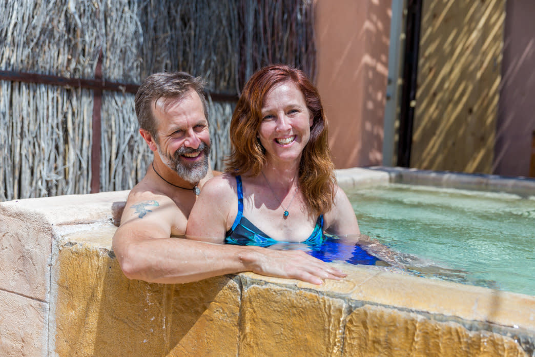
T or C is a historic resort town. Located in the downtown Hot Springs Bathhouse Historic and Commercial District, the spas and bathhouses of Truth or Consequences are central to its history. The region gained recognition as a health center at the turn of the century, and in the 1920s, ‘30s, and ‘40s motorists flocked to area resorts. Today, there are ten historic spas in the central downtown area. One of the best aspects of hosting the event in T or C is that riders can park their bikes at a downtown accommodation and then walk to all of the Rubber Chicken activities. There are also many additional accommodations ranging from small, local hotels to the typical larger chains up on Interstate 25. The more "local" you choose to stay, the more $$ probably stay in T or C!

Check out NMOHVA and what we are doing to promote, preserve, and protect motorized recreation in New Mexico at www.nmohva.org.

The Rubber Chicken Ride has consistently been NMOHVA's most popular moto-gathering ever since we hosted the inaugural event. The 2019 Ride promises to be as much or more fun than its predecessors. Come see what all the excitement is about. We hope to see you there!

[IMG]


[IMG]


[IMG]


[IMG]


[IMG]


[IMG]


[IMG]


[IMG]


[IMG]
 
Last edited:
I did this event a few years ago with Rsquared and Jfink. We went out a few days early and did a nice loop over toward Silver City, up US 191 to Alpine, then did a bunch of dirt back over through the NF just South of NM 12 to Winston and eventually back to ToC. It was great. Then we did the rally the last two days. I had some bike issues that put a kink in my fun for one day, but we still had a blast. We also made the run out to the VLA and Pie Town.

We stayed at the Desert View Motel, which was close to where they did breakfast every morning. The rooms were inexpensive and nice. They had lots of room for parking trucks with trailers.
 
I never did a full trip report, but here are a few pics from the trip. If it rains, things get REAL “interesting”... :wary:

240803


240804


240805


240806


240807


240808


240809


240810


240811
 
Oct 25-27 is Wed -Fri ?

edit: nope, I had too many tabs open, again

Watching this one closely.
 
Last edited:
Sounds like an great event. I am interested. Sander & Scott, what are the trials like ? Class 1, 2 ? Big bike friendly or thumpers?
 
I'm totally interested but there's no way I could do it this year.

You can probably count me in for 2020 if a few Houstonians want to carpool...
 
It depends on the route you take for the day. From class 1 to probably 3. The organizers build out about 15 and rate them.

The terrain is very diverse, desert east of town, high desert to pine forest in the mountains west of town.


I'm taking my XR4R. Our group the first year included big bikes. The route we usually ride on the last day, up to the Springtime campground in the Cibolo NF was all class 1ish.


Palamos gap can be ridden on a 650 class DS, by others, but I was much happier on my 400.


The NMBDR goes through T or C to Winston and up Chloride Canyon.

 
Last edited:
Got my eye on this. Great rides out there. And excellent weather generally.


Sent from my iPhone using Tapatalk
 
Originally named Hot Springs, the city changed its name to "Truth or Consequences", the title of a popular NBC Radio program. In March 1950, Ralph Edwards, the host of the radio quiz show Truth or Consequences, announced that he would air the program on its 10th anniversary from the first town that renamed itself after the show; Hot Springs officially changed its name on March 31, 1950, and the program was broadcast from there the following evening.


The way I read the NM OHV regs, if you have a tagged bike even from another state, you are not required to have any other permit or license?
 
The way I read the NM OHV regs, if you have a tagged bike even from another state, you are not required to have any other permit or license?

That's the way I understand it for a truly street legal bike. http://www.wildlife.state.nm.us/ohv/registration-permits/
A non-resident from the remaining states need not purchase New Mexico ‘s permit as long as they can provide valid proof that they have a current registration, user fee or something similar for their off-highway vehicle.

Then on a different page.
Vehicles not required to be registered for off-highway motor vehicle use:
  • Motorcycles registered for use on public streets
 
I'm in. Looks great. What date are you arriving on?

Thursday afternoon evening, ride Fri-Sun, depart Monday morning.

Extremely varied area and sometimes tests your navigational skills.

These videos are from an actual route that was an approved and distributed.


At least a road here.

I leaped before I looked as the road dropped into a creek and had to find an alternate way out.
 
5 spots remain.

1/2 the riding area was previously part of the Republic of Texas.


wow, I can tell you're like, do I want to pay attention to the terrain, or do I want to look at the scenery. This is the way it was at Cloudcroft for me.
 
Ralph,

I believe the organizers are still tweaking routes for 2019. Normally the routes are posted on the 2019 ride thread with GPS tracks 2 - 3 weeks out.

Routes I currently have under consideration, before I see if they have any new routes for this year. Probably just one route per day. I would like to try the tougher stuff, IE more than graded roads like I get to ride all the time in Texas.
  • Suggested Route 1 - Chloride Canyon: ~130 miles Rating: Easier or Suggested Route 2 - St. Cloud + Chloride Canyon + Lookout Mountain + The Nash Cut-off: ~ 147 miles Rating: Moderate
  • Suggested Route 7 - Palomas Gap (with the North exit) with an addition of Bushy Mountain Rating: Harder or Suggested Route 8 – McLeod Hills: ~87 miles.
  • Suggested Route 8 – McLeod Hills: ~87 miles. Rating: Moderate to Harder
  • Suggested Route 9 - Tipton Ranch + Redhouse Pass + Broadhurst Arroyo: ~119 miles. Rating: Moderate to Harder.
  • Suggested Route 10 - Mine Tank Loop + Broadhurst Arroyo: ~89 miles. Rating: Harder.
  • Suggested Route 15 - Apache Gap: ~94 miles. Rating: Harder to Difficult.
  • Suggested Route 18 – East Side of Caballo Reservoir: ~73 miles. Rating: Moderate.
  • Suggested Route 19 – Lyda K Mine + Pass Tank: ~94 miles. Rating Harder.
Palomas Gap (with the North exit) is currently my favorite, but I haven't ridden all 20 routes. I definitely want to ride Chloride Canyon and Palomas Gap again in some variation. The Springtime Campground routes are good if we need to take it easier one day.

At the daily breakfasts at the Sunset Grill there are ride leaders ready to provide input on the routes.

2018 route info
Starting on post 70 on the link below, and a few posts after are descriptions and GPS tracks from last years ride. I hope it helps.
https://advrider.com/f/threads/time...7th-annual-rubber-chicken-ride.1326475/page-4

Suggested Route 1 - Chloride Canyon: ~130 miles. Rating: Easier. The Chloride Canyon loop includes historic mining and logging ruins, petroglyphs, and is one of the wetter rides around southern New Mexico. The road is a bit rougher this year than the past two years due to rainfall but still in quite good shape. Expect a few rocks, numerous crossings of the small stream, and a long, somewhat rocky climb out of the canyon. The remainder of the route is the same as previous years (mostly easy Forest roads). The abundant summer rains have also left flowing water and a certain (to us New Mexicans) lushness that is much appreciated. We have added an optional loop to this ride on the north side of Hwy 59 for those who want to extend the ride. This “new” loop is very green and scenic this year and includes a segment called Adobe Canyon at the north end that is a real gem. Gas is available in Winston at the General Store and they typically have premium available.

Suggested Route 2 - St. Cloud + Chloride Canyon + Lookout Mountain + The Nash Cut-off: ~ 147 miles. Rating: Moderate. This variation of the Chloride Canyon loop was first suggested in 2016 and this year we have added another “new” optional loop on the north side of Hwy 59. After a short side trip into Chloride (the townsite), the route swings south past the active St. Cloud mining area (a zeolite mine) and winds its way up and down through the area south of Chloride Canyon. After passing several interesting historical mine sites, the road rejoins the “traditional” Chloride Canyon route about 1.5 miles up from the town site. The route eventually climbs up out of Seventyfour Draw to join the road to Lookout Mountain (where a short spur leads to some great views off this high point) before rejoining the traditional route down Forest 226 toward the Beaverhead Highway. A few miles short of the highway is the turn for The Nash Cut-Off. This is a more interesting route than the last few miles of gravel to the highway. Keep a sharp look-out for the namesake relic. After reaching the highway, the optional “new” loop is very green and scenic this year and includes a segment called Adobe Canyon at the north end that is a real gem. Gas is available in Winston at the General Store and they typically have premium available.

Suggested Route 3 - Mt. Withington – The Full Monty: ~184 miles. Rating: Moderate. This one is for the “iron buttes” out there. The loop to and over Mt. Withington is the longest and highest of the standard loops in the area. The route tops out at an abandoned fire lookout at over 10,000 feet! Mt. Withington can be accessed via a variety of ways and this version is the traditional route that has been used by many previous RCR’s. It leaves the pavement at Monticello, passes Springtime Campground, and then follows the infamous “fence line” for many miles north to Highway 107. It then swings west past the historical town site of Rosedale before climbing the Mt. Withington ridgeline. Both fire look locations (Grassy on the south, Mt. Withington on the north) can be accessed and riders can choose between Bear Trap Canyon or West Red Canyon to drop down the west side of the mountain and make their way back to Winston. This ride can be shortened by trucking bikes to Monticello or Winston and gas is available at the Winston store if fuel range is a concern.

Suggested Route 4 - Mt. Withington – A Bit Faster and Easier: ~192 miles. Rating: Easier. This variation of Mt. Withington is essentially the same as the traditional route above but skips the slower/more difficult fenceline section by running all the way out to NM Highway 1 (paved) and using NM Highway 107 (pavement and dirt) to access the rest of the route. It also includes an additional gas stop at the Santa Fe diner/truck stop for range-challenged bikes.

Suggested Route 5 - Mt. Withington – West Loop: ~172 miles. Rating: Easier. This is the easiest variation of Mt. Withington and is friendlier to big bikes or bikes with smaller fuel tanks. From Winston, the top of Mt. Withington is accessed by going up West Red Canyon and returning to via Bear Trap Canyon. A start and finish in Winston (by trucking or trailering the bikes) shortens this loop even more to a bit under 100 miles. Gas is available in Winston.

Suggested Route 6 - Palomas Gap (Classic): ~62 miles. Rating: Moderate. The standard version of the Palomas Gap loop includes the challenge of the climb up the historic route over the Gap and the outstanding view from the antenna farm at the top of Brushy Mountain. The 7500 foot summit gives a stunning “bird’s-eye view” up and down the Rio Grande Valley. We have added a short optional loop (Easier) that runs past some interesting mine ruins (Napolean and Carroll/Carolyn Mines).

Suggested Route 7 - Palomas Gap (with the North exit): ~40 miles. Rating: Harder. This alternative version of the Palomas Gap route was first offered in 2015. It is shorter in mileage but considerably more difficult. It features roads that get only infrequent use, some steep/loose/rocky hills, deep sand in arroyos, and requires excellent route finding skills. A counterclockwise travel direction will take riders down the most challenging hill. Our thanks to inmate Grizzzly for sharing with us!

Suggested Route 8 – McLeod Hills: ~87 miles. Rating: Moderate to Harder. This is one of the entirely “new” routes for 2018. It is located further east as the McLeod Hills are the major ridge east of the Caballo Mountains. As such, the “meat” of this route can be accessed by either running fast paved and gravel roads or by climbing up through Palomas Gap. The route uses a combination of very primitive (read this as hardly ever used!) roads to run along the base of the ridge for about 10 miles first on the west face and then on the east face. We can just about guarantee that you will not see anybody else out in this area! The transition from west to east is accomplished via a very interesting and fun canyon that will have you swearing you have been transported to Moab. The exit joins up with the Tipton Ranch road which eventually takes you back to civilization. Don’t run this one solo.

Suggested Route 9 - Tipton Ranch + Redhouse Pass + Broadhurst Arroyo: ~119 miles. Rating: Moderate to Harder. These routes were first offered in 2015. Combining the two provided an even “better” (and considerably harder) loop in offered for the last two years. Is 2018 the year you will test yourself? The Tipton Ranch in the title is a bit of a misnomer as the route actually bypasses the private ranch entirely. This is true southern NM desert riding with arroyos, rocky climbs and descents, old mines, and an optional short spur to some really cool rock art (petroglyphs – look but do not touch!). The return from Hatch goes back out into the desert to ride the Broadhurst Arroyo loop before using the pavement to get back to T or C. Gas/food/water can be obtained at Hatch at the southern point of the loop.

Suggested Route 10 - Mine Tank Loop + Broadhurst Arroyo: ~89 miles. Rating: Harder. Mine Tank Loop was first offered in 2016. After combining it with Broadhurst Arroyo and riding it recently, we decided to bump the rating up a notch to Harder. There are two additional “more difficult” options if you want even more rocks and ledges. We also updated the route to avoid the morass of endless gullies by exiting Mine Tank Loop via a new ridgeline route. This is very rugged and remote country (and a personal favorite) through canyons that can get mighty warm so have plenty of water and stamina if you attempt this one.

Suggested Route 11 - Hermosa: ~ 131 miles. Rating: Easier. This caters to the rider looking for an easy, scenic ride or something that is big-bike friendly. This is a long out-and-back to the seldom-visited location of the Hermosa town site. The road encompasses a wide variety of nice scenery and there are numerous interesting abandoned buildings if you go all the way to the far end of the route.

Suggested Route 12 – Sy’s Circle: ~ 205 miles. Rating: Easier. This is the first year for this additional big-bike friendly route that loops north around Mt. Withington to Magdalena and then returns through the open grasslands of Dusty and Winston. About half pavement and half dirt, there is only one section that can be a bit rocky some years. The northern end offers a chance to see the impressive dishes of the Very Large Array on the Plains of San Agustin. There is gas at the Santa Fe Diner/Truck Stop, in Magdalena, and at the Winston store.

Suggested Route 13 – Hillsboro + Lake Valley + Hatch + the Jornada + Spaceport: ~161 miles. Rating: Easier. This is a mostly paved, big-bike friendly loop through the historic mining center of Hillsboro and then south through the historical site of Lake Valley. After a gas (and perhaps famous Sparky’s burger?) top-off in Hatch, the route continues north up the recently paved road across the Jornado. The Jornada offers an amazing juxtaposition between the historical route used by the Spanish in the 1600’s and new facilities of Spaceport America.

Suggested Route 14 – Winston + Beaverhead + Emery Pass + Hillsboro: ~208 miles. Rating: Easier to Moderate. This a longer, but still big-bike friendly loop that visits Winston and Beaverhead and then traverses a corridor between two huge wilderness areas before returning via the twisties of Emery Pass and the historic mining town of Hillsboro.

Suggested Route 15 - Apache Gap: ~94 miles. Rating: Harder to Difficult. Here is a route for riders looking for even more challenge. The climb up Apache Gap is typically thought of as "very hard" with numerous rocks and ledges encountered on the way up. This version is shown as also including a loop that includes the high viewpoint from the antenna farm on the top of Timber Mountain. A rider could then descend the south side of Brushy (itself a quite technical descent) and then retrace the rocks and ledges back the way they came or could return to T or C via the (much easier) backside of the Palomas Gap loop.

Suggested Route 16 – Springtime Campground Loop: ~91 miles. Rating: Easier with Moderate Options. The loop past Springtime Campground has been a favorite of our riders looking for a very scenic but relaxing ride. It offers a unique combination of high desert with a bit of elevation as it crosses a pass at 8000 feet. The ride starts with a tour along Elephant Butte Reservoir (pavement first, then dirt) before heading west toward I-25. The route utilizes the old highway that parallels the Interstate and then dives west into the desert and rolling grasslands that slowly climb, first into pinyon/juniper forest, and then into the bigger Ponderosa Pines. After passing the campground, the road crests the highpoint and descends back toward the picturesque community of Monticello. On the way down to town, it passes through some of the finest scenery around. The rest of the route back from Monticello is paved state highway. The optional Burma Road out-and-back is a worthwhile diversion and the optional Aragon Hill Loop offers a five mile section of very scenic but interesting riding for the novice rider who is comfortable with dirt roads and wants to try something a little more challenging.

Suggested Route 17 – Springtime Campground + Blue Ribbon Trail + Aragon Hill + Rocky Top Loop: ~132 miles. Rating: Moderate to Harder. The route past Springtime Campground (above) has long been an easy, scenic favorite. Adding the Blue Ribbon Trail (Harder) Aragon Hill (Moderate) and Rocky Top (Harder) loops adds length and considerable difficulty and “spice” to this new combination. The Blue Ribbon Trail actually uses Forest Road 922 but lack of use for many years until we (minimally) cleared it this spring essentially renders it singletrack. We think you will love it! The Aragon Loop, was updated to reflect the new Forest Service Motor Vehicle Use Map route and is only a bit more challenging than last year. The trifecta ends with the 20-mile Rocky Top loop. It includes a long ride up a gravel arroyo, some really tight tree dodging as riders wind down a 2nd arroyo, and then some steep and very rocky ascents and descents. The route crosses the summit we are calling “Rocky Top” for no apparent reason other than it is the highest ground around with views to match. The descent down yet another arroyo leads riders back to the graded county road. This combo route offers enough length and challenge to appeal to most riders looking for a tougher day. By mixing and matching carefully, it can be tailored to be easier and/or shorter if the main loop is too taxing.

Suggested Route 18 – East Side of Caballo Reservoir: ~73 miles. Rating: Moderate. This was a new offering for 2017. It starts with the River Road south toward Palomas Gap but continues all the way down to the Garfield Exit staying on the east side of the river. The challenge is that portions of the road are in the "intermittent flood pool" of Caballo Reservoir. When the water level is higher, riders need to seek higher and drier ground to the east in order to find a "through" route. The road itself eventually climbs to higher but rougher ground before finally returning via the beautiful Red Hills Road. One can also easily access optional loops to the Black Jack and other mines and interesting spur roads from this route.

Suggested Route 19 – Lyda K Mine + Pass Tank: ~94 miles. Rating Harder. The Lyda K Mine portion of this route was new last year. In addition to some interesting mining ruins in the foothills west of the Caballo Mountains, it offers some rough and tumble riding up and down steep, rocky hills and winding rocky arroyos. We have teamed it with the Mine Tank Loop which offers more of the same for a day-long adventure that might have you ready for a cold one by the time you get back. Since we don’t know just how riders will fare on this new option, we have offered both easier/faster and harder/longer exit options.

Suggested Route 20 – The 2018 RCR Sufferfest: ~119 miles. Rating: The Kitchen Sink - Easier to Difficult – We first offered this by request last year and then no one finished the whole enchilada. What is the Desert Sufferfest? A taxing combination that links most of the harder and difficult loop options east of the river into one never-ending endurance festival. We have further refined and tweaked the 2018 edition by shortening the loop and including more options to bail back out to the highway… Will anyone ride it in one day? We even included an optional gas/food stop in Hatch about midway. Oh, and the hardest sections are toward the end of the day. Choose carefully and plan ahead. Have fun and stay safe.
 
Last edited:
Now after reading through the routes the "newer" Springtime Campground + Blue Ribbon Trail + Aragon Hill + Rocky Top Loop looks like fun...We have just ridden Suggested Route 16 – Springtime Campground Loop: ~91 miles, big difference.

Suggested Route 17 – Springtime Campground + Blue Ribbon Trail + Aragon Hill + Rocky Top Loop: ~132 miles. Rating: Moderate to Harder. The route past Springtime Campground (above) has long been an easy, scenic favorite. Adding the Blue Ribbon Trail (Harder) Aragon Hill (Moderate) and Rocky Top (Harder) loops adds length and considerable difficulty and “spice” to this new combination. The Blue Ribbon Trail actually uses Forest Road 922 but lack of use for many years until we (minimally) cleared it this spring essentially renders it singletrack. We think you will love it! The Aragon Loop, was updated to reflect the new Forest Service Motor Vehicle Use Map route and is only a bit more challenging than last year. The trifecta ends with the 20-mile Rocky Top loop. It includes a long ride up a gravel arroyo, some really tight tree dodging as riders wind down a 2nd arroyo, and then some steep and very rocky ascents and descents. The route crosses the summit we are calling “Rocky Top” for no apparent reason other than it is the highest ground around with views to match. The descent down yet another arroyo leads riders back to the graded county road. This combo route offers enough length and challenge to appeal to most riders looking for a tougher day. By mixing and matching carefully, it can be tailored to be easier and/or shorter if the main loop is too taxing.

Some of the scouting photos from last year. https://advrider.com/f/threads/time...ber-chicken-ride.1326475/page-7#post-36157621
Here's a few more shots of the new Blue Ribbon Trail! (aka Forest Rd. 922)
You see the trail, right?
ne_nau.gif

[IMG]


No worries...just follow the blue ribbons!
clap.gif

[IMG]


trailwerks marking trail...
[IMG]

[IMG]


more...
[IMG]


[IMG]

[IMG]


Forest Service gate at end of trail
[IMG]


BRT returns to a visible road...sort of!
icon10.gif

[IMG]
 
Last edited:
I see the ride is now full.

The updated routes haven't been published yet, however here are links to the forest service MVUMs for the area.


Paper maps should be available at:
Black Range Ranger District office
Address:
1804 North Date Street
Truth or Consequences, New Mexico, 87901
Phone: 575-894-6677
Fax: 575-894-3597
Office hours: 8:00 am - 4:00 pm, Monday through Friday except for federal holidays
Directions: Exit 79 from I-25. The district office is located one mile south in the Lakeway Shopping Center.
 
Last edited:
Back
Top