Re: Escape to Witch... er... The Smoky Mountains!
Sunday, May 20th:

Morning comes soon and I wake in eager anticipation of a great day of riding. I find the others going about getting breakfast and getting ready to ride. I don't do breakfast (in the mornings), but I do do Pop Tarts, especially the apple cinnamon ones

Now I know there are riders that like to have 100 miles behind them before the sun comes up... I am not one of those freaks of nature. This is supposed to be vacation. The riding starts no earlier than 9:00am. Besides, in this area, there is often heavy fog laying in the low valleys and trying to ride much earlier than that means riding in heavy fog, not a favorite past time of mine.
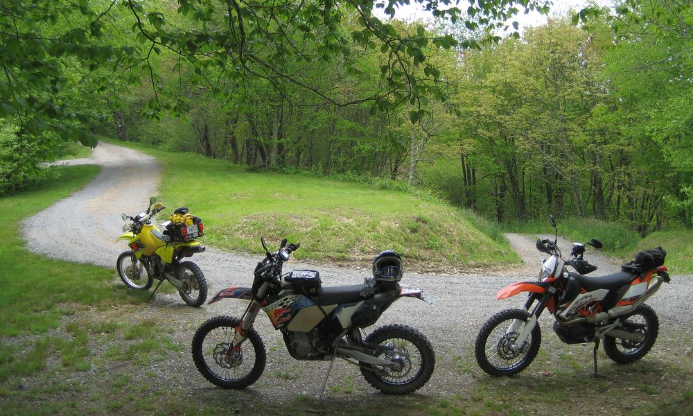
So the routes I have planned are of two types, the "small" bike routes and the "big" bike routes. The idea being that the small bike routes will hopefully include more of the technical unpaved stuff and the big bike routes will be predominantly paved with some less technical unpaved stuff. Of course I am also hoping to cover some new ground, so you just never know... Today is going to be a longish small bike route... maybe 225 miles. The whining starts before we even leave the driveway

We pull out around 9:45am and head to the local gas station, cash only. I think there is a post office here as well, but that is about it other than people's homes. Topped off, we head North on NC 215 a short bit. Other than the short straight section in town, NC 215 is pretty much non stop curves from start to finish, but it is not our goal for today. Today we are going to head West along the base of the Blue Ridge mountains. The last time I was out here in 2005, a lot of the roads in the are were unpaved. I had read on AdvRider.com that NC has been paving roads like crazy. Now we find out.
We soon reach the start of Charlie's Creek Rd., also labeled as NC 1756. North Carolina generally uses three digits for state highways and four digits for minor roads. A road may have several local names as well. So when navigating, it helps to have looked at several maps, or have a working GPS... Speaking of working GPSs... My newish Garmin Montana is not making me real happy. When I load the route and it starts to do its calculation thing, it rudely informs me that a route can only have 50 waypoints and proceeds to truncate everything after the 50th waypoint!!

I do manage to get around this by just having the GPS display the route, but the screen does not update as we move, forcing me to keep scrolling the map. My "old" 276C has better functionality than this new modern marvel

So I was talking about roads. NC 1756 is paved. At first I am a bit disappointed... like for the first curve or two... and then it is GAME ON!! The curves come fast and furious. The pavement is not perfect, but it is good. There are damp spots, but nothing that cannot be dealt with. Many curves are of the kind where I plunge down into the corner, hit the apex at max g, then point and shoot as I climb out to crest a negative g corner. Roller coasters are fun, but they can't touch this!

About now, you are probably wondering why I have no pictures. Well... What can I say!? The riding is that good and stopping just seems so... well... boring

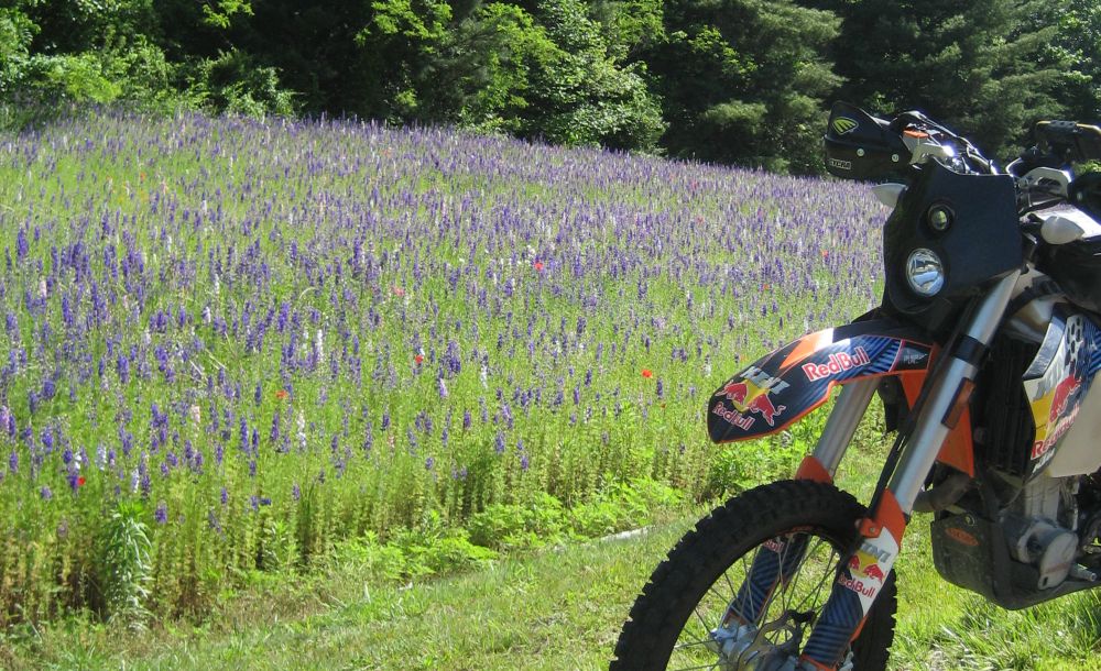
However, we eventually reach NC 281, also now paved where it was not before, and head North toward Cullowhee. So here are some pics

Pretty flowers! And you were probably thinking I'd post pics of the curves
But take a good look at that pavement, it is pretty much what is found everywhere around here, a smooth crushed granite aggregate with crazy traction!
I like bugs...
I am starting to worry that finding any unpaved riding may prove difficult

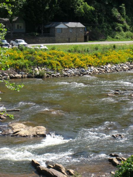
We reach Cullowhee and turn West on Little Savannah Rd. This is a typical urban road but soon gives way to a great twisting little paved road that climbs up on to a winding ridge, crosses NC 116 and eventually drops us out at the Tuckasegee River on the West side of Sylva. We stop for a break and to shed some layers. Now the teasing has stopped and several of us are asking John if he has room in his Blitz Box to carry our sweat shirts. Being the good natured guy he is, he obliges us
")
The river and more flowers
The sun us up and it is getting warm down in the lower elevations. We hop on New US 19, head West a short distance and find the start of Dick's Creek Rd. (NC 1388). I learned of this road from a fellow member on AdvRider.com, Whitebread117. He lives in Brevard and rides all over this area. The maps don't all show it going through to Old US 19, but he assures me that it does. It starts out heading North and is a narrow paved road, much like Charlie's Creek Rd., which we ran this morning. But soon...
Dick's Creek Rd., does not disappoint! It climbs up the side of a ridge, rising from around 2000 ft to 4200 ft in the space of just a few miles. The road ranges from smooth to rough washboard. The trees almost completely cover it, forming a darkened green tunnel and keeping the hot sunlight off us. As we climb I can feel the air getting cooler with the rising elevation. It amazes me how much it cools in just a few thousand feet.
Near the crest of the ridge, the maps no longer show the road. I can see the road we will eventually connect with on the downside of the ridge, but I have to figure out how to get to it. That might not be a problem except that we encounter a few intersections with options... Well... Nothing to do but explore

This road is not on the map but looks very well maintained
The road drops into a big cleared corner and there is some logging equipment sitting around, the trees obviously thinned out in the area. You can see the road continuing to the left in the following shot, but looking at the GPS, it is now clear that this is taking us away from where we want to be. The urge to explore is strong, but time is pressing and we still have a LOT of miles left if we are to even come close to completing our route. I make a mental note for future rides...
We take a break and then double back to the previous intersection. You can just see it going down and to the right behind those two big trees in the center of the following shot. From that point the road climbs coming at me and reaches the high point on the ridge.
John Steve and Roger
Hmmm, the road in the shot below looks interesting, washed out and rutted, but there is also one directly in front of the bike just out of the shot and it goes down, which means it is probably the one we want. But just to make sure, I run up the fun looking one a ways. Don't want to get the guys lost you know
It IS fun, rutted, steep, and lots of off camber surfaces. However, it doesn't go real far and sure enough, it is not the right one. So I coast back down to the intersection and head down the other road. Fortunately, I don't get real far before I want to take a picture. This is when I realize that I don't have my camera in my pocket and must have dropped it back on the top of the ridge. While the guys wait I make a fun run back to the top and find it on the ground right where I was parked. I guess I did not quite get it slipped into my pocket
I head back down to where the guys are waiting and get my shot.
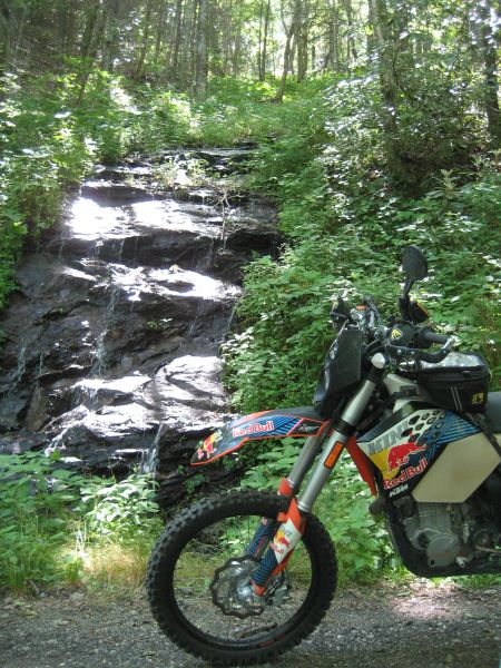
These little road side water falls are EVERYWHERE!
The road on the Northern downside of the ridge is Washington Creek Rd. You might have noticed that most roads have "Creek" in the name. Well, that is because most every road follows a creek as it flows down out of the higher elevations and there are TONS of creeks here! Anyway, as we crest the ridge and start down the North side, we cross over into the Cherokee Indian Reservation. If you want more history on this, do a web search on Trail of Tears. It's definitely not a pretty part of our glorious national history and was a flagrant "look the other way" violation of the principles on which our country was supposedly founded, all men created equal and all that stuff... The reservation was eventually created for those Indians that refused to leave and hid in the mountains in the area. It is their descendants that live here now and they make their living on tourism to the area.
The road down is fun - Roger on his KTM 450 EXC
But it soon gives way to pavement
No worries though. We head East on Old US 19 a mile or so and find the start of Bia 409, known locally as Jenkin's Creek Rd. Now I am pretty sure that I did this road with Bill "Wasabi" and John "TxRider" back in 2005. I was on my R1150GS, Bill his Vstrom 1K, and John on some kind of grey import KTM 640 Enduro. It started out easy enough...
Steve
John
... but somewhere along the way, we hung a right onto Bia 434 or Upper River Rd., and then we turned South on Hyatt Cover Rd. Both roads were great fun, but they were also a LOT of work on the big GS!! Today we bypass them in search of some roads I've not yet ridden, The Heintooga Loop. But first we have to find it...
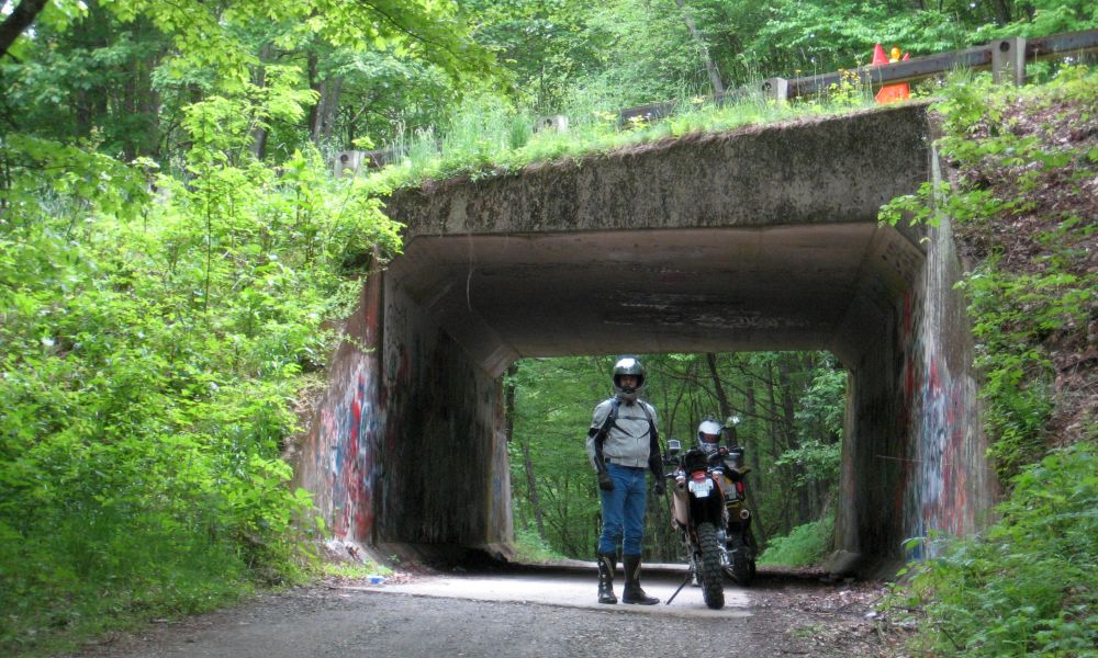
Jenkin's Creek Rd., climbs from about 2500 ft to 4500 ft, where it passes under the Blue Ridge Parkway. Just because a road looks like it intersects the BRP on a map, this does not mean you can actually access the BRP from that road! Nor is it always clear which way you need to go to find a road that does give access to the BRP. Anyway, as the climbing starts getting steeper, we get behind a Dad and two sons riding ATVs up the road. We hang behind them for a bit and the Dad finally notices us, pulling over and waving us by. Not much longer after that we reach the BRP and find a tunnel going under it.
Steve wondering where we go next and trusting me to get him there...
Must be a popular hangout for the local kids
On the far side of the tunnel, we come to a choice, left or right...? Right is the way I want to go, but the map is unclear if either way leads to access to the BRP, which is also where I want to go, because I think that is the way we get to the start of the Heintooga loop. So right we go... and go... on Bia 407, which looks like it has a short spur connecting to the BRP on my GPS map, but which doesn't exist on the ground
And so we go...
We're riding the same ridge that the BRP runs along, but we are up above it, able to look down through the woods to where we want to be. The mountainside is STEEP and there is no way I am going to attempt the short run down to the BRP. So we simply run along above it for a while and enjoy the views. We soon reach the Mile High Campground, which sits right smack on the top of the ridge at about 5300 ft in elevation. The views both directions are great! This would be a nice place to spend a weekend!
Looking North
We came up the road on the right. There are little campsite scattered all about on each side of the road.
Roger
Bia 407 eventually gets us where we want to be, but now John is getting concerned about gas for his DRZ. Not being sure how much further we will be going before we can find fuel, we decide to hop on the BRP and make a run into Maggie Valley for lunch and gas.
Of course we make a few stops along the way into town...
Your's truly
And some history...
At Old US 19, there is an exit ramp off the BRP and we head into town to fill up the bikes. As we head in, I spy what looks to be a good place to stop for lunch and drop a way point so I can be sure to find it when we come back this way.
Can't recall the name, but the food and view was good. The service was good also.
Bikes and bellies full, we head back West to the BRP... and stop at another overlook, of which there are MANY!!
The anal retentive nerd in me can't help but wonder how many people go away from here thinking there are 5250 feet in a mile
You can see the weather is AWESOME!

We find our way back to Bia 407 and start heading North on what soon becomes Heintooga Round Bottom Road. I've no idea how it got its name. Maybe it was named after some chief's wife?
Anyway, it is fantastic.
Oh yeah

Some of this...
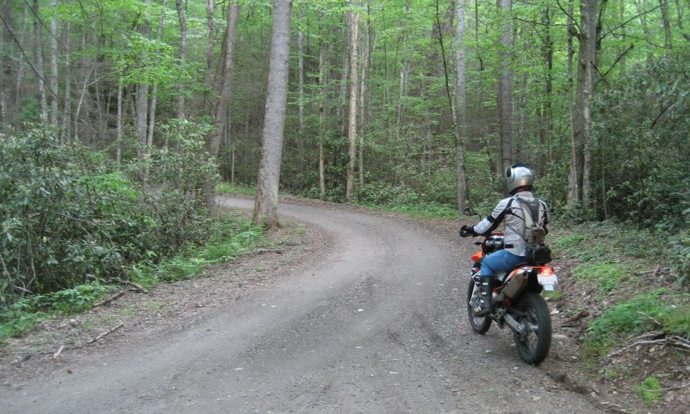
Would it be a bona fide dual sport ride report without one of these shots...?
Now I have been on a LOT of dual sport rides, with little groups, big groups, and everything in between. One thing that has always amazed me is how frequently so many guys have to go!! I mean some of them go every time we stop. I drink a lot when riding, but I guess I just sweat it out
It makes me think of those commercials where all the cars are driving around towing little trailers with port-a-potties on them and they are advertising for some drug to help with having to tinkle all the time. If I was any good at Photo Chopping, I'd be trying to stick one of those trailers behind the bikes of all the guys
(I'm probably gonna pay for that shot
)
More of the road
Wait... which way are we supposed to be going again...?

Oh, well this looks good...
Steve
Waiting while John tinkles... I mean tinkers with his GoPro...
A nice shot giving an idea of how steep the mountainsides can be. You don't wanna be blowing corners around here...

Something's still not right...
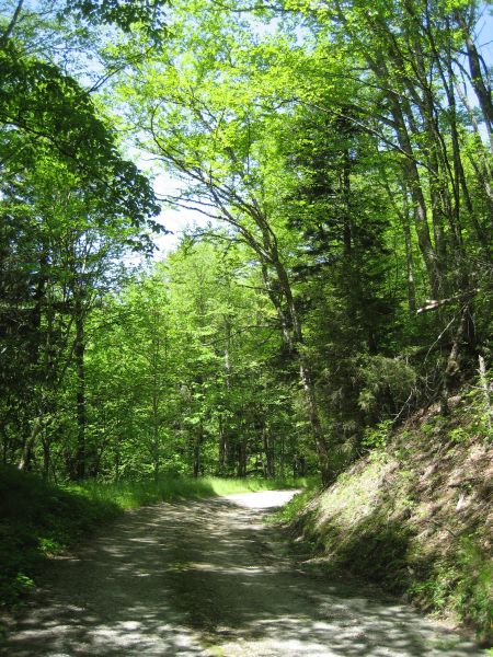
Typical of so many of the dirt roads in the area, hard pack covered with loose gravel.
As we head pretty much due North, the road runs along the side of a ridge, staying around 4800-5200 feet much of the time. This makes for very comfy riding conditions! At the Northernmost point where it turns back South, the elevation begins to drop gradually and we start seeing numerous creeks.
And cool bridges
Looking to where the road disappears back into the woods. It gives a good idea of how dark it can get down in the woods even in the middle of the day.
Unclear on how to use a bridge, Roger and John contemplate the best path for crossing the creek...
"No really, I think we can slip between those two big rocks and..."
And soon the road just follows what I think is Straight Fork Creek... Don't ask me... seems kind of like calling something "Government Intelligence"...
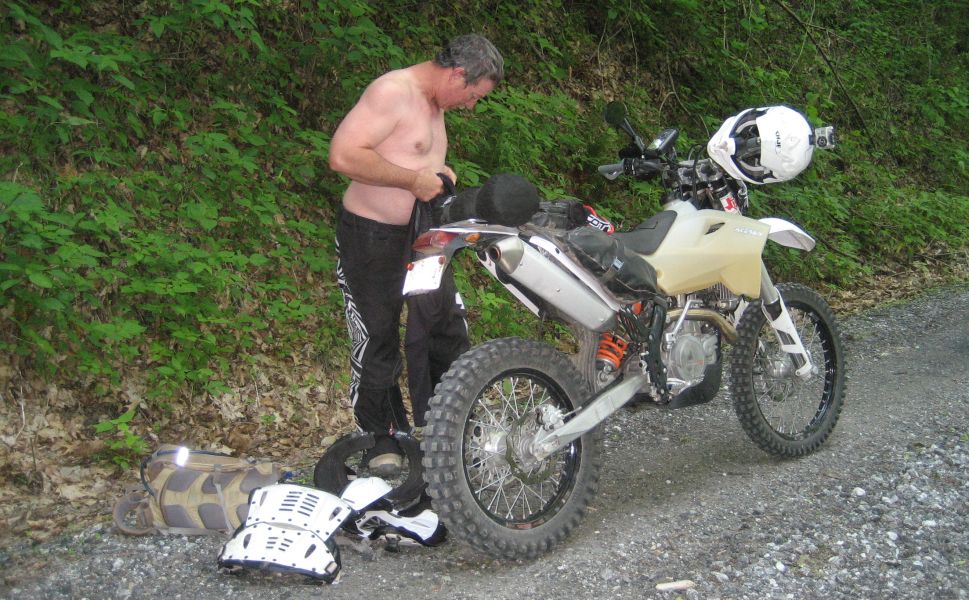
The sight of my first get off... my boot hooked on the tail bag as I dismounted to the right and the bike came right over with me... Fortunately, I landed on my tush and the bike missed me. Grace in action...
Eventually the road become Bia 405 and cuts back to the SouthEast toward the BRP. It gradually climbs from 2500 feet to about 3100 feet, then gets real steep the last bit, climbing up to about 4300 feet. This makes for some tight and technical switchbacks.
The road to the left is quite a ways down!
And what do you know...? Bia 405 goes right to the Parkway, and just to one side is the intersection where we sat earlier wondering which way to go
:lo2: No matter, had we gone left earlier and come this way to get on the BRP, we would have missed the cool road leading to the camp ground. So now we head back over the tunnel, cross under the BRP, and take a different road down the South side of the ridge, Bia 413 or Dodgson Ridge Rd. I know, you are shocked that it wasn't Dodgson Creek Rd., so was I!
Anyway, this is a fun gravel road that wanders down the mountain until it reaches Wright Creek and wait for it... wait... becomes Wright Creek Rd. This part is paved and is great fun as it runs down out of the mountains through some beautiful farming areas.
Saw this and had to pull over... got some funny looks from the neighbors across the road though.
How long has it been since you bought a Coke out of one of these!!?
Across the field there is a big hardwood tree of some sort with a really cool tree house in it. Had Daniel been here he would have already been hopping the fence and running across the field to check it out... and I might have been right behind him
Before buying a new house last fall, we spent several years shopping. My agent thought I was nuts because one of the first things I would do when checking out a prospective house was see if any of the trees were worthy of a decent tree house
There's nothing quite like a good tree house when you are a kid!
And the road becomes this... horrid and boring for miles...


Eventually the horror ends and we drop out on Old US 19 again, Head East a bit to NC 1427 and cut back to the Southwest to reach US 441. We run that South to New US 19, cut back East to a spot where we can cross the Tuckasegee River, hop on NC 1397 and run back Northwest along some railroad tracks until we reach the start of NC 1177 and turn South. These are typical of the little paved secondary roads around here, smooth pavement and they flow with the countryside. Great fun!
NC 1177 runs roughly South along the banks of Connelly Creek. Yeah, I was shocked that it isn't called Connelly Creek Rd. The start is at about 2000 feet and we soon run up to Wesser Gap, which is at about 4300 feet, rising about 1000 feet just in the last 1/4 mile!
The right side of this shot leads to the left side of the next shot
Now I have been on quite a few trips with Roger and despite his road side urinary adventures, I have never really known him to be an exhibitionist. Well... as they say, you learn something new every day!

Something zapped him!
The bike waits patiently... biding its time...
Steve heads for the bushes...

It is starting to get later in the day and tushies are getting tender. When I respond to the inquiries about how much further I am frequently met with looks of apprehension... While I don't like to start real early in the day, I do like to SQUEEZE every last bit out of the rest of the day to get in as many miles as I can, hehe. Not being familiar with the roads we're going to be riding certainly helps in that regard. Roger gets his wardrobe issues sorted and we get back to riding, crossing through numerous gaps and over creek after creek. Soon we are running down Huckleberry Creek Rd., hit Leatherman Gap Rd., and finally Ned Hill Rd., (NC 1345). We drop out on Ruby Mine Rd., (NC 1343) and try to pick up Upper Dalton Creek Rd., so we can run Southeast over to US 23 and bypass Franklin. Dalton Creek Rd., is nice, but after several dead ends at REALLY fancy entrance gates it becomes obvious the roads have gone private and behind the gates are very exclusive neighborhoods, something actually quite common in this area. So we back track to Ruby Mine Rd., and head West to Hwy 28, where we drop South in to Franklin and stop for gas.
"How much further...?"
Again with the funny looks...
This is ADVENTURE riding! No one ever really knows where they are going, how long it will take, and how far it will be!
Although... my tush is getting pretty tender...
"Let's see... this road, that road, a squiggle here, a wiggle there..."
Dang, we still have some miles to cover!

We gas up and head around the new bypass that runs from North Franklin over to US 23. We pick up US 64 South and I try to get back on some back roads just outside of town... and end up in a grocery store parking lot...

Uh right... so we back track and try another road... and end up in an exclusive neighborhood with locked gates... so we back track... and head South on US 64 for roads that I know.
In 2005, I discovered Ellijay Road. This is a real gem that runs from US 64 South of Franklin all the way back up through the mountains to Cullowhee on Hwy 107. It ROCKS!! But the plan is to only be on it a little while and then cut over on Little Ellijay road for a more direct route back toward Balsam Grove and softer seats... Ellijay is also shown as NC 1001 on many maps. It is paved and seriously twisty, so game on!
We only go a few miles though before we come to the turn off at the Ellijay Church. We head East on NC 1528, the start of Little Ellijay road and it soon becomes gravel. I start having fun roosting out of corners and enjoying myself, anything to take my attention off the misery that is my bum! I do slow up a bit and wave at the locals when we pass them by. No point annoying folks needlessly. Then I zoom off into the darkening woods and start climbing the mountain. About the time I am thinking this is a great road, I happen to glance down at the GPS... and we are going away from where we are supposed to be... I thought I knew this road :scratch
We turn around, something the guys are getting used to now, and head back down the mountain. It would appear that in my exuberance I may have missed a turn off somewhere, but I don't recall seeing anything to indicate that we had changed roads
Back down at the bottom of the mountain I see where we are supposed to be, but not how to get there. Never one afraid to ask for directions, I pull into the driveway of the locals and they come over to see us.
"We thought you might be lost when we saw you go by..."
There are dogs wailing and moaning because they are only feet away and cannot get to me to give me a good sniffing. One, not caged, gets some quality ear scratching. Moments later a FAT cat comes leaping and bounding all the way across the yard to rub his hair all over my black riding suit... What the heck, he gets some good ear scratching too.
"I'm trying to find Little Ellijay Road... Do you know where it is?"
"Oh sure, it's up there!"
And they point up on the side of the mountain behind me. Sure enough, I can see the ledge of a road running along the side of the mountain through the woods.
"Oh... How do I get up there?"
"Go back across that creek there, hang a right, go to the stop sign, hang another right."
"Awesome! Thanks!"
"Have fun!"
And with that I cross the creek, hang a right, get to the stop sign, hang another right, and there nailed to a tree is a sign for Little Ellijay Road. Well no wonder I missed it. It just looks like someone's driveway
So off we go and we are soon racing up the ledge and waving back down at the ladies below
The road starts out kind of narrow, but soon gets real wide. It is freshly covered with gravel. It looks like paving may not be in the too distant future. the gravel is of the big chunky tire kicking variety and it makes the run up the hill through the curves lots of fun. I round a corner and there are maybe 8-10 FAT turkeys having a social in the middle of the road. As I come around the corner on the gas and spitting gravel, they scatter in every direction. Some run off the road, some straight up the road, and some fly into the woods. The one's running up the road, the not so bright ones, finally catch a clue and fly off into the trees. We soon reach the junction of Walnut Creek Rd., (NC 1533) and Pine Creek Rd., (NC 1163) at Walnut Gap and are back on pavement. These roads I know.
[Time to head home... Date night
]


 Feel free to hang out and lurk as long as you like. However, we would like to encourage you to
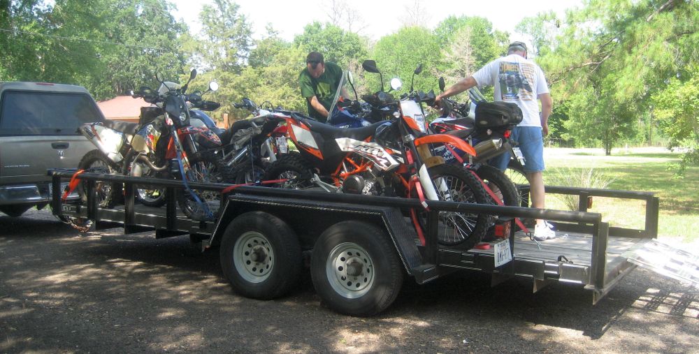


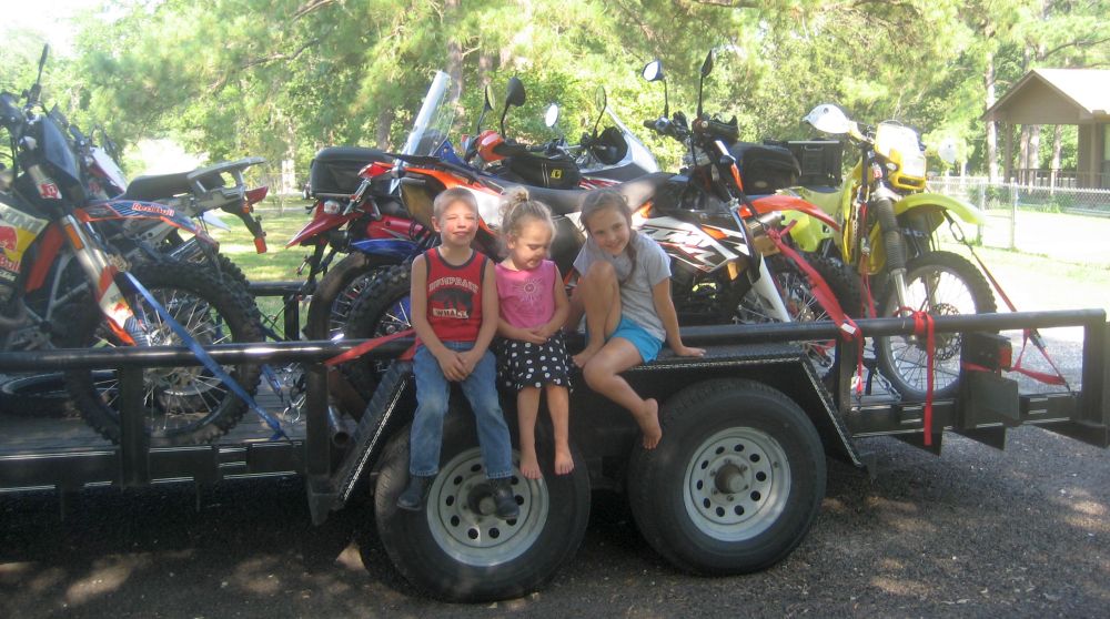


 Loaded down, we head back to the house. I spend the rest of the evening going over the routes and deciding where we'll be riding tomorrow. Then it is finally off to the land of Nod where I dream of things to come...
 Sam
Sam