Ha! Thought I was the only person who thought about this kind of stuff while riding!


-
 Welcome to the Two Wheeled Texans community!
  Feel free to hang out and lurk as long as you like. However, we would like to encourage you to register so that you can join the community and use the numerous features on the site. After registering, don't forget to post up an introduction!
You are using an out of date browser. It may not display this or other websites correctly.
You should upgrade or use an alternative browser.
You should upgrade or use an alternative browser.
Stories from Occupied New Mexico
- Thread starter TexasShadow
- Start date
Re: Big Skies of Big Bend
The Awareness Motorcycle Riding Club")
Absolutely!!!Then on top of all that, there is just this sense of awe at the complexity and interrelatedness of everything and yet it is also so incredibly aesthetically pleasing to the eye. How marvelous that the world is like this, from the MICROscopic all the way up to the MACROscopic! Fascinating.
The Awareness Motorcycle Riding Club
- Joined
- Feb 28, 2003
- Messages
- 51,246
- Reaction score
- 8,254
- Location
- Huntsville
- First Name
- Scott
- Last Name
- Friday
Ha! Thought I was the only person who thought about this kind of stuff while riding!

ThanksDesert was spent with great friends in the desert. Gray Friday was gray and windy, but in the desert, it's all good. The campfire sagas were uplifting with stories and unsung ballads, solutions to the world crises, and reaffirmation of friendship, which money can't buy.

Then this, just on the heel of finishing the book '[ame="http://www.amazon.com/Contrabando-Confessions-Drug-Smuggling-Texas-Cowboy/dp/0060883103"]Contrabando[/ame]' yesterday. Anyone that thinks that life along or across the border is 'romantic' and 'idyllic' is ignorant of reality. There is a war across the border.
- Joined
- Oct 19, 2006
- Messages
- 8,250
- Reaction score
- 36
- Location
- Big sky country; Ronan, MT
- First Name
- Bruce
- Last Name
- Taylor
- Joined
- Feb 28, 2003
- Messages
- 51,246
- Reaction score
- 8,254
- Location
- Huntsville
- First Name
- Scott
- Last Name
- Friday
Then this, just on the heel of finishing the book 'Contrabando' yesterday. Anyone that thinks that life along or across the border is 'romantic' and 'idyllic' is ignorant of reality. There is a war across the border.
Janet
0
http://www.dailymail.co.uk/news/art...xecuted-surviving-assassination-attempts.html
'Please spare my little girl': How Mexico's fearless female mayor sacrificed herself to save her daughter's life as she was abducted by drug gang, tortured and executed
Maria Santos Gorrostieta had been stabbed, beaten and burned
She defied Mexico's powerful drug gangs, who twice tried to gun her down
She was kidnapped in broad daylight in front of her terrified daughter
The former mayor leaves behind three children
By Sam Webb
PUBLISHED: 06:15 EST, 26 November 2012 | UPDATED: 16:23 EST, 26 November 2012
Brave: Dr Maria Santos Gorrostieta has been found beaten to death at the side of a road. She defied Mexico's powerful drug gangs and survived two assassination attempts, the first of which claimed the life of her husband
The woman mayor who was kidnapped and murdered by a Mexican drug gang pleaded with her attackers for her young daughter’s life, it emerged today.
Maria Santos Gorrostieta, who had already survived two assassination attempts, was driving the child to school at around 8.30am when she was ambushed by a car in the city of Morelia.
The 36-year-old was hauled from her vehicle and physically assaulted as horrified witnesses watched, according to newspaper El Universal.
They described how she begged for her child to be left alone and then appeared to get into her abductors’ car willingly.
The little girl was left wailing as her mother was driven away on Monday November 12.
For the next week, her frantic family waited by the phone for a ransom call that never came.
Gorrostieta’s body – stabbed, burned, battered and bound at wrist and ankle – would finally be found eight days on dumped by a roadside in San Juan Tararameo, Cuitzeo Township.
She left behind her daughter and two sons as well as her second husband Nereo Delgado Patinoran.
Hailed as a heroine of the 21st century, her death has prompted much soul-searching in a country ravaged by violence.
The decision to withdraw her security team in November last year – and her police escort in January – has come under particular scrutiny.
Gorrostieta was elected as mayor of Tiquicheo, a rural district in Michoacan, west of Mexico City, in 2008.
Almost immediately, she received threats. The first assassination attempt came in October 2009 when the car she was travelling in with her first husband Jose Sanchez came under fire from gunmen in the town of El Limone. The attack claimed his life but Gorrostieta lived.
She battled back from her injuries in the face of overwhelming tragedy, but she was not destined to know peace.
The next attempt on her life was just three months later, when an masked group carrying assault rifles ambushed her on the road between Michoacan and Guerreo state. The van she was traveling in was peppered by 30 bullets. Three hit her.
This time her wounds were more severe, leaving multiple scars and forcing her to wear a colostomy bag. She was left in constant pain.
But with unimaginable courage – and despite being a marked woman – she remained defiant to the very end.
Read more: http://www.dailymail.co.uk/news/art...ing-assassination-attempts.html#ixzz2DSp3y0J8
Last edited:
Storms Overhead

Spent a day and 1/2 at El Punto Coyote. It seems to be a continuing pattern that whenever I go out there and stay, storms come rolling in. That night we had a doozy.
As usual, it took awhile to build. Clouds started building to the west and north. Then we were surrounded in all directions.


We started on a hike, but turned back when the squalls and thunder in the west caught up with us. We took refuge under the ramada as it rained. I didn't have my camera with me, so I got shots only before and after the rain and thunder shower. My entertainment was watching rainwater drizzle out of the new gutter and downspout into a barrel.
Sun shown only when through holes in the clouds, and lit up portions of the landscape like a giant spotlight. The surrounding landscape remained shrouded in shadow while the moving spotlight lit features that glowed with accentuated color.

One of my favorites is Hen Egg Mnt and the Molar (mesa) next to it. Hen Egg glows rose, lavender, and green depending on the angle of the sun.

The squalls moved to the east and south, concentrating and hammering the Chisos Mnts as well as just north of the range. As the sun set, three separate cells dumped rain in the east. All the cliffs and mountains to the east had a bright and fiery rosy hue with the falling rain. One cell had a short but wide rainbow. No photos; we had resumed our hike and again, I didn't have camera. I was too awestruck anyway.
While showers and lightening continued to pound to the east and south, the sun continued it's downward trend in the west, often playing hide and seek behind big thick tufty clouds. Although the real color show was the rosy painted glow on the eastern horizon, we were treated to an abbreviated sunset over the tall ridge.


The clouds later parted to reveal a bright full moon.
It was an amazing night.
We noticed the occotillo had budded out in full flaming red flowers even before the storm had hit, as if they were expectant and ready to receive the precious moisture. One of the recently transplanted agave enjoyed the moisture, too.


The adobe blocks picked up near Alpine were unloaded from the trailer during the day before the storm and glowed along with the ramada in the setting sun. The blocks I had made at Cedar Springs Ranch survived the trip home and were safely stored under cover in the ramada for later use in the arched window of the west wall.

During a hike the next morning we found a pile of cougar scat on our road. I estimated it was dropped within 24 hours, perhaps less. Seems that the rodents are making a comeback after the drought, judging by the mass of short gray hair in the scat.
And something dragged off my javelina skull!

Spent a day and 1/2 at El Punto Coyote. It seems to be a continuing pattern that whenever I go out there and stay, storms come rolling in. That night we had a doozy.
As usual, it took awhile to build. Clouds started building to the west and north. Then we were surrounded in all directions.
We started on a hike, but turned back when the squalls and thunder in the west caught up with us. We took refuge under the ramada as it rained. I didn't have my camera with me, so I got shots only before and after the rain and thunder shower. My entertainment was watching rainwater drizzle out of the new gutter and downspout into a barrel.
Sun shown only when through holes in the clouds, and lit up portions of the landscape like a giant spotlight. The surrounding landscape remained shrouded in shadow while the moving spotlight lit features that glowed with accentuated color.
One of my favorites is Hen Egg Mnt and the Molar (mesa) next to it. Hen Egg glows rose, lavender, and green depending on the angle of the sun.
The squalls moved to the east and south, concentrating and hammering the Chisos Mnts as well as just north of the range. As the sun set, three separate cells dumped rain in the east. All the cliffs and mountains to the east had a bright and fiery rosy hue with the falling rain. One cell had a short but wide rainbow. No photos; we had resumed our hike and again, I didn't have camera. I was too awestruck anyway.
While showers and lightening continued to pound to the east and south, the sun continued it's downward trend in the west, often playing hide and seek behind big thick tufty clouds. Although the real color show was the rosy painted glow on the eastern horizon, we were treated to an abbreviated sunset over the tall ridge.
The clouds later parted to reveal a bright full moon.
It was an amazing night.
We noticed the occotillo had budded out in full flaming red flowers even before the storm had hit, as if they were expectant and ready to receive the precious moisture. One of the recently transplanted agave enjoyed the moisture, too.
The adobe blocks picked up near Alpine were unloaded from the trailer during the day before the storm and glowed along with the ramada in the setting sun. The blocks I had made at Cedar Springs Ranch survived the trip home and were safely stored under cover in the ramada for later use in the arched window of the west wall.
During a hike the next morning we found a pile of cougar scat on our road. I estimated it was dropped within 24 hours, perhaps less. Seems that the rodents are making a comeback after the drought, judging by the mass of short gray hair in the scat.
And something dragged off my javelina skull!
"Mexico is at war with itself." - from the book "[ame="http://www.amazon.com/Boquillas-Crossing-Rawles-Williams/dp/1469739267"]Boquillas Crossing[/ame]."There are some SICK people in this world. It really makes you appreciate the good folks all the more.
The county Sheriff's department wishes us to be aware of events on the other side of the river: "Piedras Negras; Four bodies were discovered in a taxi, while the other two died in a second incident and found in a house in the Colonia Acoros......The elements are in place for Piedras and Acuña to become the hotbed of the drugwar violence. " My MD, who grew up in this area, his family one of the original settlers of Casa Piedra, and now practices in Dallas, pleaded with me not to cross the border. It is not the same as when he grew up there, and knows families that have lost family members when they ventured into Mexico for a visit. A Hispanic woman I met in NM was warned by other family members not to return to Mexico to visit her extended family; word is out that any member of her family from the States would be kidnapped.
- Joined
- Oct 19, 2006
- Messages
- 8,250
- Reaction score
- 36
- Location
- Big sky country; Ronan, MT
- First Name
- Bruce
- Last Name
- Taylor
More beautiful photos  Thanks for sharing.
- Joined
- Sep 6, 2007
- Messages
- 623
- Reaction score
- 36
- Location
- Burleson, TX
- First Name
- Marty
- Last Name
- Johnston
As always your photos and narrative are awesome!!
Sunsets and Roads from Occupied New Mexico: P1
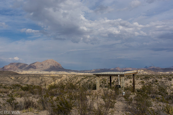
Mosied up to Thirty Eight Hill to watch the sunset over the mountains in the west. Climbed a ridge that overlooks FM 170. Wasn't spectacular, but it was wonderful just the way it was.

"Sometimes the magic works, and sometimes it doesn't." - Chief Old Lodge Skins/Grandfather, in 'Little Big Man'.
Or, "It's all good."

Mosied up to Thirty Eight Hill to watch the sunset over the mountains in the west. Climbed a ridge that overlooks FM 170. Wasn't spectacular, but it was wonderful just the way it was.
"Sometimes the magic works, and sometimes it doesn't." - Chief Old Lodge Skins/Grandfather, in 'Little Big Man'.
Or, "It's all good."
- Joined
- Feb 28, 2003
- Messages
- 51,246
- Reaction score
- 8,254
- Location
- Huntsville
- First Name
- Scott
- Last Name
- Friday
Sometimes it's not about how it looks. Sometimes it is just about being there.
Sometimes it's not about how it looks. Sometimes it is just about being there.
Burro Mesa

I have this thing for geneology, or history of families. People have asked me why I am so interested, and spend so much time and effort learning about other families that are not my own. I think it is because I don't have much of a family. Or perhaps it is my inherent curiosity of the role of families in history. Families *are* history.
As Charles Bowden portrays so eloquently in his book, Down by the River (a documentary of family, drugs and border life), family is the most close-knitting tie amongst people (other than money). Family is people, power and, for better or worse, it is who we are. There's truth in the cliche, "You can pick your jeans, but you can't pick your genes." As a scientist, I know the truth in that. As a novice student of sociology (I never would have admitted that 10 years ago), it goes deeper than just genes.
I have had a keen interest, almost an uncanny empathy, with Frederico Villalba's family. At least, his story; his family's stories. His family, and the Vasquez family (another family history I have been digging into; a descendent is my MD in Dallas), are representative fof the non-Anglican individuals, and their families, that have formed this country just as any European or Euro-American has. That has explicit application to the Big Bend area, because it is on the border of Mexico. And nowhere else in this country do historical roots go deeper and still hang a hold onto modern life than along the southern border (I have lived half of my life near the northern border near Canada; it is not the same, not by far).
Back to the Villalbas. My interest in the family began even before the book, Federico Villalba's Texas, a Mexican Pioneer in the Big Bend ,was published by one of Frederico's descendents, Juan Manuel Casas. The book answered many questions that had popped into my head over the years, but it also cued more questions.
According to Casas, Frederico and his first wife had at one time settled on or near Burro Mesa in the BB National Park. Casas claims that Villalba owned several thousand acres from the west side of the Chisos Mnts. to Terlingua Creek. That is a LOT of territory. And it includes Burro Mesa.
Supposedly, Villalba established a goat and sheep ranch somewhere on Burro Mesa. I overheard someone at the Starlight Theater/restaurant mention that Villalba's old rock corral is still intact on top of Burro Mesa. So, I guess you probably know by now that this was an impetus for a hike up on top of Burro Mesa. (There is another reason, but that's later)
Apache We Will Go
There are two trails up to the top of Burro Meso. One is well known and on the maps. The other is not, on both accounts. The reason is the second impetus for the hike I had in mind (Mission Impossible No. 1): Apache Canyon.
I came across several references to a canyon on the west side of Burro Mesa, called Apache Canyon. After a day of searching on Google ('ask and ye shall receive'), I discovered that this canyon contains a rare quarry and archeological find. In fact, it is on the National Register of Historic Places as an archeological 'district', and is an active archeological research site. Hence.... why all the more recent maps do not have the trails to Apache Canyon. Rather than an outright ban against hikers (although, no outback camping is permitted on the mesa, or above 3,400 feet in the area), the trails have been 'pulled' off the maps. I have heard tidbits of who is responsible for that, but I won't perpetuate it here. (Same individual is also of the mind that locked gates should be put at all entries into the park, and that all horses and motorcycles should be banned from the park).
Moving on...... I have been able to glean information from others that have hiked into Apache Canyon on the best route into/down into the canyon. After spending an hour or so (I have time, now!) on Google Earth, I think I have confidently located the way down into the canyon from the top of Burro Mesa.

Burro Mesa (Is this the way to San Burro Mesa?)
One day, I got the idea to see if Bob and Gloria wanted to join in. They kept talking about a place they had hiked to before, that had a stone corral and ruins, but I could not be sure if that was the same place. The more we talked about it, the more it sounded the two were the same.
We agreed to pack up water and lunch, meet together and head off down Maxwell's Silver Hammer Drive to a pull off that I read is the place to park for the Apache Trail. As we got to the place designated by GPS coordinates I had found online, Bob and Gloria confirmed this was the beginning of the trail for the top of Burro Mesa.
Now, to avoid confusion, this is not the same trail as the top of the Burro Mesa Pour-off (which, btw, is labeled as 'Javalina Pour-off' on an older USGS topo map; which one is right? who cares?). For those familiar with the Sam Nail Ranch, he used to lead his cattle up on top of Burro Mesa during the hot summer months. So, there is mention of a two-track road that goes up there. A state park ranger confirmed that, and told me it is a very obvious 'road'. Of course, when I asked him the last time he was up there, it was about eight years ago. That road has now been almost obliterated. In fact, the trail is hard to discriminate from the rest of the scrub brush.

The four of us picked our trails, sometimes separately from each others, except for when a real 'trail' was discernible. Which was not often the case. In fact, Bob and Gloria commented that it has gotten overgrown since the last time they hiked it; last year. There is a sign-in box installed by the park staff. There was only one other entry for this year beside us. But then, Laird told me they never sign in on those things. Being a former park employee, I know that sign-ins can save lives, let alone provide useful information about traffic on trails. So we signed in.
We hiked up and down hills, through and along arroyos, guessed at the trail, and bushwacked when in doubt. We knew of a few landmarks to look for, and the fact that Bob and Gloria had hiked this trail was helpful in that they were familiar with some of the landmark I had only seen as images on a digital map.
As we finally gained elevation, got thirsty and hungry, we found one of the landmarks, and then some. On the topo maps is noted a spring. Those who have hiked the trail have commented that a large, but old tinaja sits on the east side of the two hills we scouted for as primary landmarks. But all references I have read from those who have hiked this trail have commented that it has always been dry. Well, not this year.


In fact, it was full of water. And mosquitoes. Not surprising since this year has had a record rainfall in may places around Big Bend (up to 22 inches!!). It was a beautiful sight to see, and knowing that this was probably full most years back in the late 1800's- early 1900's, it was a sight to see.
We had about another 3/4 mile to go before the corrals, according to the topo maps, but we were invigorated by then. And now we were finding chert shards scattered along the trail (as well as tarantulas, Mormon crickets, and other critters). Still not sure where exactly the quarry is, but, according to my Front Porch archeology expert, Ken Barnes, the entire area was a site of encampments by various indigenous groups. Here, they fired chert in campfires, hit it with other rock, such as flint, and made many an arrow. Because of the type of chert found here, and the enormous amount (and rare colors), arrows made from Burro Mesa chert have been found all around the SW US as far back as 10,000 years ago.
Finally, we found our two hills with a wide saddle in between and the rock corrals. The rock walls are about 1.5-2 feet thick and dry stacked, about 4.5' high, and obviously of local rock. But the feat is that this corral is huge. Actually, it it two corrals with a common middle wall.

We were hungry and thirsty by then; it was 4 miles up to the top of the mesa and it took about 3 hours (by someone's watch). We found a large boulder to sit and eat lunch and quench our thirst. Looks like we weren't the only ones to use this boulder; there was a large mortar hole, probably used to grind mesquite beans into flour.


We ate, drank and did what ever else needed doing, and then hiked uphill towards the ruins of a rock cabin. It was small; probably about 8x10'. But it works, or worked for someone. It also overlooked the corrals; very strategic.

Ed started climbing the hill behind the rock cabin. And the rest of us followed in our own haphazard routes. I remembered how I used to climb hills when in the forest service; never a straight path up or down; rather a zig-zagged path sideways. It reduces falling down.
Ed made it to the top before anyone else, but then, this wasn't a contest or race. We all got there in our own time, as it should be. The views were phenomenal.


The corrals and cabin could be seen below.

And we could see Study Butte and Terlingua, far into the distance.

Of course, I had a one-track mind and I was looking for.. Apache Canyon. From the top of this hill, one can see just the upper edge of the canyon head. It is known for chert in the shades of red, pink and white. I found it.

Because it was getting late, we decided to head back. There is no longer a discernible trail to the canyon head, as I tried to relay to Laird. ("What? You didn't go to the canyon trail? It's right there, only a 1/4 mile from the rock cabin." "No, Laird. It is now over grown with thick mesquite; there is no road there anymore!!!!!") But we know the general direction to head to get to the supposed trail that descends down into the canyon. However, despite what I have been told, it's pretty much bushwacking time.
Disappointed, I reluctantly agreed to the rest of the crew that we needed to head back. It would take us another 3 hours go get to the truck. We agreed that we would try Apache Canyon another day.
So off we went.


Bob led the way. I followed up the rear so I could take a few photos this time and just take my time. Of course, when one is hiking east towards the Chisos Mnts, how can one avoid stopping to gaze at the most awesome geology that stands before you?


We were all getting tired and hungry as we got closer. "Are we there yet?" Long shadows were telling us it was getting time to go into dusk mode. Visions of dinner were dancing in our heads. By the time we got to the truck, we had all decided to eat out that night.
We drove to one of our favorite places for an evening light meal: Sierra Grill. The main attraction for us is the patio up over the entry. It's rarely busy up there, and one can watch the sunset both on the Chisos Mnts, and to the west over Reed Plateau.


And it was a full moon to boot!!


And we listened to Bob Stories, compete with hand gestures

And thus ended the day.
Are the rock cabin and corral ruins part of Villalba's homestead? No one seems to know. I contacted an acquaintance who is a descendent of several families way back to La Coyota and the Chisos Mining Company, but he didn't have any information regarding the Villalba family. A local historian thinks that the Villalba's original homestead was on the bank of Terlingua Creek near Fulcher Road (supposedly the ruins of this home are still there). But they also lived for a period of time near the mine which he owned in partnership with Will Study (silent partner, too, he was; how did he get the mine, butte and town named after him if he didn't even live here?!?!?!).
I think a direct query is in order to author Juan Casas. Meantime, I learned where Villalba's original store was (about 1/4 mile from where I sit at this moment), and the rock ruins on the west side of Hwy 118, before the RV park, is the old school that Villalba built for the children of the Mexican miners.
If anyone is ever interested in visiting Frederico, you can find him in the Terlingua cemetery. His headstone is behind the tall one of his son, Jacobo.

I have this thing for geneology, or history of families. People have asked me why I am so interested, and spend so much time and effort learning about other families that are not my own. I think it is because I don't have much of a family. Or perhaps it is my inherent curiosity of the role of families in history. Families *are* history.
As Charles Bowden portrays so eloquently in his book, Down by the River (a documentary of family, drugs and border life), family is the most close-knitting tie amongst people (other than money). Family is people, power and, for better or worse, it is who we are. There's truth in the cliche, "You can pick your jeans, but you can't pick your genes." As a scientist, I know the truth in that. As a novice student of sociology (I never would have admitted that 10 years ago), it goes deeper than just genes.
I have had a keen interest, almost an uncanny empathy, with Frederico Villalba's family. At least, his story; his family's stories. His family, and the Vasquez family (another family history I have been digging into; a descendent is my MD in Dallas), are representative fof the non-Anglican individuals, and their families, that have formed this country just as any European or Euro-American has. That has explicit application to the Big Bend area, because it is on the border of Mexico. And nowhere else in this country do historical roots go deeper and still hang a hold onto modern life than along the southern border (I have lived half of my life near the northern border near Canada; it is not the same, not by far).
Back to the Villalbas. My interest in the family began even before the book, Federico Villalba's Texas, a Mexican Pioneer in the Big Bend ,was published by one of Frederico's descendents, Juan Manuel Casas. The book answered many questions that had popped into my head over the years, but it also cued more questions.
According to Casas, Frederico and his first wife had at one time settled on or near Burro Mesa in the BB National Park. Casas claims that Villalba owned several thousand acres from the west side of the Chisos Mnts. to Terlingua Creek. That is a LOT of territory. And it includes Burro Mesa.
Supposedly, Villalba established a goat and sheep ranch somewhere on Burro Mesa. I overheard someone at the Starlight Theater/restaurant mention that Villalba's old rock corral is still intact on top of Burro Mesa. So, I guess you probably know by now that this was an impetus for a hike up on top of Burro Mesa. (There is another reason, but that's later)
Apache We Will Go
There are two trails up to the top of Burro Meso. One is well known and on the maps. The other is not, on both accounts. The reason is the second impetus for the hike I had in mind (Mission Impossible No. 1): Apache Canyon.
I came across several references to a canyon on the west side of Burro Mesa, called Apache Canyon. After a day of searching on Google ('ask and ye shall receive'), I discovered that this canyon contains a rare quarry and archeological find. In fact, it is on the National Register of Historic Places as an archeological 'district', and is an active archeological research site. Hence.... why all the more recent maps do not have the trails to Apache Canyon. Rather than an outright ban against hikers (although, no outback camping is permitted on the mesa, or above 3,400 feet in the area), the trails have been 'pulled' off the maps. I have heard tidbits of who is responsible for that, but I won't perpetuate it here. (Same individual is also of the mind that locked gates should be put at all entries into the park, and that all horses and motorcycles should be banned from the park).
Moving on...... I have been able to glean information from others that have hiked into Apache Canyon on the best route into/down into the canyon. After spending an hour or so (I have time, now!) on Google Earth, I think I have confidently located the way down into the canyon from the top of Burro Mesa.
Burro Mesa (Is this the way to San Burro Mesa?)
One day, I got the idea to see if Bob and Gloria wanted to join in. They kept talking about a place they had hiked to before, that had a stone corral and ruins, but I could not be sure if that was the same place. The more we talked about it, the more it sounded the two were the same.
We agreed to pack up water and lunch, meet together and head off down Maxwell's Silver Hammer Drive to a pull off that I read is the place to park for the Apache Trail. As we got to the place designated by GPS coordinates I had found online, Bob and Gloria confirmed this was the beginning of the trail for the top of Burro Mesa.
Now, to avoid confusion, this is not the same trail as the top of the Burro Mesa Pour-off (which, btw, is labeled as 'Javalina Pour-off' on an older USGS topo map; which one is right? who cares?). For those familiar with the Sam Nail Ranch, he used to lead his cattle up on top of Burro Mesa during the hot summer months. So, there is mention of a two-track road that goes up there. A state park ranger confirmed that, and told me it is a very obvious 'road'. Of course, when I asked him the last time he was up there, it was about eight years ago. That road has now been almost obliterated. In fact, the trail is hard to discriminate from the rest of the scrub brush.
The four of us picked our trails, sometimes separately from each others, except for when a real 'trail' was discernible. Which was not often the case. In fact, Bob and Gloria commented that it has gotten overgrown since the last time they hiked it; last year. There is a sign-in box installed by the park staff. There was only one other entry for this year beside us. But then, Laird told me they never sign in on those things. Being a former park employee, I know that sign-ins can save lives, let alone provide useful information about traffic on trails. So we signed in.
We hiked up and down hills, through and along arroyos, guessed at the trail, and bushwacked when in doubt. We knew of a few landmarks to look for, and the fact that Bob and Gloria had hiked this trail was helpful in that they were familiar with some of the landmark I had only seen as images on a digital map.
As we finally gained elevation, got thirsty and hungry, we found one of the landmarks, and then some. On the topo maps is noted a spring. Those who have hiked the trail have commented that a large, but old tinaja sits on the east side of the two hills we scouted for as primary landmarks. But all references I have read from those who have hiked this trail have commented that it has always been dry. Well, not this year.
In fact, it was full of water. And mosquitoes. Not surprising since this year has had a record rainfall in may places around Big Bend (up to 22 inches!!). It was a beautiful sight to see, and knowing that this was probably full most years back in the late 1800's- early 1900's, it was a sight to see.
We had about another 3/4 mile to go before the corrals, according to the topo maps, but we were invigorated by then. And now we were finding chert shards scattered along the trail (as well as tarantulas, Mormon crickets, and other critters). Still not sure where exactly the quarry is, but, according to my Front Porch archeology expert, Ken Barnes, the entire area was a site of encampments by various indigenous groups. Here, they fired chert in campfires, hit it with other rock, such as flint, and made many an arrow. Because of the type of chert found here, and the enormous amount (and rare colors), arrows made from Burro Mesa chert have been found all around the SW US as far back as 10,000 years ago.
Finally, we found our two hills with a wide saddle in between and the rock corrals. The rock walls are about 1.5-2 feet thick and dry stacked, about 4.5' high, and obviously of local rock. But the feat is that this corral is huge. Actually, it it two corrals with a common middle wall.
We were hungry and thirsty by then; it was 4 miles up to the top of the mesa and it took about 3 hours (by someone's watch). We found a large boulder to sit and eat lunch and quench our thirst. Looks like we weren't the only ones to use this boulder; there was a large mortar hole, probably used to grind mesquite beans into flour.
We ate, drank and did what ever else needed doing, and then hiked uphill towards the ruins of a rock cabin. It was small; probably about 8x10'. But it works, or worked for someone. It also overlooked the corrals; very strategic.
Ed started climbing the hill behind the rock cabin. And the rest of us followed in our own haphazard routes. I remembered how I used to climb hills when in the forest service; never a straight path up or down; rather a zig-zagged path sideways. It reduces falling down.
Ed made it to the top before anyone else, but then, this wasn't a contest or race. We all got there in our own time, as it should be. The views were phenomenal.
And we could see Study Butte and Terlingua, far into the distance.
Of course, I had a one-track mind and I was looking for.. Apache Canyon. From the top of this hill, one can see just the upper edge of the canyon head. It is known for chert in the shades of red, pink and white. I found it.
Because it was getting late, we decided to head back. There is no longer a discernible trail to the canyon head, as I tried to relay to Laird. ("What? You didn't go to the canyon trail? It's right there, only a 1/4 mile from the rock cabin." "No, Laird. It is now over grown with thick mesquite; there is no road there anymore!!!!!") But we know the general direction to head to get to the supposed trail that descends down into the canyon. However, despite what I have been told, it's pretty much bushwacking time.
Disappointed, I reluctantly agreed to the rest of the crew that we needed to head back. It would take us another 3 hours go get to the truck. We agreed that we would try Apache Canyon another day.
So off we went.
Bob led the way. I followed up the rear so I could take a few photos this time and just take my time. Of course, when one is hiking east towards the Chisos Mnts, how can one avoid stopping to gaze at the most awesome geology that stands before you?
We were all getting tired and hungry as we got closer. "Are we there yet?" Long shadows were telling us it was getting time to go into dusk mode. Visions of dinner were dancing in our heads. By the time we got to the truck, we had all decided to eat out that night.
We drove to one of our favorite places for an evening light meal: Sierra Grill. The main attraction for us is the patio up over the entry. It's rarely busy up there, and one can watch the sunset both on the Chisos Mnts, and to the west over Reed Plateau.
And it was a full moon to boot!!
And we listened to Bob Stories, compete with hand gestures
And thus ended the day.
Are the rock cabin and corral ruins part of Villalba's homestead? No one seems to know. I contacted an acquaintance who is a descendent of several families way back to La Coyota and the Chisos Mining Company, but he didn't have any information regarding the Villalba family. A local historian thinks that the Villalba's original homestead was on the bank of Terlingua Creek near Fulcher Road (supposedly the ruins of this home are still there). But they also lived for a period of time near the mine which he owned in partnership with Will Study (silent partner, too, he was; how did he get the mine, butte and town named after him if he didn't even live here?!?!?!).
I think a direct query is in order to author Juan Casas. Meantime, I learned where Villalba's original store was (about 1/4 mile from where I sit at this moment), and the rock ruins on the west side of Hwy 118, before the RV park, is the old school that Villalba built for the children of the Mexican miners.
If anyone is ever interested in visiting Frederico, you can find him in the Terlingua cemetery. His headstone is behind the tall one of his son, Jacobo.
- Joined
- Feb 28, 2003
- Messages
- 51,246
- Reaction score
- 8,254
- Location
- Huntsville
- First Name
- Scott
- Last Name
- Friday
Bob can certainly tell some stories! 
Loving the history lessons. Look forward to the Apache Canyon report/pics
Loving the history lessons. Look forward to the Apache Canyon report/pics
- Joined
- Oct 19, 2006
- Messages
- 8,250
- Reaction score
- 36
- Location
- Big sky country; Ronan, MT
- First Name
- Bruce
- Last Name
- Taylor
Nice to see stuff that is off the beaten path. Most of us visitors don't have time to get out into the back country. Thanks

- Joined
- Oct 19, 2006
- Messages
- 8,250
- Reaction score
- 36
- Location
- Big sky country; Ronan, MT
- First Name
- Bruce
- Last Name
- Taylor
Janet
0
One to Remember
Somewhere, at some time, you might find a glimpse of a fleeting reality where every triviality, all the daily complexities and demands dissipate into the air. The old rocks welcome you and remind you that you are small. Trees and plants of all sizes and colors invite you to look closely, touch and share their space. You can't see the animals who call this place their home, but their tracks and sign let you know they play hide and seek. The child inside that we have too often discarded, or buried in our own personal dungeons, surfaces and is delighted. And like a mother wrapping all her children in her big comforting arms, the wild outside us merges with the innocence of our inner child and the cautious adult armor we sometimes bear like a cross. We become whole.

It was my birthday. I don't often celebrate or even acknowledge the day, often forgetting it myself. I sometimes go off on my own and reflect on the year, my life, the future; then shrug it off and carry on like any other day. November seems like a month of contradictions for me every year. So I was born on this day in this month. So were thousands of other people. It's no big deal. I'm not special.
I'm not big on presents. I don't like the attention because it's not special and I don't subscribe to obligations of buying and giving presents dictated by tradition. Presents should be given based on genuine caring. I only want to do something special: go camping, go to a movie, go for a long bike ride, do something different. So I did.
I suggested to Ed that we invite Bob and Gloria to go on a day's hike in the Chisos Basin, something I have not yet done. I chose the Window Trail because it was relatively short, ~5 mile round trip, with a drop of 980 feet, and top it off with cobbler and ice cream at the Basin Lodge restaurant. So we did.
Packing hiking boots, camera, snacks and water on the bikes, we rode up to the campground in the Basin and struck out on the trail. We were joined by a new addition to the Trickster family, a large coyote puppet, compliments of Ed. Indeed, the two of them make a really good team, as you will see.

After a short but quite steep beginning, the trail began to reveal cliffs tinged with orange, brown and muted green where lichens form large patches indicating moisture and shade from the sun. Tall rough grasses and other interesting plant life begin to dot the typical low shrubby desert growth of mesquite, prickly pear and creosote. Soon we see unusually tall yuccas, some with flowering stalks, interspersed with giant clumps of agave. And I'm constantly distracted by unknown tiny wildflowers that blast with color and gray-green foliage, or branches of shrubs I've never seen before.

The trail gradually becomes a winding gravelly path with a moderate descent. It's easy to keep a comfortable pace in the wide open space. Soon my attention is directed up and ahead as giant upright boulders appear, like monstrous flakes of skin shed by the inside of a great mountain. Grasses hugging the ground begin to give way to shrubs with gnarled branches and small evergreen leaves. Some small trees have yellowing leaves stubbornly hanging on and it reminds us that the temperatures here in this microclimate are very different from those that we are used to on the warm desert floor. At times we all just stop and absorb the views around us.


I am attracted to the Chisos Mountains like a food magnet pulls a starving person. This group of mountains defies the desert stereotype of drifting sand dunes and absence of life (topic of an essay in progress). Like the surrounding rugged and angular valleys and dry arroyos, these mountains were created by a changing landscape: landmass collisions, continental distentions, and an ancient river basin whose origins began with mountains that rose far to the northwest.
Unlike in the east and north, the landscapes of mountain ranges in the Chihuahuan desert are relatively new. Earlier land mass collisions far to the west caused deposited sediments of an ancient sea to rise and form the Sierra Madre mountain range along the eastern edge of the desert in Mexico. More tectonic collisions initiated volcanic activity for thousands of years, during which the western Sierra Madra mountain range was formed. This was following by periods of several millions of years during which the North American continental plate stretched and distended. The last known period of tectonic loosening (called the Rio Grande distension) began over five million years ago, and which we are currently experiencing. The isolated groups of mountains that we know today, as well as the features associated with the Rio Bravo, were created during this period. And will continue long after we are gone.
Anyone visiting the southern Big Bend region of Texas associates it with the Chisos Mountains, an isolated group of stark rock sharply thrusting upwards out of the northern Chihuahuan desert. This group, and others like it, are known as 'sky islands', isolated oases surrounded by an entirely different environment. Because of their often perceived abrupt change in terrain, they are considered 'islands in a sea of desert'. Yet even though they are often widely separated by several to hundreds of miles of hot and dry desert, these islands are cooler, wetter and create their own ecology, even weather.
The steep slopes of these mountains transition from low elevation desert to high elevation mountain tops. Along these transitions are overlapping ecosystems that favor a changing myriad of vegetation. From the typical hot and dry-adapted cacti and low scrub brush, vegetation zones transition to lush sections containing many species of oak and junipers, then soaring cliffs of pines, finally to clumps of fir and spruce trees at the top. And, because each sky island is ecologically isolated, some species of plants and small animals cannot move easily from one island to the next.
The complex and changing nature of diverse life and its surrounding geomorphology is what captivates me. Like a child in a new world, I can spend hours, even days, exploring the small and large rocks, diversity and richness of wildlife -from lichens and moss to the big predators and tiny birds. It's a playground for the inquisitive child inside and the largest field lab for the scientist that was the successor of that child. This is what I try to do on my birthdays; celebrate that child and adult because they are connected. And I loved every minute of that hike, sharing it with people I cared about.


During our hike, our companion coyote demonstrated his trickster self with the help of Ed's child inside. Coyote traveled most of the hike cradled on Ed's hand, and often in his folded arms. Because of its size and surreal resemblance to a small live coyote, most fellow hikers of all ages reacted to its presence; from surprise, amusement, entertainment, and, with one adult woman, fear.


Reactions ranged from identification as a small dog, a raccoon, a cat, a cougar cub, to plain perplexity. Some of the younger children (and an occasional adult) stopped to stroke its 'fur' as Coyote's mouth 'panted' and his muzzle 'smiled'. Ed actually became very adept at imitating an adolescent canine through his arms and hand, down to a wagging tail. And, of course, we derived immense amusement from the mini puppet shows.
As the trail descends deeper into the Basin floor, we are ringed with towering cliffs whose colors overlap with yellow, orange, rose and dark brown. Some of the towering crags are angular rock almost resembling spikes of geological teeth. Others are giant round boulders as big as a house. On closer inspection, some of these reveal themselves as humge amalgamations of different types of rock all fused into one resembling some giant transparent and complex dead organism. Some have waves as if the dead organism spasmed while being melded together and belched from the throat of an angry volcano. Almost a juxtaposition, and an example of enduring and perseverance of opportunity and adaptation, life grows in and/or out of these hard geological remnants, finding any pocket or crevasse to take hold and squeeze out water and food, from moss and lichens, to succulents to small trees. And we are amazed at how they thrive even in glazed and fragmented black rock born of fire.


The trail begins to wind and descend into Oak Creek Canyon. The changes in vegetation are testimony to periods of flowing water and lingering moisture. Grasses and tens of wildflower species grow alongside the trail where light penetrates easily. Off the trail, the canyon thickens with gnarled and intertwining trees and shrubs. As the trail leveled next to the dry creek, we came around a corner to enter a tunnel of vines that do as vines do: seek opportunities to twin themselves around shrub and tree branches, or attach themselves by little vestigial stems commonly called 'tendrils.'
One look at the leaves and I knew right away I had found the elusive 'canyon grape'. Fewer vines are found in the Chihuahuan desert than in the Sonoran desert, which both share a boundary. That is attributed solely to the evolution of the desert's geomorphology: its mountain ranges and elevation. Because the Sonoran desert has had a historically greater influence of tropical climate, due to the Gulf of California, many of the existing species there are tropical remnants, especially vine plants.
Conversely, the Chihuahuan desert has been isolated from most tropical influences because of the long bordering mountain ranges, and is at a higher elevation. Therefore, it has had a more temperate and cooler climate history and few plants of pan-tropical neo-tropical origins remain.
However, two vines of note, and my favorite, grow here in the Chihuahuan desert: Clematis drummondii (Old Man's Beard), found over a wide range in the Big Bend area; and the canyon grape, Vitis arizonica. The latter has been a rather elusive plant for me to find here in this area. Until now. And here it forms a tunnel under which we walked, and I lingered to relish my discovery. Now if only I can get cuttings, I can root them and establish plants to cultivate (and eat the grapes!)

The Chisos Basin is home to the most diverse wild collection of agave I have ever encountered. Probably my most favorite plant of the region, agaves come in many sized, shape and forms, but with similar characteristics. And they are the most photogenic to me because of their color, texture and shapes. In the Basin, they grow as big as a child and even shorter adults. Most of them show the dolphin-like colors and texture that I love to photograph and touch. Even Coyote likes the agave.


Soon the trail began to descend again and the canyon walls narrowed in on us. We were now in the Oak Creek Canyon. As I started the decent on the trail that has been built into the side of the towering orange and tan cliff, I began to feel smaller. I must have eaten the one pill that makes you smaller. Or entered the land of the Hobbits. I felt the kid inside taking over the rest of me and giving in to wonder and mouth-dropping awe, and tended to drop behind the rest of my fellow hikers to wallow in this majesty.
I'm a canyon addict and these canyons always leave me feeling wonderfully small and insignificant with a primordial pleasure that I'm sure my caveman ancestors did not share. Or perhaps I share the spiritual connections of the Navajo, who consider many canyons as sacred places. The light was just right on this overcast day; no bright blue sky and light distorting the deep greens of the evergreen oaks and madrones, or blinding my eyes from bounced light off the canyon walls. Indeed, the overcast day and light only deepened the mystery and magnificence of the canyon walls towering over the gravel bottom and trees.
If one stopped their walking to look up at the cliffs, the waves and fissures in the cliff rock, these grandfathers, would evoke a movement inside your body that might be hard to resist. But I realized that others might be waiting for me, so reluctantly I continued on my hike.


Then, turning the corner of the cliff base in the canyon revealed another section of the canyon. Here, a chasm is carved from the creek with undulating smooth gray slick rock and small pools of water. A hiker can hop from rock to rock, but if wet, it could be dangerously slippery. Sections of steps are tastefully built to aid navigating the descent closer to the window pour-off.


Soon the steps disappeared at the bottom of another drop-off and small tinaja in the chasm. The rock surface alongside the bottom reminded me of gills, whale's gills.


The last quarter of a mile to the window pour-off is slick rock. Here, thousands of years of rainwater rushing down the creek and through this canyon have polished the rock baby smooth. It's impressive to feel how smooth it is. It is also very dangerous to get to close to the Window opening.

There we met a young couple from Russia, and we all took a break to chat and devour a snack.

The pour-off, appropriately named the Window, frames panoramic desert vistas through a V-slice in the cliff walls, 220 feet above any surface below. I hope that some time I will be able to see the water falling through his slice some time.

After resting and marveling at the slickrock canyon, and the views below, we turned around and made the hike back with discipline. aka, I did not stop to take any photographs. We all knew that the return hike was up, up, and a long up. By this time, several hours after we started with bubbling enthusiasm, we were tiring and looking forward to a late lunch at the Basin's restaurant.
I was literally dragging my self up that last steep ascent to the restroom. Where I realized my clothes were drenched with salty sweat despite the relatively mild and overcast day. Luckily, I had packed a spare pair of dry socks and I exchanged those on my feet for the wet sweaty ones and hiking boots. We slowly donned our riding gear and rode to the Basin. Where we had to wait for 35 minutes for the restaurant to reopen for dinner (we missed lunch). Outside on the patio, I took a group photo while we sat and relaxed.


After dinner, I was too full and tired for cobbler. And it was getting dark. Not really relishing riding down the Basin Road on the DR with a little flashlight of a headlight, I rode behind Bob and Gloria on his Motoguzzi, Ed following behind.
It was the best day I have had here thus far, and the best birthday ever. One I will remember and cherish for a long time to come.
"The world crumbles as it turns into distance; countries become abstract, and even absurd notions; one simply comes to feel one's own existence on the planet, in the bosom of what -not without contradiction and a certain dose of pagan spirituality- we still call Nature." - Enrique Servin Herrera
Somewhere, at some time, you might find a glimpse of a fleeting reality where every triviality, all the daily complexities and demands dissipate into the air. The old rocks welcome you and remind you that you are small. Trees and plants of all sizes and colors invite you to look closely, touch and share their space. You can't see the animals who call this place their home, but their tracks and sign let you know they play hide and seek. The child inside that we have too often discarded, or buried in our own personal dungeons, surfaces and is delighted. And like a mother wrapping all her children in her big comforting arms, the wild outside us merges with the innocence of our inner child and the cautious adult armor we sometimes bear like a cross. We become whole.
It was my birthday. I don't often celebrate or even acknowledge the day, often forgetting it myself. I sometimes go off on my own and reflect on the year, my life, the future; then shrug it off and carry on like any other day. November seems like a month of contradictions for me every year. So I was born on this day in this month. So were thousands of other people. It's no big deal. I'm not special.
I'm not big on presents. I don't like the attention because it's not special and I don't subscribe to obligations of buying and giving presents dictated by tradition. Presents should be given based on genuine caring. I only want to do something special: go camping, go to a movie, go for a long bike ride, do something different. So I did.
I suggested to Ed that we invite Bob and Gloria to go on a day's hike in the Chisos Basin, something I have not yet done. I chose the Window Trail because it was relatively short, ~5 mile round trip, with a drop of 980 feet, and top it off with cobbler and ice cream at the Basin Lodge restaurant. So we did.
Packing hiking boots, camera, snacks and water on the bikes, we rode up to the campground in the Basin and struck out on the trail. We were joined by a new addition to the Trickster family, a large coyote puppet, compliments of Ed. Indeed, the two of them make a really good team, as you will see.
After a short but quite steep beginning, the trail began to reveal cliffs tinged with orange, brown and muted green where lichens form large patches indicating moisture and shade from the sun. Tall rough grasses and other interesting plant life begin to dot the typical low shrubby desert growth of mesquite, prickly pear and creosote. Soon we see unusually tall yuccas, some with flowering stalks, interspersed with giant clumps of agave. And I'm constantly distracted by unknown tiny wildflowers that blast with color and gray-green foliage, or branches of shrubs I've never seen before.
The trail gradually becomes a winding gravelly path with a moderate descent. It's easy to keep a comfortable pace in the wide open space. Soon my attention is directed up and ahead as giant upright boulders appear, like monstrous flakes of skin shed by the inside of a great mountain. Grasses hugging the ground begin to give way to shrubs with gnarled branches and small evergreen leaves. Some small trees have yellowing leaves stubbornly hanging on and it reminds us that the temperatures here in this microclimate are very different from those that we are used to on the warm desert floor. At times we all just stop and absorb the views around us.
I am attracted to the Chisos Mountains like a food magnet pulls a starving person. This group of mountains defies the desert stereotype of drifting sand dunes and absence of life (topic of an essay in progress). Like the surrounding rugged and angular valleys and dry arroyos, these mountains were created by a changing landscape: landmass collisions, continental distentions, and an ancient river basin whose origins began with mountains that rose far to the northwest.
Unlike in the east and north, the landscapes of mountain ranges in the Chihuahuan desert are relatively new. Earlier land mass collisions far to the west caused deposited sediments of an ancient sea to rise and form the Sierra Madre mountain range along the eastern edge of the desert in Mexico. More tectonic collisions initiated volcanic activity for thousands of years, during which the western Sierra Madra mountain range was formed. This was following by periods of several millions of years during which the North American continental plate stretched and distended. The last known period of tectonic loosening (called the Rio Grande distension) began over five million years ago, and which we are currently experiencing. The isolated groups of mountains that we know today, as well as the features associated with the Rio Bravo, were created during this period. And will continue long after we are gone.
Anyone visiting the southern Big Bend region of Texas associates it with the Chisos Mountains, an isolated group of stark rock sharply thrusting upwards out of the northern Chihuahuan desert. This group, and others like it, are known as 'sky islands', isolated oases surrounded by an entirely different environment. Because of their often perceived abrupt change in terrain, they are considered 'islands in a sea of desert'. Yet even though they are often widely separated by several to hundreds of miles of hot and dry desert, these islands are cooler, wetter and create their own ecology, even weather.
The steep slopes of these mountains transition from low elevation desert to high elevation mountain tops. Along these transitions are overlapping ecosystems that favor a changing myriad of vegetation. From the typical hot and dry-adapted cacti and low scrub brush, vegetation zones transition to lush sections containing many species of oak and junipers, then soaring cliffs of pines, finally to clumps of fir and spruce trees at the top. And, because each sky island is ecologically isolated, some species of plants and small animals cannot move easily from one island to the next.
The complex and changing nature of diverse life and its surrounding geomorphology is what captivates me. Like a child in a new world, I can spend hours, even days, exploring the small and large rocks, diversity and richness of wildlife -from lichens and moss to the big predators and tiny birds. It's a playground for the inquisitive child inside and the largest field lab for the scientist that was the successor of that child. This is what I try to do on my birthdays; celebrate that child and adult because they are connected. And I loved every minute of that hike, sharing it with people I cared about.
During our hike, our companion coyote demonstrated his trickster self with the help of Ed's child inside. Coyote traveled most of the hike cradled on Ed's hand, and often in his folded arms. Because of its size and surreal resemblance to a small live coyote, most fellow hikers of all ages reacted to its presence; from surprise, amusement, entertainment, and, with one adult woman, fear.
Reactions ranged from identification as a small dog, a raccoon, a cat, a cougar cub, to plain perplexity. Some of the younger children (and an occasional adult) stopped to stroke its 'fur' as Coyote's mouth 'panted' and his muzzle 'smiled'. Ed actually became very adept at imitating an adolescent canine through his arms and hand, down to a wagging tail. And, of course, we derived immense amusement from the mini puppet shows.
As the trail descends deeper into the Basin floor, we are ringed with towering cliffs whose colors overlap with yellow, orange, rose and dark brown. Some of the towering crags are angular rock almost resembling spikes of geological teeth. Others are giant round boulders as big as a house. On closer inspection, some of these reveal themselves as humge amalgamations of different types of rock all fused into one resembling some giant transparent and complex dead organism. Some have waves as if the dead organism spasmed while being melded together and belched from the throat of an angry volcano. Almost a juxtaposition, and an example of enduring and perseverance of opportunity and adaptation, life grows in and/or out of these hard geological remnants, finding any pocket or crevasse to take hold and squeeze out water and food, from moss and lichens, to succulents to small trees. And we are amazed at how they thrive even in glazed and fragmented black rock born of fire.
The trail begins to wind and descend into Oak Creek Canyon. The changes in vegetation are testimony to periods of flowing water and lingering moisture. Grasses and tens of wildflower species grow alongside the trail where light penetrates easily. Off the trail, the canyon thickens with gnarled and intertwining trees and shrubs. As the trail leveled next to the dry creek, we came around a corner to enter a tunnel of vines that do as vines do: seek opportunities to twin themselves around shrub and tree branches, or attach themselves by little vestigial stems commonly called 'tendrils.'
One look at the leaves and I knew right away I had found the elusive 'canyon grape'. Fewer vines are found in the Chihuahuan desert than in the Sonoran desert, which both share a boundary. That is attributed solely to the evolution of the desert's geomorphology: its mountain ranges and elevation. Because the Sonoran desert has had a historically greater influence of tropical climate, due to the Gulf of California, many of the existing species there are tropical remnants, especially vine plants.
Conversely, the Chihuahuan desert has been isolated from most tropical influences because of the long bordering mountain ranges, and is at a higher elevation. Therefore, it has had a more temperate and cooler climate history and few plants of pan-tropical neo-tropical origins remain.
However, two vines of note, and my favorite, grow here in the Chihuahuan desert: Clematis drummondii (Old Man's Beard), found over a wide range in the Big Bend area; and the canyon grape, Vitis arizonica. The latter has been a rather elusive plant for me to find here in this area. Until now. And here it forms a tunnel under which we walked, and I lingered to relish my discovery. Now if only I can get cuttings, I can root them and establish plants to cultivate (and eat the grapes!)
The Chisos Basin is home to the most diverse wild collection of agave I have ever encountered. Probably my most favorite plant of the region, agaves come in many sized, shape and forms, but with similar characteristics. And they are the most photogenic to me because of their color, texture and shapes. In the Basin, they grow as big as a child and even shorter adults. Most of them show the dolphin-like colors and texture that I love to photograph and touch. Even Coyote likes the agave.
Soon the trail began to descend again and the canyon walls narrowed in on us. We were now in the Oak Creek Canyon. As I started the decent on the trail that has been built into the side of the towering orange and tan cliff, I began to feel smaller. I must have eaten the one pill that makes you smaller. Or entered the land of the Hobbits. I felt the kid inside taking over the rest of me and giving in to wonder and mouth-dropping awe, and tended to drop behind the rest of my fellow hikers to wallow in this majesty.
I'm a canyon addict and these canyons always leave me feeling wonderfully small and insignificant with a primordial pleasure that I'm sure my caveman ancestors did not share. Or perhaps I share the spiritual connections of the Navajo, who consider many canyons as sacred places. The light was just right on this overcast day; no bright blue sky and light distorting the deep greens of the evergreen oaks and madrones, or blinding my eyes from bounced light off the canyon walls. Indeed, the overcast day and light only deepened the mystery and magnificence of the canyon walls towering over the gravel bottom and trees.
If one stopped their walking to look up at the cliffs, the waves and fissures in the cliff rock, these grandfathers, would evoke a movement inside your body that might be hard to resist. But I realized that others might be waiting for me, so reluctantly I continued on my hike.
Then, turning the corner of the cliff base in the canyon revealed another section of the canyon. Here, a chasm is carved from the creek with undulating smooth gray slick rock and small pools of water. A hiker can hop from rock to rock, but if wet, it could be dangerously slippery. Sections of steps are tastefully built to aid navigating the descent closer to the window pour-off.
Soon the steps disappeared at the bottom of another drop-off and small tinaja in the chasm. The rock surface alongside the bottom reminded me of gills, whale's gills.
The last quarter of a mile to the window pour-off is slick rock. Here, thousands of years of rainwater rushing down the creek and through this canyon have polished the rock baby smooth. It's impressive to feel how smooth it is. It is also very dangerous to get to close to the Window opening.
There we met a young couple from Russia, and we all took a break to chat and devour a snack.
The pour-off, appropriately named the Window, frames panoramic desert vistas through a V-slice in the cliff walls, 220 feet above any surface below. I hope that some time I will be able to see the water falling through his slice some time.
After resting and marveling at the slickrock canyon, and the views below, we turned around and made the hike back with discipline. aka, I did not stop to take any photographs. We all knew that the return hike was up, up, and a long up. By this time, several hours after we started with bubbling enthusiasm, we were tiring and looking forward to a late lunch at the Basin's restaurant.
I was literally dragging my self up that last steep ascent to the restroom. Where I realized my clothes were drenched with salty sweat despite the relatively mild and overcast day. Luckily, I had packed a spare pair of dry socks and I exchanged those on my feet for the wet sweaty ones and hiking boots. We slowly donned our riding gear and rode to the Basin. Where we had to wait for 35 minutes for the restaurant to reopen for dinner (we missed lunch). Outside on the patio, I took a group photo while we sat and relaxed.
After dinner, I was too full and tired for cobbler. And it was getting dark. Not really relishing riding down the Basin Road on the DR with a little flashlight of a headlight, I rode behind Bob and Gloria on his Motoguzzi, Ed following behind.
It was the best day I have had here thus far, and the best birthday ever. One I will remember and cherish for a long time to come.
"The world crumbles as it turns into distance; countries become abstract, and even absurd notions; one simply comes to feel one's own existence on the planet, in the bosom of what -not without contradiction and a certain dose of pagan spirituality- we still call Nature." - Enrique Servin Herrera
Janet
0
Re: One to Remember
Happy birthday, Elzi. It sounds like it was very special.
Miss y'all.
It was the best day I have had here thus far, and the best birthday ever. One I will remember and cherish for a long time to come.
Happy birthday, Elzi. It sounds like it was very special.
Miss y'all.
Snow in Occupied New Mexico
*giggle*
Morning.....


Night.....


Night.....
*giggle*
- Joined
- Oct 19, 2006
- Messages
- 8,250
- Reaction score
- 36
- Location
- Big sky country; Ronan, MT
- First Name
- Bruce
- Last Name
- Taylor
I was hoping for some snow pictures.