• Welcome to the Two Wheeled Texans community! Feel free to hang out and lurk as long as you like. However, we would like to encourage you to register so that you can join the community and use the numerous features on the site. After registering, don't forget to post up an introduction!

The people and the trees were the highlights. A 51 day ride west.

Californians don't talk about highways like Texans do. We go on I-45 or 290, they go on The 401 or The 1. I recommend that you go to California just to ride The 1 from Leggett to the coast. It rained on me for the entire ride but it was still enjoyable.

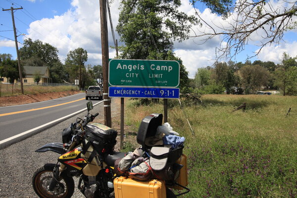
Day 35-Sunshine with a forecast of rain. The further south, the less likely it will rain. I head south.
Last night's low budget motel was not reflected in the landscaping.
IMG_6380.JPG


IMG_6375.JPG


The ocean vistas along highway 1 north of San Francisco rival those of the Kahekili highway on Maui.
IMG_20220509_104146838_HDR.jpg


IMG_6390.JPG


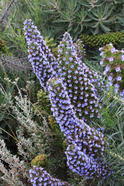
I'm not sure what this is about, but it's at a scenic turn out. Maybe someone disagrees with my assessment of beauty.
IMG_6405.JPG


If these are edible, there are plenty to go around.
IMG_6402.JPG


I'm going to quote my notes exactly as I wrote them, but with punctuation. "Stunning ocean views on 1. I grinned involuntarily many times as I crested a hill. .... More of this road should be gold on Butler Maps."

A single lane tunnel, with a 5 minute wait to enter, led to this view of the Golden Gate Bridge from the Marin Headlands.
IMG_6407.JPG


Remove the distraction and add a sailboat.
IMG_20220509_182423923.jpg


I paid a lot for a room today because my data limit on my phone has been reached. I can't post pictures, find campgrounds or compare prices of motels because my internet and Google Maps don't work. My loving wife wants me to have a phone so we can be connected and I agreed to have one if I could use the internet to save money to offset the cost of a phone. She takes care of my plan, but today I decided that I would no longer have a phone if my service is not restored by tomorrow. It's been 3 days since she was told. She won't read this so all of you who know us can just settle down.:-P:-P
 

Attachments

  • IMG_6413.JPG
    IMG_6413.JPG
    567 KB · Views: 109
Day 36. Just 15 days left after today and some of those 15 days will be those sorry days at the end of a trip. You know, those days of just traveling home.

I passed through Happy Camp where children admitted being happy campers and now I'm at Angels Camp where ???? It's not over yet. More camp to come.
IMG_20220510_142215587_HDR.jpg


Angels Camp is where Mark Twain's short story "The Jumping Frog of Calaveras County" was inspired.
IMG_6414.JPG


Also close to Angels Camp. I will not be camping or visiting there.
IMG_6415.JPG


I bypassed the city of San Francisco on my quest to ride highway 1. I'm headed to Yosemite before turning back to San Jose to resume the 1 ride, bypassing the 60 miles of Urban development.

Reservoirs are low in this area of California. Lots of vineyards and fruit trees are growing in the Sonoma and Napa Valley areas. They both need irrigation.
IMG_6417.JPG


I told you the "camps" were not over. This camp once held over 5,000 Chinese miners. It's down to less than 200 people today and I didn't see anyone that looked like they were from East Asia.
IMG_6420.JPG


Going up to Yosemite.
IMG_20220510_164742130_HDR.jpg


I found this campground with my newly restored internet services and my phone had been saved from a gruesome death in a convenience store trash can. It was just a couple of miles outside the north entrance to Yosemite and I was surprised to be the only occupant. I bought 2 1/2 pounds of the best cherries I have ever eaten for $7 just before this camp and I nearly ate them all for dinner. It was the only time I found a bargain on cherries, but even convenience stores sold oranges super cheap. The store in Yosemite sold large, sweet naval oranges for 50 cents each.
IMG_6426.JPG


There were flowers next door.
IMG_6430.JPG


Day 37
I rode through Yosemite today from highway 120 to Wawona without doing much exploration. I camped in Campground 4 which is a first come first serve campground until May 20. There are 61 sites that are shared by up to six people and four tents. To get a site after May 20, you have to submit an application, along with a $10 non refundable fee, to a lottery. They say the chance of getting a spot averages 10%.
IMG_6433.JPG


It is amazing what flowing ice can do.
IMG_20220511_103007820_HDR.jpg


Ice forms overnight from the waterfall mist.
IMG_20220511_110220553.jpg


I met this guy. We ride similar motorcycles. Yea right:-P:-P:-P. He is having just as much fun as I. I really should wash my bike more often.
IMG_6460.JPG


IMG_6463.JPG


I don't know the name of this waterfall, but I like the view.
IMG_6468.JPG


I really like this picture.
IMG_20220511_134257920_HDR.jpg


Some kids sell cookies to raise money, some have a bake sale and some sell mattresses.
Mattresses? Presales were good according to the worker in the convenience store in Wawona.
IMG_6472.JPG


The store was built around this tree. Also, notice the keys in my bike. I was warned to stop doing this if I want to retain my keys.
IMG_20220511_152509537_HDR.jpg


This guy, or at least one of his species, is the key thief.
IMG_6483.JPG


I must do some prep work to my van and camper to be sure I am ready for departure next Saturday morning. More when I get time. You might get tired of Yosemite pictures.
 
Last edited:
It's supposed to be a beautiful ride also.
It is, although I've only ridden the lower portion from Apache Junction to the end of the pavement past Tortilla Flat.

This was the first time I rode it on the Wing; this is from the end of the pavement back down to Tortilla Flat. I don't know why I never posted the rest of the ride as the next section is far more technical; the upper portion as you will see is much more of a high speed stretch.

 
John Muir as a younger man took Theodore Roosevelt on a 3 day camping trip in the Yosemite valley. They probably admired much of the same scenic beauty you did. When the president got back to Washington he designated 230 million acres to become the first five of today's national parks system in the US. Some pretty inspiring views I'd say...
 
John Muir as a younger man took Theodore Roosevelt on a 3 day camping trip in the Yosemite valley. They probably admired much of the same scenic beauty you did. When the president got back to Washington he designated 230 million acres to become the first five of today's national parks system in the US. Some pretty inspiring views I'd say...
The report I read said they went without presidential security or even letting security know where they were.
 
Day 38
I decided to hike today and since the Upper Trail to Yosemite Fall started about 1/4 mile from my camp, it was chosen. It was four miles up and took me seven hours round trip.
IMG_6507.JPG


I came upon this Penguin Tree. It's the only known species of tree that lays an egg and incubates it between its roots and the cambium layer of its bark.
IMG_6509.JPG


It was a little cool last night. Ice formed from the mist. I heard a baby crying close to my tent, probably because it got cold. Hushed voices tried to comfort it, but in the end it was moved between the parents.
IMG_20220512_092917568_HDR.jpg


Same, but a little higher up.
IMG_6527.JPG


Conveniently placed hand rails.
IMG_6543.JPG


The zigzag route up caused it to be four miles. A couple passed me on the way up. Daddy was carrying his small son in a backpack. The little boy was having a lot of fun. Dad was breathing heavily. They also passed me again on the way down and the baby was still having fun. He and I exchanged grins and waved goodby.
IMG_6539.JPG


The wind picked up and blew the misty water of the falls. I tried to get rainbows, but they were very fleeting.
IMG_20220512_144011378_HDR.jpg


When I got back to camp, I found out that the couple with the baby had the site next to mine. Their baby was the one crying last night and he was placed in their big sleeping bag to keep him warm. I asked the lady to take my picture so I could send proof of life to my wife. The baby and I are still goofing off. That's why I'm not looking at the camera.
IMG_20220512_171743368.jpg


His name is River. Mom said he was one, but I believe he's at least half way to two. When he saw me texting on my phone, he came over to my camp and wanted to play with my phone. I showed him how to take a selfie and he did a good job except for the nose that need a little powder to cut down glare. :-P
IMG_20220512_171954463.jpg


I had baby wipes sitting on the table, so I wiped his nose. He wanted a baby wipe. I gave him one and he wiped my nose. My photo skills don't come close to his.
IMG_20220512_172003568.jpg


Dad said it was OK so River and I started eating the last of my sweet cherries. I cut his off the pit so he wouldn't get choked . It was his first time to eat cherries and he loved them. When his dinner was ready, he refused to leave so Dad came over and got him. I needed V-8 juice to combat the leg cramps I knew I was going to have during the night. I rode to the Village Store and missed my turn. That necessitated a 5 or 6 mile long ride because the road is one way. When I got back to camp, River was asleep. As I was leaving the next morning, I heard Mom talking to River in the tent so I said goodby. River yelled something.
 
Last edited:
Day 39
I wanted to see the Mariposa Grove of Sequoias in Yosemite, but the road was still closed. The road through Tioga Pass was also still snowed in. I had been warned by TWT members that this might be a problem.

The roads out of the park on the south side weren't shabby.
IMG_6573.JPG


IMG_6575.JPG


I saw this at least six times. At first, I wasn't sure what was happening. Part of the water in a creek is diverted in these big tubes and rerouted through turbine generators. The head pressure needed is created by mountains instead of dams. After generating electricity, the water is returned to the creek without ever disrupting marine life.
IMG_6576.JPG


Something is missing.
IMG_6578.JPG


Day 40
I stopped early yesterday and stayed in a motel in Modesto. Hiking for two days has made me sore. Being 74 years old and sleeping on the ground may have contributed a little to the sore body. :trust: :trust: Every time I was low in elevation on this trip, my bike would run cold until it was completely warm. Lowering the clip one slot on the needle and perfection. Any work I did in motel parking lots was done in the morning when staff was busy and if I did get kicked out, it wouldn't matter.
IMG_6579.JPG


Palm tree lined streets.
IMG_6582.JPG


I have been told to go out in the heat and sun to work on my camper. Day 40 continued later.
history-oresman-rower-rowing-galley_slaves-slaves-hbrn1898_low.jpg
 
Day 40
I stopped early yesterday and stayed in a motel in Modesto.

Palm tree lined streets.
View attachment 322355


My home for a couple of years in the late 80s, early 90s. I lived on the far west side of town surrounded by walnut and almond orchards. One of the Gallo brothers lived about 1/2 mile from me and when I was doing my flight training I would see his helicopter pilot take off from the airport to land at the house to pick him up to visit his wineries. Also on the far west side of Modesto is Paradise Road... made famous as the site of the race at the end of American Graffiti. AG was based upon George Lucas's life growing up in Modesto although the movie wasn't filmed there.
 
40 Cont.
Butler Maps says Del Puerto Road, and Mt. Hamilton Road should be ridden. I agree. If you are going to San Jose and it's been so long that you may not know the way, take this route. If you want, take the Mines Rd. to Livermore. When you get close to San Jose start looking for Antipasto Deli on the east side of town. When the bill comes, tell them Boulder Ed sent you and will be coming by to pay your bill. It's his old stomping grounds. Have a credit card as a backup.
What should someone name this rock on Del Puerto Rd. OK, we'll name it Graffiti Rock.
IMG_6585.JPG


As room on the rock diminished, the graffiti overflowed onto the road.
IMG_6586.JPG


The higher the road went, the more the terrain changed from grassland to scrub trees. Continuous curves regardless of vegetation.
IMG_6592.JPG


A large group of flowers were near where I stopped to eat lunch, a tuna kit, cheese and Fritos.
IMG_6596.JPG


Motorcycles are not the only vehicles enjoying these remote curves. A large group of these passed me near the summit.
IMG_6597.JPG


There are five of these structures of differing sizes and a sign that implores visitors to keep the noise down because researchers sleep during the day.
IMG_6598.JPG


The view of San Jose happened so quickly as I descended the mountain. Around a curve and over a hill and this view exploded in my field of view.
IMG_6599.JPG


I stopped for a butt rest and a soda at a local service station in San Jose. I struck up a conversation with a 72 year old man driving a 1967 Corvette convertible. He has lived all his life in San Jose and for some reason he wanted to show me a picture of him and his 'vette in front of his high school when he was 67 years old.
IMG_6601.JPG


Engine is clean.
IMG_6602.JPG


The Corvette guy told me to take highway 9 south of San Jose to the 1, the coast highway. I did just that because he said it was good pavement, nice scenery and some redwoods. All of that is true, but there was also lot of houses, crossroads, stop lights and traffic. I was highly disappointed until I got past Monterrey.
 

Attachments

  • IMG_6609.JPG
    IMG_6609.JPG
    339.3 KB · Views: 85
Day 41
Steinbeck would be sorely disappointed with the changes to Monterrey since he wrote CANNERY ROW and TORTILLA FLAT. There are souvenir shops, posh boutiques, mini breweries, luxurious rooms and expensive restaurants where the fish canneries once stood. There was no sign of Danny, Pilon, Jesus Maria, Doc, Mack, Lee Chong or any people that even remotely resembled them. The original name of the road that John S. wrote about was Ocean View Road. It has been renamed Cannery Row to appeal to the largest number of tourist possible. It worked. Cannery Row is a tourist trap that is a constant traffic jam.

I did stop toward the end of Cannery row and take this picture of fishing boats moving back and forth over the same area. I don't know what they were catching, but whatever it was wasn't moving very fast.
IMG_6604.JPG


Next up was 17 Mile Drive, a scenic loop that includes views of Pebble Beach Golf Course, The Lone Cypress, rocky coastline, mansions and many beautiful views. It's closed to motorcycles. No explanation, just directions on where to do a U-turn.

Once I got to the coast highway there were lots of these. I had seen them cultivated earlier, but the ones along the coast were growing wild.
IMG_6609.JPG


I like this sign along the Big Sur Highway.
IMG_6610.JPG


Today was another day to just burst out laughing with joy as I rounded a corner or came over a hill and saw the view. Here they are, but the entire 74 miles are stunning.
IMG_6617.JPG


IMG_6624.JPG


IMG_6627.JPG


IMG_20220515_133953112_HDR.jpg


There is a house to the left of that large tree on the horizon, just down from where the cut was made in the mountain for the road. I can't imagine how much just the lot cost.
IMG_6641.JPG


There was a sign that said Elephant Seals so I turned in thinking I would see a couple of seals sunning on a rock.
IMG_6652.JPG


There were hundreds of them in both directions. At least two were quarreling at any given moment, though none that I saw were actually causing wounds with their ferocious teeth.
IMG_6650.JPG


I stayed in a pay campground with a table. My neighbor had a 650 KLR parked in front of his motor home. He came over and we chatted for over two hours. He was about my age and has been riding longer than I have (59 years). He has also done better financially than I have. I know this because he showed me pictures of part of his collection of motorcycles and his garage that would be the envy of many bike shops. He has an RZ-350 with Kenny Roberts' actual signature as well as Eddie Lawson's, three RE-5 Suzukis, two of which run, as well as several other older collectible bikes. His picture of Kenny Roberts signing his RZ-350 showed Kenny has gotten old. Day 42 coming up. More giant trees, more closures and my first $50 campsite. Later I encounter an $80 campsite. I stayed at neither.
 
Last edited:
Experience regenerating pictures! I'm enjoying the accounting of who, what and where...thank you!
I'm assuming you've been using your Canon exclusively for photos, have you resorted to using an iPhone/or similar? The colors are beautiful.
Now I'm looking forward to reading and seeing more. Amazing how doing, seeing and recalling never gets boring.
1654508267518.png
 
Didn't John Steinbeck return there in his last book "Travels with Charley" I seem to remember him finding it changed then, and not for the best. This was written 1960 - 1961. Either way J.S. is one of my favorite authors and appreciate the reference. Always enjoy your ride reports and this may be one of your best.
 
Didn't John Steinbeck return there in his last book "Travels with Charley" I seem to remember him finding it changed then, and not for the best. This was written 1960 - 1961. Either way J.S. is one of my favorite authors and appreciate the reference. Always enjoy your ride reports and this may be one of your best.
He did. I think it has change much more now and none of the changes considered progress unless you are a business owner or patron along the coast. Steinbeck is in my top three authors. He understands the mentality and thought process of poor people as good as anyone who grew up in the middle class can. Since you like him, may I suggest one of Erskine Caldwell's books? Maybe TOBACCO ROAD.
 
MValspeed, I keep my Canon in the top box and use it for most pictures. My phone is readily available under a flap on my tank bag and I use it for keeping track of where I have been and for "in a hurry" pictures. I take a lot of pictures of road signs with it. My memory is fading in certain areas, especially directions and which way to turn when I get to intersections. I get lost a lot and I can look back at the trail of highway signs and see where I've been and can usually figure out which way to turn. Occasionally, I have to call my wife and get her help, but the phone pics work. The phone is also a backup in case of failure or loss of my camera memory card. Some of the pictures posted are from my phone.
 
Day 42, a little over 8,000 miles at the start of the day.

Today is a travel day to get from the coast to Sequoia, NP.
This is a Yucca, a giant Yucca. The stem at the base of the flower is over 2" in diameter. For reference, the flower shadow and my shadow are side by side. There were lots of these beside this road.
IMG_20220516_174249901_HDR.jpg


I have posted this on another thread, but I think it deserves a repeat. The jokes about Boudreaux from Louisianna have been around forever, but so has Boudreaux.
IMG_20220516_182955069.jpg


I was passing lots of national forest campgrounds, but it was too early to stop. Later in the day when it was time to stop, there were no campsites along the road and no cell service to help. I came to a small town with phone service and this campground was just down the road. It was afterhours and this sign was on the bulletin board. Notice only one of twenty-one tent sites are rented. I rode 4 miles down the highway.
IMG_20220516_193733718_HDR.jpg


This site was $10 and had showers.
IMG_20220516_202046170_HDR.jpg


It was dark before I got signed in, but in the morning, I woke up to this.
IMG_20220517_064310409_HDR.jpg


My neighbor had a little better cooking set-up than I have.
IMG_20220517_072159019_HDR.jpg
 
Day 43
IMG_6662.JPG


The entrance road up from the south ain't bad either.
IMG_6675.JPG


Language barrier kept me from conversing with this group.
IMG_6669.JPG


They rode a wide variety of bikes
IMG_6665.JPG

This is not a bottle brush plant according to the internet. It should be.
IMG_6663.JPG


Let's start the hike off with a crushing rock.
IMG_6670.JPG


I turned on a road because it was named Tunnel Log Road. There was no mention of this grove of trees or many more similar groves. It is amazing how many of these large trees exist, especially when one of the signs says that 97% of the old growth has been harvested. Find me.
IMG_6682.JPG


My original goal when turning on this road.
IMG_6702.JPG


Which came first, the road or the fallen tree? The tree was 2,000 years old when it fell in 1937.
IMG_6689.JPG


No comment. Yeah, I will. The root and all evil.
IMG_6700.JPG

A trio just beside the main road through the park.
IMG_6678.JPG

The view from Morrow Rock. Well worth the short, but steep, climb. Handrails and cables are available to assist in climbing.
IMG_6714.JPG


Looking the other direction at the high Sierras, AKA what is blocking my direct route east.
IMG_6705.JPG


All campgrounds in the park were full so I just drove past unspeakable beauty and out the north end of the park to a private campground. I shall return.
 

Attachments

  • IMG_20220517_090639641.jpg
    IMG_20220517_090639641.jpg
    668.5 KB · Views: 91
Last edited:
What a small world. That is the 76 station in Saratoga. I used to live a couple of blocks from there.
Wow, do you happen to know that guy? It's right on the corner of Saratoga Ave. and Highway 9. I said it was in San Jose, but it's actually in the suburb of Saratoga. Sharp eye, you recognized the station without even knowing the correct town.
 
Wow, do you happen to know that guy? It's right on the corner of Saratoga Ave. and Highway 9. I said it was in San Jose, but it's actually in the suburb of Saratoga. Sharp eye, you recognized the station without even knowing the correct town.
His car looks familar but I don't know him. I used to walk up and down that road every day and immediately recognized the location in the photo. Excellent ride report! Thanks...
 
Day 44- Back to Sequoia/Kings Canyon

I found this interesting. The Sherman tree is 1,000 years younger than the oldest known Sequoia, yet the Sherman Tree has more volume than any known tree. There is an unnamed 1,000 year older tree that is taller and in an undisclosed location. Note the half dollar and the cutting from a 100 year old tree that germinated in a poor spot.
IMG_6717.JPG


IMG_6722.JPG


The strength of dovetail joints and the rot resistance of redwood. This unpainted house was built 150 years ago.
IMG_6732.JPG


A 24' diameter tree cut for display at the 1875 Philadelphia Centennial. Those in the East called it the California Hoax. It took two men nine days to cut it down.
IMG_6736.JPG


That guy on the motorcycle is having more fun than we are. On the way to Kings Canyon.
IMG_6738.JPG


I stopped, twice.
IMG_6740.JPG


The start of the canyon that the park was named after, but not good enough to be part of the actual park
IMG_6741.JPG


Do people really need a warning?
IMG_6747.JPG


Yeah, one would never guess that it would be dangerous to enter this cold water.
IMG_6748.JPG


The actual park begins.
IMG_6750.JPG


Sometimes there just isn't a place to build a road. Kings Canyon is just so majestic and so big that any camera skills I may have were defeated. Instead of showing you my picture of a tree and trying to get you to imagine a forest, I'm going to admit defeat and just ask you to go there. Maybe a younger me or a current me with no wedding anniversary awaiting me in Texas and robbing me of trip time could have climbed to the rim and gotten a "Grand Canyon" kind of picture, but the current me with a time frame admits defeat.
IMG_6759.JPG


According to the store operator, these are the oldest gas pumps still in use in America. 1928
IMG_6760.JPG


IMG_6764.JPG


They sell 4 gallons at a time. If the station ever shuts down the grandfather clause won't apply and the pumps would not be allowed to be used because they will not meet California standards. Or any other state's standards, probably. Trivia: Texas is supposed to inspect every gas pump at least once every 4 years or more often if a complaint is filed.
IMG_6761.JPG


Another gravity feed creek water diversion powerplant. Hydroelectricity with no lake, no dam.
IMG_6767.JPG


I headed back to Bakersfield because all the northern passes over the Sierra Nevada Mountains are closed and It's time for me to head back in the direction of Texas.
 
Last edited:
Day 45-I rode 300 miles today with a route through Death Valley to get to Pahrump, NV and stayed at the same campground that I stayed at six weeks ago.

Just outside Bakersfield, heading east on 178. The canyon along the Kern River gets exciting.
IMG_6769.JPG


A Joshua Tree about to burst forth in full bloom beside the road.
IMG_6772.JPG


Good? Bad? Arguments for both. If you sell gas in California, you must provide free air, water and the use of a pressure gauge.
IMG_6774.JPG


A month changed the temperature in Death Valley a lot. I used 64 ounces of water for wetting my base layer in an attempt to stay cool.
IMG_6775.JPG


End of day 45. I know it was abbreviated, but I zipped through the 150 miles of Death Valley because I had been there a month ago and it was HOT.
 
Last edited:
Back
Top