• Welcome to the Two Wheeled Texans community! Feel free to hang out and lurk as long as you like. However, we would like to encourage you to register so that you can join the community and use the numerous features on the site. After registering, don't forget to post up an introduction!

Sam Houston NF

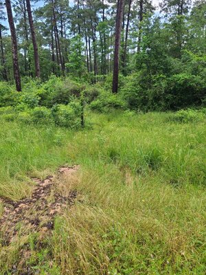
Keep in mind, these are by my house, I don't have a boat to take pictures back where they were rescuing folks. Water was over mailboxes.
 
A neighbor took these from a boat. Game warden photo is Trinity county.

667DF04E-3F7B-4FA5-BFAE-E55767D11937.jpeg


Screen Shot 2024-04-29 at 2.18.00 PM.png


Screen Shot 2024-04-29 at 2.19.57 PM.png


Screen Shot 2024-04-29 at 2.20.39 PM.png


Screen Shot 2024-04-29 at 2.21.40 PM.png
 
My subdivision is prone to this, but I've been here since 1984, this us just barely the worst I've seen. Harvey was pretty much the same. The problem with this one, it hit middle of the night, folks didn't have time to get out. Probably 30+ cars ruined. Bad deal, glad I'm on a hill.
 
A huge round of rain again, more coming. I imagine erosion problems again. Tiresome.
 
We're getting hammered again today. Seems as bad as Sunday night. Everything in Walker county closed, government wise.
 
We had a real STORM in the Golden Triangle area today. My Generac has just shut off, started around 9am. Just got cable and the internet also. I luuuvvv my Generac! Update: just found out we had 85mph winds which is 10 above Hurricane stage. Scary!!!
 
Last edited:
Could be a long time for the forest to reopen again, just my opinion. But erosion has to be terrible again. This is a forest service road for reference by the trails.

BF71384C-6473-47AB-8CAB-549742F10E56.jpeg
 
UPDATE: 5-3-24

ALL TRAILS AND RECREATION AREAS CLOSED:
Due to the extreme rain events of this week and preliminary surveys by the FS:

The Sam Houston National Forest will be doing an administrative closure, due to weather and road conditions. This closure will include all trails (Lone Star Hiking Trail, Northwest Cycling Club Mountain Bike Trail, Double Lake Mountain Bike Trail, Richards-Raven Equestrian Trail, and the Multi-Use Trails), all campgrounds, boat launches and other day-use areas.
 
Just found out we had 85mph winds in Nederland today which is 10 above Hurricane stage. We got 6.5in just this morning.
I was driving I-10 yesterday during that, worst driving experience I've had ever or at least in a very long time, unreal rain.
And more coming today.

69DB76B0-82F7-48F6-A471-06782593EFD2_4_5005_c.jpeg
 
Thanks for the reports/pics Rob. Even after Harvey the flooding still is hard to imagine. Just a few days rain can destroy the lives/homes of so many. Sadly, I'm betting many of those folks have no flood insurance.
 
After some very short exploring, I could see trails closed through end of the year. Destruction out there is unreal. So much erosion and trees down. Most FS roads suffered severe damage. This will be first priority before even thinking about trails.
 
Same thing happens occasionally at Toledo Bend Dam and floods the areas below all the way to the Orange area. A buddy has had a family camp below the Toledo Dam on the "island" immediately below the dam that was totally washed away in '89. It was built in the 60s when we were in College and before the Dam was completed. We replaced it with a beach type 10 feet high on steel piers. It has flooded twice since 6ft high inside so at least 16 ft of flooding. Couple solid out buildings for a tractor, lawnmowers, generator etc and other stuff needed to maintain a camp washed away. Tractor was salvaged. Heartbreaking but at least it is a camp and not a home.
 
A bridge was closed Monday and actually partly collapsed Tuesday on FM 787 outside Cleveland over the Trinity river. I go over this bridge twice daily 3 X's a week! If it wasn't closed first would have been on it Tuesday! Pier washed out. See the water in background, almost to top of bridge.

F9E47567-FBF9-451E-8848-A51341035D68.jpeg


DE8AFC0C-31E3-4954-83B4-DD4C686AB1C0.jpeg
 
Life changing flood for many. Because of the sandy soil everything is built on in the area I'm betting many more roads/bridges are close to failure.
 
This is the creek by me that flooded my neighbors. Notice the white fencing in top of tree. That's how high it got.

75B02291-010A-43F8-BF22-0562AA5A2756.jpeg
 
Lake Loop from Harvey, let's hope whole forest doesnt go this route.
 

Attachments

  • 20240505_094911.jpg
    20240505_094911.jpg
    949.1 KB · Views: 24
Last edited:
"well we heard that yes james guntner is the new motorized board member. And there are a lot of forest service folks out doing assessments on the trails and the roads and entering them into a data base , so a final assessment can be completed. Time frame unknown , at least nothing happening till MAY 21, WHICH IS THE FIRST OPPTURNITY TO LIFT THE CLOSURE. AND LIKEY TO BE WAY PAST THAT DATE."

Only report I found from Coalition meeting.
 
Back
Top