


-
 Welcome to the Two Wheeled Texans community!
  Feel free to hang out and lurk as long as you like. However, we would like to encourage you to register so that you can join the community and use the numerous features on the site. After registering, don't forget to post up an introduction!
You are using an out of date browser. It may not display this or other websites correctly.
You should upgrade or use an alternative browser.
You should upgrade or use an alternative browser.
AUSTIN: Austin TARA: Monthly ride
- Thread starter Trail Boss
- Start date


jwaller
0
- Joined
- May 2, 2012
- Messages
- 355
- Reaction score
- 267
- Location
- Cibolo, TX
- First Name
- Justin
- Last Name
- Waller
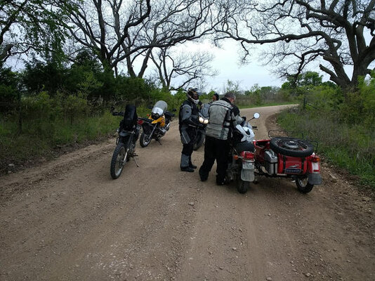
Maybe I shouldn't have headed out alone. I was using the Scenic App for the iphone as a gps and it got us sort of lost out of Llano heading up to San Saba. It turned me down some road that might have been public at one time, but now had no sign of any sort. It looked more like a path made by a herd of cattle. I tentatively followed it for a bit until coming to a deer hunting camp. Getting shot didn't seem like a good idea, so I turned back to the last known public road. I then pulled up the map and tried to plot a course toward Sloan so I could pick the trail up again. I kept coming up to roads ending in locked gates. Some of the roads shown on the Scenic map turned out to not even exist. I eventually just made my way back to Highway 16 about 15 miles south of San Saba and then took it to San Saba where I picked the route back up for home. That's where I ran into some other guys going the opposite direction. Once I got to Round Mountain, instead of heading back through Dripping Springs, I stayed on 281 to Blanco, then took 32 to Purgatory Road and home in New Braunfels. My wife made me a cup of hot cocoa and heated up some food for Gunny. I lit up the fireplace and Gunny and I crashed in front of it for the rest of the day. Next time, we'll stay with a group and hopefully not have such unexpected cold weather.
Sounds like a good adventure—explored without getting yelled or shot at, no flats, no mechanicals. And a loving wife waiting at home!
Assuming Gunny is your dog?
Assuming Gunny is your dog?
jwaller
0
- Joined
- May 2, 2012
- Messages
- 355
- Reaction score
- 267
- Location
- Cibolo, TX
- First Name
- Justin
- Last Name
- Waller
Sounds like a good adventure—explored without getting yelled or shot at, no flats, no mechanicals. And a loving wife waiting at home!
Assuming Gunny is your dog?
Any time I can go out with the Ural and have no real mechanical issue is indeed a good adventure. I think the thing's caused more mis-adventures, but maybe it's just that I remember those more. Two weeks ago, Builtea and I went out together on our Urals, joined by two other Urals. We rode about 250 miles and, believe it or not, there were no issues. That's the first time Bill and I rode our Urals together that didn't either lead to a flat tire, mechanical issue, or near total disaster.
And yes, Gunny is my dog, my four-legged monkey. My 12 year old daughter, who used to be my sidecar monkey, no longer enjoys it since we use it to commute to and from school. The dog never complains.
StromXTc
0
What kind of temps did you guys see on Saturday morning. Heck, it was still 46 down here this Sunday morning.
Jeremy J
0
- Joined
- Jun 6, 2011
- Messages
- 73
- Reaction score
- 0
- Location
- Dripping Springs
- First Name
- Jeremy
- Last Name
- Johnson
I enjoyed the short ride out to Llano despite the weather. After lunch I saw 38 and knew I was done. ") Still good to meet you all and I enjoyed the short ride out to Llano. I doubt we'll have the same issue with the weather again next time.
Still good to meet you all and I enjoyed the short ride out to Llano. I doubt we'll have the same issue with the weather again next time.
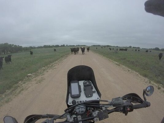
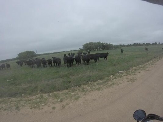
I have had similar issues to jwaller when I go out by myself. Google and my Garmin tell me to take roads that don't look like roads and I really don't want to get shot either. I've had one guy chase me down to tell me to get off his property but there wasn't a single no trespassing sign and google said it was a public road. Chris mentioned Saturday about the public roads with gates that some ranchers think are private. How can I confirm what is really public? Is there a good site that documents that?
Still good to meet you all and I enjoyed the short ride out to Llano. I doubt we'll have the same issue with the weather again next time.I have had similar issues to jwaller when I go out by myself. Google and my Garmin tell me to take roads that don't look like roads and I really don't want to get shot either. I've had one guy chase me down to tell me to get off his property but there wasn't a single no trespassing sign and google said it was a public road. Chris mentioned Saturday about the public roads with gates that some ranchers think are private. How can I confirm what is really public? Is there a good site that documents that?
Last edited:
- Joined
- Apr 15, 2013
- Messages
- 1,299
- Reaction score
- 22
- Location
- Beeville
- First Name
- Bryan
- Last Name
- Hughes
Yet again, another ride I missed. A buddy called with an emergency move. Funny how owning a truck nets you a professional career as a mover!
Hopefully next time.
Hopefully next time.
- Joined
- Aug 22, 2008
- Messages
- 466
- Reaction score
- 71
- Location
- Austin
- First Name
- Michael
- Last Name
- Barnes
TXDoT has a county by county map of public roads available online. I don't have the link handy, but it should be easy to find.I enjoyed the short ride out to Llano despite the weather. After lunch I saw 38 and knew I was done.
I have had similar issues to jwaller when I go out by myself. Google and my Garmin tell me to take roads that don't look like roads and I really don't want to get shot either. I've had one guy chase me down to tell me to get off his property but there wasn't a single no trespassing sign and google said it was a public road. Chris mentioned Saturday about the public roads with gates that some ranchers think are private. How can I confirm what is really public? Is there a good site that documents that?
Sent from my SM-G930U using Tapatalk
- Joined
- Oct 20, 2010
- Messages
- 3,716
- Reaction score
- 3,072
- Location
- Victoria
- First Name
- Gary
- Last Name
- Turner
I enjoyed the short ride out to Llano despite the weather. After lunch I saw 38 and knew I was done.
I have had similar issues to jwaller when I go out by myself. Google and my Garmin tell me to take roads that don't look like roads and I really don't want to get shot either. I've had one guy chase me down to tell me to get off his property but there wasn't a single no trespassing sign and google said it was a public road. Chris mentioned Saturday about the public roads with gates that some ranchers think are private. How can I confirm what is really public? Is there a good site that documents that?
TXDoT has a county by county map of public roads available online. I don't have the link handy, but it should be easy to find.
Sent from my SM-G930U using Tapatalk
https://www.dot.state.tx.us/apps-cg/grid_search/county_grid_search.htm
Type in the county name then select it in the drop down. It will not work until you select it in the drop down. I was looking at one last week that was dated 2014 as last update. These are usually correct. When I find myself on a questionable road I slow down to limit noise and dust. In the event I encounter someone I politely ask and explain that I am following this Texas county map, most folks calm down and point you in the right direction if you are on private land.
Jeremy J
0
- Joined
- Jun 6, 2011
- Messages
- 73
- Reaction score
- 0
- Location
- Dripping Springs
- First Name
- Jeremy
- Last Name
- Johnson
https://www.dot.state.tx.us/apps-cg/grid_search/county_grid_search.htm
Type in the county name then select it in the drop down. It will not work until you select it in the drop down. I was looking at one last week that was dated 2014 as last update. These are usually correct. When I find myself on a questionable road I slow down to limit noise and dust. In the event I encounter someone I politely ask and explain that I am following this Texas county map, most folks calm down and point you in the right direction if you are on private land.
Thanks! That works pretty well. Sure would be nice in google, OSM or Garmin integrated this info and didn't send me down private roads.
I found these: http://www.txdot.gov/inside-txdot/forms-publications/maps.html
but it appears to not map all roads. An example is that Hamilton pool road stops before it crosses the Pedernales. I am also not seeing Old Spicewood Rd or the back 962 to 281. That was annoying.
This new link is showing some roads that I know about so that is awesome. I'll use it to map out my routes in basecamp and keep a few pdfs on my phone for reference.
Last edited:
jwaller
0
- Joined
- May 2, 2012
- Messages
- 355
- Reaction score
- 267
- Location
- Cibolo, TX
- First Name
- Justin
- Last Name
- Waller
Its still a couple of weeks out, but can we get a head count on riders who are planning to do the May group ride, instead or attending TAR in Junction?
I will try to be there. I rode most of the route yesterday, kind of a route recon, just to see what kind of terrain and to help me decide which bike to take on a group ride. Most of the route is paved, so I'm not concerned with dropping my bike, so I think if I join, it will be on my Scrambler. Anyone concerned with the route and wondering what kind of bike can handle it, I did a portion of the route on an unpaved road on a Triumph Sprint ST, so any bike will do.
Jeremy J
0
- Joined
- Jun 6, 2011
- Messages
- 73
- Reaction score
- 0
- Location
- Dripping Springs
- First Name
- Jeremy
- Last Name
- Johnson
I am 90% in as of now. Should know for sure by the end of the week.
I may be in Durango then, but if not, I will be there.
The route is mostly paved, eh? Like how much?
The route is mostly paved, eh? Like how much?
- Joined
- Feb 29, 2016
- Messages
- 1,422
- Reaction score
- 704
- Location
- Austin
- First Name
- Michael
- Last Name
- Morisoli
Way to make us all jealous "Texas Mud Taco", I can't wait to get back to the Durango area!
I am out for this ride, this is my final push for some clients, hopefully back to a more normal schedule after the end of this month.
I am out for this ride, this is my final push for some clients, hopefully back to a more normal schedule after the end of this month.
Well, if that makes you jealous, then I shouldn't tell you i'm going up there because we are buying property in the area. We're DONE with Texas summers!
- Joined
- Feb 29, 2016
- Messages
- 1,422
- Reaction score
- 704
- Location
- Austin
- First Name
- Michael
- Last Name
- Morisoli
Oh yea, just rub salt into that wound!
Congrats for you, what part of Durango? My wife and I have fallen in love with the Purgatory area, hopefully one of these days we too will summer in CO.
We have been renting houses up there for the last few years, typically in late September. Just love the area and the ridding !!!
Congrats for you, what part of Durango? My wife and I have fallen in love with the Purgatory area, hopefully one of these days we too will summer in CO.
We have been renting houses up there for the last few years, typically in late September. Just love the area and the ridding !!!
- Joined
- Jan 1, 2005
- Messages
- 4,465
- Reaction score
- 1,228
- Location
- Buda, TX
- First Name
- Rich
- Last Name
- Gibbens
The route is mostly paved, eh? Like how much?
About 95% is paved.
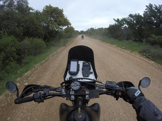
May's route makes a loop out to Fredericksburg and back. It's about 70% typical hill country roads (paved, narrow, twisty, elevation changes, no center strip, scenic), 25% highway, and 5% dirt.
Ok, thanks Boss.